
![Africa Minor Nova Tabula [shows Malta]](/map/small/59626.jpg)
Nice example of Gastaldi's map of the Northern portion of Africa, based on Ptolemy. Shows the region from Malta in the Mediterranean to Ethiopia, the Benin River, Libya, Numidia and the Gulf of Zimair. Giacomo Gastaldi is considered as the foremost...
![[Port Mahon, Menorca] Plan de la Fortification Fait par les Anglois sur la Fort St. Philippo Situe a Lembouchire du Port de Mahon dans l'Isle de Minorque.](/map/small/59725.jpg)
Extremely Rare Map of Fort St. Philip in Minorca Rare, fine map of Fort St. Philip (Castle of St. Philip) and the surrounding area in Port Mahón, Minorca, by Peter Schenk. The sharply-geometric star fort sits at the center of the map and is...
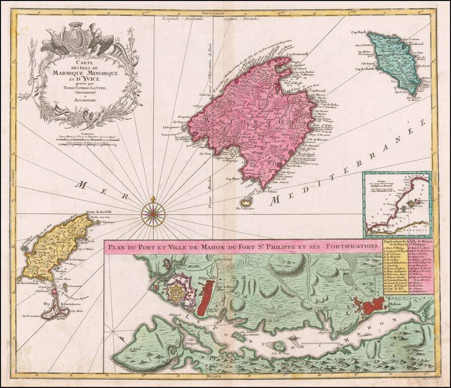
Striking map of the Balearic Islands, with a large plans of the Harbor and Town of Mahon. The map includes a striking coat of arms and windrose.
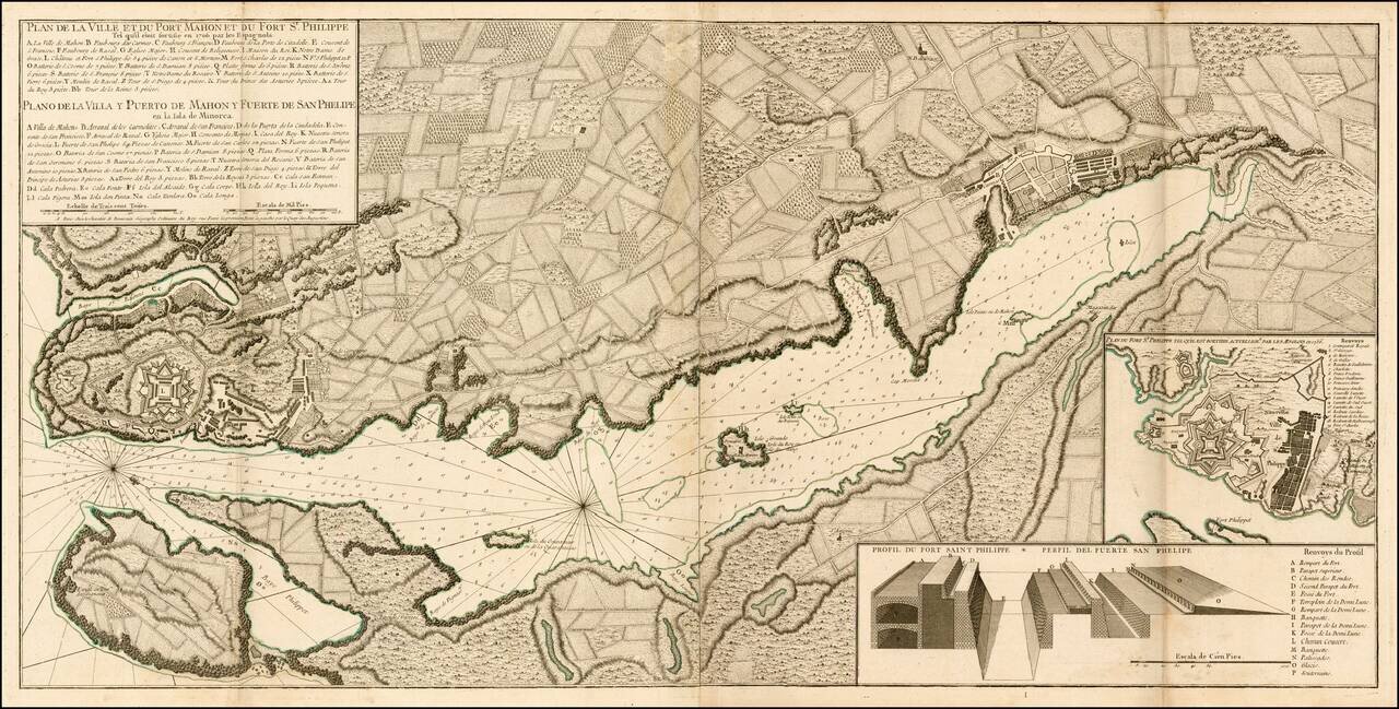
A finely engraved example of the first edition of Beaurain's important plan of Mahon and Fort Philippe, first published in 1756. A scarce, large folding plan of the Port of Mahon and the Fort of San Felipe on the Island of Minorca. The map itself...
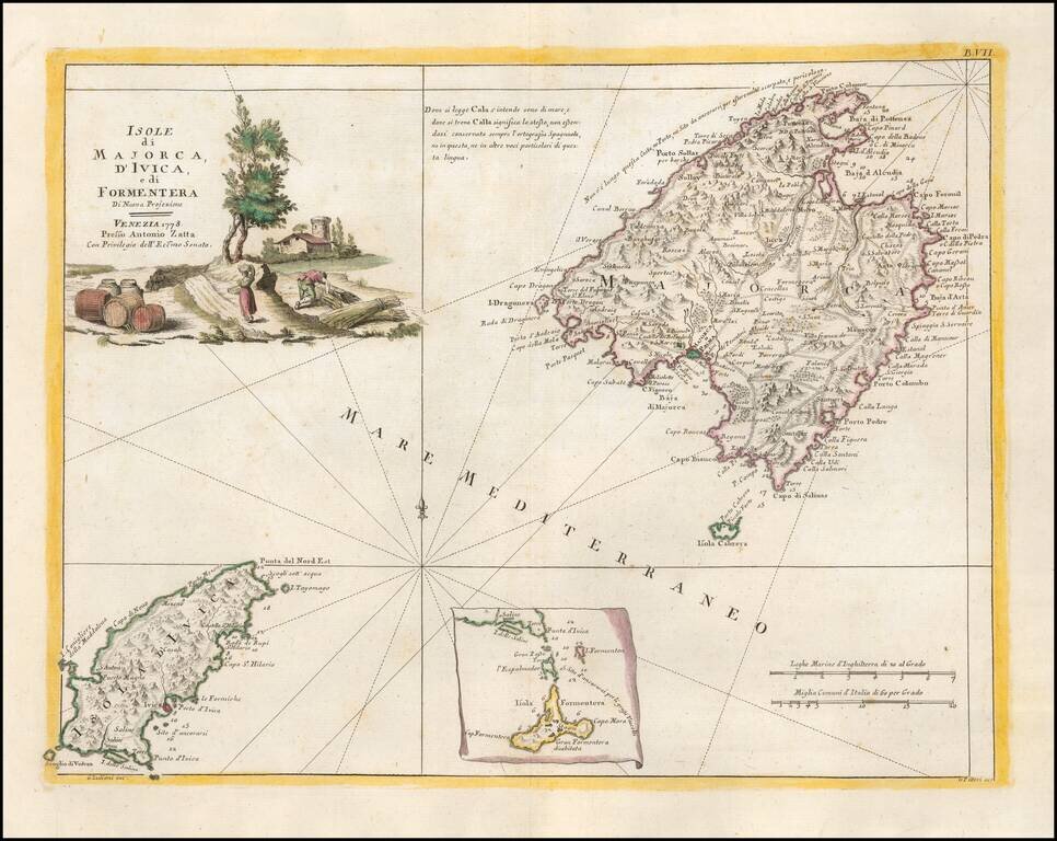
Detailed map of the the Balearic Islands of Ibiza and Majorca. Very interesting early map, with nice detail. Decorative title cartouche. From Zatta's monumental Altante Novissimo, one of the last great decorative atlases of the 18th Century.
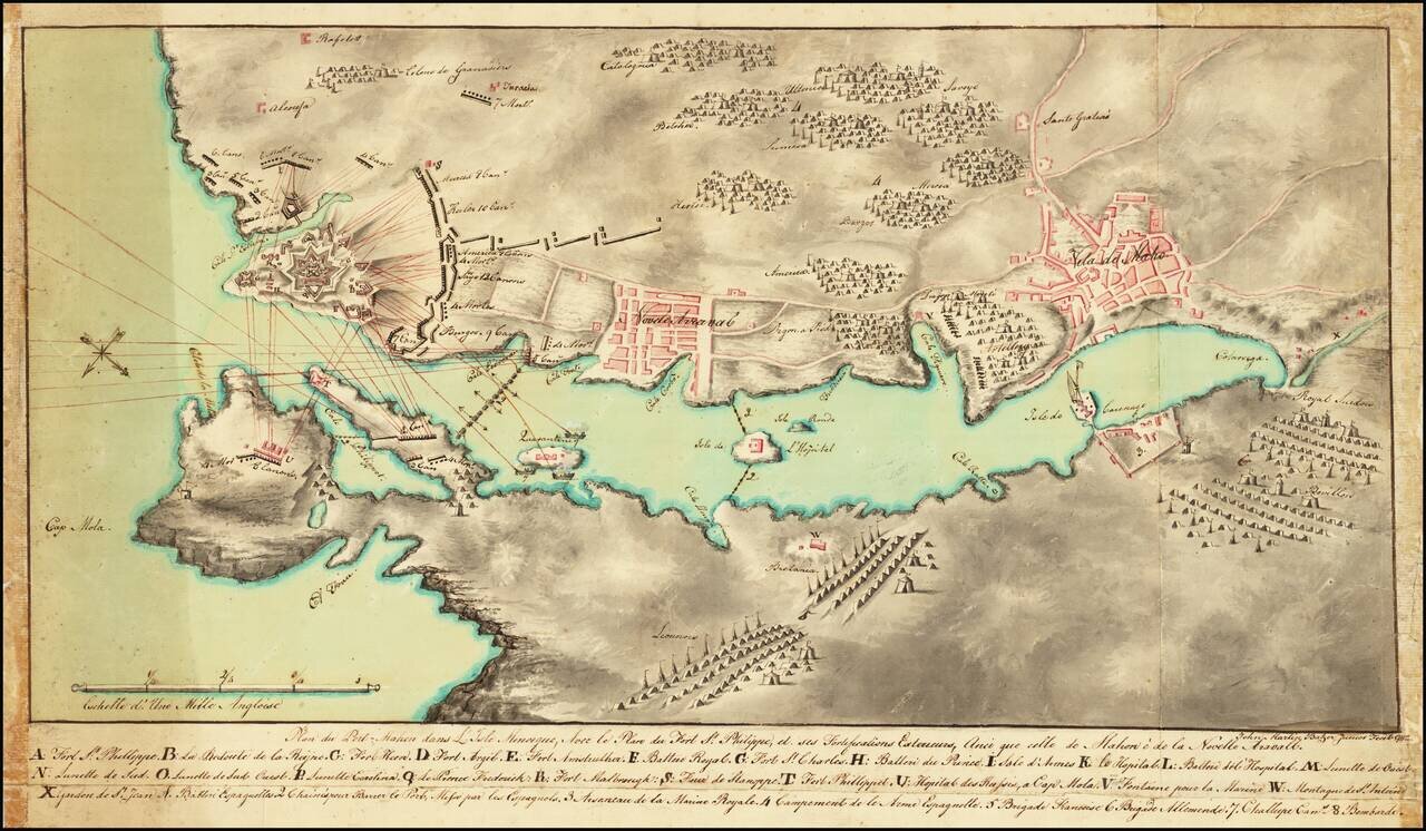
Plan of the Siege of Fort St. Philip Signed By A Future US Consul Finely executed manuscript map showing the Second Siege of Minorca. The map is oriented with southwest at the top, showing the bombardment of the British held Fort St. Philip from...
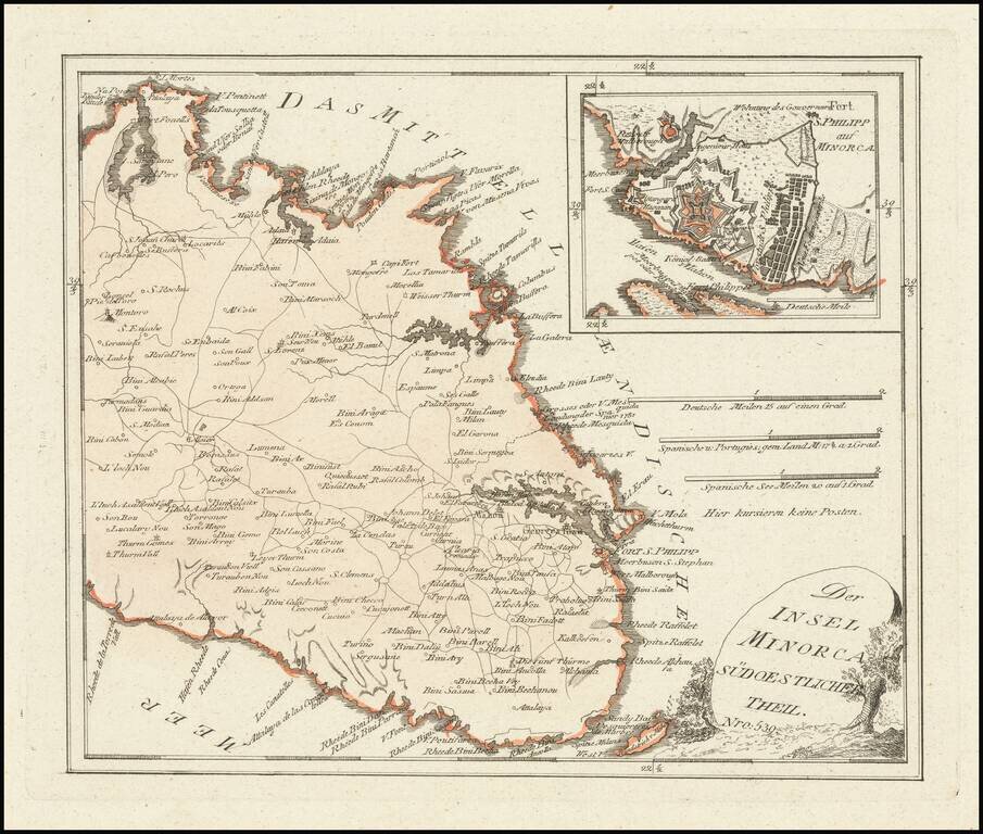
Scarce map of the Eastern part of Menorca, published by Franz Joseph Johann Von Reilly in Vienna. Includes a large inset of Mahon and Port Philip.
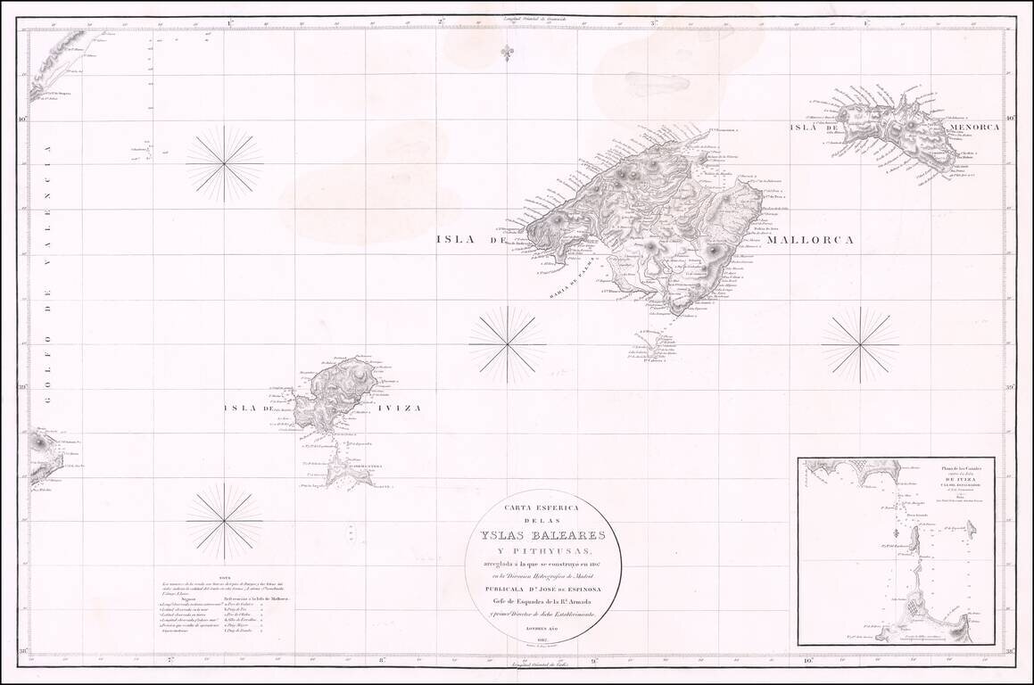
Rare Chart of the Balearic Islands -- Published in London Fine chart of the Balearic Islands by Jose de Espinosa y Tello, published in London in 1812 and engraved by "E. Jones". The chart was produced during the time period when Spain's Direccion...