
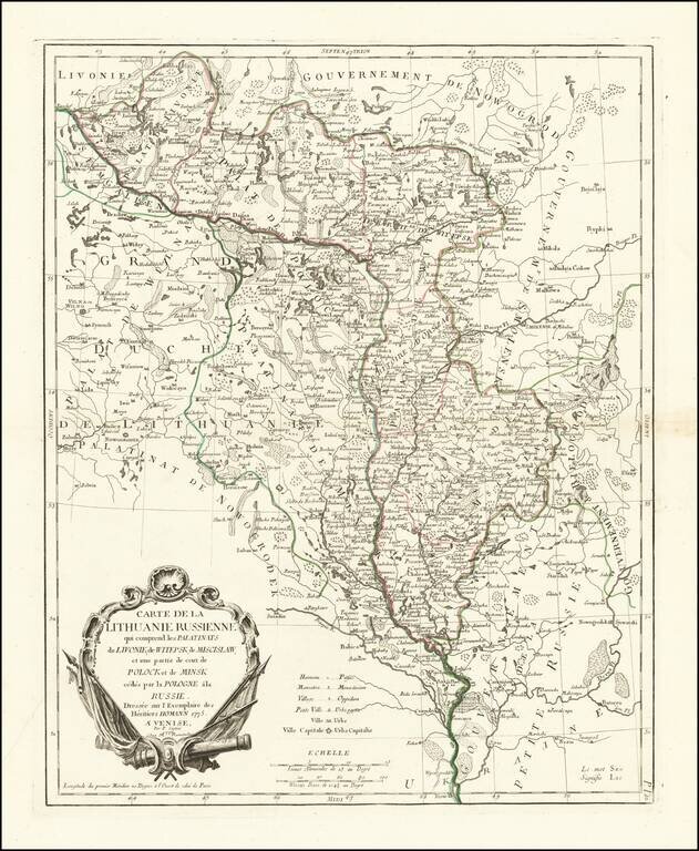
Fine and highly detailed map of Belarus, Latvia, with the Dnieper River. The map includes the towns of Smolensk, Orsa, Minsk, etc. Santini gives credit to Homann Heirs in the cartouche.
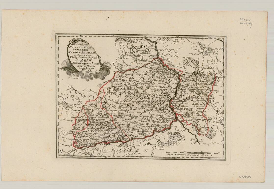
Very scarce regional map of Poland and the Ukraine, showing the region traversed by the Bug River and centered on Braclaw. Shows rivers, roads, towns, castles, forests, lakes and a host of other details. Quite possibly the most detailed map of this...
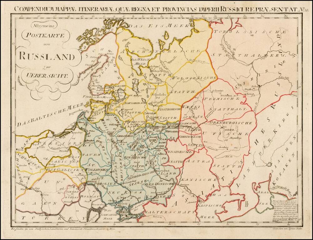
Rare postal map of the Russian Empire, which appeared in Von Reilly and Kuhn's Atlas Universae rei veredariae bilinguis ... Allgemeiner Postatlas von der ganzen Welt . . . , published in Vienna in 1799. Von Reilly & Kuhn's atlas is the first...
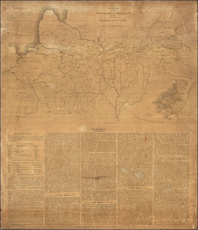
Wall Map Version of Napoleon's Grand Army Marches on Russia Rare separately published broadside and map illustrating the Russian Campaign of 1812, published by John Cary. At the top left corner, Cary reproduces a letter which he received from The...
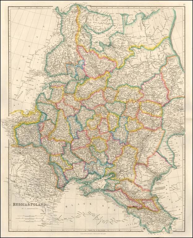
Detailed map of Russia, Belarus, Ukraine, Poland and the Baltic region, published by John Arrowsmith, London's leading mapmaker of the period. The map appeared in Arrowsmith's London Atlas.
![Secunda Asie Tabula [Ukraine, Russia, Black Sea]](/map/small/55578.jpg)
Fine old color example of this remarkable early map of the Russia, Ukraine and the Black Sea region, from the 1486 Ulm edition of Ptolemy's Geographia. The map is drawn from the work of Nicolas Germanicus, whose manuscript maps were created to...
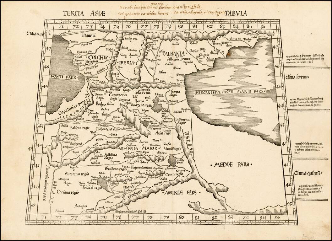
A striking example of Waldseemuller's map of the region between the Black and Caspian Seas, centered on Armenia. The first modern atlas, prepared by Martin Waldseemuller using the translation of Mathias Ringmann. This is one of the most important...
Fine unfolded example of Gastaldi's modern map of Russia, including Poland, Lithuania, Estonia and Ukraine. Gastaldi's map is among the earliest modern maps of the region. Based upon the 1546 map of Sigmund Herberstein, it extends further to the north...
![Europae Tabula VIII [Russia, Ukraine, Baltic, Scandinavia]](/map/small/44610.jpg)
Nice example of Gastaldi's map of the region bounded by the Baltic in the North and the Black Sea in the south, based upon Ptolemy. Giacomo Gastaldi is considered as the foremost Italian cartographer of the 16th century along with Paolo Forlani. From...
![Desciptione de la Moscovia per Giacomo Gastaldo piamo[n]tese, Cosmographo in Venetia MDL](/map/small/31057.jpg)
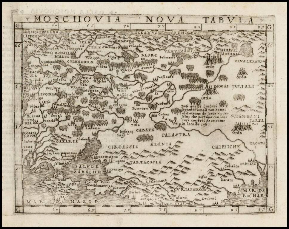
Extremely rare map of Russia, engraved by Gastaldi, based upon the work of Baron Sigismund von Herberstein. Herberstein, a diplomat from the Austrian Imperial Court, was sent to Russia twice between 1516-26, during which time he gathered enough...
![[Russia, Sweden, Finland, Estonia Latvia and Lithuania].](/map/small/36638.jpg)
A fine wide margined example of the northern sheet of the first edition of Gastaldi's 2-sheet map covering Russia, Sweden, Finland, Lithuania, Latvia and Estonia, published in Venice in 1562. The present offering is the northern sheet only (of 2) of...
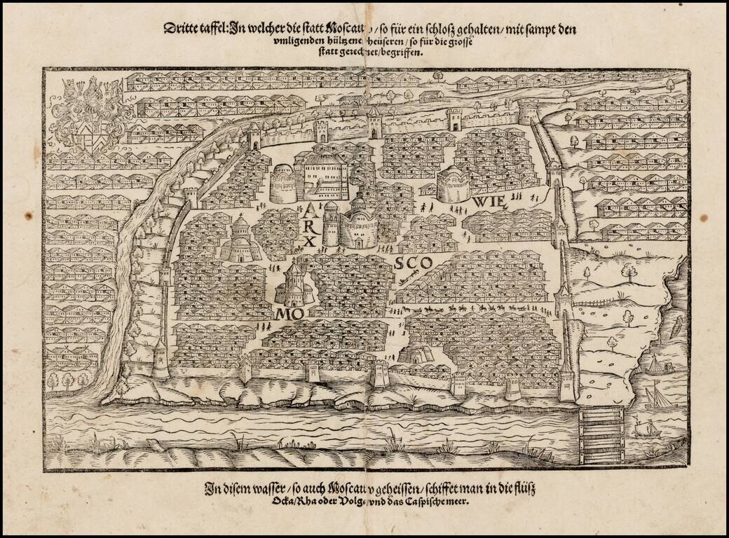
Nice example of the first printed plan of Moscow, from a German edition of Sigismund Herberstein's Moscoviter Wunderbare Historien, first published in Basel in 1563. Herberstein's view of Moscow would influence the depiction of the city for the next...
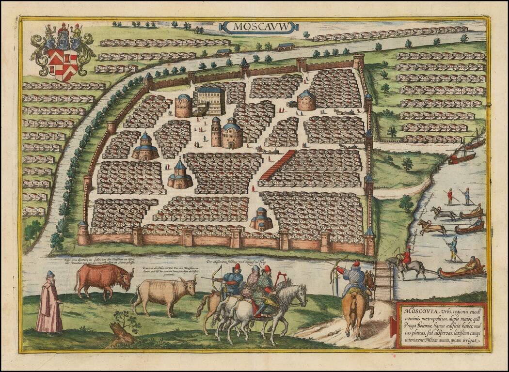
Decorative full color example of Braun & Hogenberg's first view of Moscow, from a slightly elevated viewpoint from across the frozen Moskva River, first published in 1575. The walled center of the old city is depicted with its many churches. The...
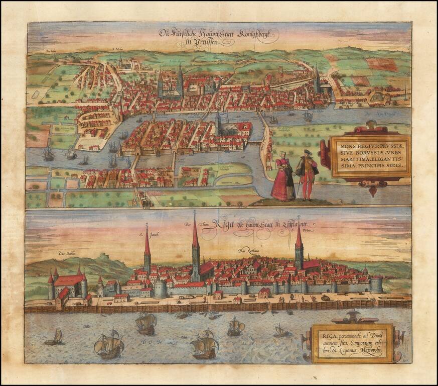
Fine early views of Kalingrad and Riga, first published by Braun & Hogenberg in 1581. The view is one of the earliest obtainable views of Kalingrad and Riga.
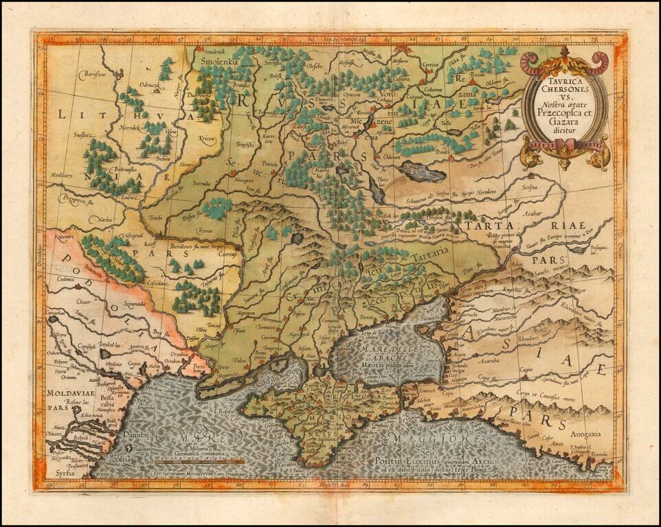
Detailed map of Southern Ukraine, Crimea and surrounding regions between the northern coast of the Black Sea and Moscow. Shows ports, fortified cities and the mouths of the Danube. Minor splitting along the towns, rivers, mountains, etc. Decorative...
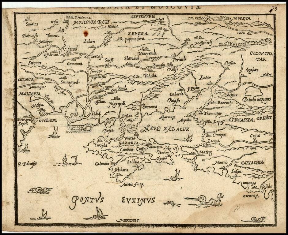
Rare 16th Century map of Russia and Ukraine, published by Zacharias Heyns in his rare Le Miroir du Monde, ou, Epitome du Theatre d'Abraham Ortelius, published in Amsterdam in 1598. Zacharias Heyns was the son of Peter Heyns, who wrote the rhyming text...