

One of the earliest separately published maps of Croatia. Rare early map of Croatia, published in 1593, published to commemorate a critical turning point in the Croation Wars with the Ottoman Turks. Published to commemorate the battle successes of...
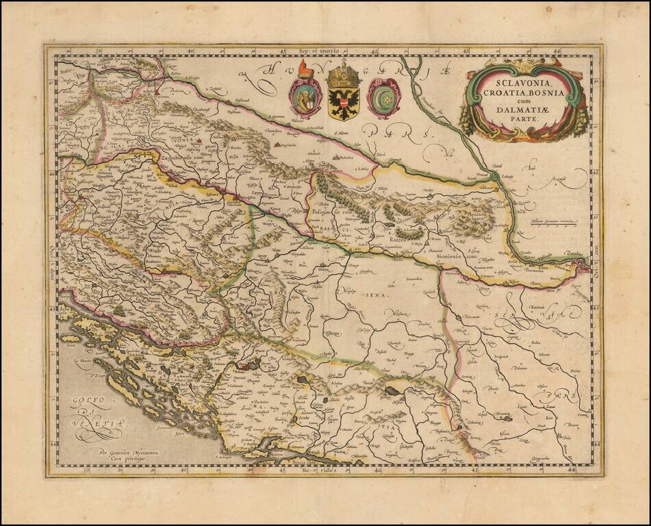
Decorative old color example of this fine map of the Balkans and the Gulf of Venice, with a large decorative cartouche. Includes Slovenia, Croatia, Bosnia, Herzegovina and the western half of Serbia, extending to Belgrad. Includes 3 large coat of arms.
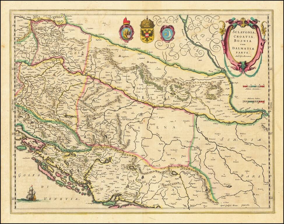
Nice example of Blaeu's decorative early map of the Balkans and the Gulf of Venice, with a large decorative cartouche. Includes Bosnia, Serbia, Croatia, and Slovenia. Includes 3 coats of arms and a sailing ship.
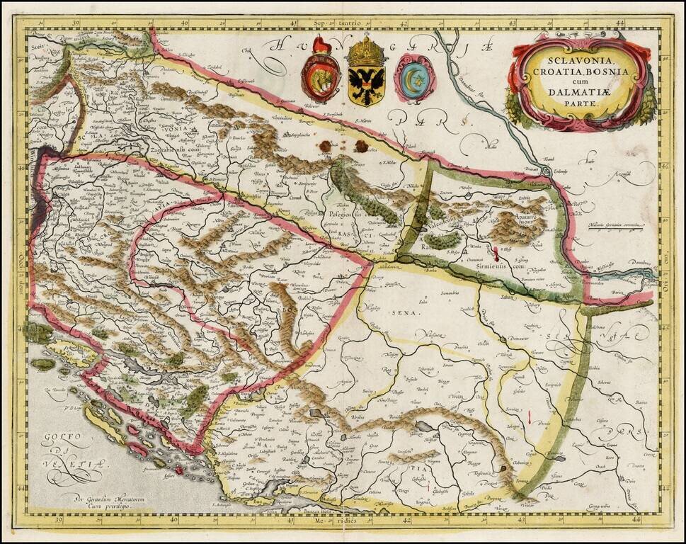
Decorative old color example of this fine map of the Balkans and the Gulf of Venice, with a large decorative cartouche. The map is in original ENGLISH color, which is very rare on the market and easily distinguished from contemporary Dutch color.
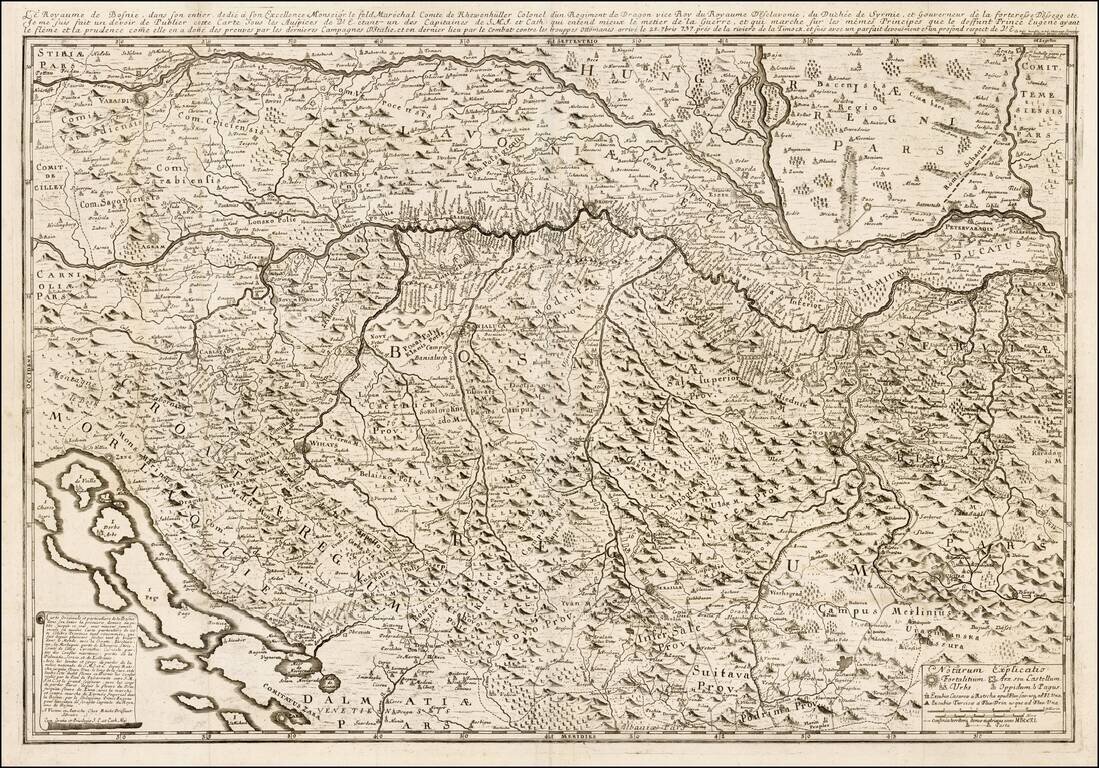
Rare map of of the Kingdom of Bosnia by Etienne Briffuant and published in Vienna. The map extends from Varazdin and Zagreb (Agram) and Senj (Zeng) in the west, to Belgrade in the east, following the course of the Danube and Sava Rivers, encompassing...
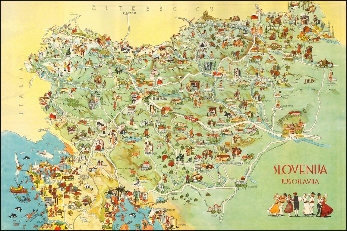
Decorative pictorial map of Slovenia, published by the Slovenian Tourist Bureau. On one side is a lively pictorial map. On the verso is a road map of the northern part of Yugoslavia. Promotional text appears in English, French, German and Italian....
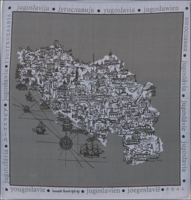
Pictorial map printed on linen in the former Yugoslavia.
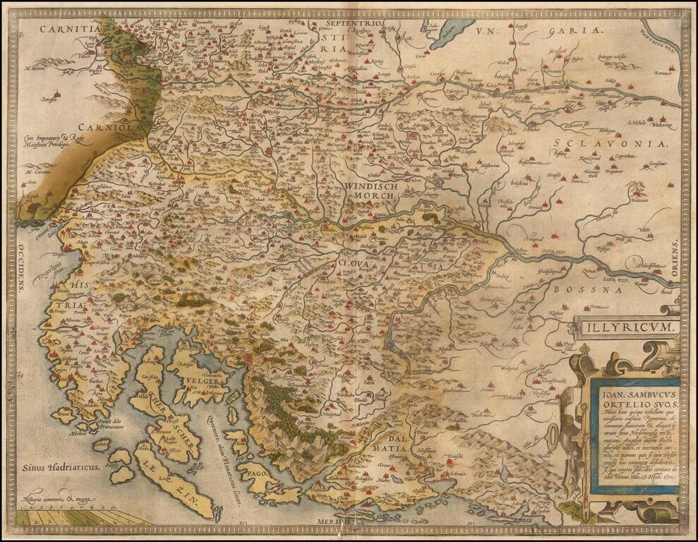
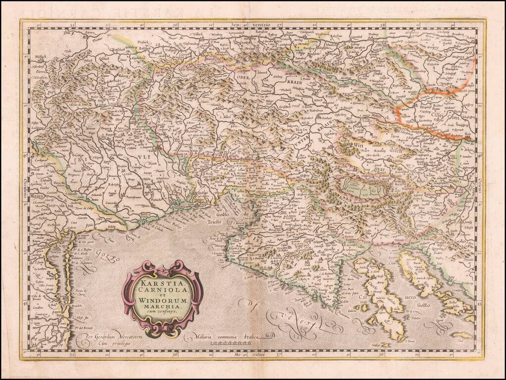
Nice old color example of Ortelius' map of the region from Triest and Villach in the west, to Brod in the east, along the course of the Sava, centered on Zagreb and Novograd. Includes nice detail along the Dalmatian Coast, including Zara, Alt Zara and...
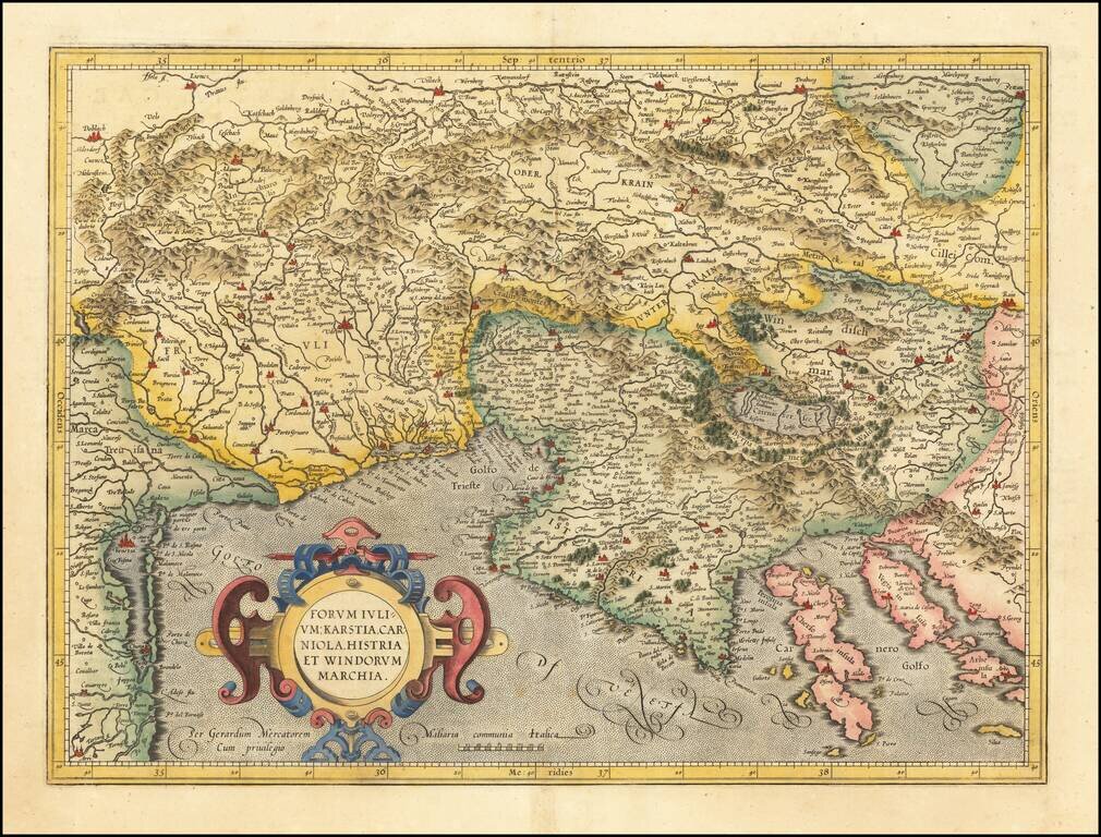
Detailed regional map of the Gulf of Venice and Gulf of Trieste regions, including Friuli and Istria. Includes Slovenia, northwestern Croatia and parts of Italy and Austria.
Detailed regional map of the Gulf of Venice and Gulf of Trieste regions, including Friuli and Istria. Includes Slovenia, northwestern Croatia and parts of Italy and Austria.
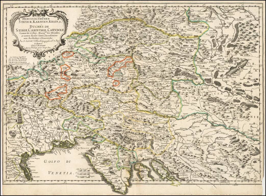
Nicolas Sanson's 1657 double-page engraved map of the Gulf of Venice in the southwest extending to southeastern Austria in the north, and to Croatia in the southeast. The map shows towns, rivers, lakes, mountains, islands and other details.
![Le Cours Du Po . . . [Eastern Sheet--Gulf of Venice, Padua, Vincenz, Feltre, Friouli, Carniola, Istria]](/map/small/58163.jpg)
Striking map of the Course of the Lower Po River, showing the Theater of War in Italy. Nolin's map was first issued in 1702 and corrected in 1703. The map was probably made to illustrate all the territories of the War of Spanish Succession in northern...
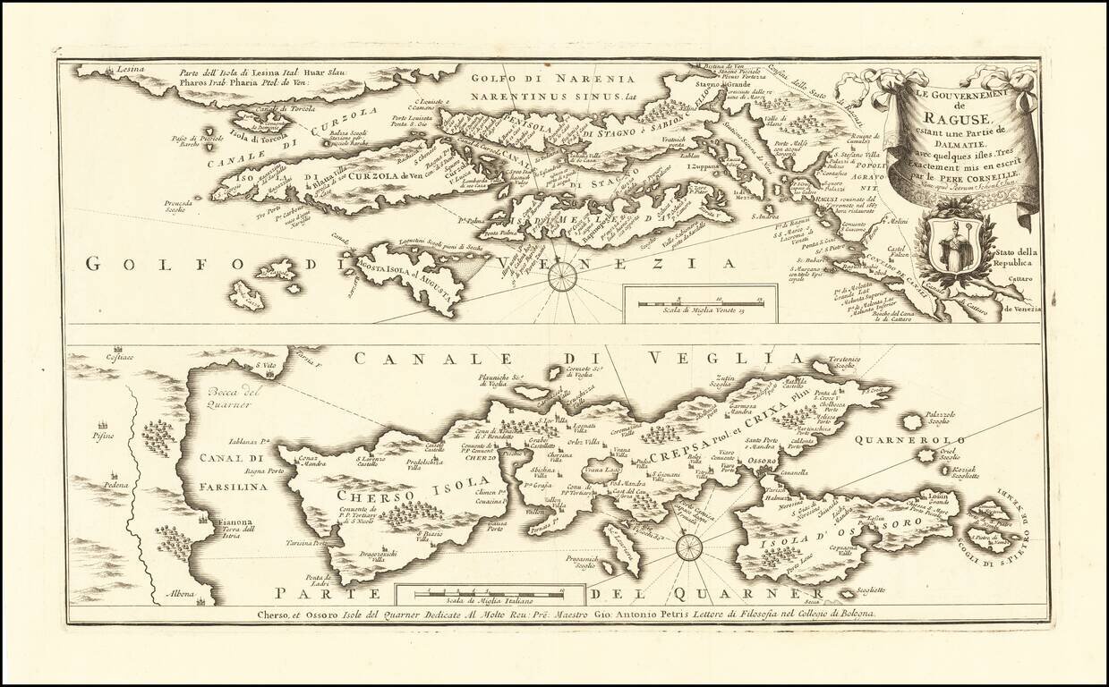
Rare map of the Republic of Ragusa on the Dalmatian coast around Dubrovnik, published in Amsterdam by Peter Schenk Junior. The map covers the area from Kotor to the island Korcula, Hvar and Island Cres and Losinj, with a part of the Istrian coast...
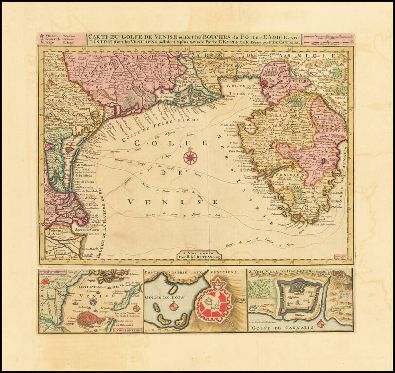
Fine Old Color Example Finely executed chart of Istria and the Gulf of Venice, based upon an earlier map by Cantelli. The map includes plans of the “Laguna” of Venice, the bay and town of Pula and the town of Rijeka below the chart representing...
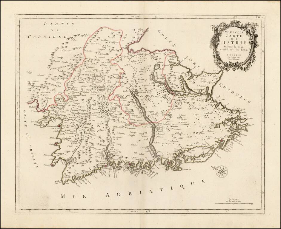
Scarce regional map of Istria, published in Venice by Francois Santini. Unlike many of the maps in Santini's atlas, this regional map of Italy is not drawn from De Vaugondy and is based upon Italian sources. One of the most detailed maps of the...
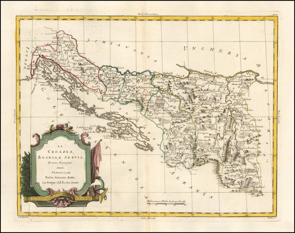
Detailed map of Croatia, Bosnia-Herzagovenia and Serbia, published in Venice by Zatta. Excellent coastal detail.