
![Pour Les Vents [world map centered on Asia]](/map/small/59768.jpg)
Decorative world map, with rhumb lines and a 16 point compass rose and 2 8 point compass roses. Incomplete image of Australia, showing the discoveries prior to Captain Jams Cook.
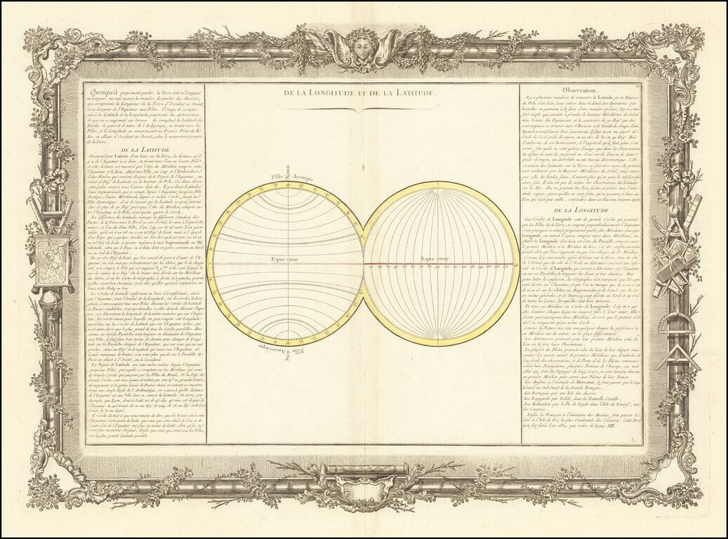
Decorative chart illustrating longitude and latitude. Includes remarkable decorative borders found only in the deluxe edition of Buy De Mornas' Atlas Methodique et Elementaire de Goegraphie et l'Histoire.
![[The centre of this Slider is to be placed by a Thread or Pin over the centre of the respective Planisphere for any Operation]](/map/small/65557.jpg)
Rare overlay "slider" device, which was to be placed over the terrestrial and celestial planishere maps which were published by Dunn & Owen in their Description and Use of the Universal Planispheres. Dunn's Universal Planisphere work was published...
![Sphere De Ptolemee [with] Rose De Boussole…](/map/small/63929.jpg)
Decorative chart, showing a compass rose, Ptolomaic Sphere and various other 18th Century spheres, from Janvier's Atlas.

Sedition in New York in 1766, The Stamp Act, "America's Nabob", and the Origins of "Yankee Doodle". Rare engraved caricature of William Pitt the Elder, Earl of Chatham, represented as a Colossus straddling the Atlantic Ocean and attempting to gain...
![[Title Page] Atlas Moderne ou Collection de Cartes sur toutes les partier du Globe Terrestre . . .](/map/small/27455.jpg)
Decorative title page from Janvier's Atlas Moderne, engraved by Monnet in 1762 and thereafter used for the next 20 years as the title page for this highly successful atlas.
![[Set of Four Allegorical Mezzotints of the Continents -- With a Mastodon!] America. Europa. Africa. Asia.](/map/small/56726.jpg)
An 18th-Century Image of an American Elephant or Mastodon! Four separately published allegorical mezzotints, showing representations of America, Europe, Africa, and Asia. The mezzotints were made by the famed German artist and printmaker Johann Elias...
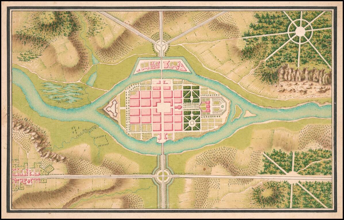
Finely executed plan by Mr. de Lancelles. M. de Lancelles was likely an engineer in the Army of the Prince of Soubise.
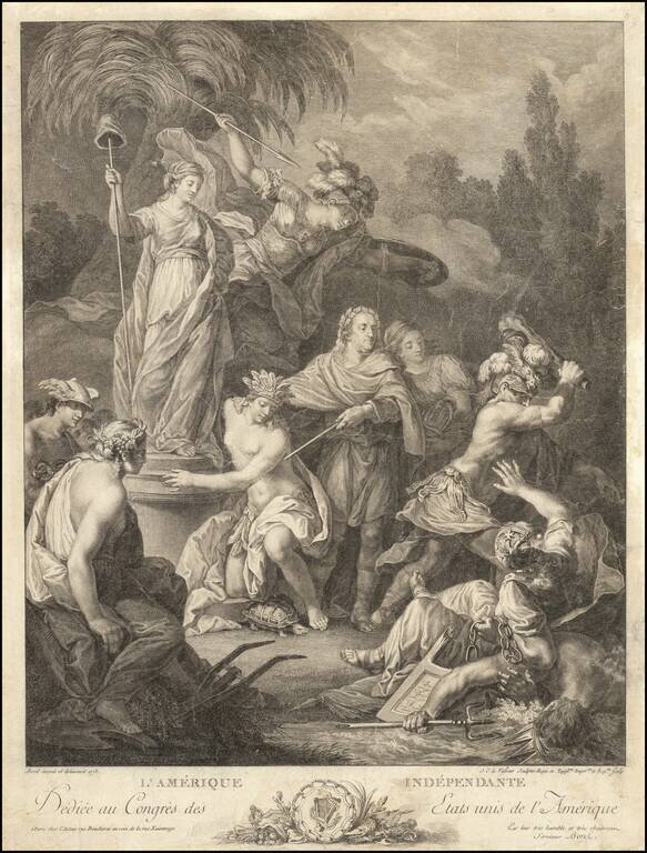
A Tribute To Benjamin Franklin and an Independent America: dedicated to the Congress of the United States of America Second state of this fine engraved allegorical image of an Independent United States of America, engraved by Jean Charles Le Vasseur...
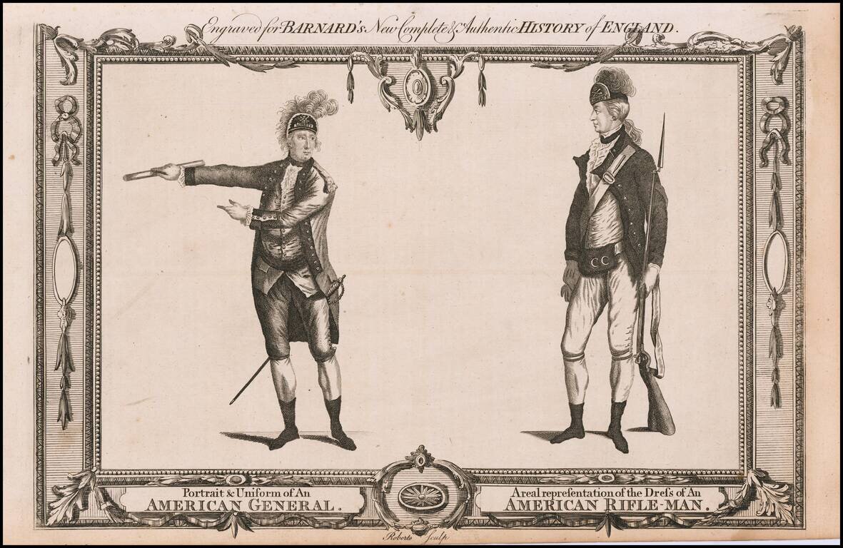
A contemporary depiction of American Revolutionary War figures set within a decorative border, engraved by Roberts. From "Barnard's New Complete & Authentic History of England."
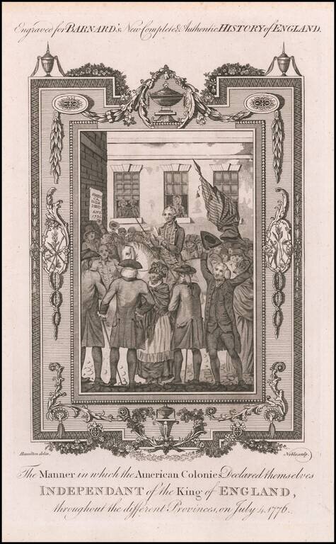
Lively image of a crowd watching the reading of the Declaration of Independence on July 4, 1776. Fine image of the reading of the Declaration of Independence, which appeared in Barnard's New-Completed Authentic History of England. The image is also...
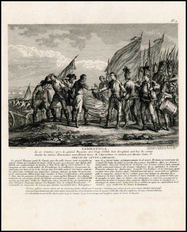
Rare view showing the surrender of General John Burgoyne at the Battle of Saratoga on October 7, 1777, one of the first important American victories during the American Revolution. The view appeared in Nicolas Ponce and Francois Godefroy's Recueil...
![Carte d'Etude [Study Map]](/map/small/66795.jpg)
A superlative example of its kind; an 18th-century French manuscript map drawn by a student (possibly a student surveyor or military officer) to demonstrate competence in the art of classical map drafting. The map incorporates a diversity of...
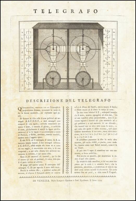
An Early Plan for an Alternative Semaphore Design This work presents a new type of semaphore in which the operator rotates two wheels in order to create a symbol. In such a way, eighteen letters of the alphabet can be signaled. A sketch of this...
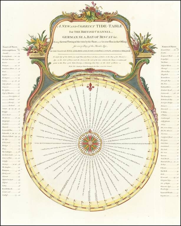
Elaborate chart illustrating the period tides, with times, etc. This chart was first issued in Sayer & Bennett's A Complete Channel Pilot, comprehending the English and French coasts, from the Thames Mouth to the Bay of Biscay, including the North...
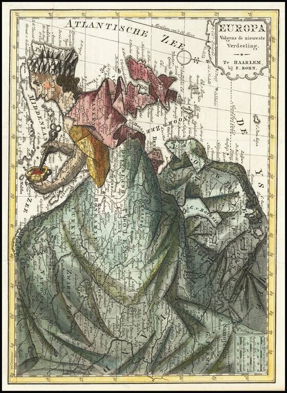
This is a map showing Europe representing the continent as a matronly housewife. This depiction follows a centuries-old tradition in which Europa, the mythical Phoenician queen, is overlain on a map of Europe. In this present representation, Europa's...