Map size in jpg-format: 25.0875MiB
Click to open in high resolution (open in new tab).
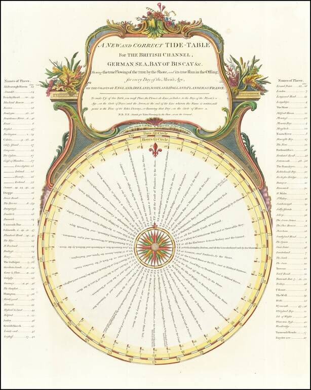
Elaborate chart illustrating the period tides, with times, etc.
This chart was first issued in Sayer & Bennett's A Complete Channel Pilot, comprehending the English and French coasts, from the Thames Mouth to the Bay of Biscay, including the North Sea, with sailing directions, by John Stephenson and George Burn, first issued in about 1781.
James Whittle (1757-1818) was a British engraver and map printer. Whittle was employed by Robert Sayer (ca. 1725-1794). Together with Robert Laurie (1755?-1836), he took on Sayer’s business when the older man died in 1794. The two traded together as Laurie & Whittle until 1812, when Laurie retired. They had specialized in sea charts and maritime atlases. Whittle then partnered with Laurie’s son, Richard Holmes Laurie, until he died in 1818.
If you are a student, write to us in telegram: @antiquemaps and indicate what material you need and for what work you need a map in high detail. We are ready to provide material on special terms. For students only!


