logo

1756. De La Longitude Et De La Latitude

  • De La Longitude Et De La Latitude

De La Longitude Et De La Latitude information:

Year of creation: 
Resolution size (pixels): 
 14021x10379 px
Disk Size: 
 36.7927MiB
Number of pages: 
 1
Place: 
 Paris
Author: 

Print information. Print size (Width x height in inches):
Printing at 72 dpi 
  194.74 х 144.15
Printing at 150 dpi 
 93.47 х 69.19
Printing at 300 dpi 
 46.74 х 34.6

An example of detailing the file of this map of in a printable high-resolution:

Click to open in high resolution (open in new tab).
Attention! this is just the central piece (central area 960x960 px) of the map file!
This is an example, so that you can see and study the level of detail of a given map. The entire Map will be fully available after payment!

De La Longitude Et De La Latitude

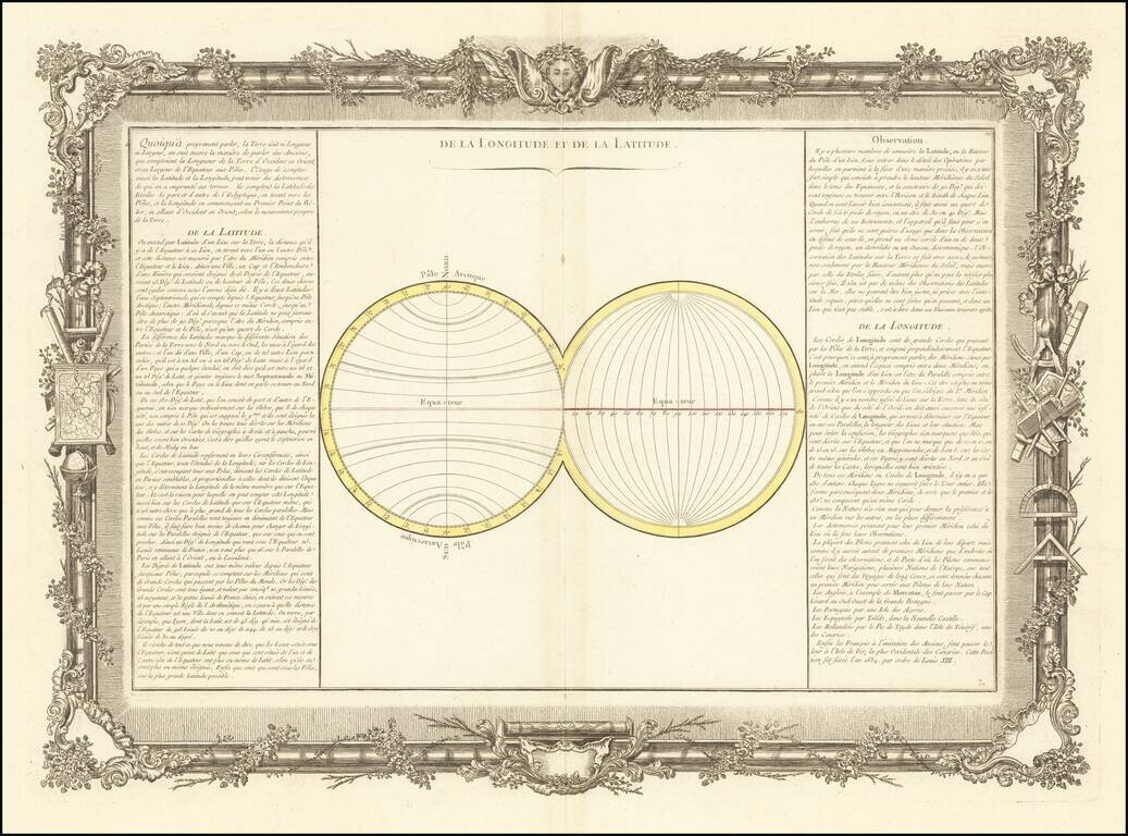
Decorative chart illustrating longitude and latitude.

Includes remarkable decorative borders found only in the deluxe edition of Buy De Mornas' Atlas Methodique et Elementaire de Goegraphie et l'Histoire.


Special conditions for students!

If you are a student, write to us in telegram: @antiquemaps and indicate what material you need and for what work you need a map in high detail. We are ready to provide material on special terms. For students only!

Item information:

Year of creation:
Size:
14021x10379 px
Disk:
36.7927MiB
Number of pages:
1
Place:
Paris
Author:
Buy de Mornas.
$14.99

Related item