
![[The Spice Map] Insulae Moluccae celeberrimae sunt ob Maximam aromatum copiam quam totu terrarum orbem mittunt harum praecipue sunt Ternate, Tidoris, Motir Machion et Bachion, his quidam adiungunt Gilolum, Celebiam, Borneonem, Amboinum et Bandam, Ex Insu](/map/small/70838.jpg)
The Spice Map—Rare, Striking Map of Southeast Asia Rare English edition of Petrus Plancius's "Spice Map," first published in 1594, covering the Philippines and Maritime Southeast Asia, including the famed Spice Islands. Plancius based his map on...
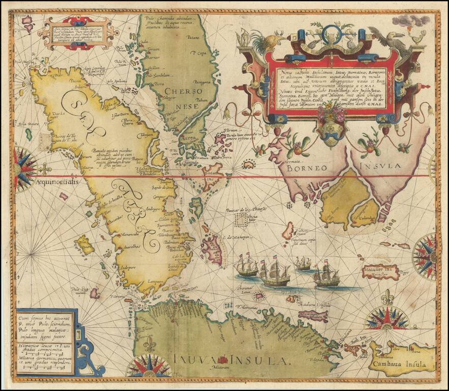
Theodore De Bry's Edition of The Most Important Map of the Straits of Malacca and Vicinity published in the 16th Century Fine example of Willem Lodewijcksz's suppressed map of the region centered on the Straits of Malacca, from Part II of Theodor De...
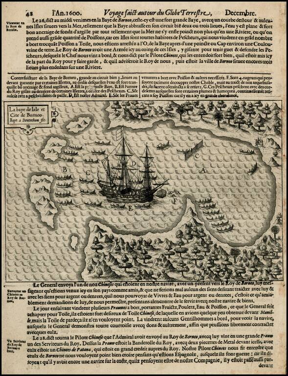
Rare early map of Borneo and neighboring islands, from Olivier Van Noort's Description du Penible Voyage Faict entour de l'Univers ou Globe Terrestre, published by Cornelis Claes in 1602, the first printed account of Van Noort's voyage, which would...
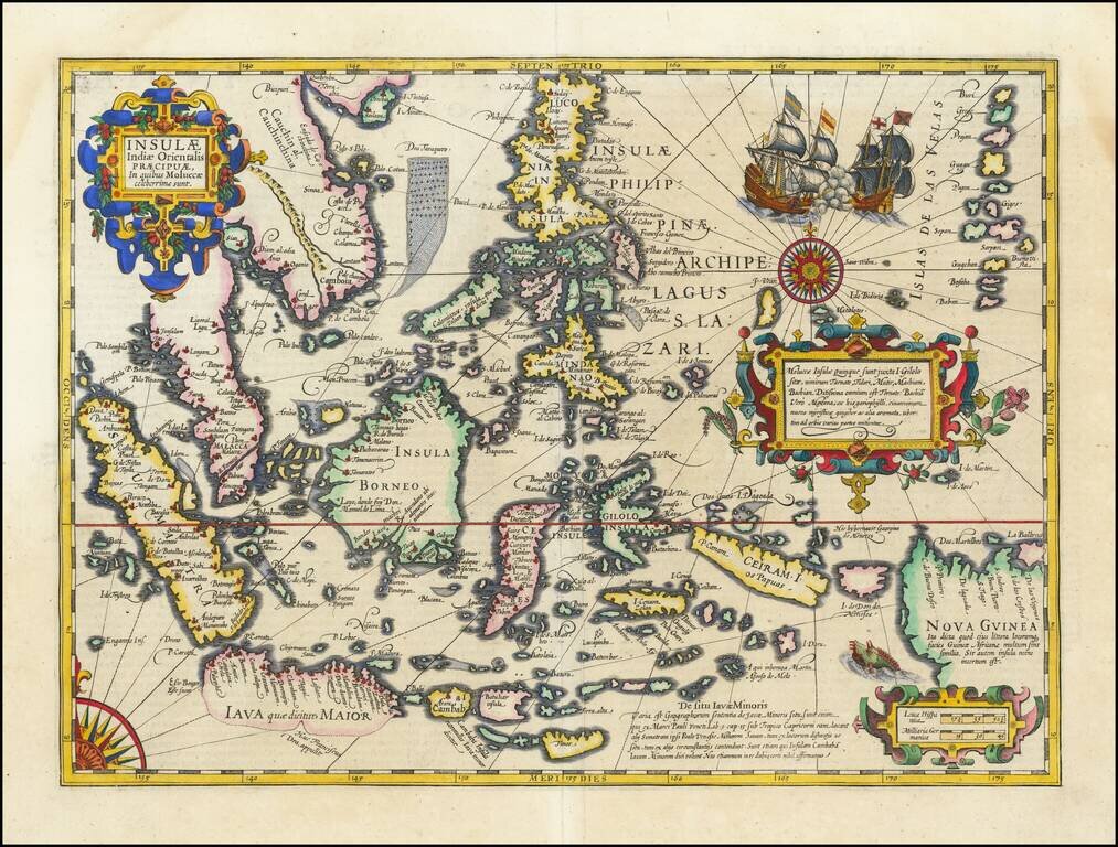
Fine Example of Decorative Map of the East Indies from the Mercator-Hondius Atlas This map showcases European knowledge of the East Indies, an area of increasing importance to Europe from the early-sixteenth century onwards. The focus is on the...
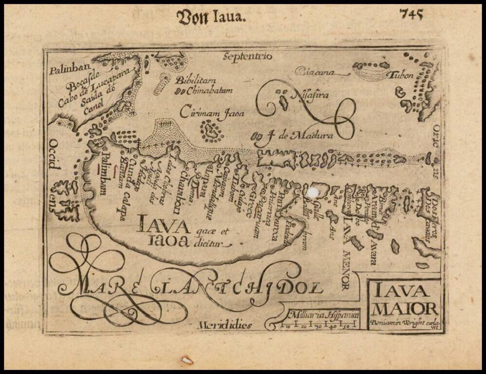
Nice example of this early state of Barent Langenes, map of Java and neighboring Islands, which first appeared in the 1598 edition of Langenes Caert-Thresoor, published in Middelburg. The present map is one of the earliest obtainable maps of Java,...
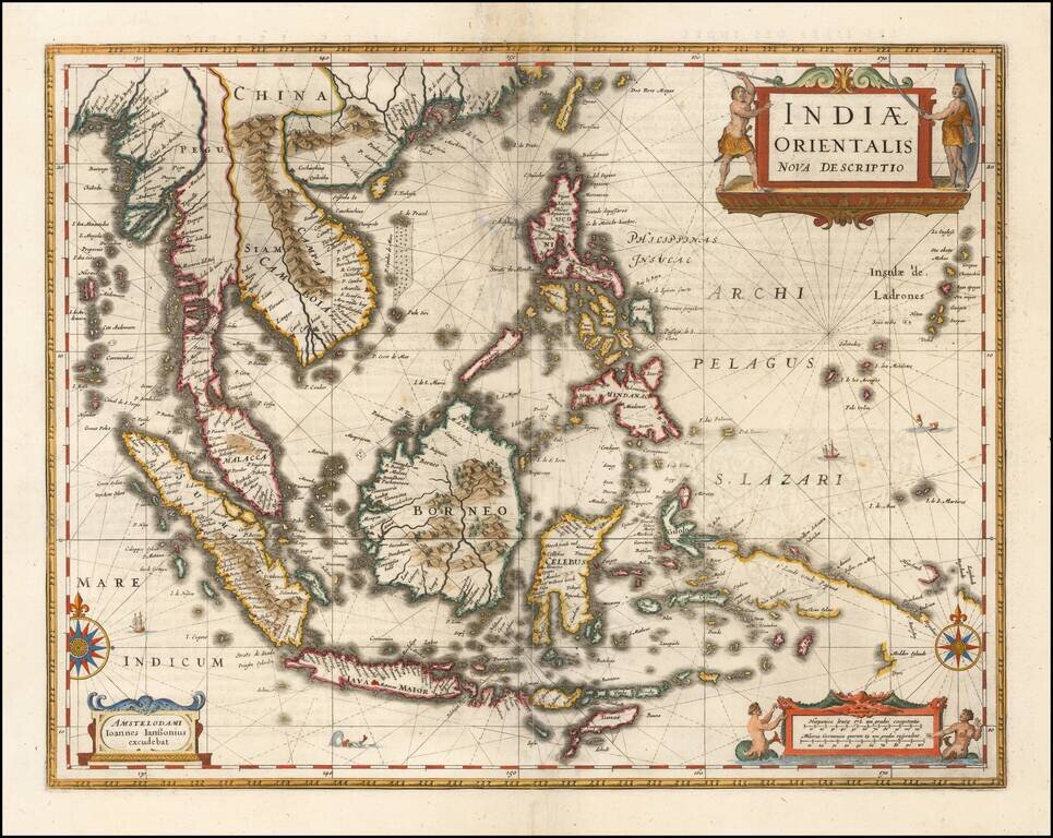
Important early map of Southeast Asia and the Philippines as well as a landmark map in the mapping of Australia, first published by Jan Jansson in 1630. The detail in the Philippines and Southeast Asia is excellent for the period. The map is perhaps...
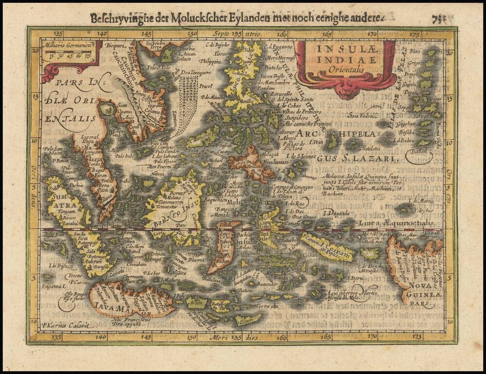
Fine example of Jansson's new map of Southeast Asia and the Philippines, which appeared in his Atlas Minor, first issued in 1628. Jansson has revised and significantly improved this regional map, which had been previously issued by Hondius in 1607,...
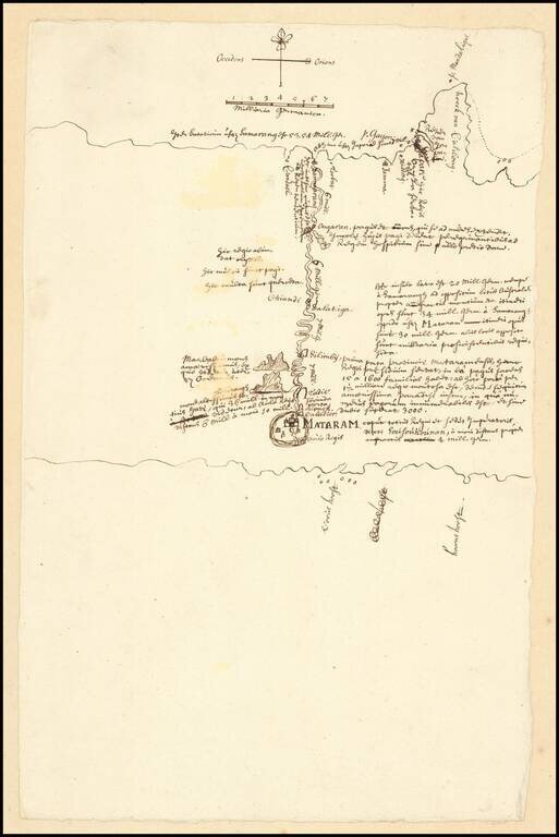
VOC Manuscript Map Record of an Inland Expedition to the Kingdom of Mataram Important early VOC manuscript map of Central Java, focusing on the Kingdom of Mataram at the time of the Dutch embassy led by Captain Tack to Surakarta in 1685. The map...
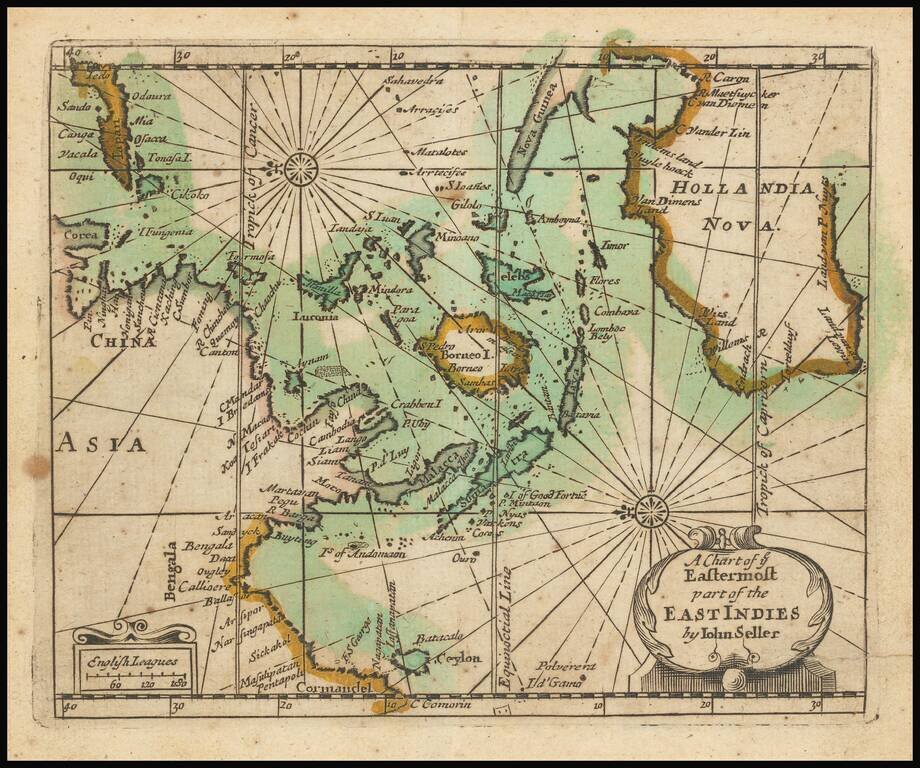
Extremely rare English map of the East Indies and Australia, oriented with the East at top of the map. The map covers the East Indies from India to Japan in the north and New Guinea and Australia in the south. Australia is named Hollandia Nova and...
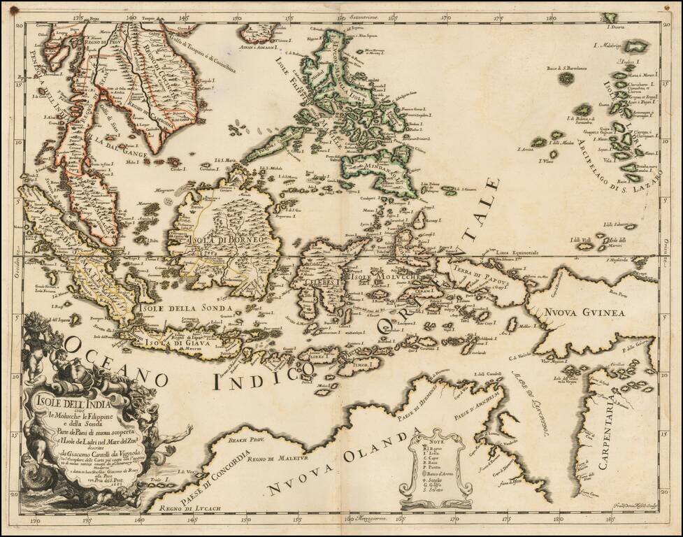
Scarce first state of this decorative map of Southeast Asia and the North Coast of Australia by Cantelli da Vignola and published in Rome by Rossi. Detailed and highly decorative 17th-century Italian map of northern Australia and the islands of...
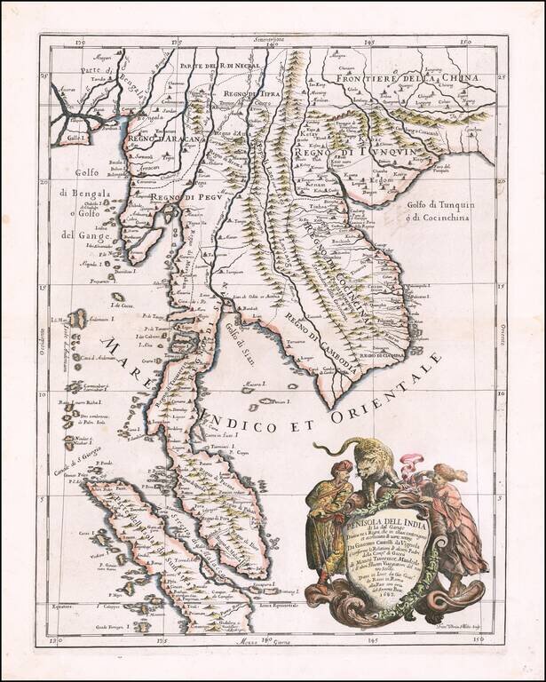
Decorative example of the Cantelli-Rossi map of part of Southeast Asia, extending from Singapore and the Straits of Malacca in the south, to the mouth of the Ganges and southeastern China in the north, produced by Cantelli da Vignola and published in...
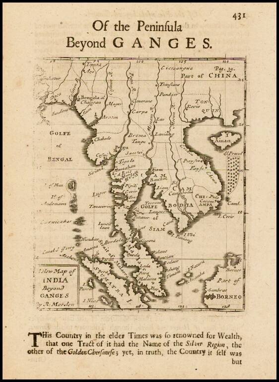
Rare English map of the Malay Peninsula, Cambodia, Vietnam, Thailand, part of China, Borneo, Sumatra and the Gulf of Bengal. One of the earliest obtainable English maps of the region.
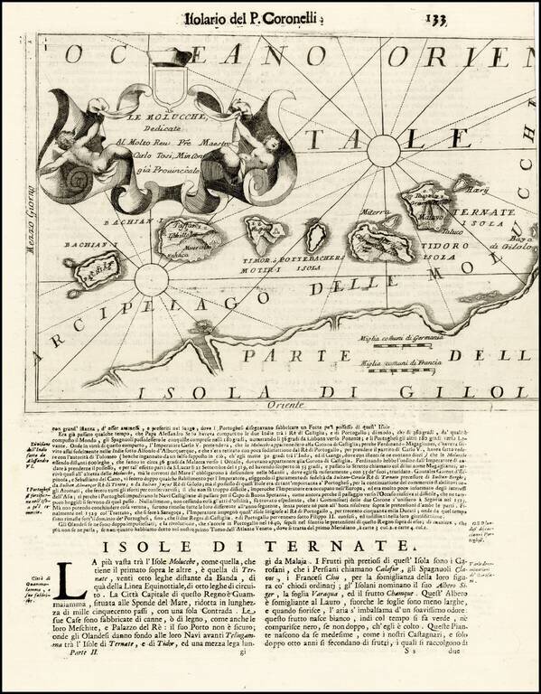
Striking map of the Spice Islands, published in Venice. The map provides detailed topographical image of the Spice Islands, including topography, towns, and fortifications, along with an elaborate cartouche and text below the image.
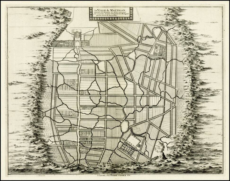
Rare plan of the city of Mataram on the Island of Lombok, immediately east of Bali in Indonesia. The Dutch had first visited Lombok in 1674 and the Dutch East India Company concluded its first treaty with the Sasak Princess of Lombok.
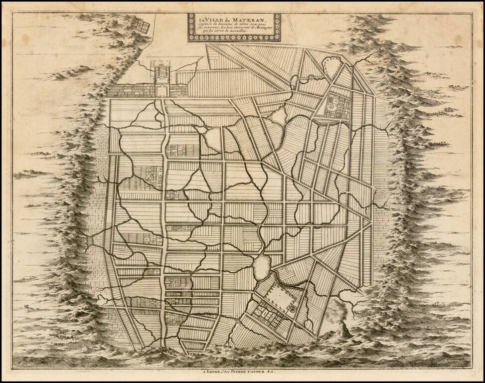
Rare plan of the city of Mataram on the Island of Lombok, immediately east of Bali in Indonesia. The Dutch had first visited Lombok in 1674 and the Dutch East India Company concluded its first treaty with the Sasak Princess of Lombok.
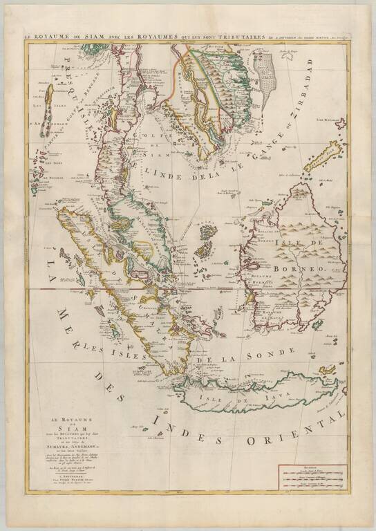
Mortier's Large Format Map of the Kingdome of Siam, Malaysian Peninsula, Singapore, Indonesia, etc. Finely colored example of Pierre Mortier's map of Southeast Asia, extending from Thailand, Cambodia, Viet Nam, and the Malay Peninsula and Gulf of...