
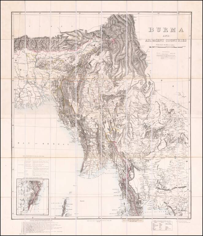
Published in Calcutta Finely executed map of Burma, compiled by Colonel Henry Ravenshaw Thullier and published by the Survey of India Office. One of the most accurate maps of Burma for of the period, derived from a host of contemporary sources...
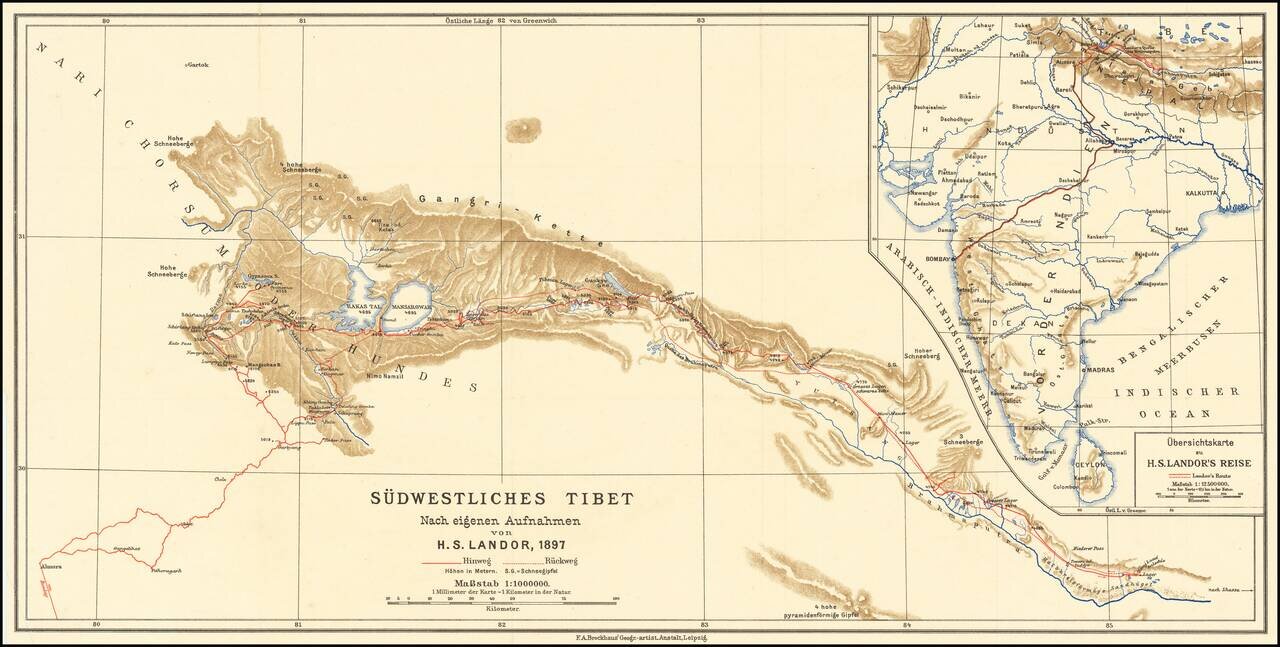
Scarce map of southwestern Tibet, illustrating the report of H.S. Candor. Candor was the first European to reach both sources of the Brahmaputra River. His book on Tibet was published in 1897.
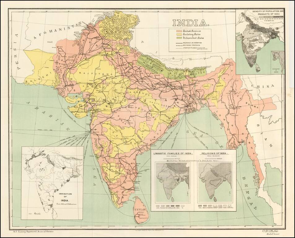
Detailed map of India, showing density of population, lingusitic information, religion, etc. The map is color coded to show British Provinces, Fendatory Provinces and Independent Provinces.
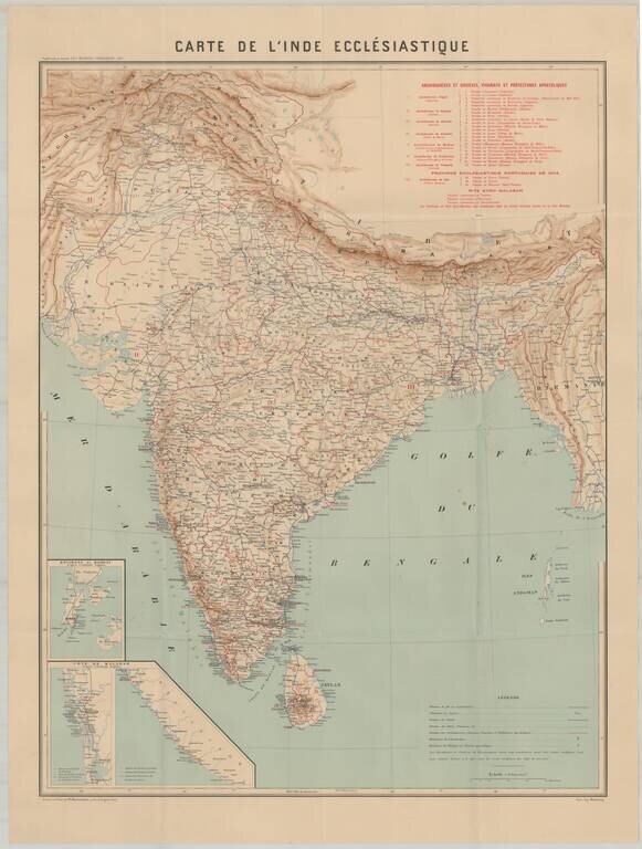
Rare map showing the Catholic Missions in India. The map includes topographical details, locations of Missionaries, Archdioces, Diocese, Vicariats and Prefectures. The Société des Missions Étrangères de Paris (Society of Foreign Missions of Paris)...
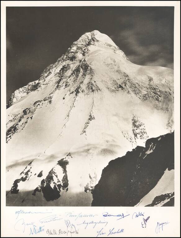
Vittorio Sella K2 Photograph Commemorating the Duke of Albruzzi's Expedition in 1909 -- Signed by A 1954 Team of Italian Climbers This photograph of the south-east face of K2 was taken on the expedition of Luigi Amedeo, Duke of Abruzzi's to K2 and...
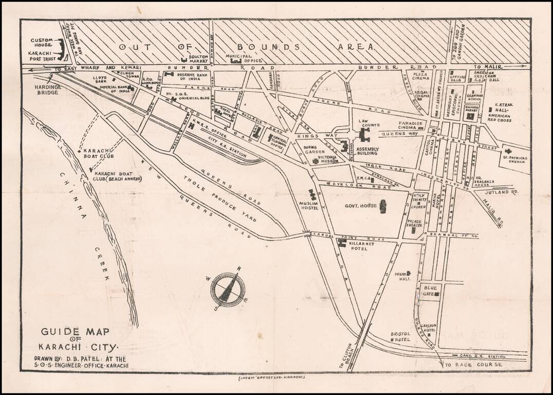
Rare Karachi Imprint Early guide map of Karachi, drawn by D.B. Patel. Points of interest shown on the map include: Customs House Karachi Port Trust Imperial Bank of India Boulton Market Reserve Bank of India Hq. S.O.S. Oriental Building...
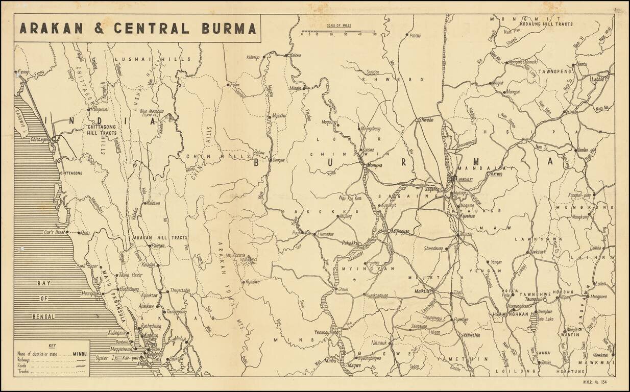
Scarce Map of the War in Burmah / Myanmar Detailed map of Burmah and India, published in India for audiences within the British Empire, providing news of the war around the world. The present map illustrates the theater of War in Birmah, centered...
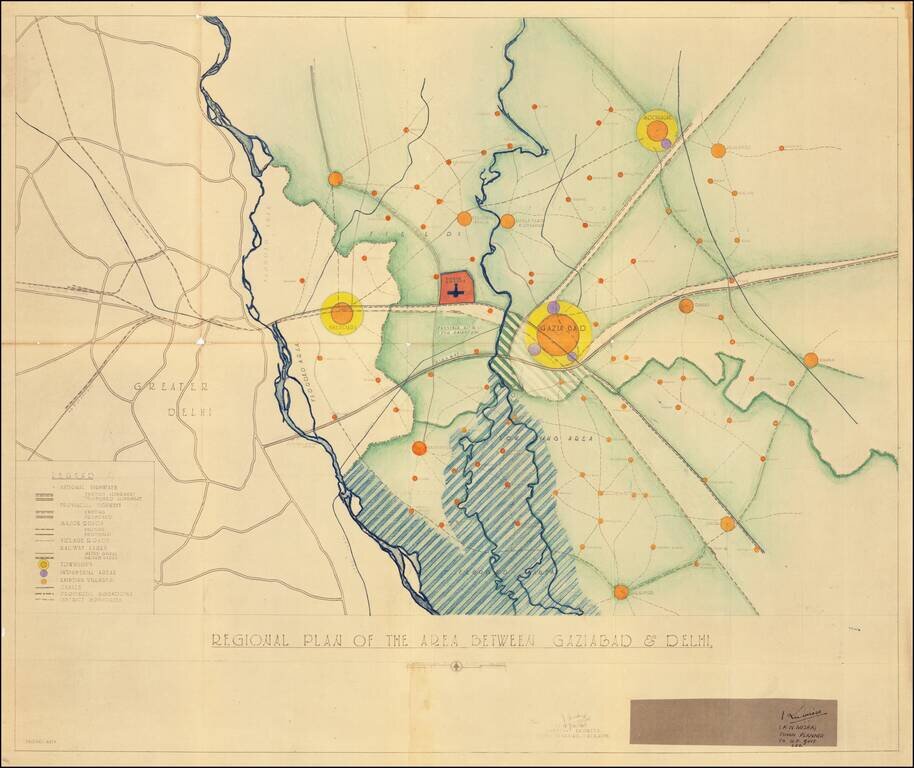
Modernizing Utter Pradesh Following Indian Independence By Renowned Urban Planner Robert Dudley Trudgett Interesting master planning document and map, prepared by the Town & Village Planning Office in Lucknow by renown American architect and urban...
![[District Bholawade]](/map/small/66013.jpg)
Fine large map of Bholawade District and environs, in the region of Maharashtra, in Western India.
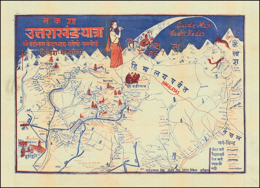
Pictorial Pilgrimage Guide Map for Uttarakhand, India Showing Important Holy Sites for Multiple Religions This interesting pictorial guide map shows pilgrimage routes for all the temples on the Chota Char Dam pilgrimage circuit, Badrinath, Kedarnath,...

Large Tourist Map Poster of Assam, India. Nice map of Assam, published in Shillong, India in the middle of the 20th century, aimed at the budding tourist industry in that tea-producing region. The key enumerates the following: Rail Road; Rail Road...
![[Trekking in the Himalayas]](/map/small/43997.jpg)
Trekking in the Annapurna Conservation Zone Detailed trekking map of the Himalayas, centered on the Gandaki Zone and the town of Pokhara, published in Kathmandu for Amtrek Nepal, "Your Reliable Partner in Himalayas." Includes inset maps showing:...
![[Early Trekking Map] Latest Map of Kathmandu to Tibet](/map/small/51007.jpg)
Large format Trekking map of the Tibetan Mountains, published in Kathmandu. Includes a larger inset of Lhasa City and a second inset map of Tibet.
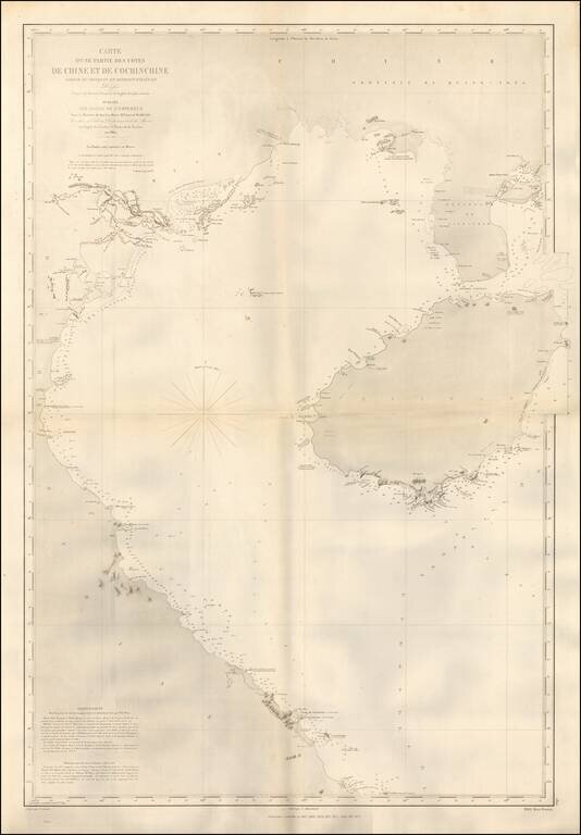
Detailed coastal chart of the Southern Coastline of China and the Coast of Vietnam, south to the Da Nang area, published in Paris by the French Depot de la Marine. The chart was apparently used in the 1870s, shortly after French obtained Territorial...
![[Southeast Asia] Tabu. Mo. In. Orig. (First Modern Map of Southeast Asia -- Old Color)](/map/small/41330.jpg)
Old color gold heightened (on verso) example of the rare 1522 edition of the first printed map to focus on the Southeast Asian islands and indeed, the only map to focus on this area in the first half of the 16th Century. Fries map was a significant...
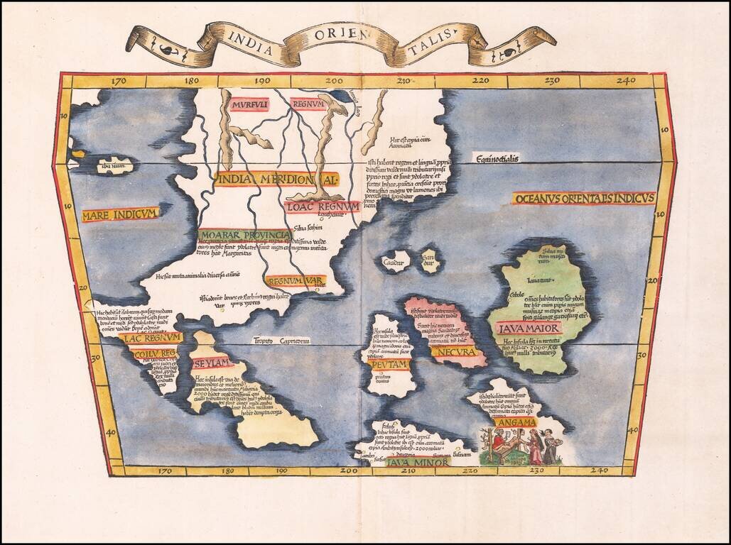
Early Antique Map of Southeast Asia Finely colored example of the first printed map to focus on Southeast Asia and the only map to focus on this area in the first half of the 16th century. Fries' map was a significant milestone in the Mapping of...