
![Plan du Typa ou de Macao [with] Plan De La Baye D'Awatwska…Du Kamtschatka [with] Parti Du Japon ou Nipon](/map/small/36150.jpg)
Detailed maps of Macao, Awatska Island and part of Japan (Nihon), which appeared in the French edition of the Official Account of Cook's Voyages. Includes soundings and other details of each of the Bays.
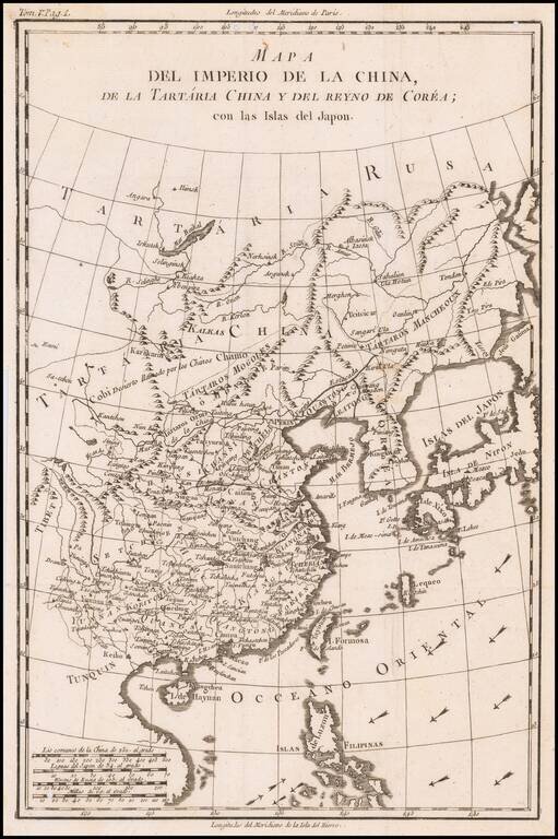
18th Century Spanish Map of China, &c. Rare Spanish map of China, Tartary and Korea, published by the Duke of Almodovar in Madrid. The map appeared in Volume 5 of Historia politica de los establecimientos ultramarinos de la nacionales Europeas,...
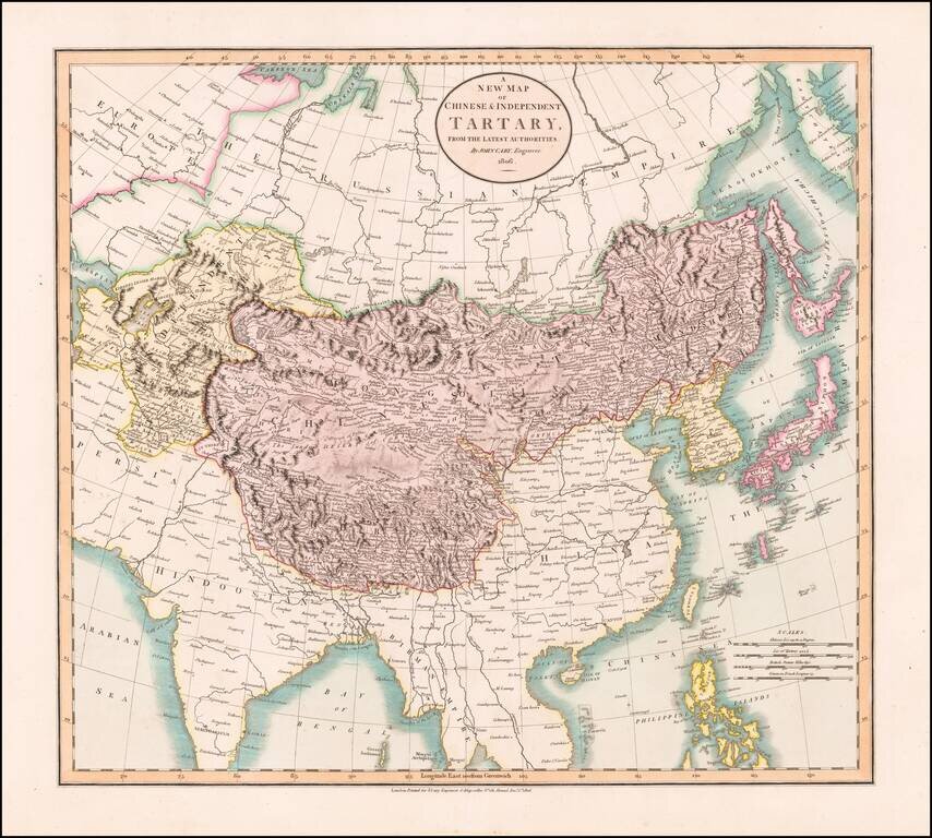
Antique Map of Central and Eastern Asia, from the Caspian Sea to China A marvelous map of Chinese Tartary, Corea and Japan. Includes nice detail and notes in the interior of Mongolia. Shows towns, rivers, mountains, lakes and other features.
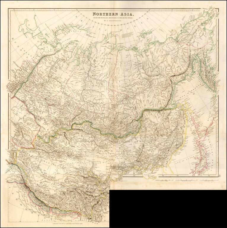
Striking example of Arrowsmith's rare map the region North of the Himalayas. A highly detailed map of Northern Asia, taking in Mongolia, Tibet, Bhutan, Tartary, Siberia and Manchuria. Part of Japan engraved also. The map provides a highly detailed...
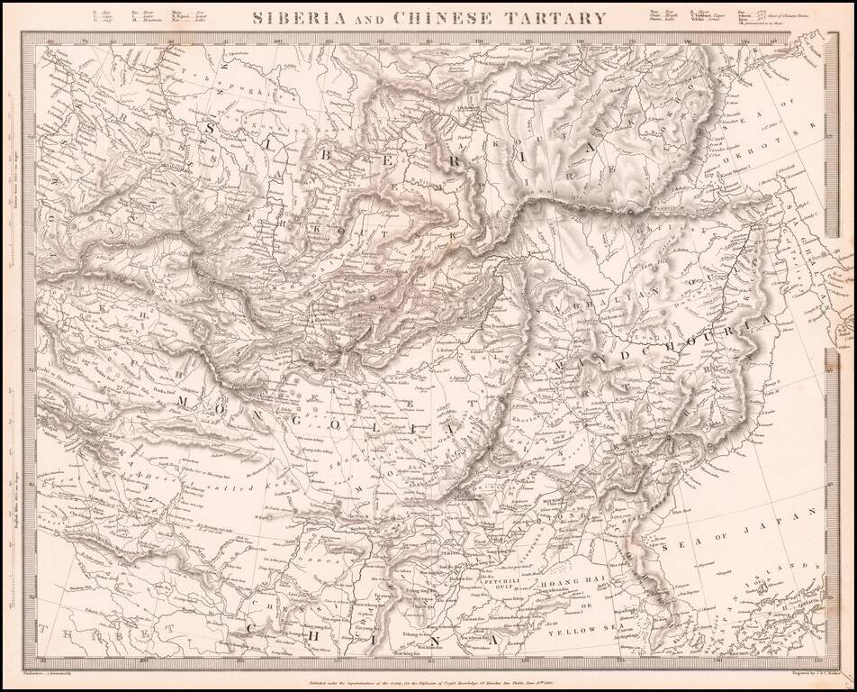
Detailed map of Siberia, Mongolia, Manchuria, etc., issued by the Society for the Diffusion of Useful Knowledge (SDUK).
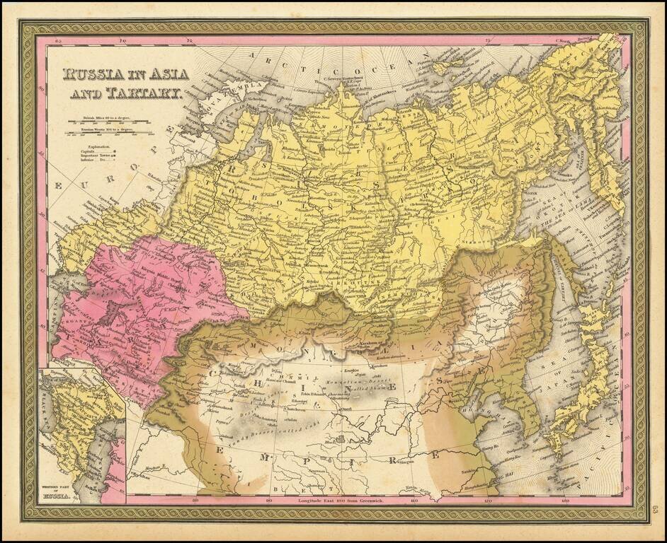
Detailed map of Russia, Tartaria and China, extending to Corea and Japan. Decorative border. An excellent map from the leading American mapmaker of the mid-19th Century.
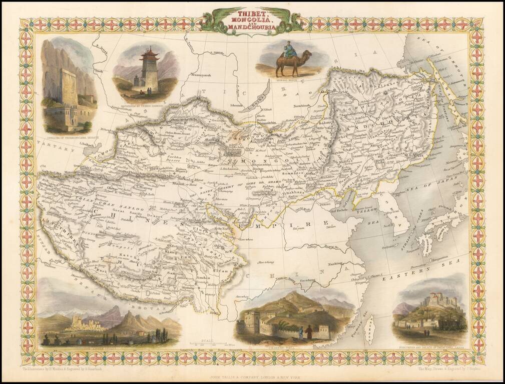
Striking full color example of this marvelous regional map. Extends to Nepal and Lake Balkach. Decorative vignettes of Dwelling of Tessaling Lama, Shigatei, Mausoleum At Teshoo Loom Boo, a Mongol Noble riding a camel, Fortress and Palace of the Dalai...
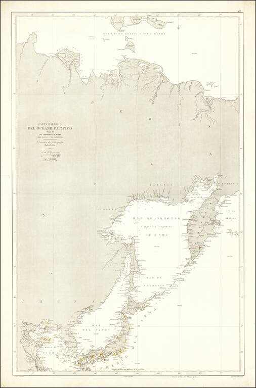
Rare Spanish Sea Chart of the Northeast Coast of Asia, published by the Spanish Hydrographical Department. The chart extends from Korea and the Yellow River to Kamtchatka.
Detailed map of the Theater of War during the Russo-Japanese War. The map was created to illustrate the progress of the Russo-Japanese War (1904 - 1905). The Russians and Japanese were struggling for control of Port Arthur, which would be surrendered...
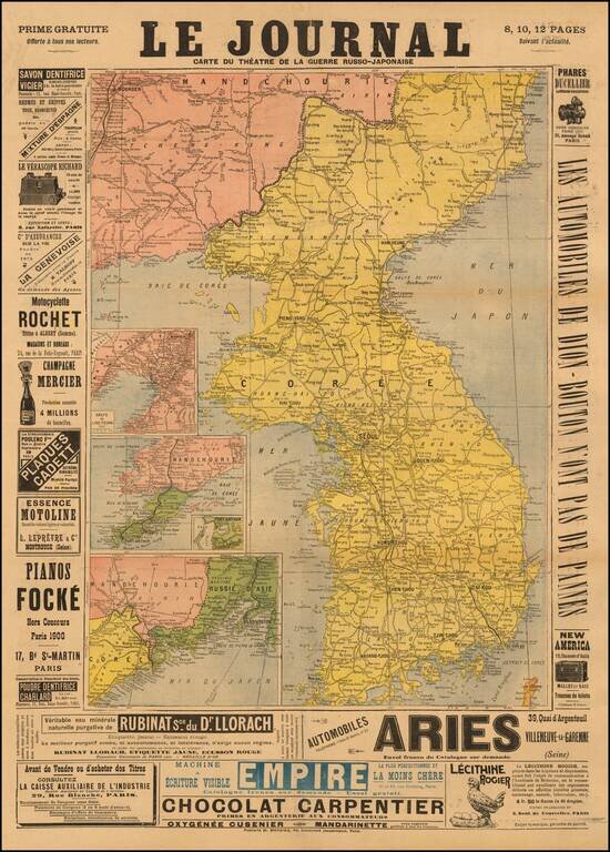
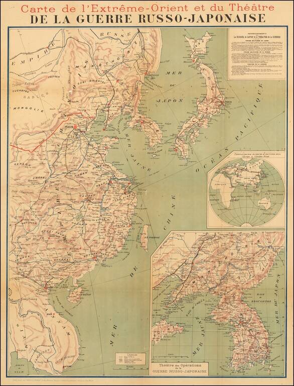
Detailed map of of the Theater of War during the Russo-Japanese War, published in Paris. The map appeared as a "Prime Gratuite" offered to subscribers of Le Journal and is surrounded by advertising. Includes inset maps of: Manchuria, Korea, Russia...
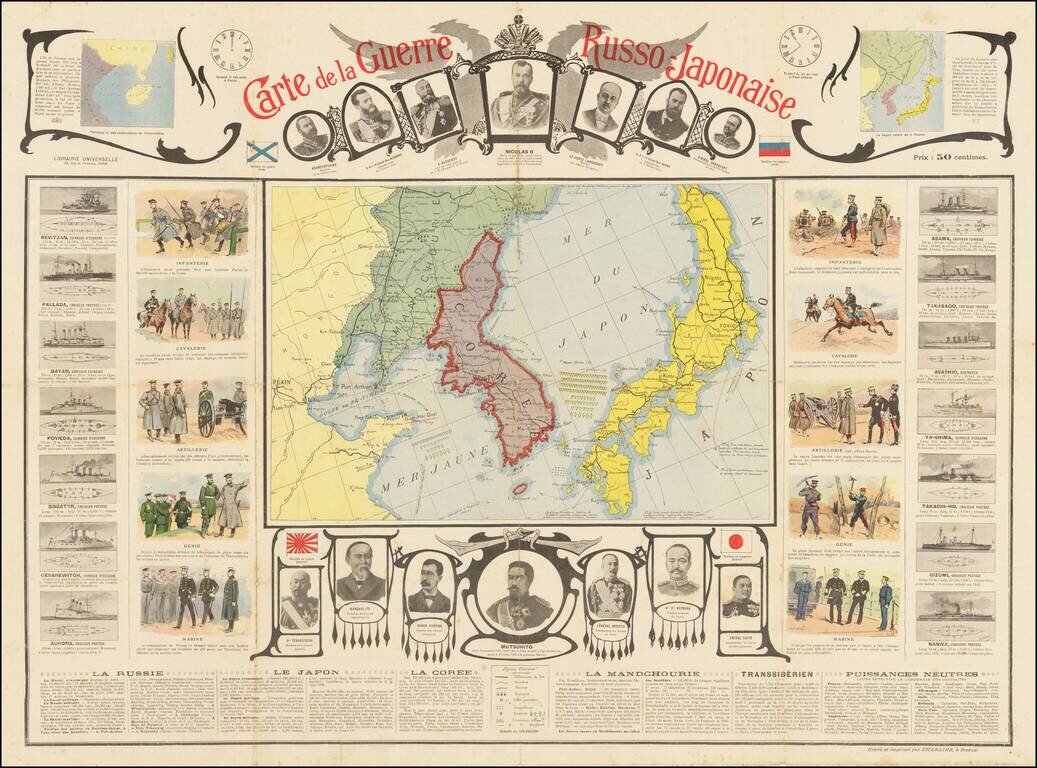
Detailed pictorial map of the Pic, published in Paris. The map is surrounded by vast amounts of pictorial and textual information, including: The time difference between Port Arthur and Paris (about 8 hours) Portraits of Russian leaders across the...
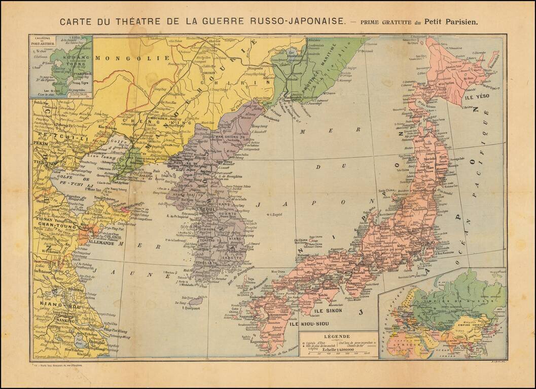
Scarce broadside map of the Theater of War in China and Korea, issued as a "Prime Gratuite" by the Petit Parisien. The map is centered on Korea and identifies by Color the regions owned by the different stakeholders in the War: Russia-Green...
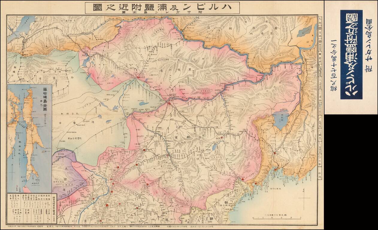
Highly detailed large format map of the Harbin and Vladivostok areas, with a large inset map of Sanghalien Island. The map is dated year of Meiji era 38th and locates roads, railroads and other features.
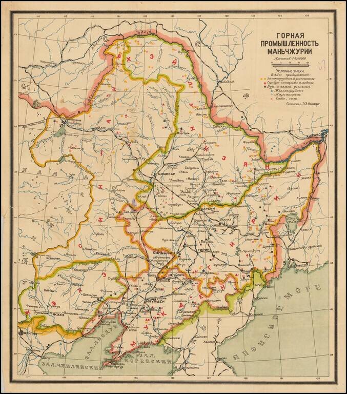
Interesting Soviet-era map of Manchuria, with particular focusing on the natural mineralogical resources of the region and the efforts to exploit them. The key in the upper right has symbols for iron ore, gold ore, salt, etc. Rail lines are depicted...
![Zhuili (Dili) Tu [Geographical Map (of China)] 墬理圖](/map/small/65048kb.jpg)
The Earliest Known Map of China. Extremely rare and early example of the emblematic Dili Tu (墬理圖) [Geographic Map of China] stone map, originally made in circa 1190 by the Chinese polymath Huang Shang (黃裳). The map is a traditional Chinese...
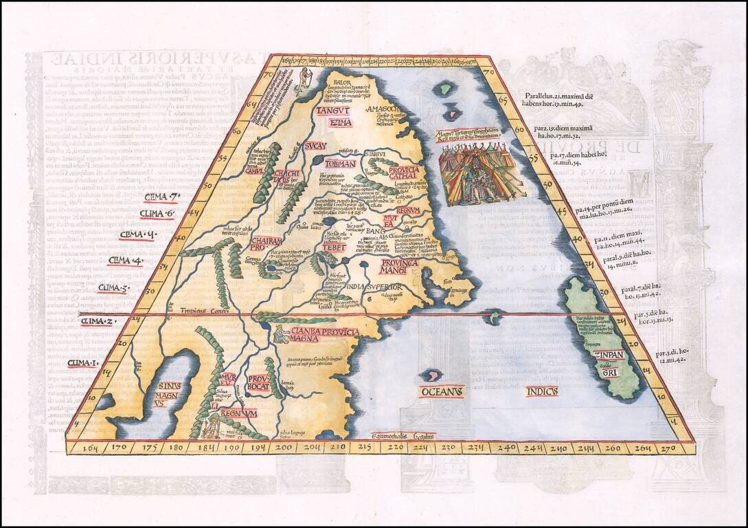
Finely colored example of Lorenz Fries map of China, Japan and adjoining regions, the first printed map to focus on China. Fries map of eastern Asia is the first European map to focus on the region of Japan and China alone . This map derives from...