
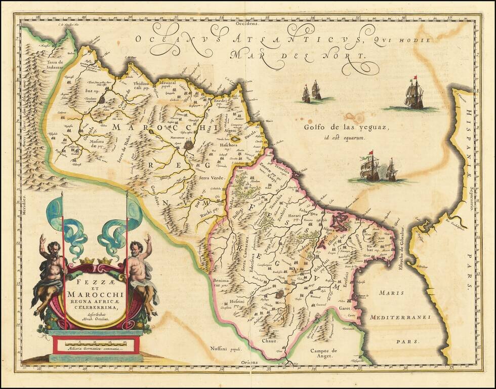
A striking map of Morocco, showing large fortified towns of Marrakesh, Taradante and Fez, towns, mountains, rivers, lakes, etc. Tanger, Cueta and Rio Rabata also appear. Large decorative cartouche and sailing ships. Ortelius is credited in the title...
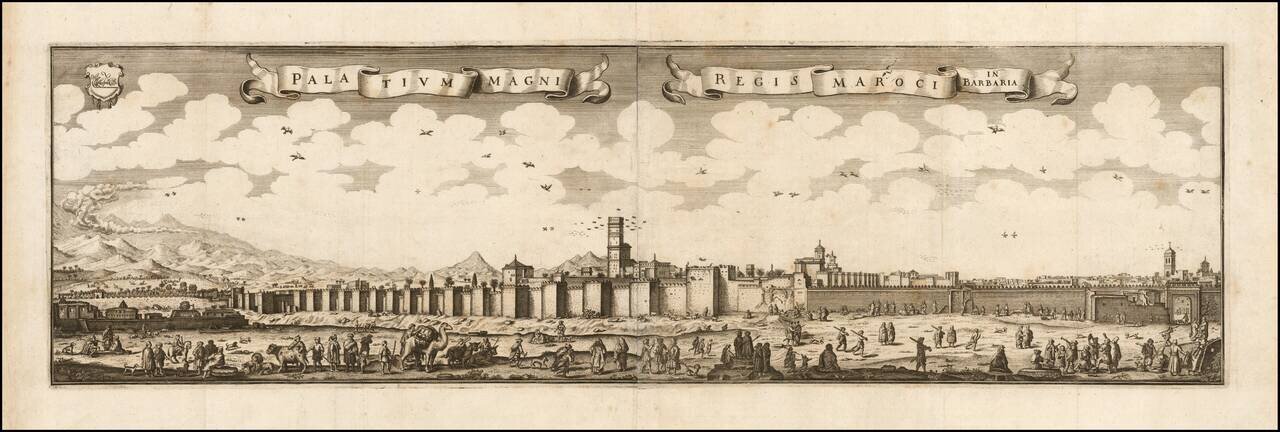
Rare early view of Marakesh. Rare and superb view of the city of Marrakech and its walled fortifications, from the book Archontologia Cosmica published in 1649. The view is derived from a print of 1646 by Adriaen Matham, who accompanied in 1641 the...
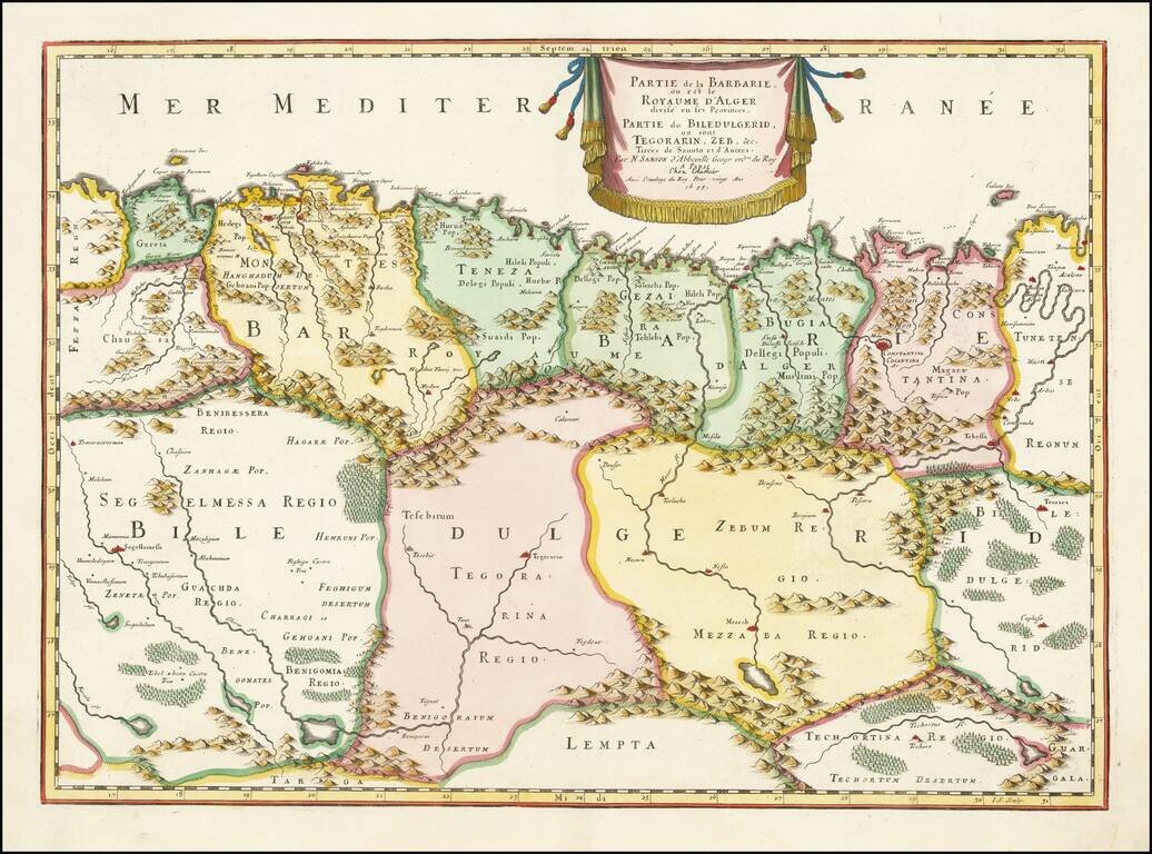
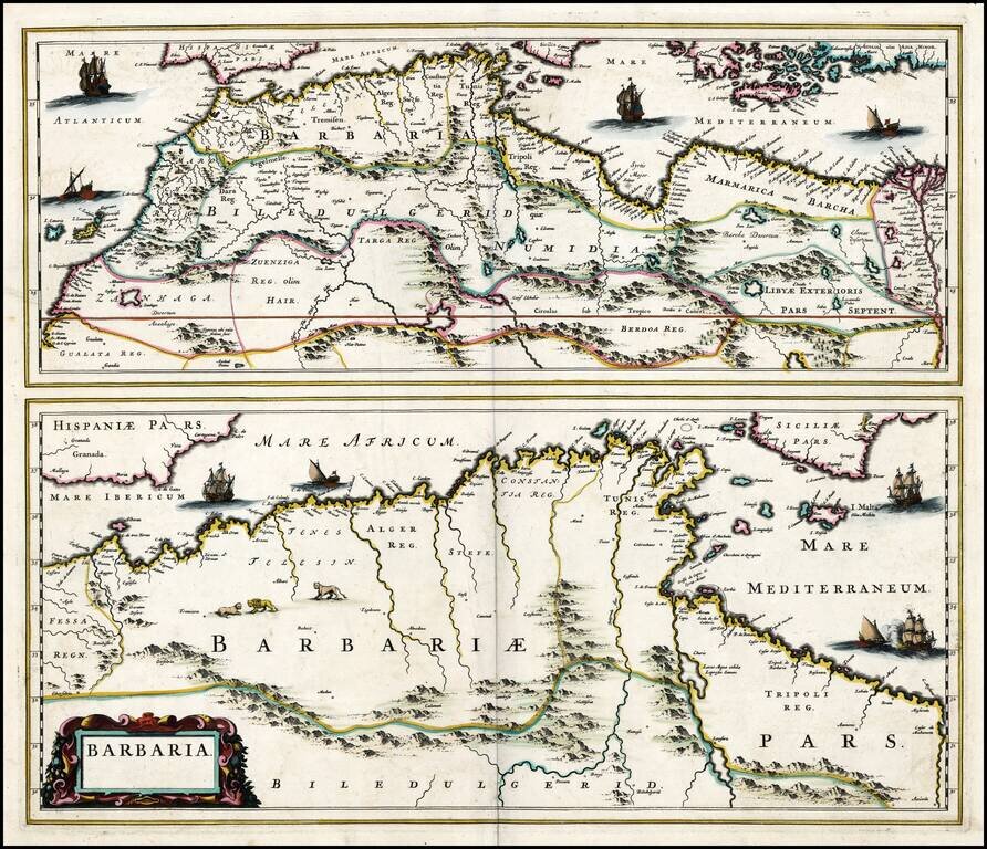
A nice example of Sanson's 1655 double-page engraved map of the Algerian coast of North Africa. The map shows the Barbary Coast divided a large number of states extending inland from the Mediterranean to the southern Atlas Mountains. This gives way to...
Fine ENGLISH color example of Jansson's map of Sicily and North Africa. Decorative map showing the North African coast (Tunisia), Malta and its neighboring islands, and a part of Sicily. Decorative title cartouche and text box. Maps in early English...
Rare map of part of North Africa, which appeared in Picart's Tresor des carte Geographiques, published in Paris. Picart's map is based upon Jansson's map, published in his Atlas Minor in 1628. The first French version of the map was published by...
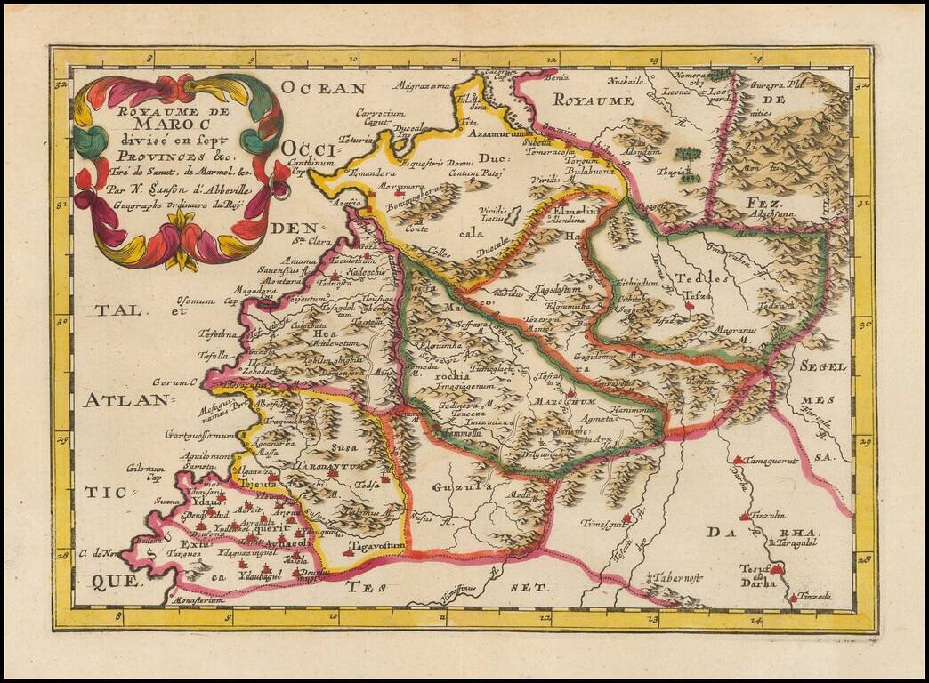
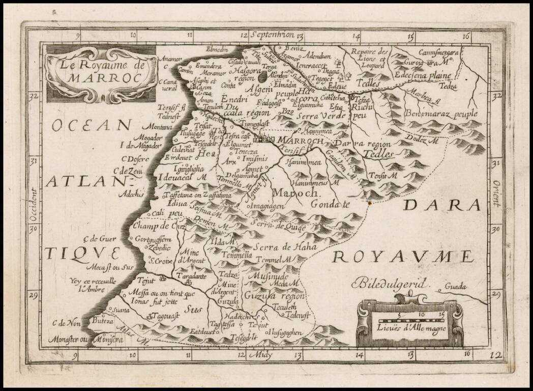
Fine old color example of this finely engraved map of Morocco, first published by Nicholas Sanson in 1654. Sanson was the Royal Geographer to the King of France and perhaps the most important commercial mapmaker of his generation. The map is based in...
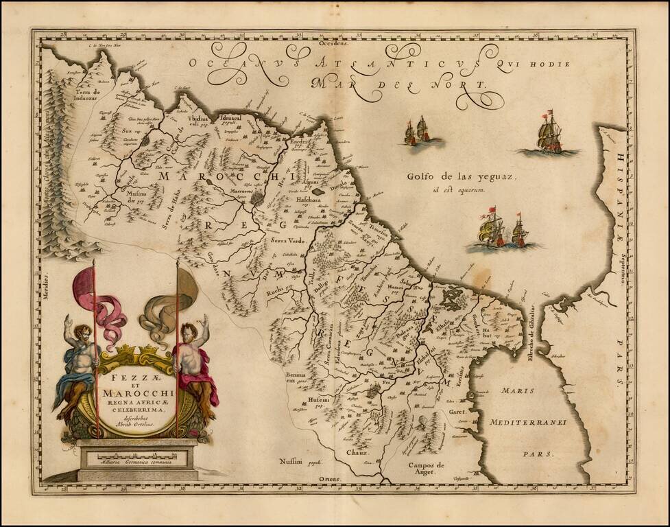
Nice old color map of Morocco, showing large fortified towns of Marakesh, Taradante and Fez, towns, mountains, rivers, lakes, etc. Tanger, Cueta and Rio Rabata also appear. Large decorative cartouche and sailing ships. Ortelius is credited in the...
![Africa ex Bello Africano [with] Egiptus ex Bello Alexandrino](/map/small/49002.jpg)
Small engraved map of two of the African theaters in Julius Ceasar's Civil War, produced by Pierre Du Val in Paris, circa 1660. The map shows the two African components of Ceasar's war of power consolidation, including Tunisia (showing the B.C. 49...
Gold Heightened, old color example of Blaeu's map of the North African Coastline. From a composite atlas published by Abraham Wolfgang in Amsterdam.
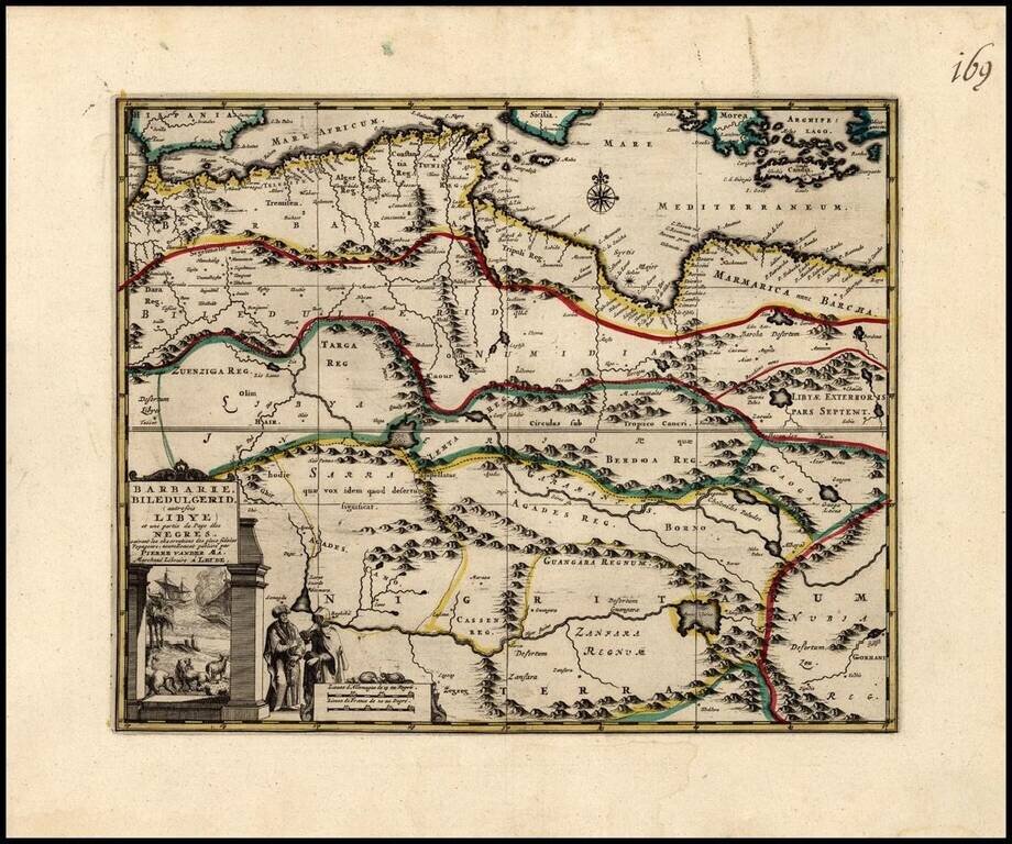
Decorative regional map of North Africa, with an elaborate title cartouche. The map illustrates North Africa and part of the region inhabited by the Negro Countries.
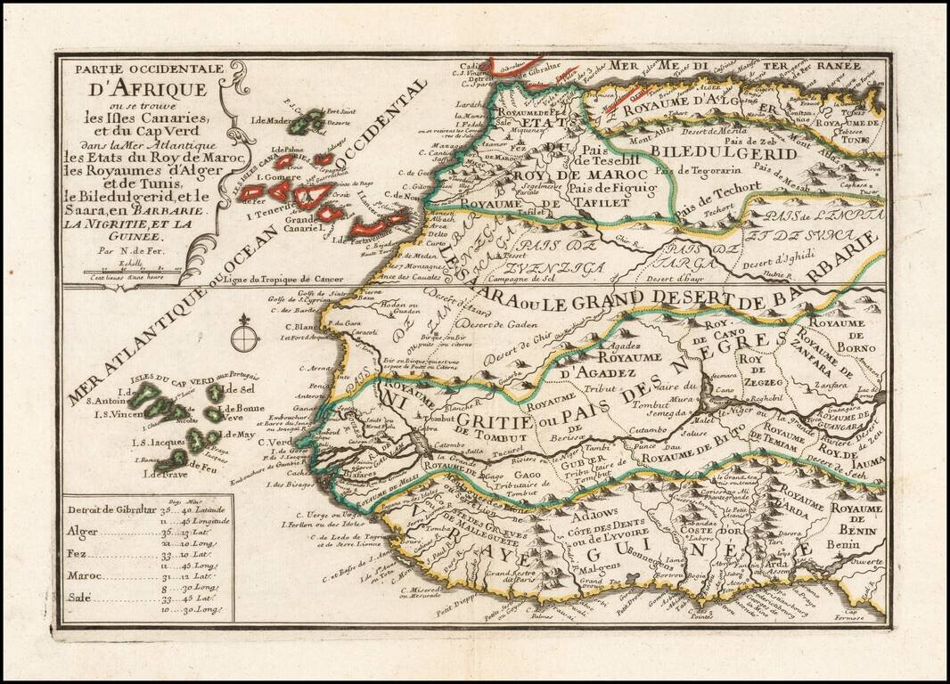
A striking decorative map of the northwestern portion of Africa and Madeira, the Canary and Cap Verde Islands, showing excellent detail throughout. From De Fer's Atlas Curieux. Nice wide margins and decorative cartouche.
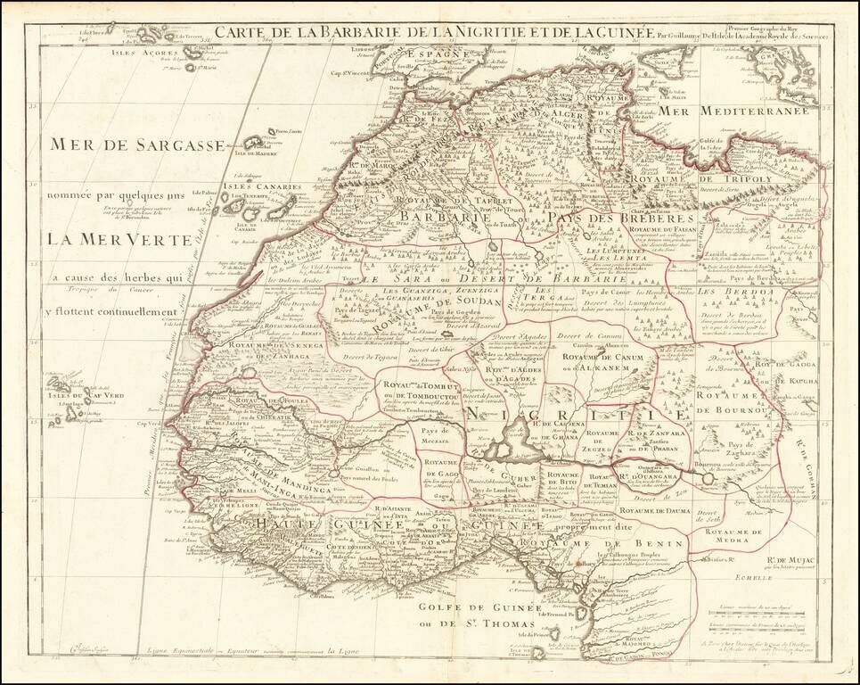
Detailed map of Northwestern Africa, published by Guillaume De L'Isle, the French Royal Mapmaker. Extends from the Kingdom of Tripoli and the Mediterranean to the Gulf of Guinea and the Gabon River, with remarkable detail throughout. Includes the...
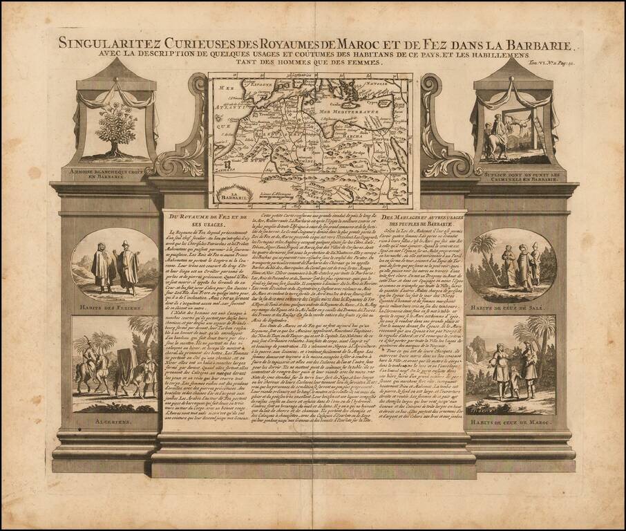
Decorative map and series of inset views of Morocco, with small vignettes of local life.
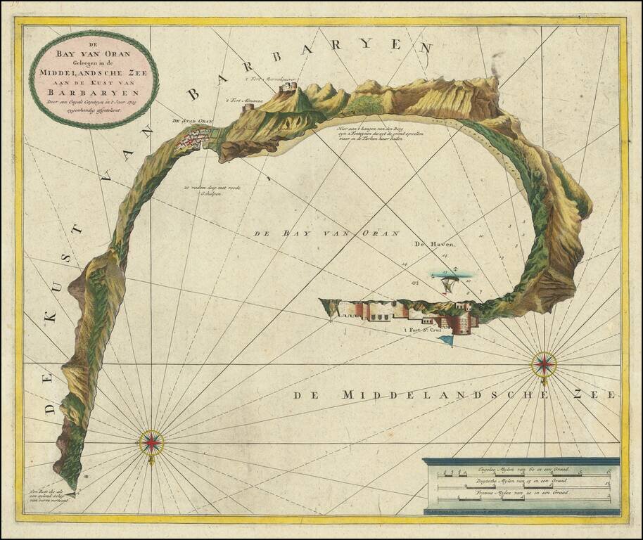
Unusual plan of the Harbor at Oran, showing coastal profiles towns, castles, etc. Locates and shows profile views of 3 forts, anchorages, soundings, etc. Includes compass rose, sailing ships, and a scale of Miles. OCLC locates only 1 example (Hebrew...
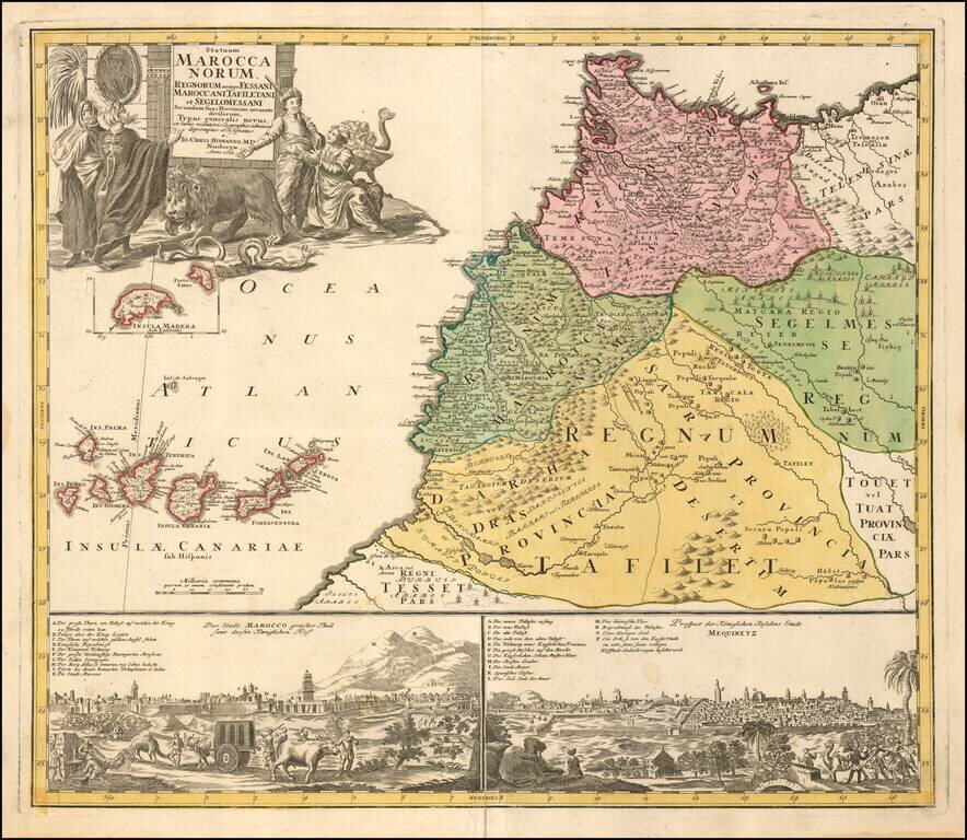
Scarce map of Morocco, with two city views below. Includes a striking allegorical cartouche and inset map of Madeira.
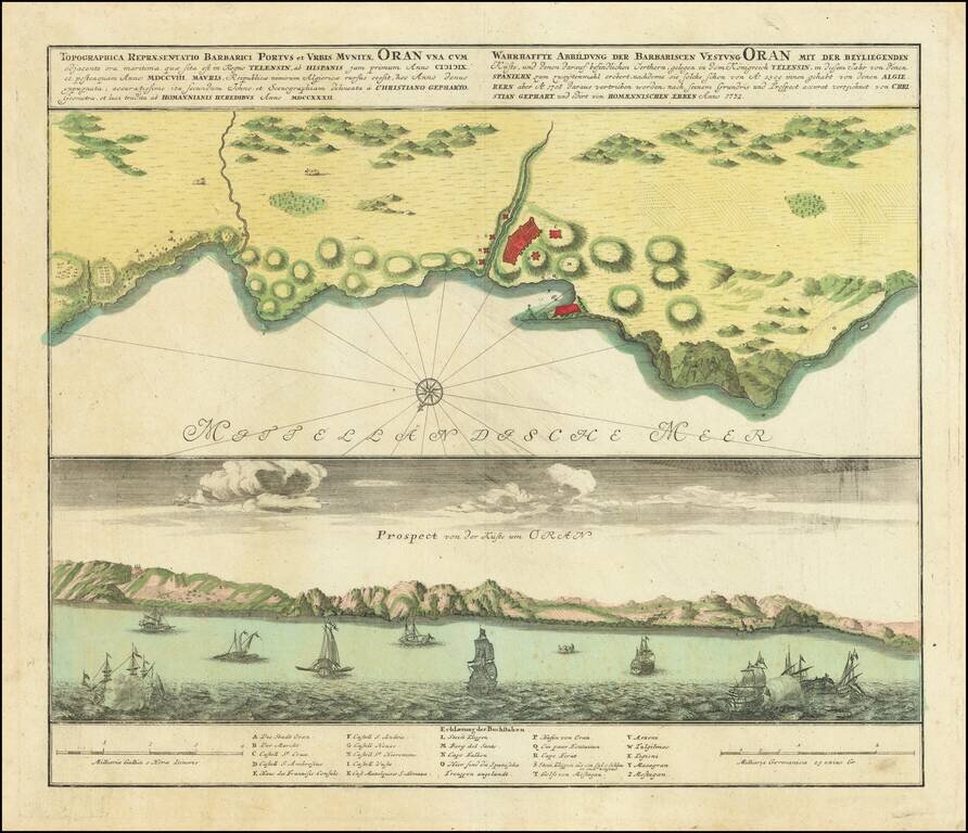
Scarce antique engraved view and plan of Oran, in Algeria, by the German mapmakers Homann Heirs, published in Nuremberg in 1732. In the view at the bottom, there are xebecs and other sailing vessels, including some firing on one another, possibly...