Map size in jpg-format: 50.1677MiB
Click to open in high resolution (open in new tab).
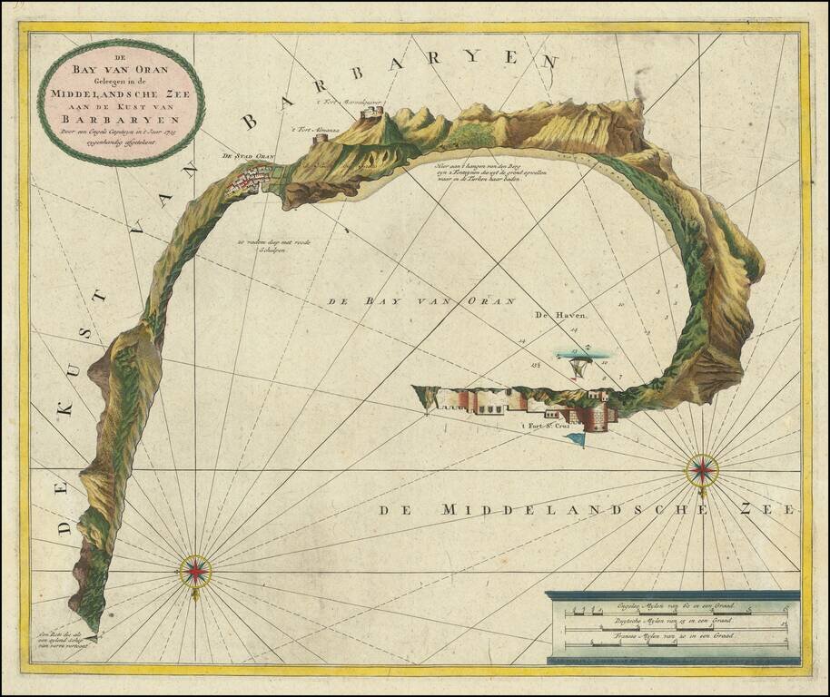
Unusual plan of the Harbor at Oran, showing coastal profiles towns, castles, etc.
Locates and shows profile views of 3 forts, anchorages, soundings, etc. Includes compass rose, sailing ships, and a scale of Miles.
OCLC locates only 1 example (Hebrew University).
If you are a student, write to us in telegram: @antiquemaps and indicate what material you need and for what work you need a map in high detail. We are ready to provide material on special terms. For students only!


![The West Part of Barbary... [on sheet with:] The East Part of Barbary...](/map/small/52496.jpg)