Map size in jpg-format: 32.7771MiB
Click to open in high resolution (open in new tab).
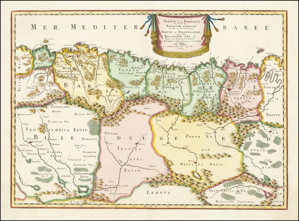
A nice example of Sanson's 1655 double-page engraved map of the Algerian coast of North Africa. The map shows the Barbary Coast divided a large number of states extending inland from the Mediterranean to the southern Atlas Mountains. This gives way to an area labeled as part of Biledulgerid (the country of dates). Maps of this period typically name the area as such, though there are indications that Bildulgerid was, in fact, closer to Tripoli. These many states were often at war during this period, and piracy was common in the waters off of this area.
The map includes nice detail pertaining to the features and cities of the area. The Atlas mountains and other coastal areas are relatively well mapped, but the area to the south is given many lakes and forests which in fact do not exist. However, cities and towns like "Mezzab" [M'Zab], are somewhat accurately mapped.
Nicholas Sanson (1600-1667) is considered the father of French cartography in its golden age from the mid-seventeenth century to the mid-eighteenth. Over the course of his career he produced over 300 maps; they are known for their clean style and extensive research. Sanson was largely responsible for beginning the shift of cartographic production and excellence from Amsterdam to Paris in the later-seventeenth century.
Sanson was born in Abbeville in Picardy. He made his first map at age twenty, a wall map of ancient Gaul. Upon moving to Paris, he gained the attention of Cardinal Richelieu, who made an introduction of Sanson to King Louis XIII. This led to Sanson's tutoring of the king and the granting of the title ingenieur-geographe du roi.
His success can be chalked up to his geographic and research skills, but also to his partnership with Pierre Mariette. Early in his career, Sanson worked primarily with the publisher Melchior Tavernier. Mariette purchased Tavernier’s business in 1644. Sanson worked with Mariette until 1657, when the latter died. Mariette’s son, also Pierre, helped to publish the Cartes générales de toutes les parties du monde (1658), Sanson' atlas and the first French world atlas.
If you are a student, write to us in telegram: @antiquemaps and indicate what material you need and for what work you need a map in high detail. We are ready to provide material on special terms. For students only!


![The West Part of Barbary... [on sheet with:] The East Part of Barbary...](/map/small/52496.jpg)