
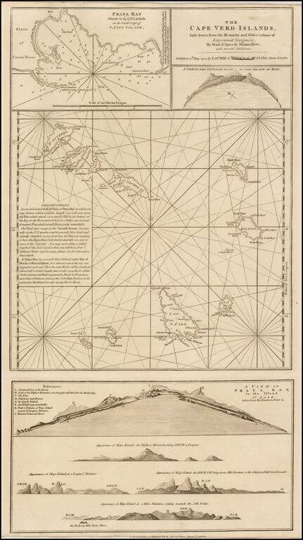
A finely detailed chart of the Cape Verde Islands off the Coast of Africa, which appeared in a later edition of the West India Atlas. This sheet of sea charts details the Cape Verde Islands. First settled by the Portuguese in 1462, it soon became a...
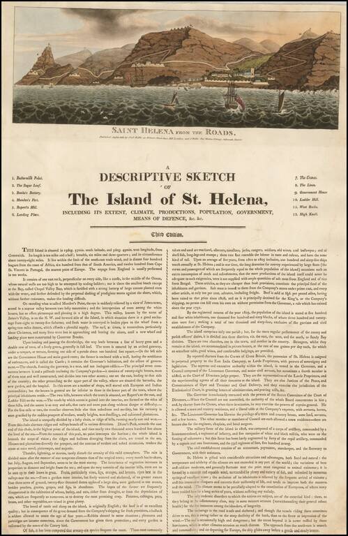
Rare early broadside describing St. Helena, published in London and Devon in 1815 by the Wallis family. The broadside is dated August 8, 1815, approximately 2 months prior to the arrival on the island of Napoleon Bonaparte, who would remain there in...
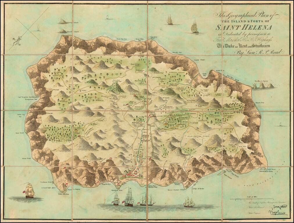
Finely colored example of Liuetenant Read's map of St. Helena, published shortly after Napoleon Bonaparte's first (and second) exile. Napoleon I's exile on the island of St Helena has contributed greatly to a heightened interest among he British...
![[Untitled View of the Coast of Saint Helena]](/map/small/37759hs.jpg)
Historically interesting sketch view of the coast of Saint Helena, attributed to Jean-Baptiste Henri Durand Brager; signed with initials on the lower right side. Durand-Brager (1814 - 1879), was the official artist accompanying the official French...
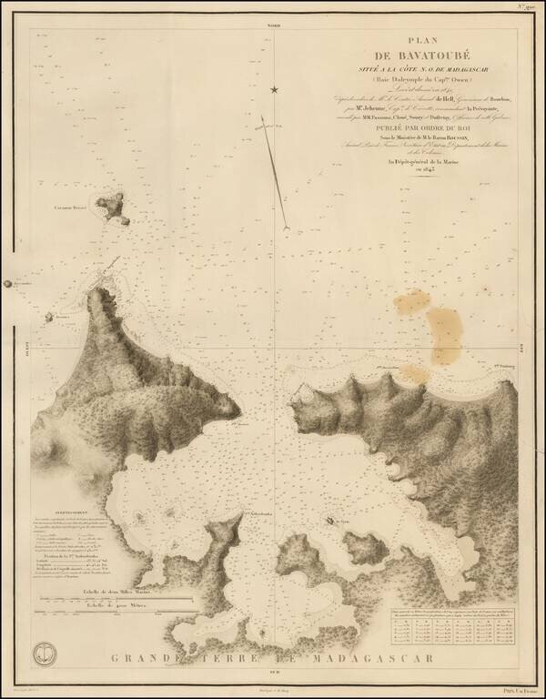
Rare French sea chart of Bavatoube (also known as Dalrymple Bay) on the northeast coastline of Madagascar. The Bay is about 20 miles east of Nosy Iranja and 40 miles west of Noy Ambariovato and Hell-Ville.
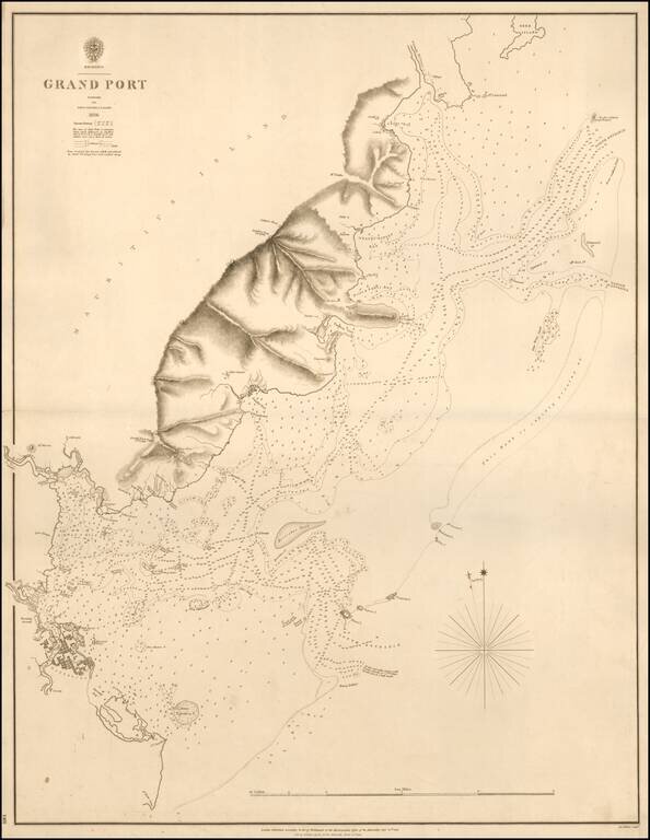
A Rare Chart of Mauritius by its Surveyor General Rare separately published sea chart of Grand Port, Mauritius, published in 1843 by the British Admiralty. The map is based upon the surveys led by John Augustus Lloyd in 1836. The map is centered on...