
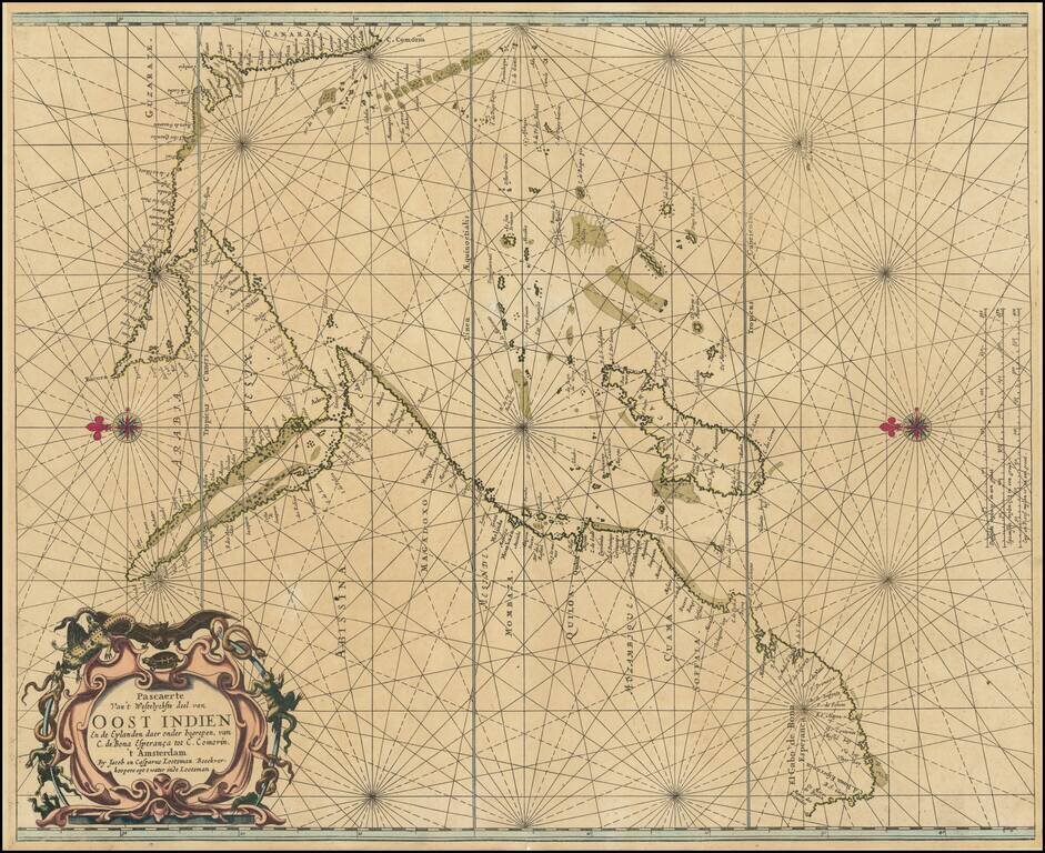
An Important Early Sea chart of the Western Indian Ocean Rare early sea chart of the East Coast of Africa, the Indian Ocean and the West Coast of India, by Jacob and Casper Lootsman, one of the first commercial publishers of Dutch sea charts. The...
![[South African Section] [A discription of Aegipt from Cair downeward] . . . Printed in London by Iohn Wolfe Graven by William Rogers](/map/small/69463.jpg)
Southern sheet of John Wolfe's rare 2-sheet map of Africa, based upon Filiippo Pigafetta's important early map of Africa, which appeared in the rare English edition of Linschoten's Itinerario, Iohn Huighen van Linschoten. His discours of voyages . . ....
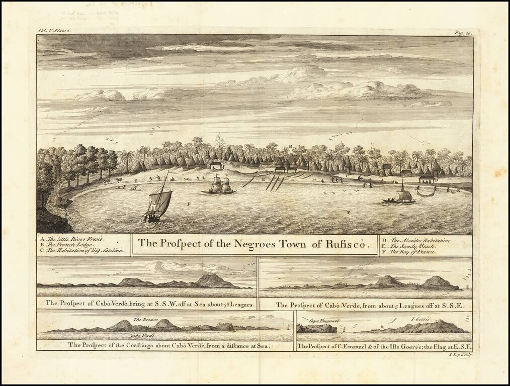
Views of the Senegal Coast From the Churchills’ Celebrated Voyage Collection A fine set of views showing Rufisco, today Rufisque, in Senegal, as well as Cape Verde and Gorée. They featured in the voyage account of Jean Barbot in the Churchill...
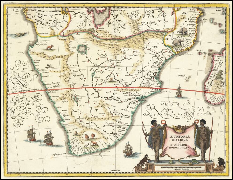
Attractive map of Southern Africa and part of Madagascar, shortly before the first Dutch settlement in the region. The area shown is from the Congo River basin around the Cape of Good Hope and up the east coast as far as northern present-day...
Attractive map of Southern Africa and part of Madagascar, shortly before the first Dutch settlement in the region. The area shown is from the Congo River basin around the Cape of Good Hope and up the east coast as far as northern present-day...
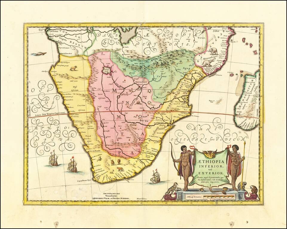
Attractive map of Southern Africa and part of Madagascar, shortly before the first Dutch settlement in the region. The area shown is from the Congo River basin around the Cape of Good Hope and up the east coast as far as northern present-day...
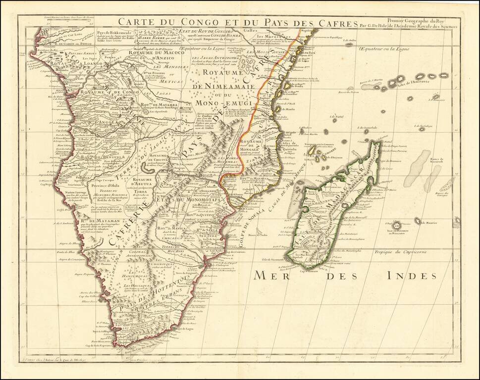
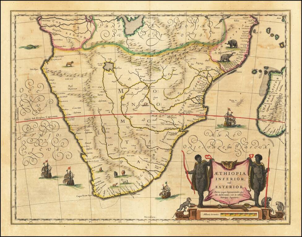
De L’Isle’s Fine Map of Southern Africa Striking example of De L'Isle's impressive map of South Africa and Madagascar, showing De L’Isle’s characteristic precision and attention to detail. Stretching from Congo in the north to what is now...
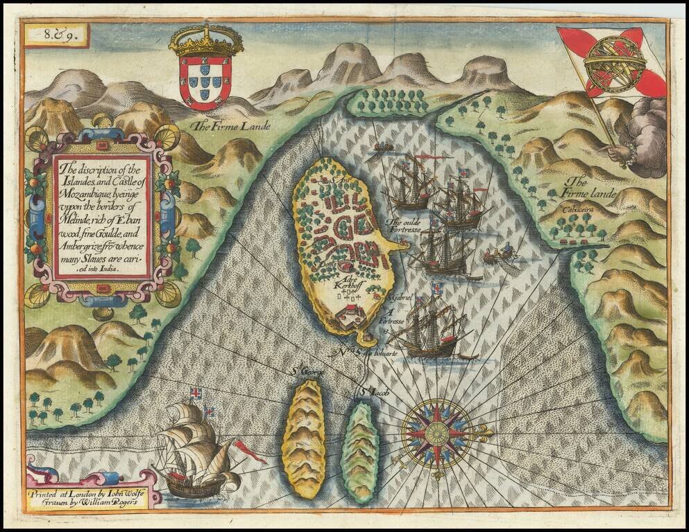
Rare English Edition! Decorative view of Melinde harbor on the island of Mozambique, which appeared in the rare English edition of Linschoten's Itinerario, Iohn Huighen van Linschoten. His discours of voyages . . . , published in London in 1598, and...
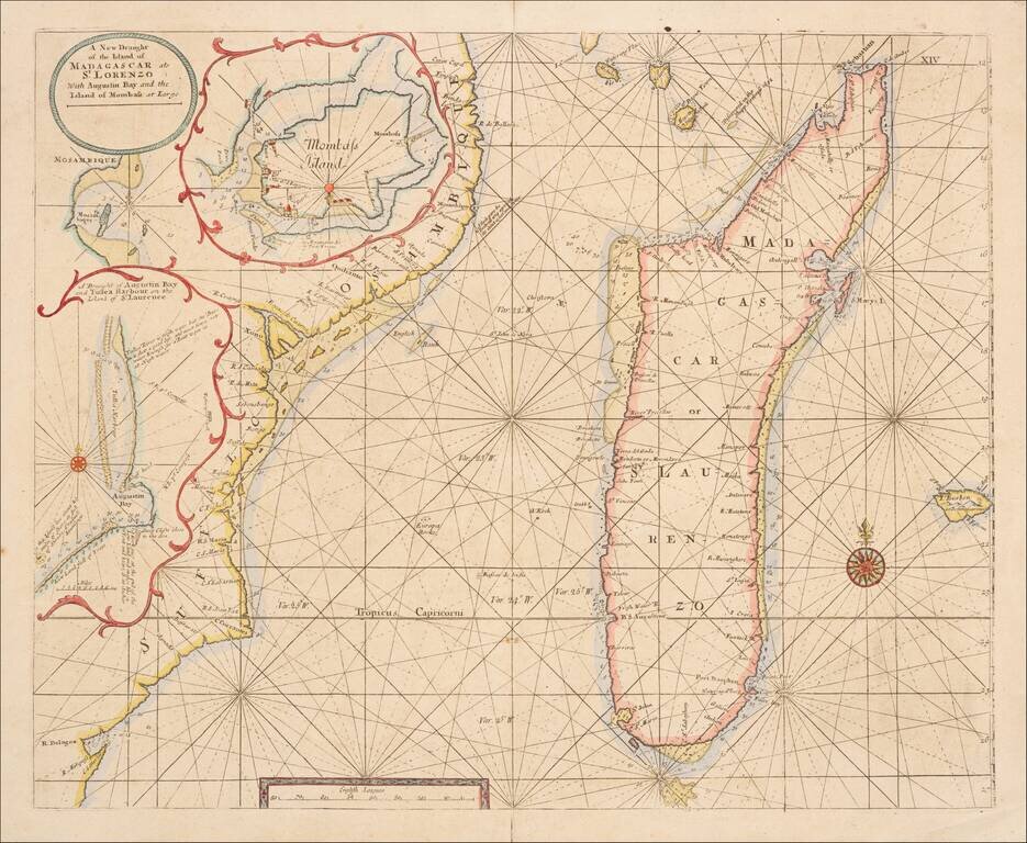
Scarce engraved sea chart of the coast of coast of Mozambique and the island of Madagascar with three insets of important ports north of Mozambique. This is an important map for Kenya as well, as it shows "Mombass Island", now Mombasa, with a...
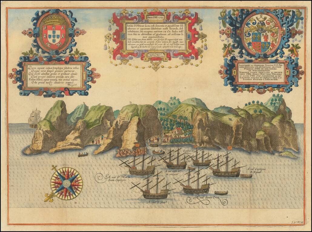
Spectacular birds-eye view of the island of Santa Helena, engraved by Baptista van Deutecum in Amsterdam, for Linschoten's Itinerario. Linschoten served 6 years as the bookkeeper for the Archbishop of Goa (1583-89). While in Goa, as a result of his...
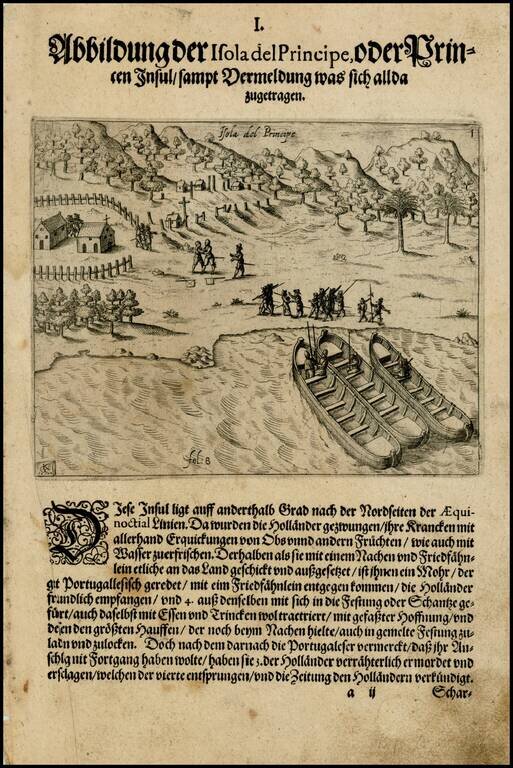
Early image of Sao Tome and Principe, off the coast of West Africa, from the De Bry edition of Olivier Van Noort's Description du Penible Voyage Faict entour de l'Univers ou Globe Terrestre, published by Cornelis Claes in 1602. Van Noort's map,...
Detailed engraved antique map of the West African coast showing present-day Senegal, Gambia, and Cape Verde. An inset map shows Île de Gorée (here called "Isola Goree"), which is a large island in the harbor of Dakar, Senegal. The island played an...
![[Madagascar] S. Lorenzo](/map/small/37926.jpg)
Marvelous example of Porcacchi's map of the Island of Madagascar. One of the earliest obtainable maps of the Island and one of the few published in the 16th Century. Excellent topographical detail, if a bit conjectural, and naming many locations....
Nice example of this early state of Barent Langenes map of the Cape Verde Islands, which first appeared in the 1598 edition of Langenes Caert-Thresoor, published in Middelburg. Langenes's map was first issued in his Caert-Thresoor and later...
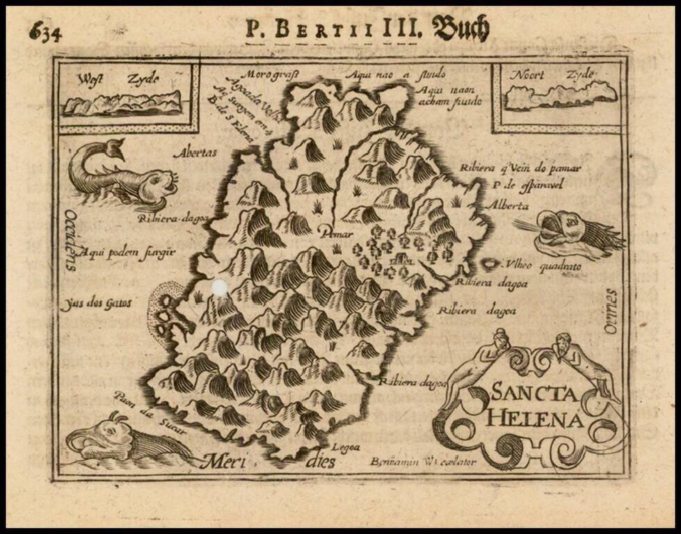
Nice example of this early state of Barent Langenes map of the island of St. Helana, which first appeared in the 1598 edition of Langenes Caert-Thresoor, published in Middelburg. Langenes's map was first issued in his Caert-Thresoor and later...
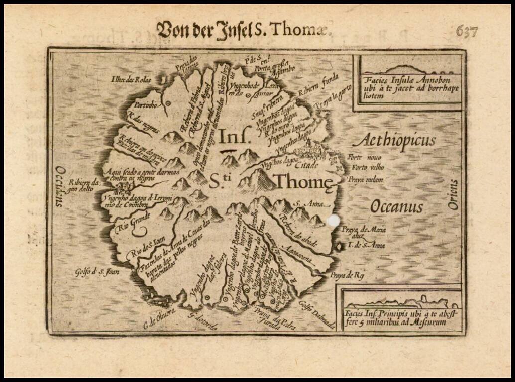
Nice example of this early state of Barent Langenes map of the island of St. Thomas, which first appeared in the 1598 edition of Langenes Caert-Thresoor, published in Middelburg. Langenes's map was first issued in his Caert-Thresoor and later...