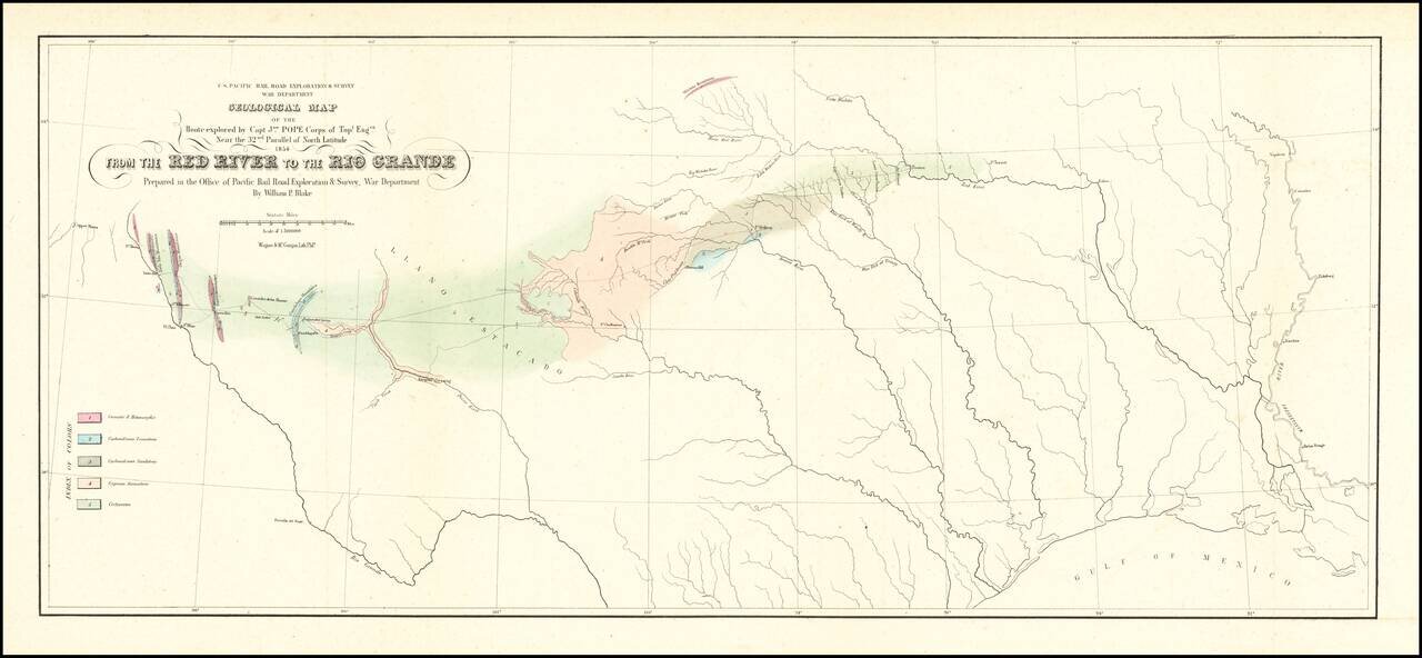
Finely executed Geological Map, centered on Texas and published in conjunction with search for the most practicable route for a railroad line to the Pacific Ocean. Nice example of William Phipps Blake's geological railroad survey of the region between...
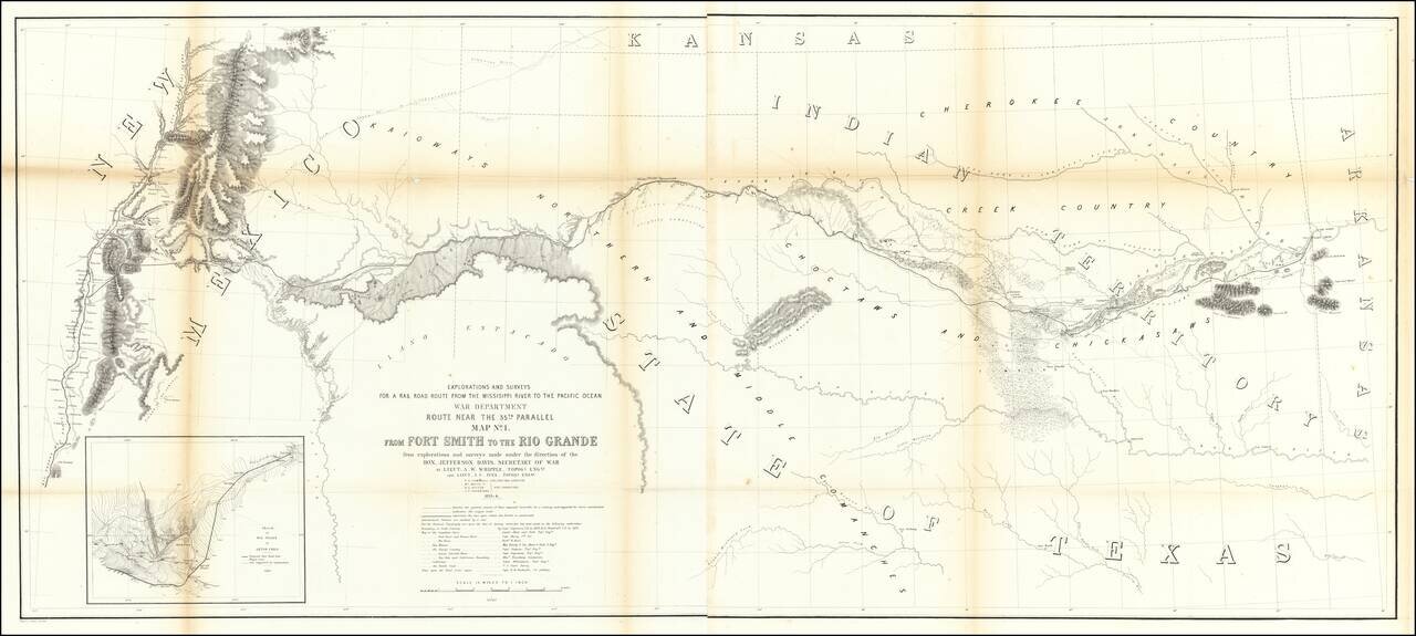
Important early map of the region between Fort Smith Arkansas and the Rio Grande River (Santa Fe, Taos, etc), prepared by the US Pacific Railroad Survey. The primary cartographic detail is in the Rio Grande Valley of New Mexico and along the Canadian...
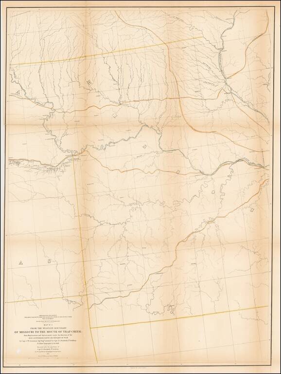
Detailed survey map of the region centered on the course of the Missouri River, published as part of the Surveys to find the most practicable routes from the Mississippi River to the Pacific Ocean. The present map is one of the first maps created by...
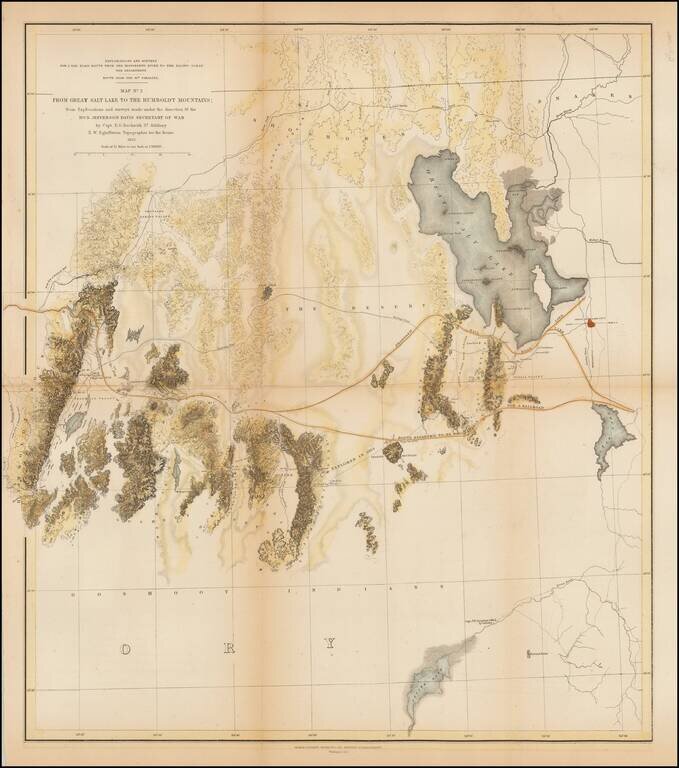
A detailed map showing the Great Salt Lake, Utah Lake and Sevier Lake, with the Humboldt Mountains at left edge. Includes the region from the Great Salt Lake and across the flats to the Humboldt range. Several proposed railroad routes noted, including...
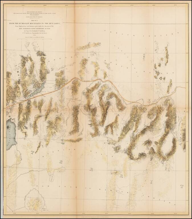
A detailed map of Northwestern Nevada, showing Pyramid Lake, the Carson River, Walker River and northern part of Walker Lake and extended East to the Elko area and the south fork of the Humboldt River. Wheat considers this an excellent map "due in...
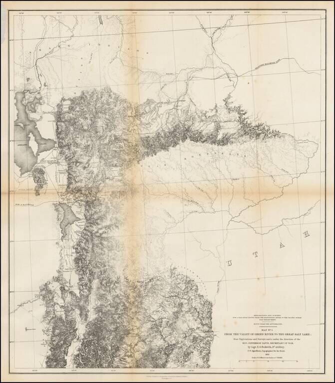
Finely detailed map of the area from Brown's Hole east of today's Vernal to the Great Salt Lake and south to below Fillmore. The map locates the Emigrant Road to California. Several Proposed Railroad lines are shown. One crosses the Green River near...
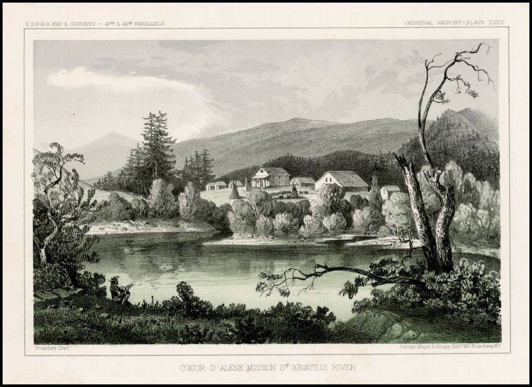
Striking view from the Pacific Railroad Surveys. The survey notes: "The mission is located upon a hill overlooking extensive prairies stretching to the east and west toward the Coeur D'Alene Mountains and the Columbia River. About a hundred acres...
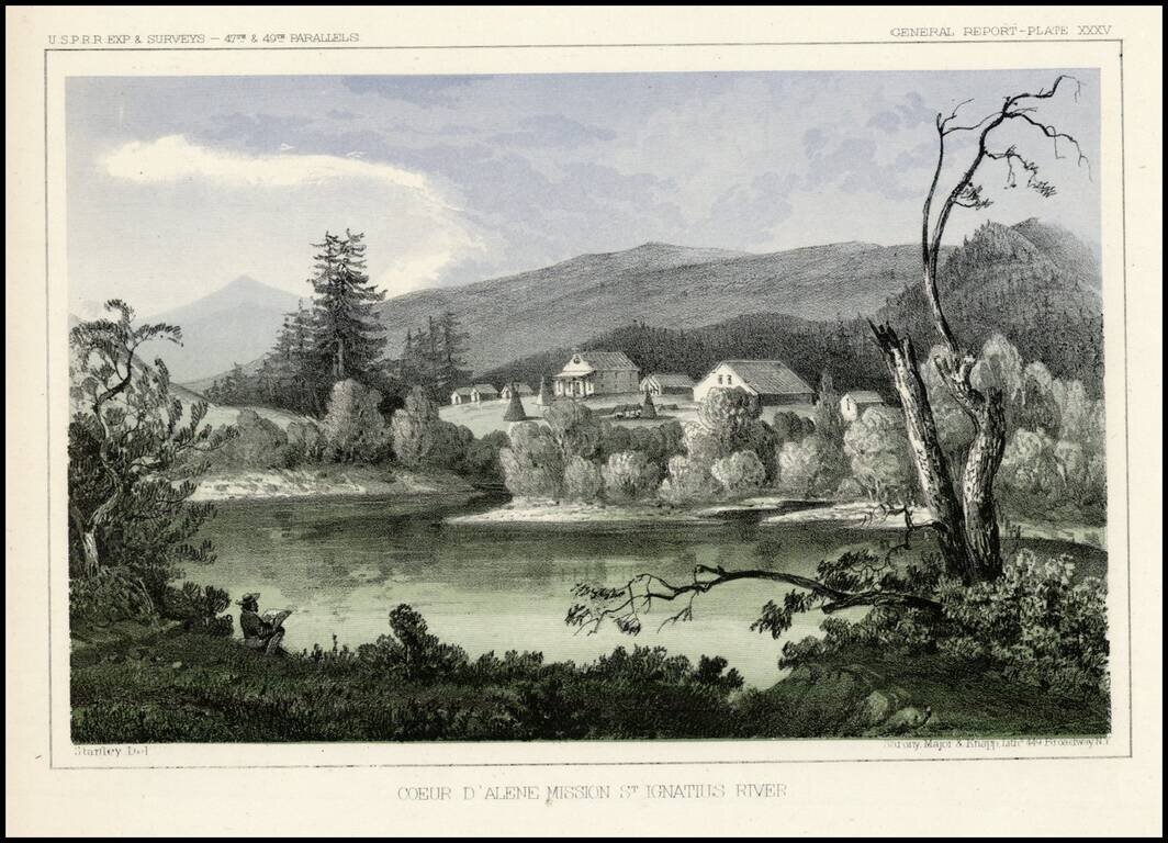
Striking view from the Pacific Railroad Surveys. The survey notes: "The mission is located upon a hill overlooking extensive prairies stretching to the east and west toward the Coeur D'Alene Mountains and the Columbia River. About a hundred acres of...
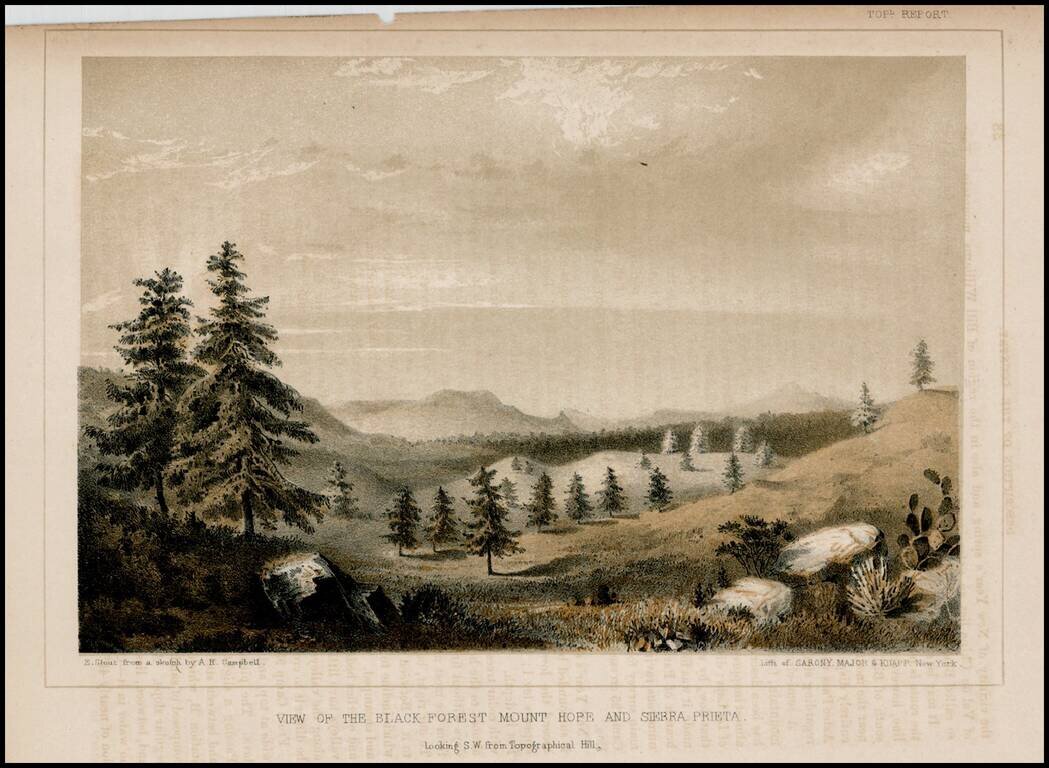
Detailed view from the Report of the United States Pacific Railroad Expedition and Surveys
Important early survey map, covering the region between Crescent City and San Francisco Bay, showing the results of R.S. Williamson and H.L. Abbot's surveys in Oregon and California, in anticipation of the location of the first transcontinental...
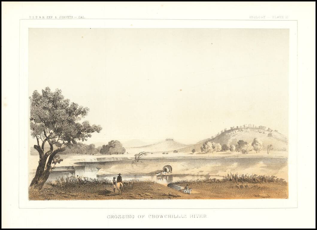
Interesting depiction of a crossing of the Chowchilla River, in Central California. The Chowchilla River is a river in Central California and a minor tributary of the San Joaquin River. It flows for 65 miles from the western side of the Sierra Nevada...
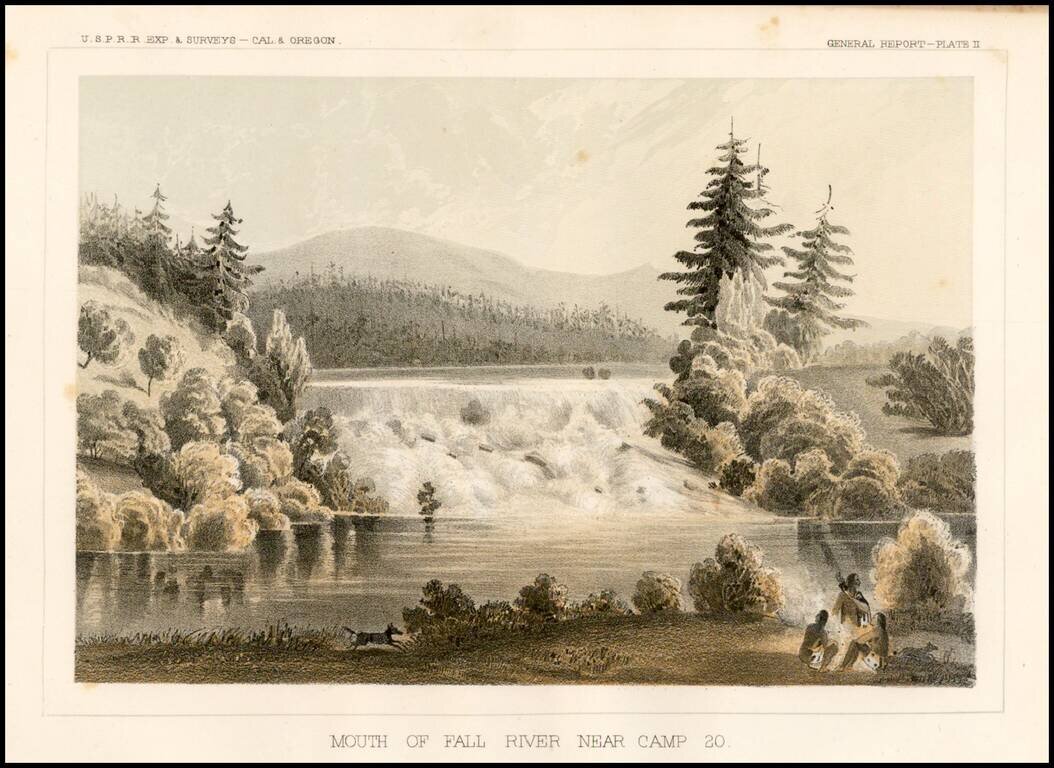
Striking view of Fall River near Camp 20, from the Pacific Railroad Surveys.