George-Louis Le Rouge (1712-1790), though known for his work in Paris, was originally born Georg Ludwig of Hanover, Germany. He grew up and was educated in Hanover, after which he became a surveyor and military engineer. Around 1740, however, Le Rouge moved to Paris and set up shop as an engraver and publisher on the Rue des Grands Augustins. It was at this time that he changed his name, adopting a French pseudonym that would later become quite famous.
Le Rouge spent much of his forty-year career translating various works from English to French, and his cartographic influence often came from English maps. His experience as a surveyor and engineer in Germany made him a skilled and prolific cartographer, and he produced thousands of charts, maps, atlases, and plans. His work spans from garden views and small-town plans to huge, multiple-continent maps. Le Rouge eventually accepted the position of Geographical Engineer for Louid XV, the King of France.
Later in life, Le Rouge became well-known for publishing North American maps, such as in his Atlas ameriquain septentrional of 1778. One of Le Rouge’s other more famous works is the Franklin/Folger chart of the Gulf Stream, which he worked on with Benjamin Franklin. Franklin and Le Rouge corresponded around 1780 and collaborated to create this map, a French version of Franklin’s famous chart which was originally printed in 1769.
An Early Sea of the West, with Contributions from Charlevoix and Condamine The first map to show Behring's discoveries along in Alaska and the Northwest Coast and a prototype map for the subsequent Buache, De L'Ise, Jefferys debate of the 1750s. The...

This is a scarce map encompassing Poland and parts of the grater Baltic Region, Russian, and Ukraine. The map extends from the Gulf of Riga to the Black Sea at the mouth of the Dniepr. The map includes an attractive cartouche. This is only the second...
![[Naval Flags of the World] les Pavillons des Mer du Mond Nouvellement Corriges](/map/small/60259.jpg)
Rare sheet with about 184 maritime flags of nations and provinces. Includes many interesting flags, like the one of Mallorca, Corsaires, Constantinople, Ragusa, West Frise, Isle of Man, a few with curious titles like "Portuguese discovery of the New...
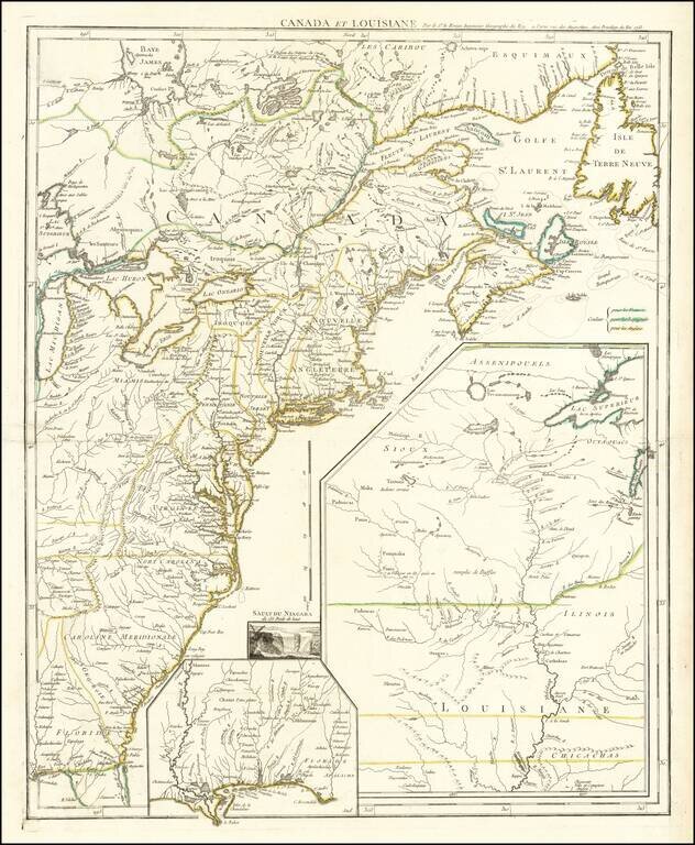
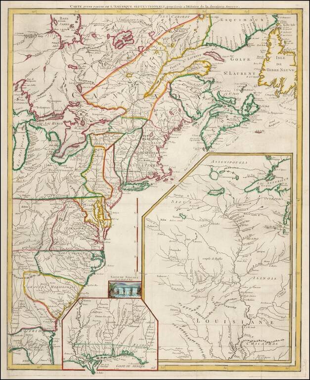
France Claims on the Eve of the French & Indian War Rare French & Indian War map of the British and French Colonies in North America, published by Le Rouge. Fine example of this highly detailed set of maps illustrating the French &...
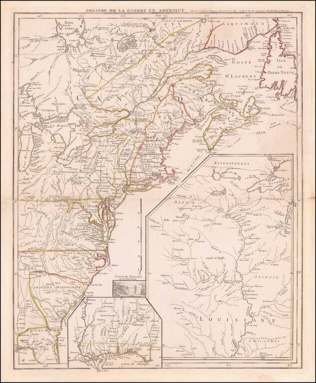
Antique Map of The Theater of The American Revolution on the Eve of the French Joining the War Coming the year after the creation of the United States and signing of the Declaration of Independence, this antique map illustrates the British Colonies...
Fine example of this highly detailed set of maps illustrating the British Colonies in North America at the conclusion of the American Revolution, published by Soules in his Histoire des Troubles de Amerique Anglaise. The primary map shows the British...
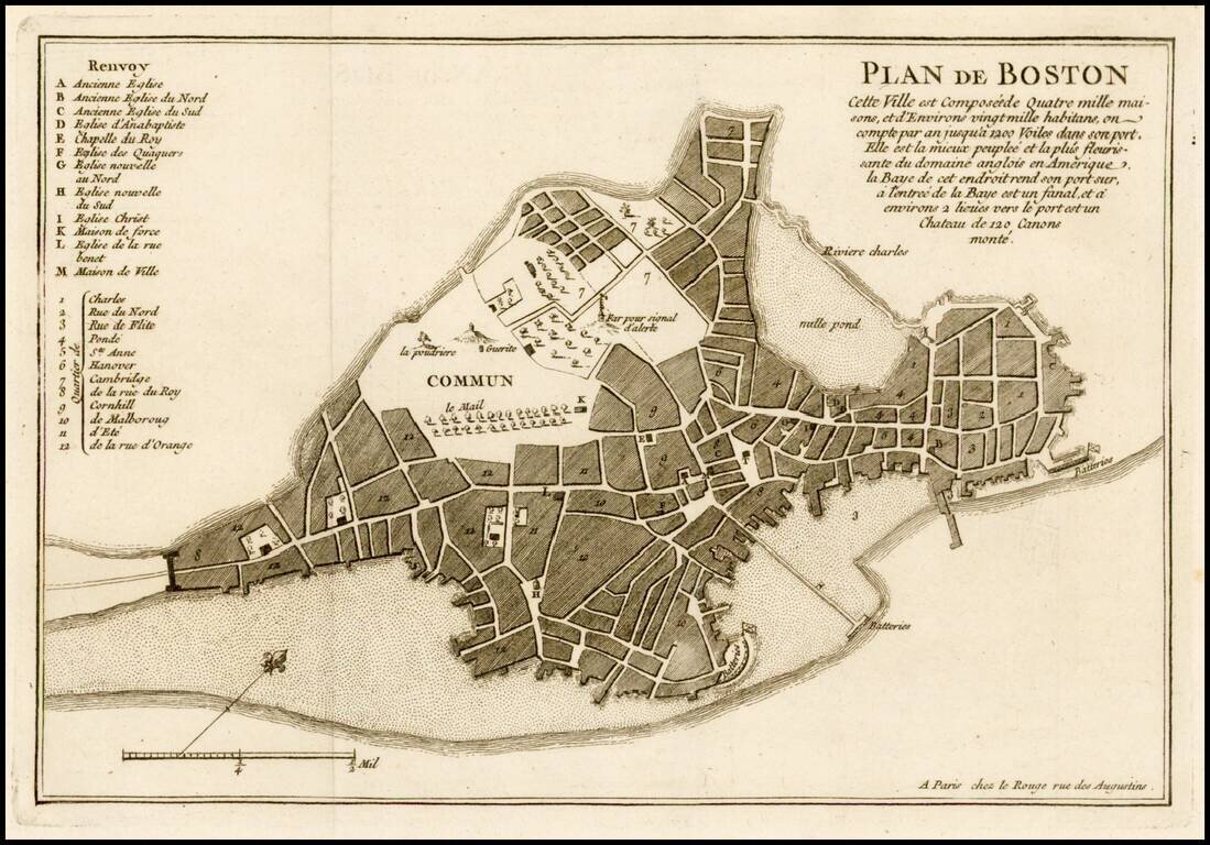
Fine example of Le Rouge's plan of Boston, issued at the beginning of at the outset of the French & Indian War in his Recueil des plans de l'Amerique septentrionale. Le Rouge's plan has been reduced French from John Bonner's New Plan of ye Great...
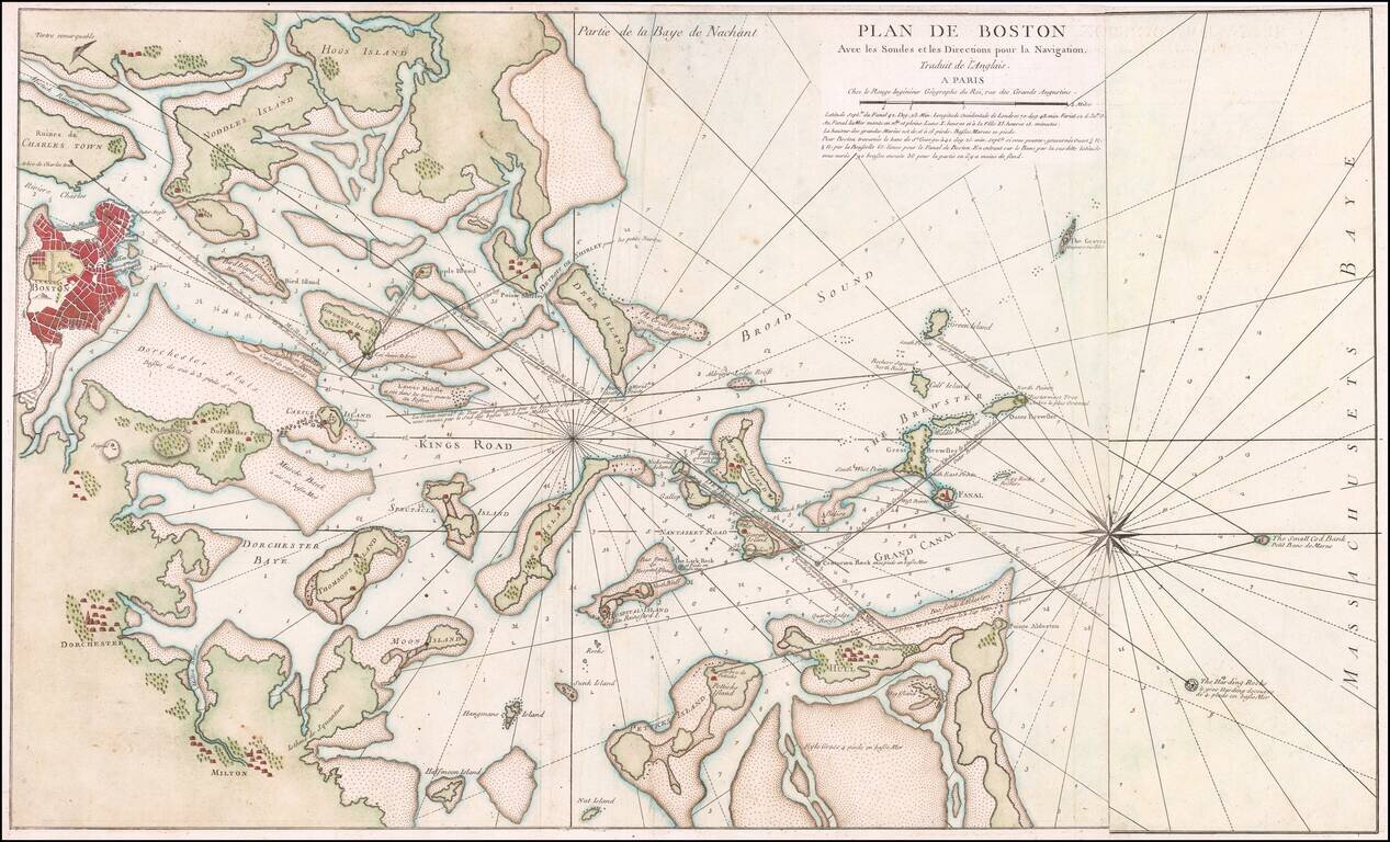
Rare French edition of Sayer & Bennett's rare chart of Boston Harbor revised and issued in Le Rouge's Pilote Americain Septentrionale, which was compiled specifically for use by the French Navy during the American Revolution. A note following the...
Rare French edition of this important early Revolutionary War map, published to illustrate the Northern Theater of War in the early years of the American Revolution, shortly after the French entered the conflict in alliance with the American...
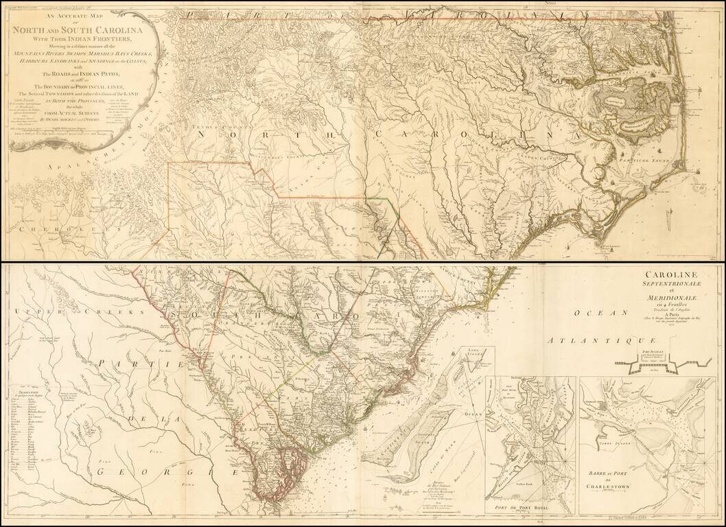
Second edition (first French Edition) of Henry Mouzon's landmark 4-sheet map of the Carolinas, the primary source for the geographical details of the Carolinas for the American, English and French armies during the American Revolution. Le Rouge...
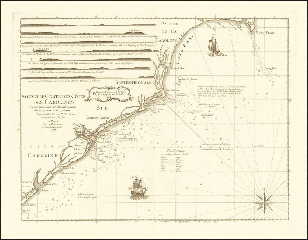
Rare chart of the Carolina coast, prepared by Le Rouge in connection with France's participation in the American Revolutionary War. This rare chart is one of a group of charts prepared by Georges Louis Le Rouge for use by the French Navy, which...
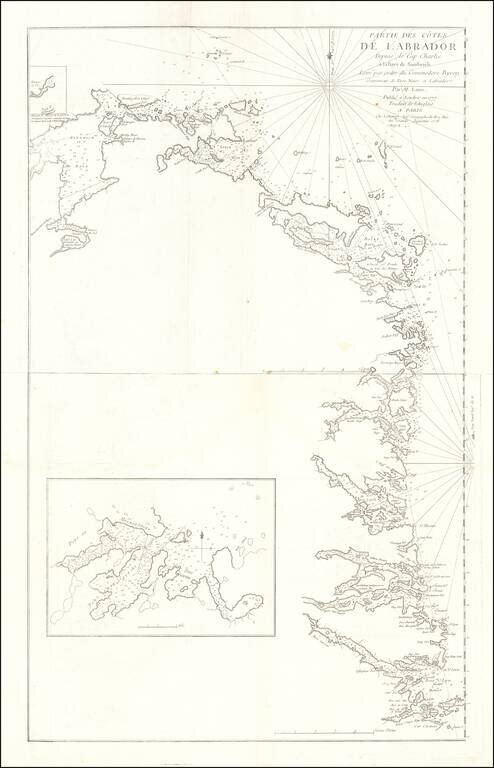
Rare French edition Jefferey's 2-sheet map of part of Labrador, which appeared in Le Rouge's Pilot Americain Septentrionale. Includes extensive soundings, sailing directions, rhumb lines and many other fine details. The chart was included in Le...
![Isle St. Christophle une antilles aux anglois [and]La Barbade une des antilles anglois divisee par Paroisses](/map/small/24310.jpg)
Detailed maps of St. Christopher and Barbardos, the latter showing Parishes.
![La Jamaique… [with] La Bermude…](/map/small/53986.jpg)
Delightful map of Bermuda and Jamaica in outline color, showing parishes, cities, forts, and the various types of plantations on Jamaica.
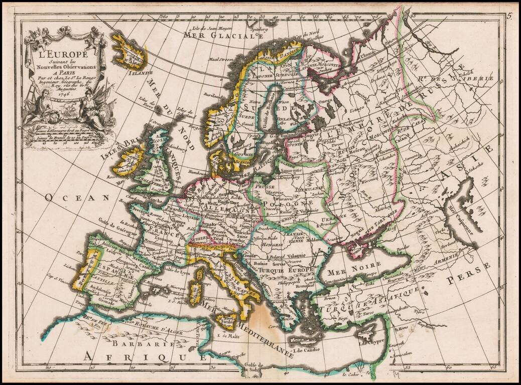
Decorative map of Europe with a detailed cartouche.