George-Louis Le Rouge (1712-1790), though known for his work in Paris, was originally born Georg Ludwig of Hanover, Germany. He grew up and was educated in Hanover, after which he became a surveyor and military engineer. Around 1740, however, Le Rouge moved to Paris and set up shop as an engraver and publisher on the Rue des Grands Augustins. It was at this time that he changed his name, adopting a French pseudonym that would later become quite famous.
Le Rouge spent much of his forty-year career translating various works from English to French, and his cartographic influence often came from English maps. His experience as a surveyor and engineer in Germany made him a skilled and prolific cartographer, and he produced thousands of charts, maps, atlases, and plans. His work spans from garden views and small-town plans to huge, multiple-continent maps. Le Rouge eventually accepted the position of Geographical Engineer for Louid XV, the King of France.
Later in life, Le Rouge became well-known for publishing North American maps, such as in his Atlas ameriquain septentrional of 1778. One of Le Rouge’s other more famous works is the Franklin/Folger chart of the Gulf Stream, which he worked on with Benjamin Franklin. Franklin and Le Rouge corresponded around 1780 and collaborated to create this map, a French version of Franklin’s famous chart which was originally printed in 1769.
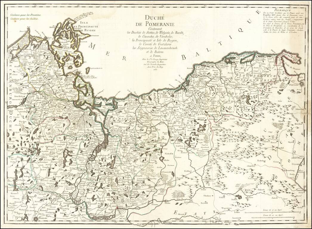
Scarce large format map of Pomerania and Szczecin, including the northwestern part of Poland, published by Le Rouge in Paris. Includes several roads, as well as towns, rivers, woods and lakes and other local details. The map is based on early maps by...
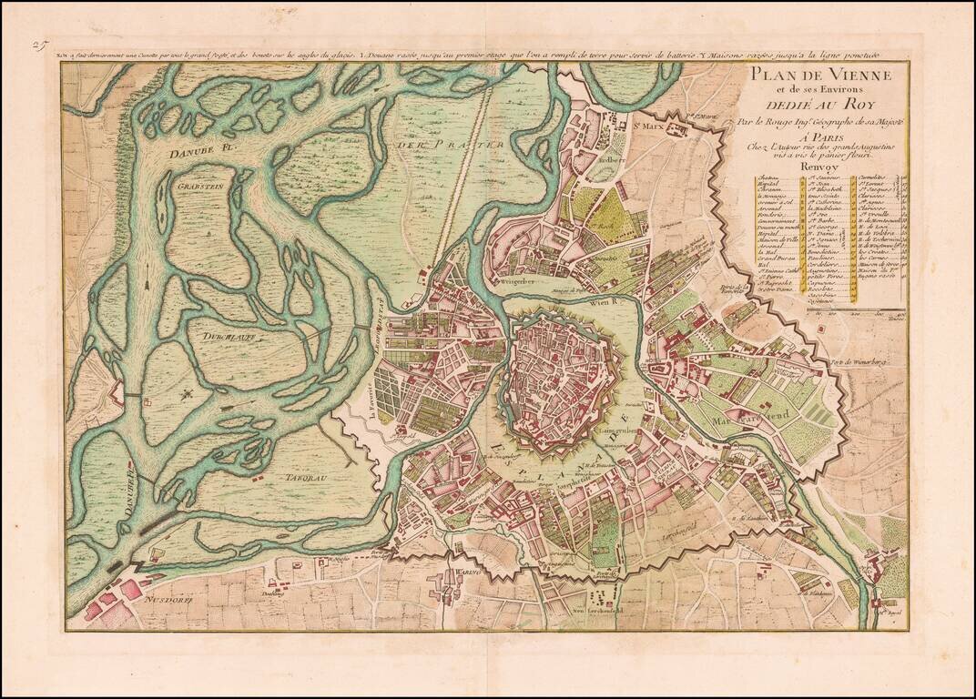
Finely colored plan of Vienna, published in Paris by George Louis Le Rouge and dedicated to the King of France. Shows the fortified walls both in the environs of Vienna, the Esplanade surrounding the old city and the fortified walls of the Old City,...
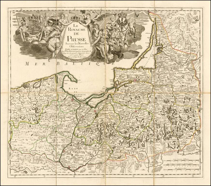
Fine separately issued example of Le Rouge's map of the Kingdom of Prussia, incorporating Poland and the Baltic countries. The map was published two years into the reign of Frederick II (1712-1786) as 'king in Prussia." Includes a fine elegant...
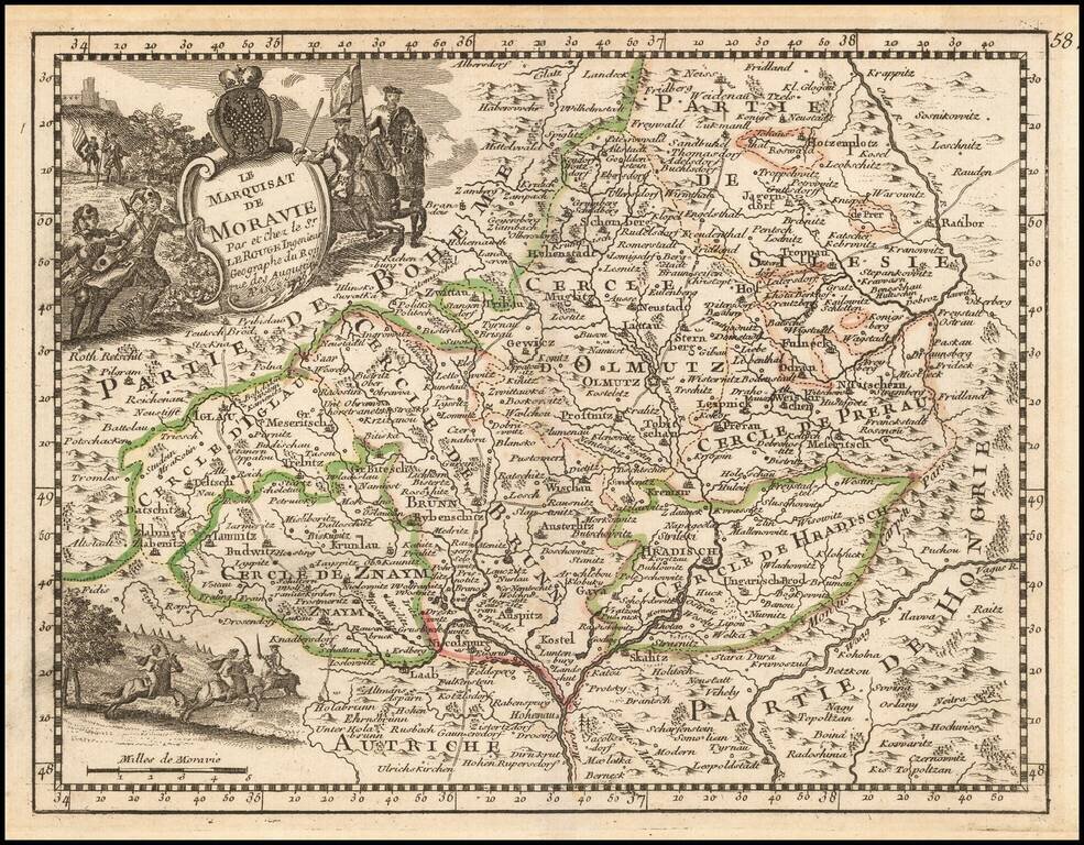
Decorative map of Moravia, published by George Louis Le Rouge, one of the most important French mapmakers of his generation. Includes a coat of arms.
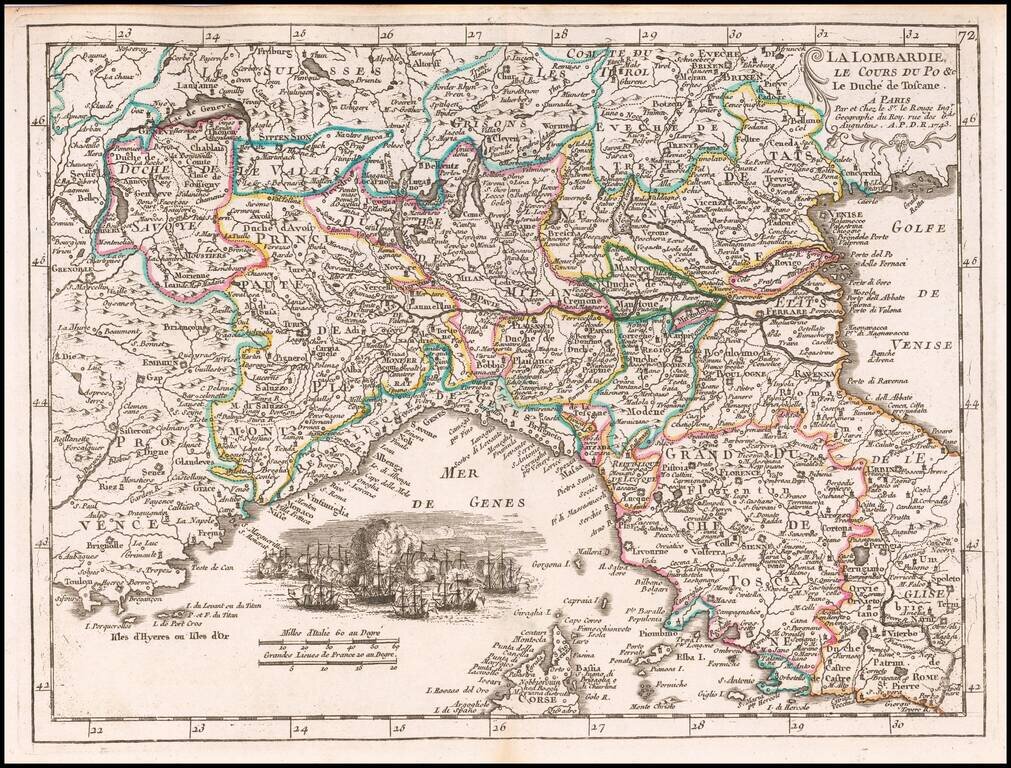
Detailed map showing Northern Italy.
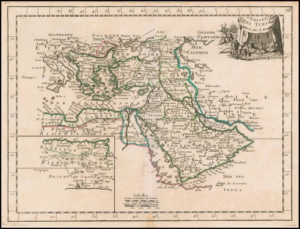
Scarce map of the Turkish Empire, from Le Rouge's Atlas Nouvel Portatif . . . , first issued in Paris in 1748. Includes a fine decorative cartouche.
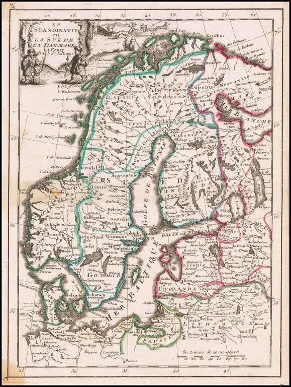
Decorative map of Scandinavia, with a cartouche in the upper left corner.
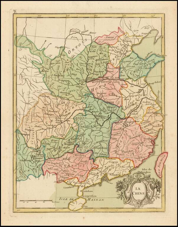
Detailed antique map of China by George Louis Le Rouge. The map is hand-colored by provinces.
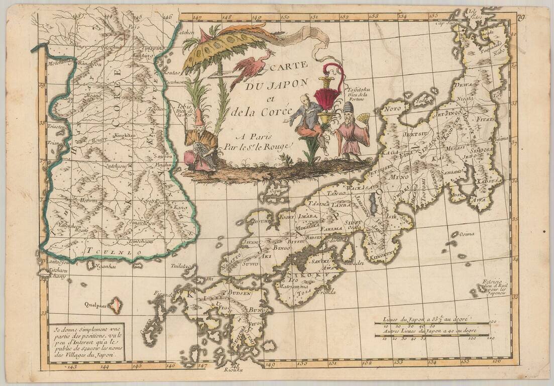
Scarce map of Japan and Korea, from Le Rouge's Atlas Nouvel Portatif . . . , first issued in Paris in 1748. Japan is divided into its provinces, with mountains, lakes and rivers named. Korea includes major cities, lakes, rivers and mountains....