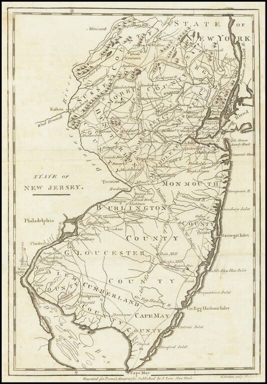
One of the earliest obtainable maps of the state of New Jersey. Shows counties, towns, roads, rivers, lakes, islands, churches, court houses, and other early details. Includes topographical details. The map is reduced from the Reid map, which in...
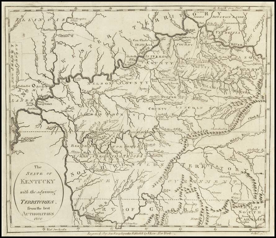
Early Map of Kentucky, Tennessee and Southern Ohio Important early map of Kentucky, Tennessee (then still Southwestern Territory) and the Ohio Valley, with marvelous early information. Kentucky includes about a dozen early counties, plus towns,...
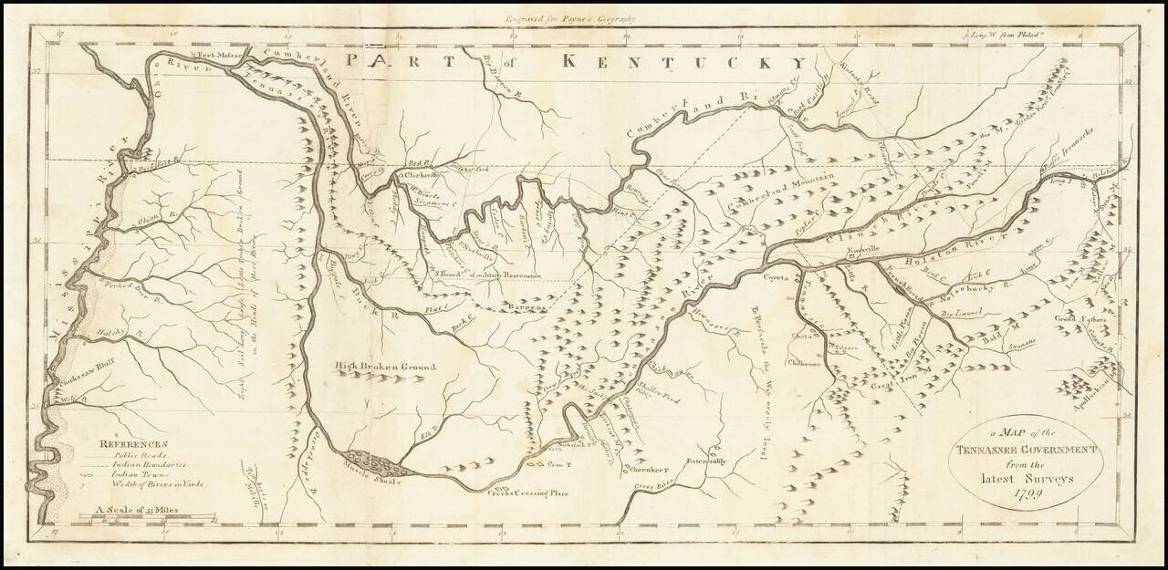
One of the earliest obtainable maps of Tennessee. Shows early counties, Rivers, Mountains, Indian Villages, military reservations and many topographical details. Nashville appears, as does Clerksville, although the primary detail in the map is along...
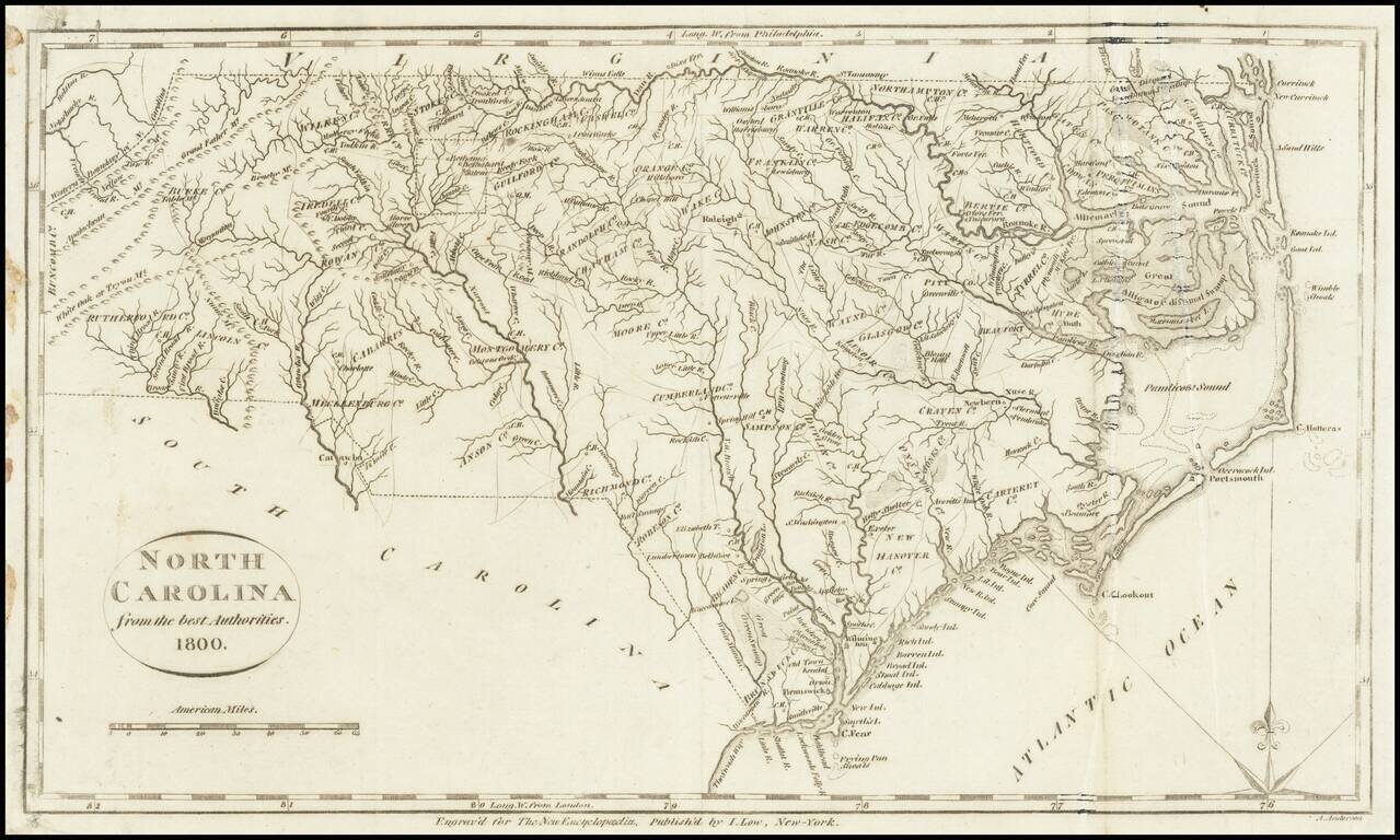
One of the earliest obtainable maps of the state of North Carolina. Shows counties, towns, roads, rivers, lakes, islands, swamps, court houses, and other early details. This map appeared in Volume IV of John Payne's New and Complete Universal...
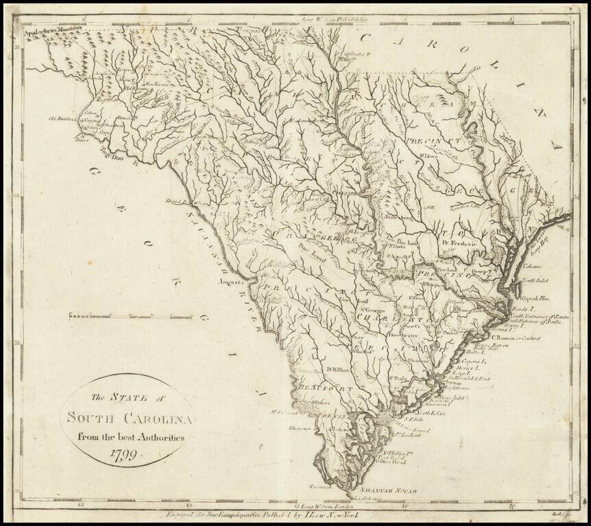
One of the earliest obtainable maps of the State of South Carolina. The map shows counties, towns, roads, rivers, lakes, islands, swamps, courthouses, along with topographical details. The map is based upon earlier maps that appeared in atlases...
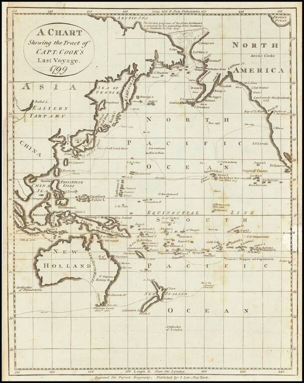
Early American printed map showing the Tract of Cook's final voyage. Cover Alaska, the Northwest Coast of America, Australia, New Zealand, the Coast of Russia, China, Japan, the Philippines, etc. Centered on Hawaii (Sandwich Islands)
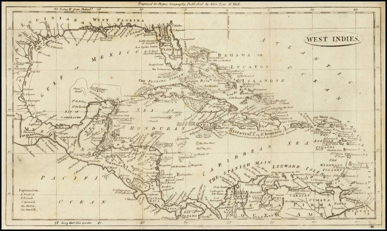
Highly detailed map of the Gulf Coast and the Caribbean, published in 1799 in Payne's Geography. Includes an interesting treatment of Florida and detail among the islands, and locating well over 100 place names. Shows East and West Florida, the...