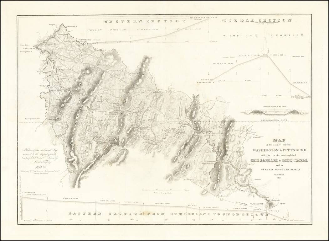
Rare separately issued map showing the route of the proposed Chesapeake and Ohio Canal, likely published as a presentation piece. After the Revolutionary War, George Washington was the chief advocate of using waterways to connect the Eastern Seaboard...
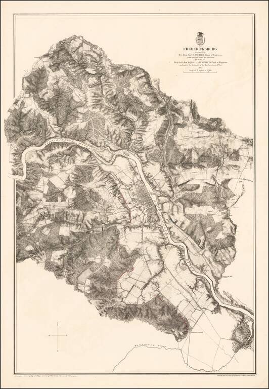
Highly detailed map of the area around Fredericksburg, Virginia, showing the theater of the Battle of Fredericksburg. The map is colored to show the troop positions of the respective armies, with red (Confederate) and blue (Union) positions shown on...
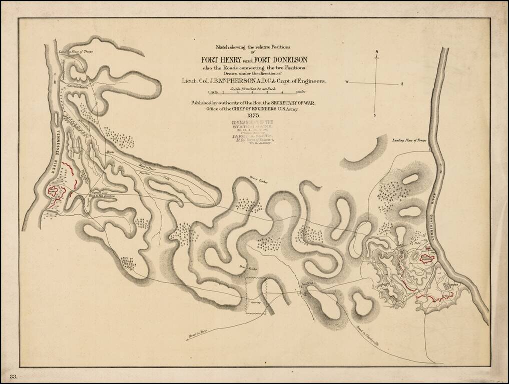
Scarce early battle plan showing the troop positions around Fort Henry and Fort Donelson, between the Tennessee River and Cumberland River. Includes fortifications in red, roads, rivers, telegraph lines and other topographical details.
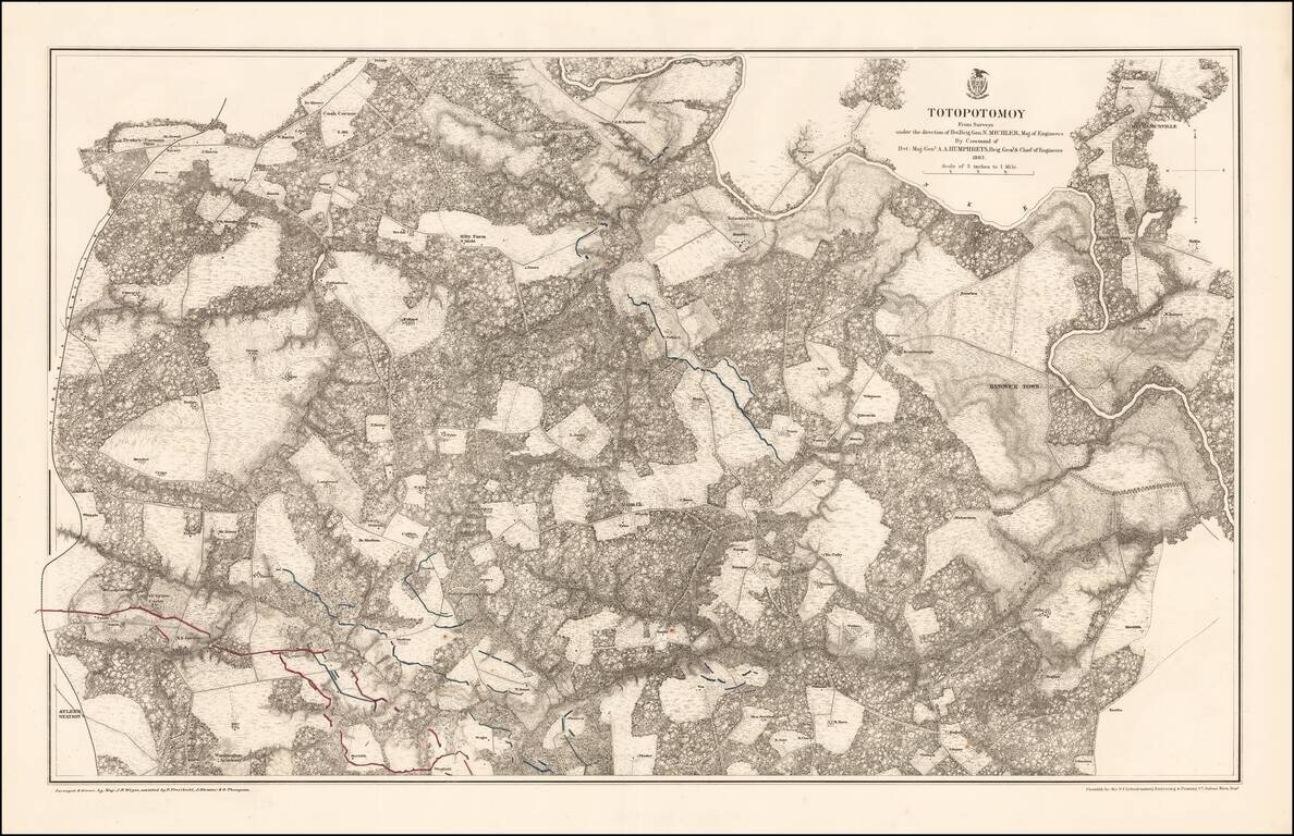
Highly detailed map of the area around Totopotomoy, Virginia, highlighting the battles fought in the area during the Civil War. The Battle of Totopotomoy Creek, also called the Battle of Bethesda Church, Crumps Creek, Shady Grove Road, and...
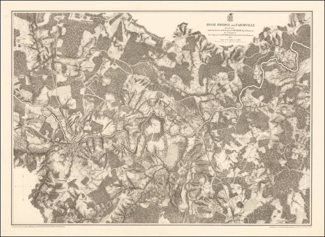
Highly detailed map of the area around Farmville, Virginia, depicting one of the final battle fields of the Civil War. Farmville Robert E. Lee retreated through Farmville as he escaped the Union Army in the Civil War. Farmville was the object of the...
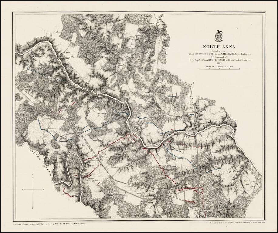
Fine example of this detailed map of area around North Anna. Rumsey describes the map as follows: Stephenson states these are a "detailed series of maps indicating fortifications, roads, railroads, houses, names of residents, fences, drainage,...
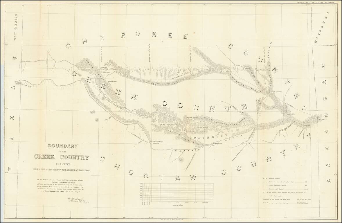
Detailed survey of the lands in Indian Territory occupied by the Creek Indians by agreement with the United States Government. The map shows the results of the earliest surveys of the watershed of the Canadian River and Red Fork of the Arkansas River...