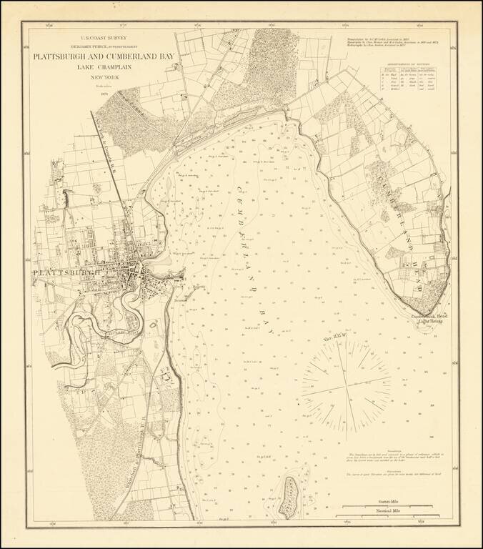
Separately Published Example on Heavy Paper Detailed sea chart of the area around Plattsburgh, published by the Coast Survey. The map extends from Cumberland Head to Crab Island and includes a detailed plan of Plattsburgh, along with the surrounding...
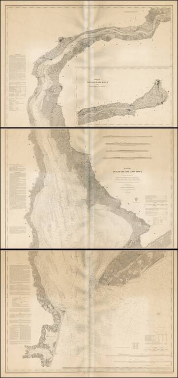
Fine example of this extremely scarce separately issued engraved nautical chart on 3 sheets, covering Delaware Harbor and Bay from the mouth of the harbor to Trenton. While the map appears occasionally on the market bound into an early coast survey...
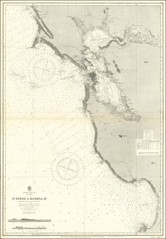
Scarce separately issued sea chart of San Francisco Bay and Vicinity, extending from Monterey Bay to Bodega Bay, with large revisions up to 1926. First issued in the mid-19th century, this map was regularly updated well into the 20th century.
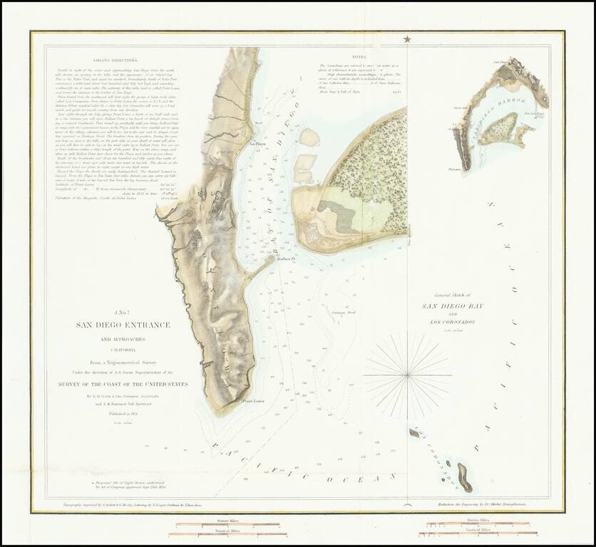
First American Map of the Bay of San Diego Nice example of the first edition of the US Coast Survey's first mapping of San Diego Bay. This first edition can be distinguished from the 2nd edition by the addition of the official seal of the US Coast...
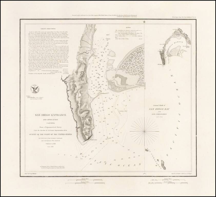
Rare Separately Issued Variant Edition of The First Modern Map of San Diego Bay -- Thick Paper -- Presentation Copy: Rare variant of the 1853 US Coast Survey's first mapping of San Diego Bay. The present example has several changes for the standard...