Matthäus Seutter (1678-1757) was a prominent German mapmaker in the mid-eighteenth century. Initially apprenticed to a brewer, he trained as an engraver under Johann Baptist Homann in Nuremburg before setting up shop in his native Augsburg. In 1727 he was granted the title Imperial Geographer. His most famous work is Atlas Novus Sive Tabulae Geographicae, published in two volumes ca. 1730, although the majority of his maps are based on earlier work by other cartographers like the Homanns, Delisles, and de Fer.
Alternative spellings: Matthias Seutter, Mathaus Seutter, Matthaeus Seutter, Mattheus Seutter
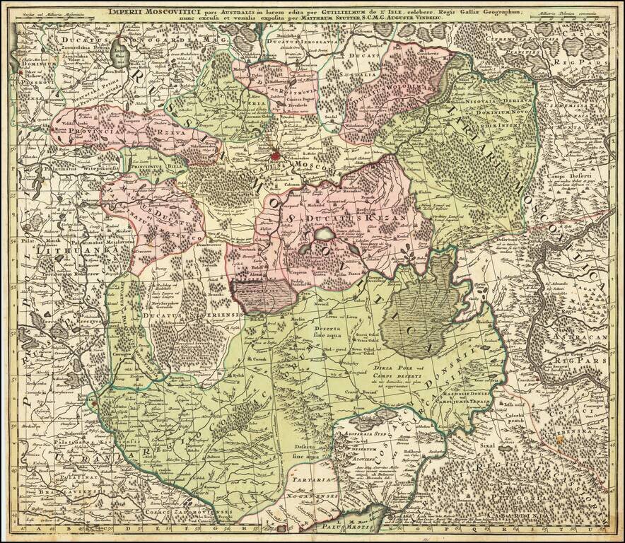
Centered on Moscow Detailed map of Southern Russia, including the Ukraine, Cosack Regions and the Southern part of Moscovie. Includes towns, roads, rivers, lakes, mountains, castles, forests and other details.
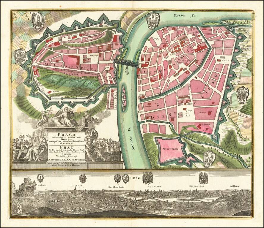
Fine example of Seutter's decorative and highly detailed plan of Prague, with a striking view of the city below. The map shows the city divided into three neighborhoods, the "small," "old," and "new" cities. Fields and Vysehard Cemetary surround the...
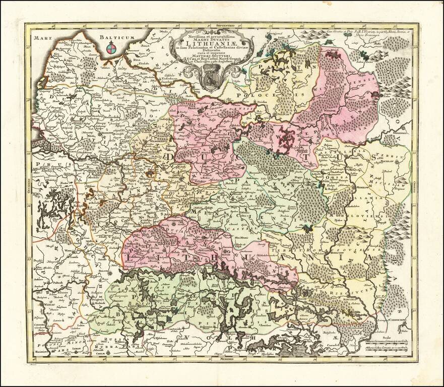
Second State of Seutter's map of Lithuania, extending from the Baltic (Riga) to Palatinat Polesia Bressicenis in the south. A highly detailed map of Lithuania, showing towns, castles, Palatinates, rivers, lakes, forests, etc. There are 3 states of...
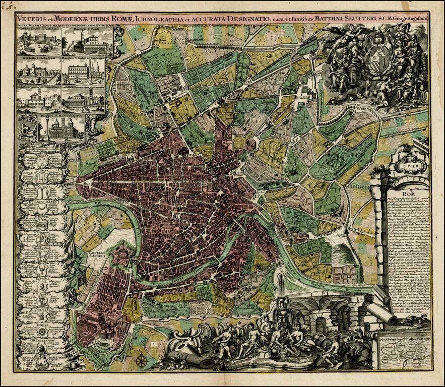
Decorative plan of Rome by Seutter, one of the most prolific printers of town plans in Germany during the 18th Century. The plan includes ichnographic representations of a number of the major buildings and structures of ancient and modern Rome, along...
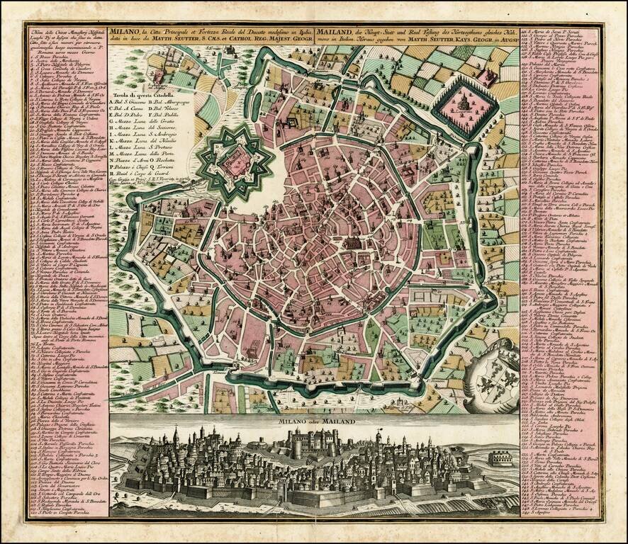
Fine old color example of Seutter's decorative and highly detailed plan of Milan, with a striking view of the City below. The view below the map shows the city atop a hill, with the fortifications in the foreground.
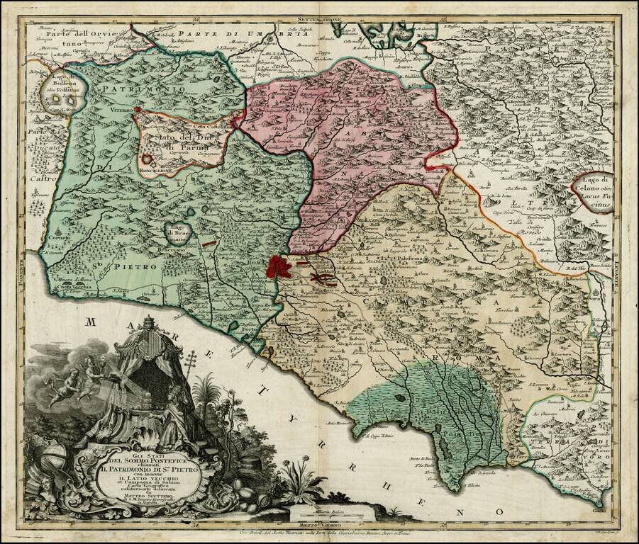
Scarce map of the "Stati del Sommo Pontefice," showing the area centered on Rome, controlled by the Pope. Fine decorative cartouche. The first time we have ever seen this map.
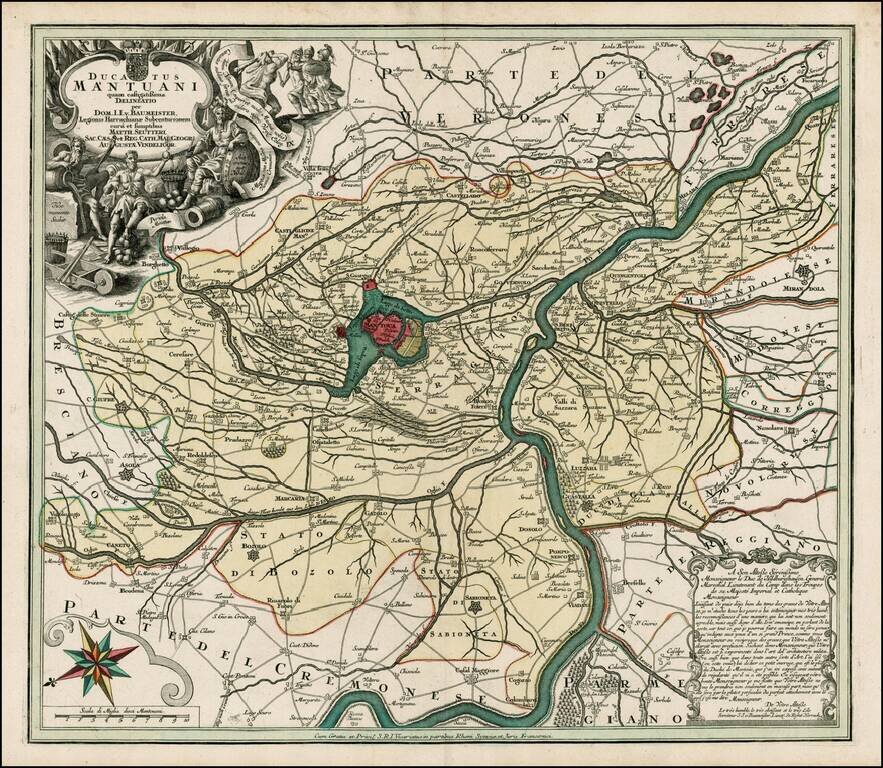
Fine full color example of this scarce decorative map, with Mantua at the center. Includes a decorative allegorical cartouche showing the history of the region, coat of arms and compass rose.
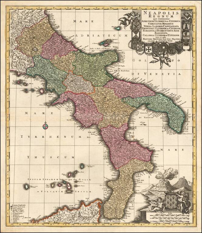
A Fine Dark Impression of Seutter's Map of the Kingdom of Naples Finely engraved map of the Kingdom of Naples, published by Mattheus Seutter in Augsburg. The region is depicted extending from Aprutium to Calabria and including part of Sicily....
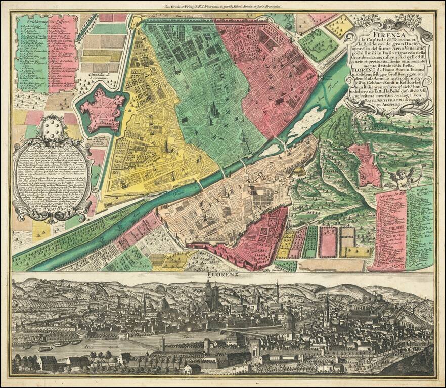
Fine old color example of Seutter's decorative and highly detailed plan of Florence, with a striking view of the City below. The view below the map shows the city from the far side of the Arno, with the Duomo in the center.
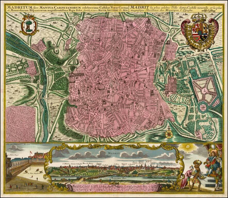
Fine old color example of Seutter's decorative and highly detailed plan of Madrid, with a striking view of the City below. The map includes 2 coats of arms, and a unique view of the City from across the Xarama River, set within a scene on the palace...
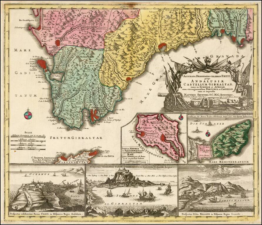
Decorative regional map of the southern parts of Spain, with large inset maps of Minorca, Ceuta, Cadiz, Gibralter and Malaga.
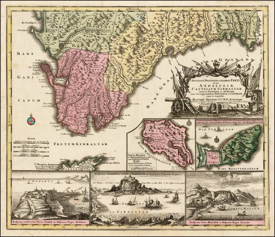
Decorative regional map of the southern parts of Spain, with large inset maps of Minorca, Ceuta, Cadiz, Gibralter and Malaga.
![[Barcelona] Barcino Metropolis Hispanici Principatus Cataloniae in littore Maris Mediterranei, perquam munita, et ab portus como ditatem celeberrimum Emporium cura Impensis . . .](/map/small/58971.jpg)
Fine old color map and view of Barcelona and environs, published by Seutter in Augsburg. At the top, a map-like view of the fortified town and harbor of Barcelona is shown, with a second set of walls on Montjuic (called Mont Juif on the map). Below...
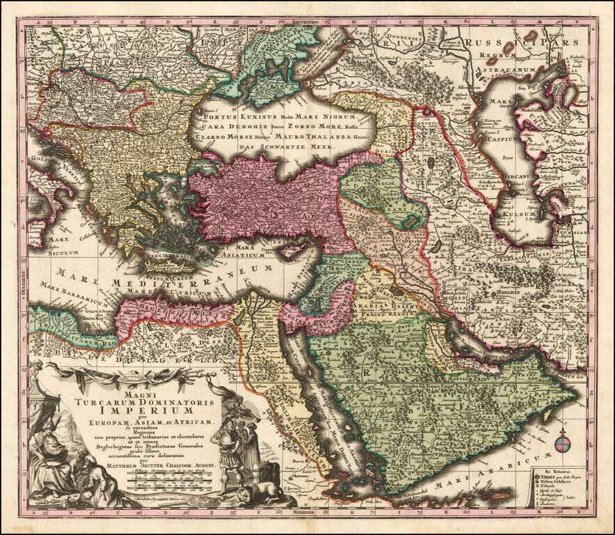
Striking hand-colored engraved regional map, centered on Turkey and Asia Minor, and showing the Eastern Mediterranean, Balkans, Greece, Persia, Saudi Arabia, the Black Sea and the Caspian Sea, published by Seutter. Includes decorative cartouche and...
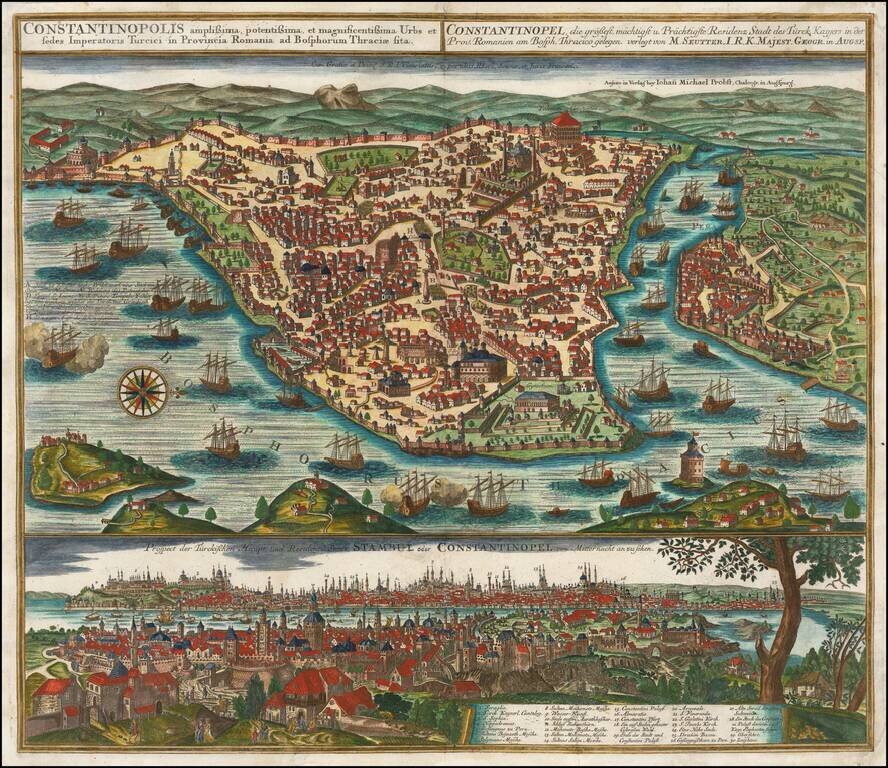
Striking plan of Istanbul, with the Bosphorus in the foreground.. The plan includes a large detailed view of the City at the bottom, with a key locating 30 landmarks. Fine old color example of Seutter's city plan and local views. Seutter engraved...
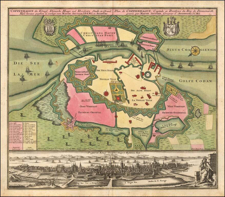
Fine large plan of Coppenhagen, with a city view below. Oriented with southeast at the top, the map focuses on the town's fortifications. Includes 2 large coats of arms.