Matthäus Seutter (1678-1757) was a prominent German mapmaker in the mid-eighteenth century. Initially apprenticed to a brewer, he trained as an engraver under Johann Baptist Homann in Nuremburg before setting up shop in his native Augsburg. In 1727 he was granted the title Imperial Geographer. His most famous work is Atlas Novus Sive Tabulae Geographicae, published in two volumes ca. 1730, although the majority of his maps are based on earlier work by other cartographers like the Homanns, Delisles, and de Fer.
Alternative spellings: Matthias Seutter, Mathaus Seutter, Matthaeus Seutter, Mattheus Seutter
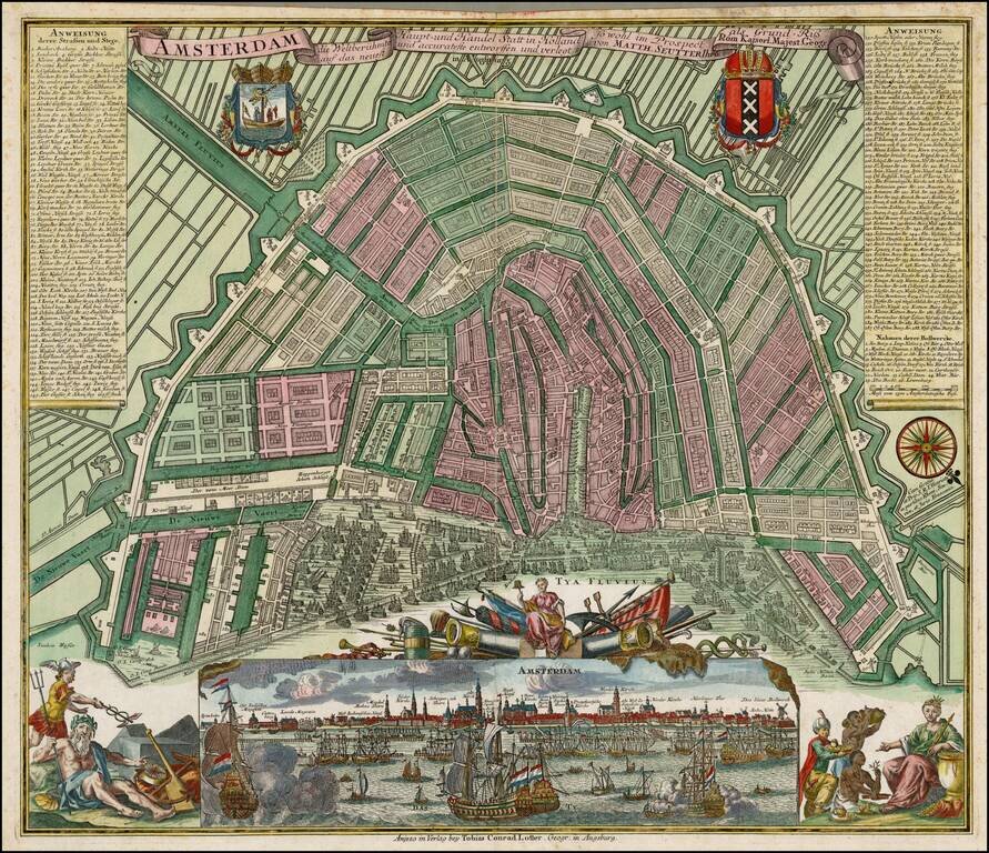
Nice full color example of Seutter's decorative and highly detailed plan of Amsterdam, with a striking view of the City and allegorical embellishments below. Includes 2 coats of arms and a key naming over 300 places on the map and view.
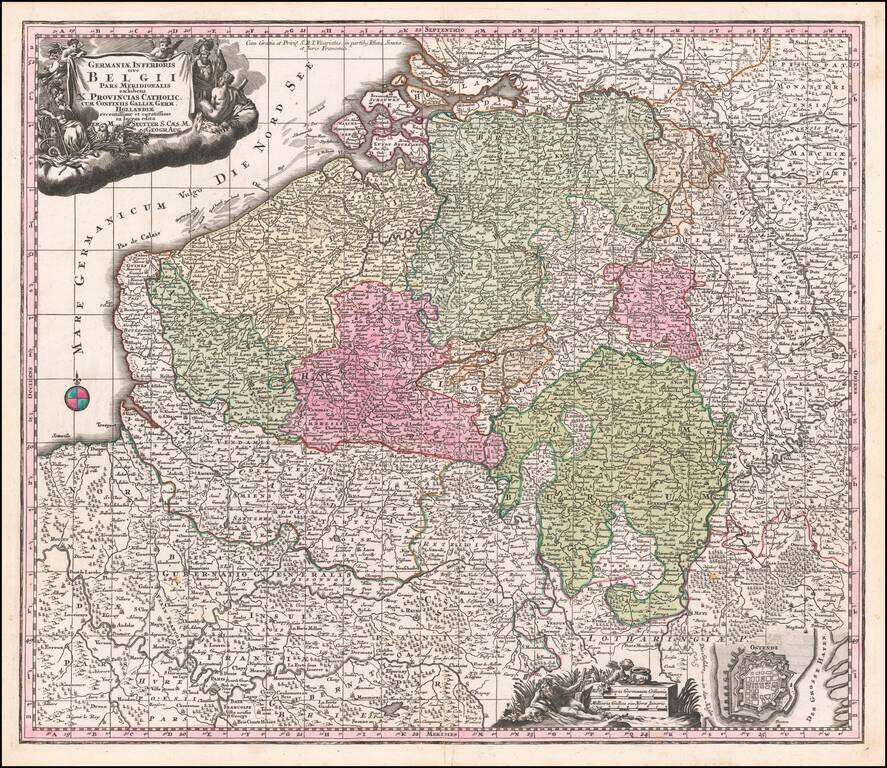
Decorative regional map of the Low Countries, published by Seutter.
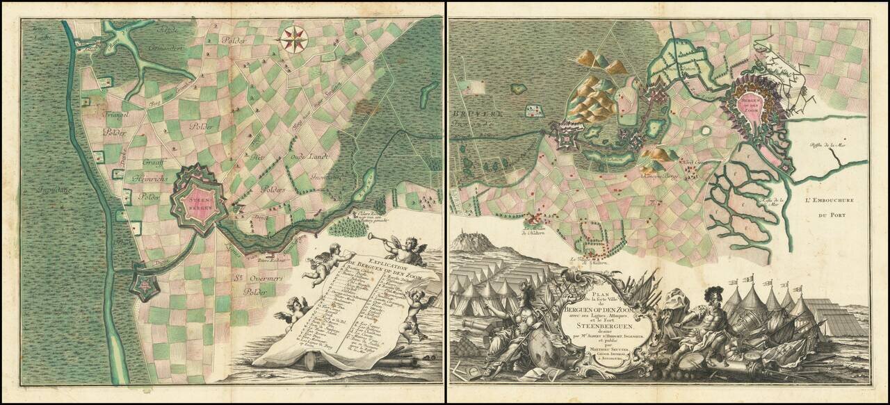
A Grand Battle Plan From the War of Austrian Succession Fine 2 sheet map of the area around Bergen-op-Zoom, illustrating the region at the time of its Siege in 1747. Oriented with east at the top, the 2 sheet map shows the town and fortifications of...
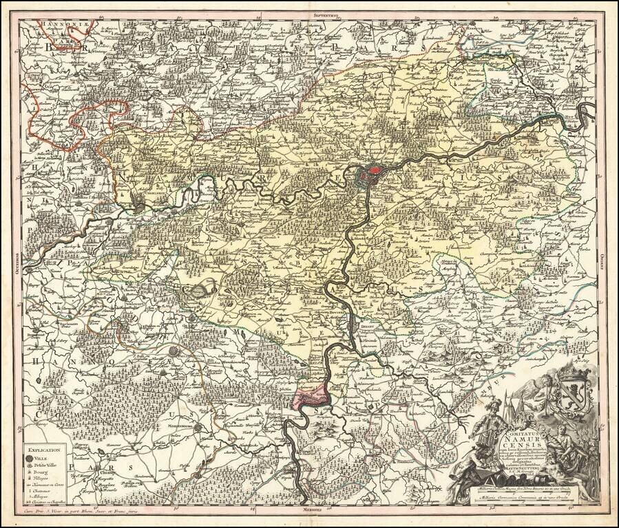
Decorative map of Namur, published in Augsburg by Seutter. Includes an elaborate allegorical cartouche and coat of arms.
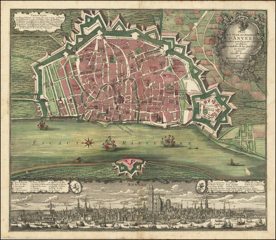
Fine old color example of Seutter's decorative and highly detailed plan of Antwerp, with a striking view of the City below. A fine dark impression.
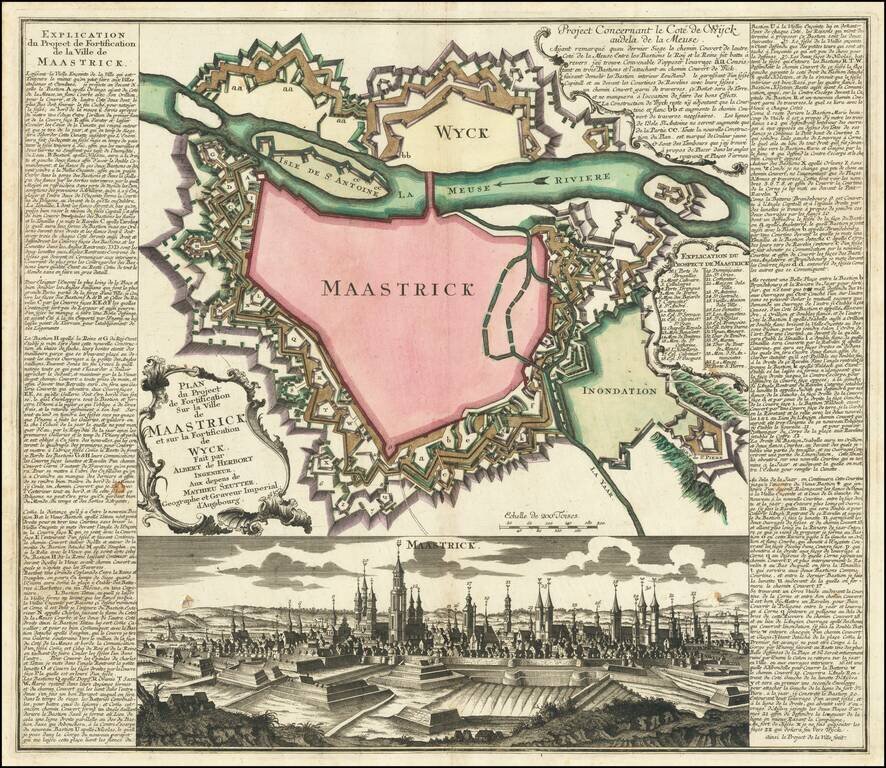
Fine plan of the fortification of Maastricht, showing the impressive defensive walls of Maastricht and Wyck, published circa 1748. The plan includes a detailed view the city, and an extensive engraved text and key in French down the sides. The plan...
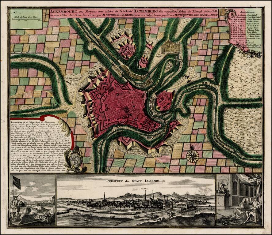
Fine old color example of Seutter's decorative and highly detailed plan of Luxemburg, with a striking view of the City below. The view below the map shows the city and two military views to the left and right of the main prospect of the City.
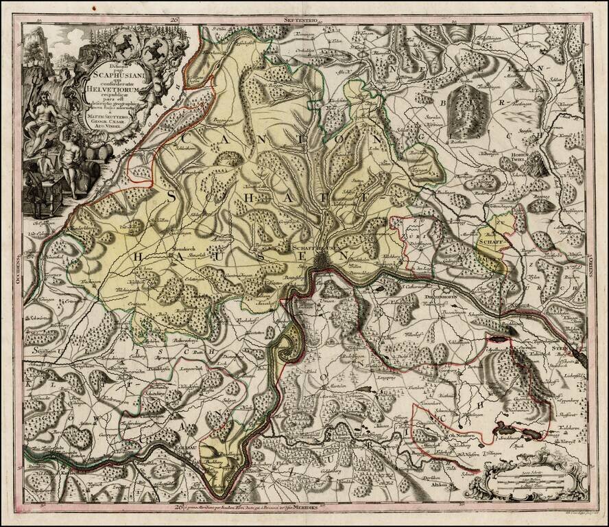
Nice example of Seutter's map of the area around Schffhausen on the Rhein River. One of a series of finely engraved regional maps of Switzerland produced by Seutter. Includes fine details, including towns, roads, rivers, mountains, castles, forests,...
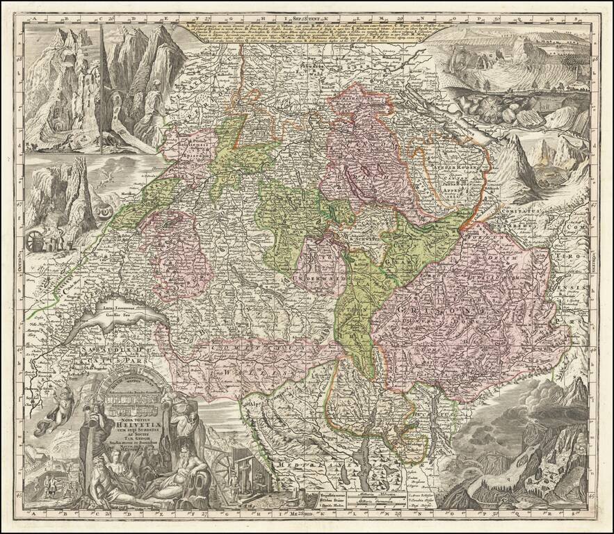
Striking and highly detailed map of Switzerland, with 8 elaborate vignettes and title cartouche. The vignettes show scenes of various mountains and rivers and other scenes, most notably a flying dragon. Includes the coats of arms of each of the...
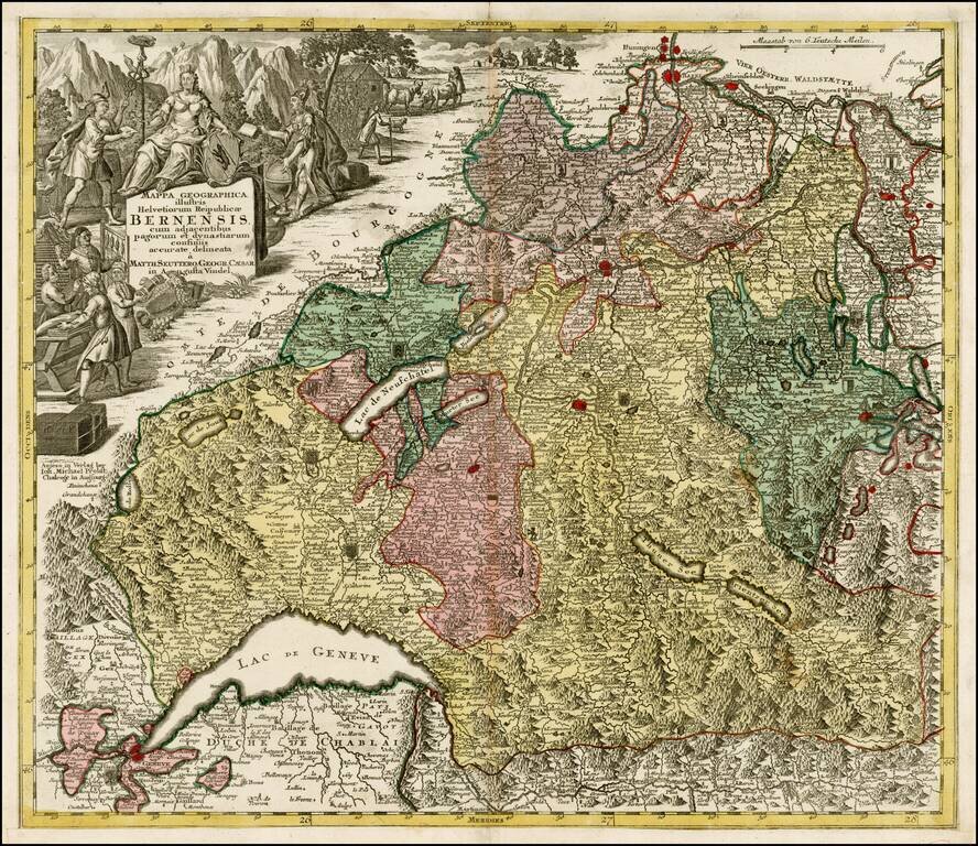
Decorative map of the Kanton of Bern and environs, extending to Geneva, Lucerne and Basel. Includes a decorative cartouche and a number of coat of arms within the map.
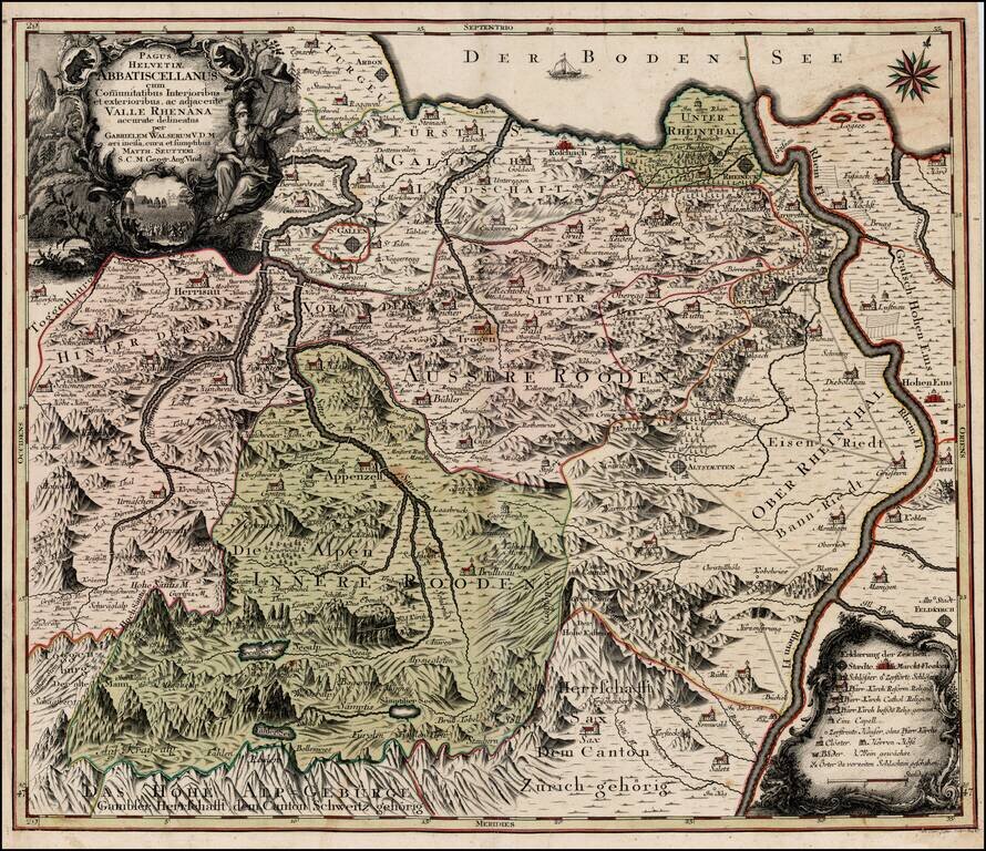
Scarce regional map of Switzerland showing the Cantons south of the Boden See. Includes St. Gallen, Appenzell, Altstatten, Hohen and Hochst on the Rhine River.
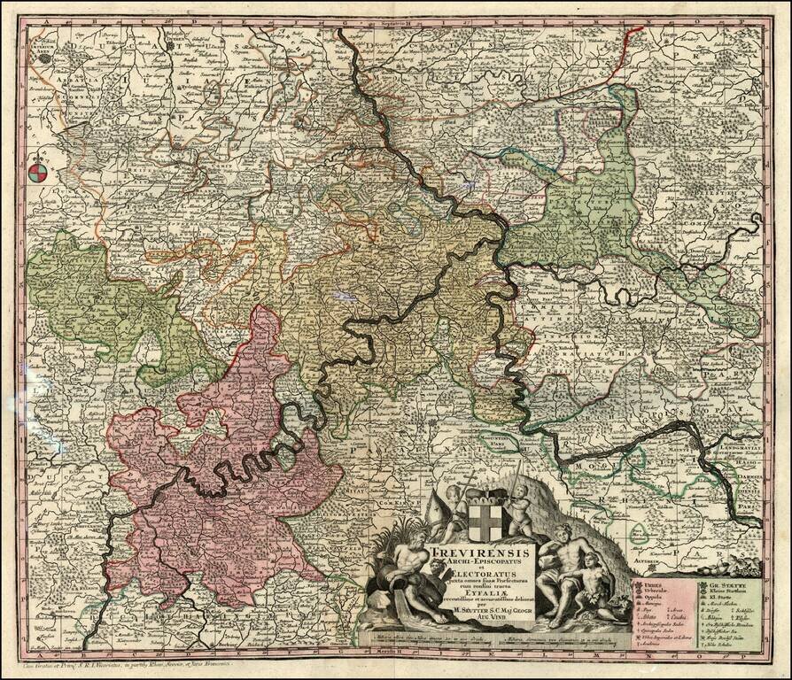
Decorative map of the Moselle & Rhine River Valleys. Includes a decorative cartouche.
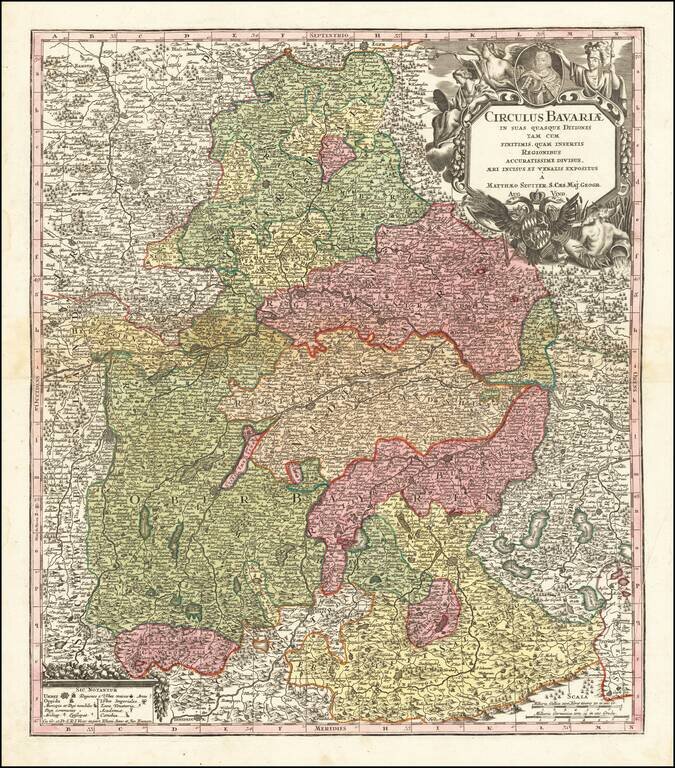
Detailed map of Bavaria, published in Augsburg by Seutter. The map extends from Obere Phaltz, Ober Bayern, Ertzstift Saltzburg, Burkhausen, Stift Passau, Freisingische Gr. Werdenfels, Hertzogt Neuberg, Pfalz Neuberg and a number of other German...
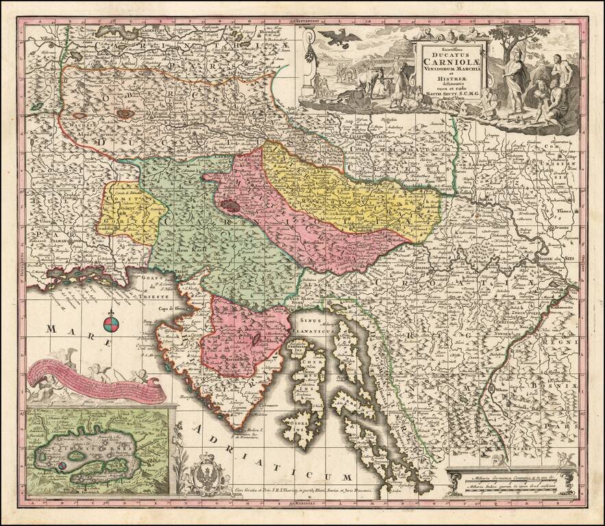
Detailed map of the region from Obercrain and Southern Carinthia in the west to Croatia in the east, centered on Istria, Chres and Krk Islands and the Dalmatian Coastline. Ljubjana (Laybach or Laubach) appears prominently to the north of the Czirnizer...
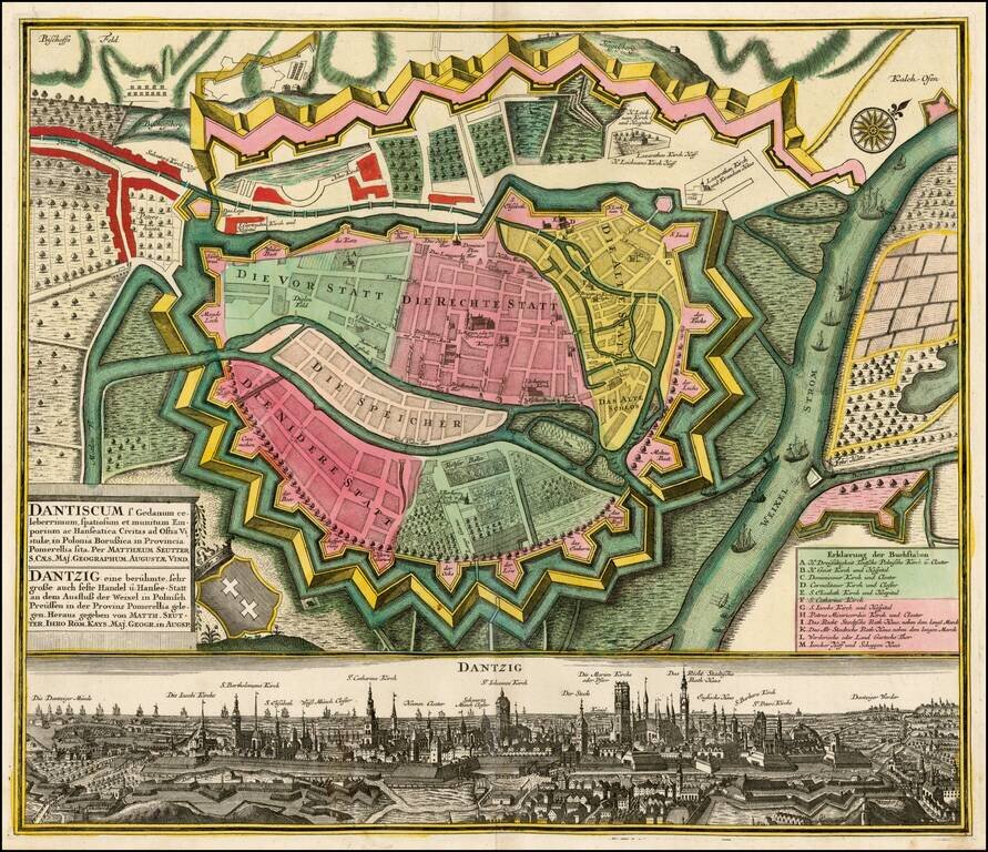
Fine example of Seutter's plan and birdseye view of Dantzig. The plan shows the fortifications of the town, streets, buildings and other points of interest. At the bottom is a fantastic view of the city.
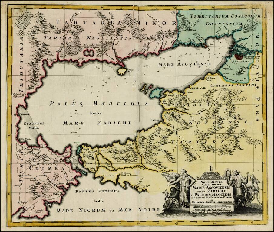
Striking map of the Sea of Azov and the surrounding regions, with a decorative allegorical cartouche, showing the costumes of the indigenous people of the region.