Matthäus Seutter (1678-1757) was a prominent German mapmaker in the mid-eighteenth century. Initially apprenticed to a brewer, he trained as an engraver under Johann Baptist Homann in Nuremburg before setting up shop in his native Augsburg. In 1727 he was granted the title Imperial Geographer. His most famous work is Atlas Novus Sive Tabulae Geographicae, published in two volumes ca. 1730, although the majority of his maps are based on earlier work by other cartographers like the Homanns, Delisles, and de Fer.
Alternative spellings: Matthias Seutter, Mathaus Seutter, Matthaeus Seutter, Mattheus Seutter
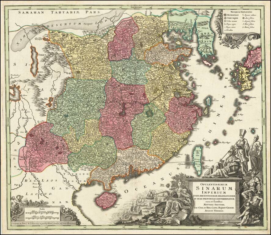
Striking and highly detailed map of China, colored by provinces, published by Seutter in Augsburg, circa 1730. The map extends from southern China to Korea, which is shown as a peninsula and includes southern Japan and Taiwan. The elaborate cartouch...
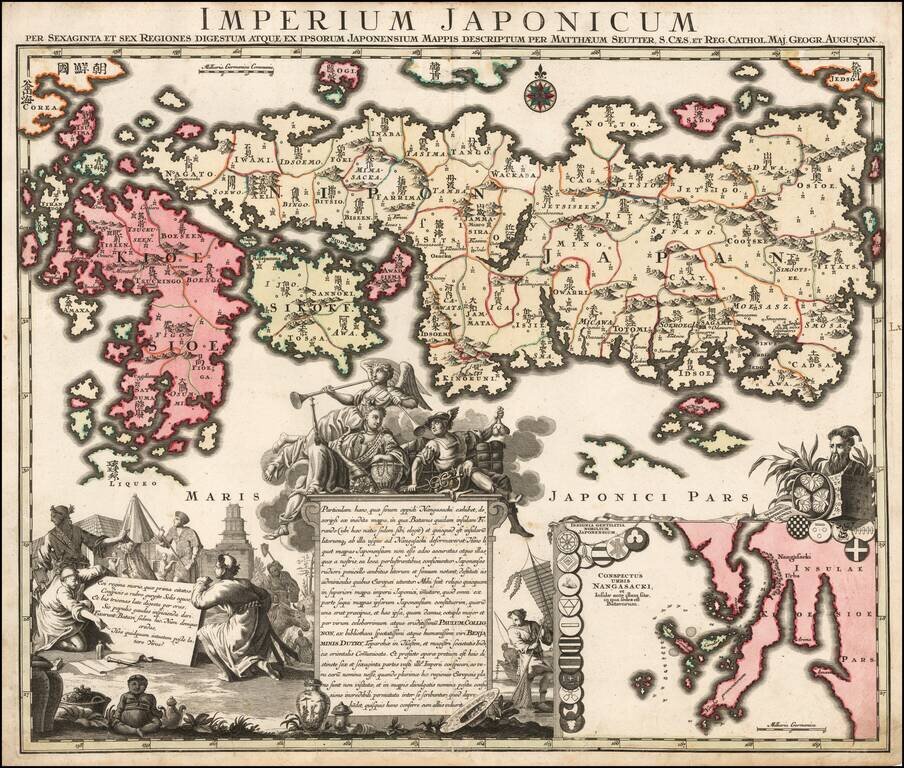
Nice example of Matthaus Seutter's edition of Adrien Reland's seminal map of Japan. Adrien Reland's map of Japan is the first map to use Sino-Japanese characters on a European printed map and represents a radical departure from prior European maps of...
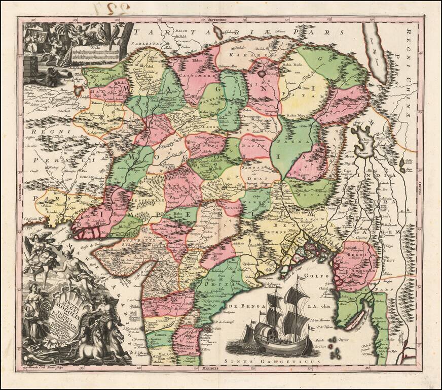
Detailed map of India, extending from the Ganges to Eastern Persia and North to the Mont de Caucause (Himalayas). Colored by provinces. Includes 2 large decorative vignettes and a sailing ship.
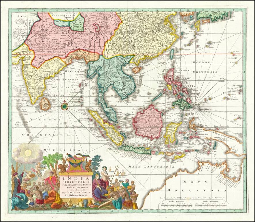
Antique Map of Southeast Asia, Indian Ocean and Australia A nice example of Seutter's scarce map of the East Indies and part of Australia, from the Atlas Novus. The map extends from Japan and Persia in the North, to the Maldives and Australia and the...
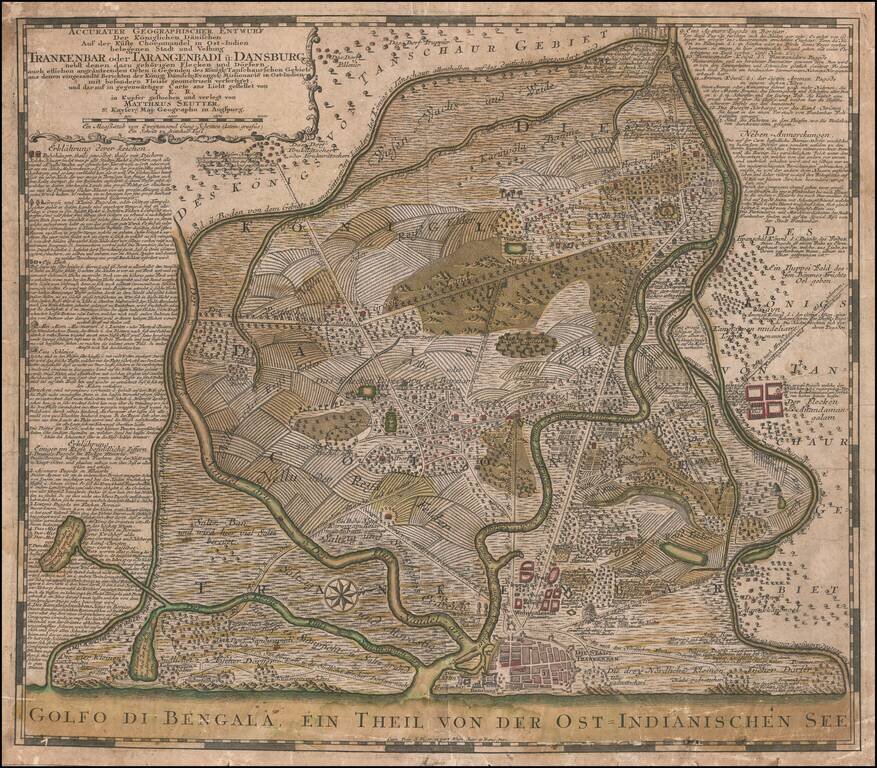
Scarce plan city of Tranquebar, primary factory for the Danish East India Company in the Madras Province. The Danish East India Company established a trading fort at Tranquebar around 1620. After years of sporadic and poor trading, Tranquebar became...
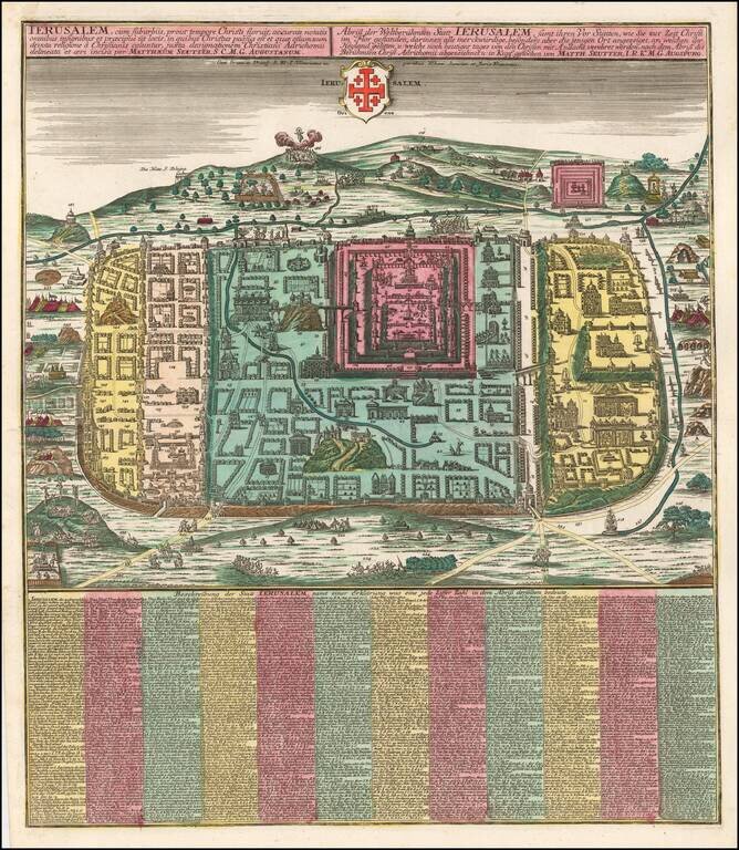
Fine full color example of Seutter's plan of the city of Jerusalem, based upon the 16th century map of Christian van Adrichom. The plan includes a key locating 254 major points of interest in the Holy City. Van Adrichom's plan was originally issued...
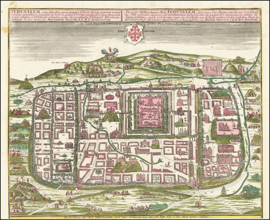
A fine full-color example of Seutter's plan of the city of Jerusalem, based on the 16th-century map of Christian van Adrichom. Most buildings shown are numbered and can be referenced to an index included with some copies of this map. The view is a very...
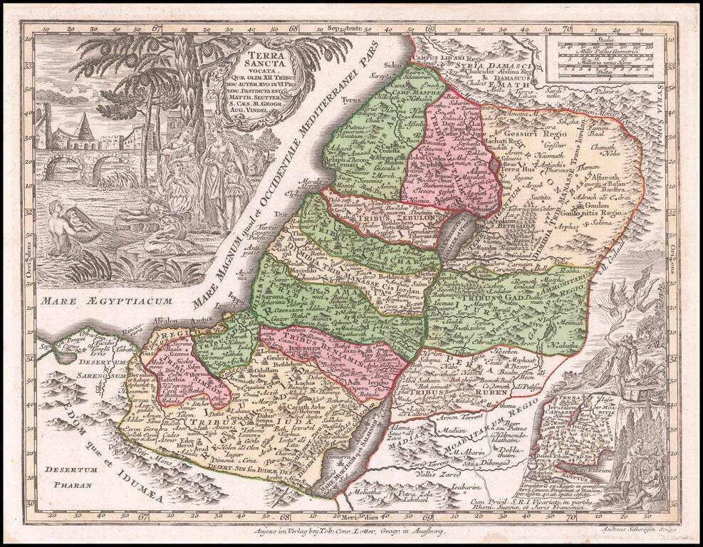
Detailed map of the Holy Land and Exodus, from Seutter's Atlas Minor.
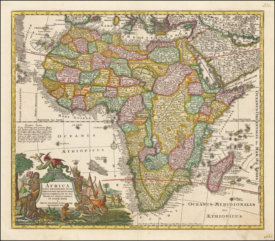
Nice example of Seutter's map of Africa. The map is packed full of geographical and other information, some of which is based upon reality. Marvelous combination of up to date information, myth and legend. A highly detailed and richly engraved map....
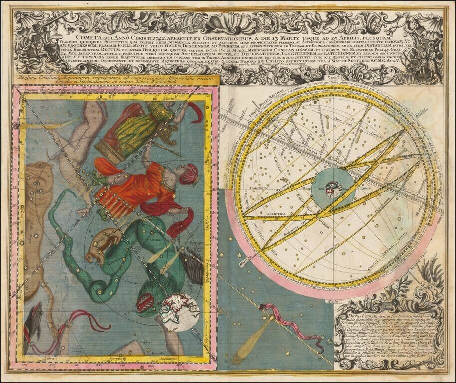
Fine pair of celestial models illustrating the bright comet which transited the sky in March and April of 1742. On the right is an image of the Celestial Sky, illustrating the various constellations visible in the sky at the time of the transit of the...