George Davidson (1825-1911), was one of the most important mapmakers and scientific minds of the 19th Century.
Davidson was born in England and moved to the US in 1832. He met Alexander D. Bache in 1842, when he assisted Bache in his observations of the magnetic elements at Girard College. Upon his graduation in 1845, he began his career as clerk to Bache who was superindentent of the United States Coast Survey.
From 1846 to 1850, Davidson was occupied in geodetic field work and astronomy on the east coast. In 1850, he went to California, where he was engaged in the determination of the latitude and longitude of prominent capes, bays, etc., and of the magnetic elements of the Pacific Coast, including a survey of Washington and Puget sounds, and the main triangulation of the coast in the region of San Francisco.
From 1861 to 1867, he was again on the Atlantic seaboard, principally engaged in engineering work on coast and river defences. In 1866, he became chief engineer of an expedition for the survey of a ship canal across the Isthmus of Darien.
In 1867, he was appointed to make a special examination and report upon the geography and resources of Alaska, pending its purchase; his published report and conferences with congressional committees influenced the passage of the bill. He was placed in charge, during 1867, of the work of the Coast Survey on the Pacific, planned work for the land parties from 1868 until 1875, and inspected all the fields of work.
From 1876 to 1886, he had charge of the main triangulation and astronomical work on the west coast; the records of the computing division showed that the results of his observations stood higher than any ever executed in America, Europe, or India, and they were characterized as “unique in the history of geodesy.
In 1881, Davidson twice measured the Yolo base line, one of the geodesic base lines that formed the foundation of triangulating distances in California. At that time, it was the longest base line yet attempted in trigonometrical operations, and the system of triangulation directly connected therewith was called in his honor the “Davidson quadrilaterals.” He also measured the Los Angeles base line three times in 1888-1889. He retired from the Coast Survey in 1895, after 50 years of service.
Davidson also founded the Davidson Observatory in San Francisco, which was the first astronomical observatory on the Pacific coast of North America, and in 1869 brought the Pacific geodetic of the coast survey in telegraphic longitude connection with Greenwich. His astronomical work includes the observation of the total solar eclipse under the 60th parallel, in 1869; determination of the 120th meridian in 1873; charge of the U. S. transit of Venus expedition, in 1874; recovery of the transit of Venus station of 1709 in Lower California occupied by Auteroche de la Chappe; observation of the total solar eclipse of January 7, 1880; and in 1882 charge of the party to observe the transit of Venus in New Mexico.
Other positions held by Davidson include president of the California Academy of Sciences from 1871 to 1887, Honorary Professor of Geodesy and Astronomy, and Regent of the University of California from 1877 to 1885. After his retirement from the Coast Survey,[4] he became the first professor of geography at the University of California, Berkeley, and chaired that department from 1898 until his retirement in 1905, and remained an emeritus professor until his death. Davidson was one of 182 charter members of the Sierra Club in 1892 and served as a member of its board of directors from 1894 to 1910.
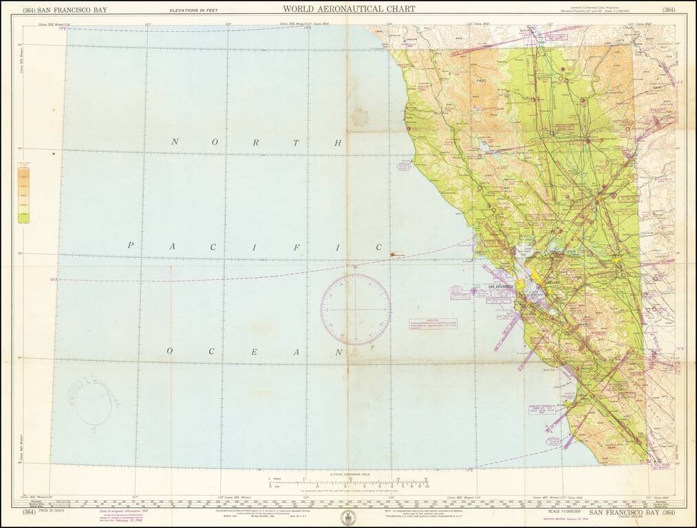
Detailed aeronautical map of the area around San Francisco Bay, and the Northwestern part of California. The chart is a font of information about civil and military aviation in postwar Northern California. It was intended for civil aviators flying by...
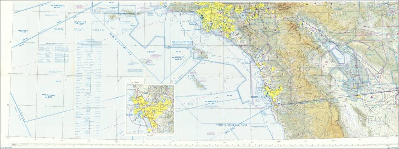
Detailed aeronautical map of Southern California covering the region from south of the Mexican border to the Central Valley. Most of Los Angeles and San Diego (with an inset of San Diego) can be seen on one side, with the other focusing on the region...
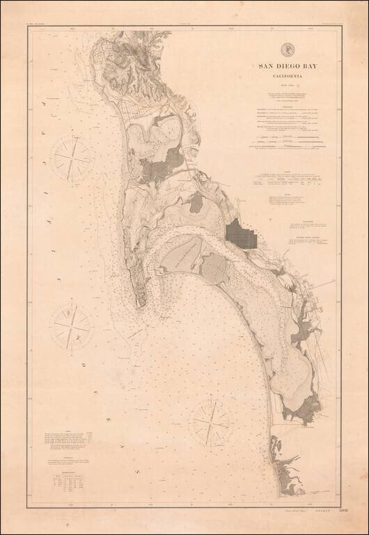
Rare 1895 Coast & Geodetic Survey Chart of San Diego Bay, published February 1895. The map extends north to La Jolla, La Hoya Valley (La Jolla Shores) and Rose Canyon and south to Otay Valley, the Tijuana River and the monument locating the...
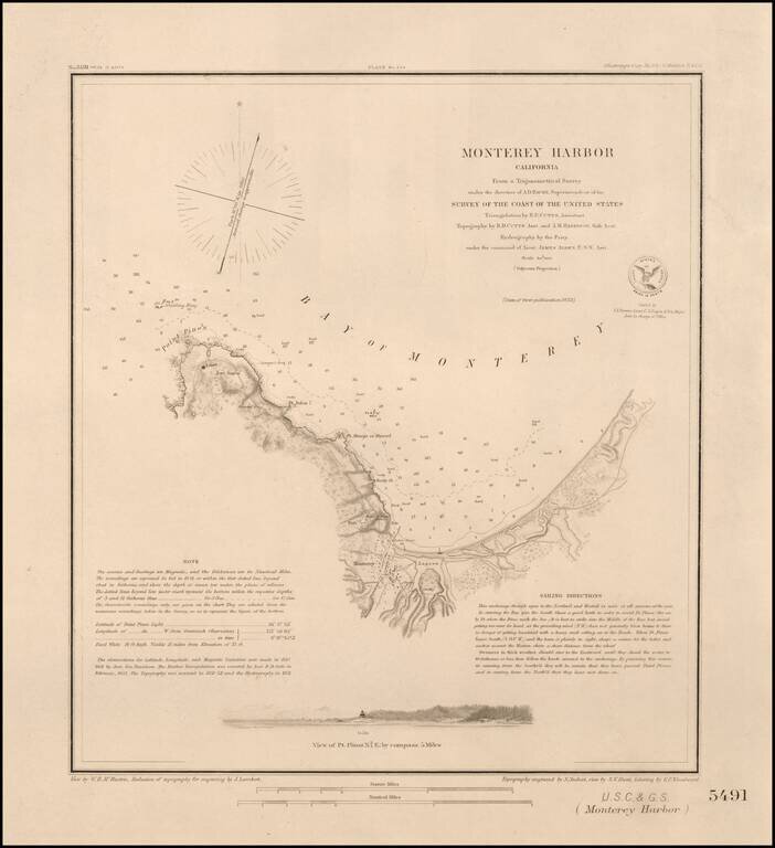
Nice example of this important early survey of Monterey Bay, published by the United States Coast & Geodetic Survey. Incudes a profile view of Pt. Pinos. Shows a Monterey town plan, Point Pinos, Pt. Anlon, Pt Almejor Mussell, the Lagoon, Fort,...
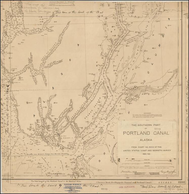
Original artwork for George Davidson's book on the Alaskan Boundary Dispute. The work consists of a US Coast and Geodetic Survey chart amended by George Davidson, for publication in "The Alaska Boundary," published in 1904. In addition to the...
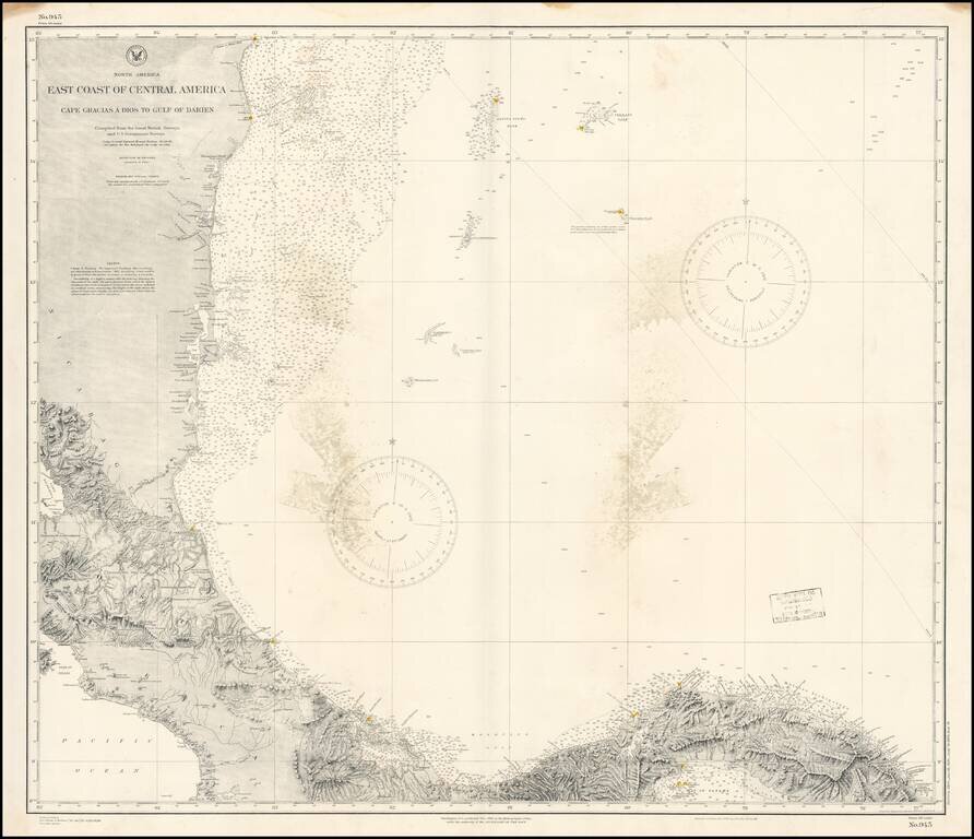
Detailed chart of the Mediterranean Coast of Panama, Costa Rica and Honduras, published by the US Coast & Geodetic Survey. The chart provides a highly detailed coastal treatment of the region, along with the offshore islands, soundings, sailing...
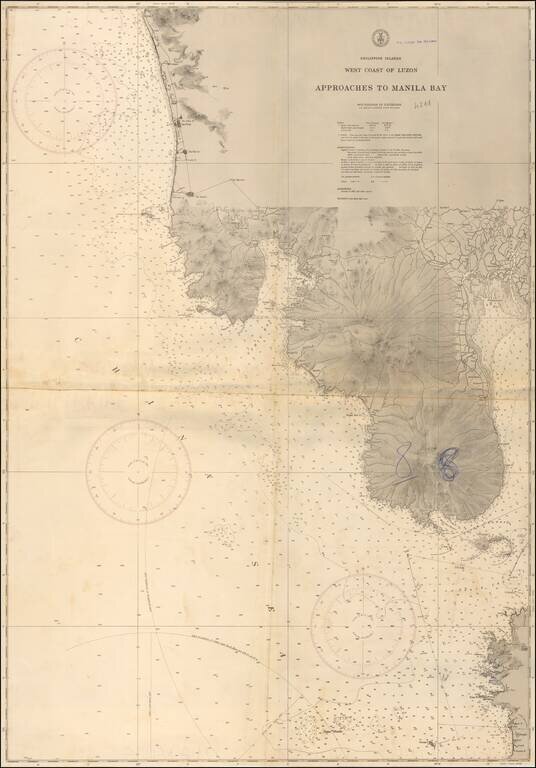
Finely detailed chart showing the approaches to Manila Bay, published by the US Commerce Department. The map extends to Botolan Point and Mt. Botolan in the northwest and Pamanga Bay, covering all of Subic Bay and the westernmost coastline of Manila...
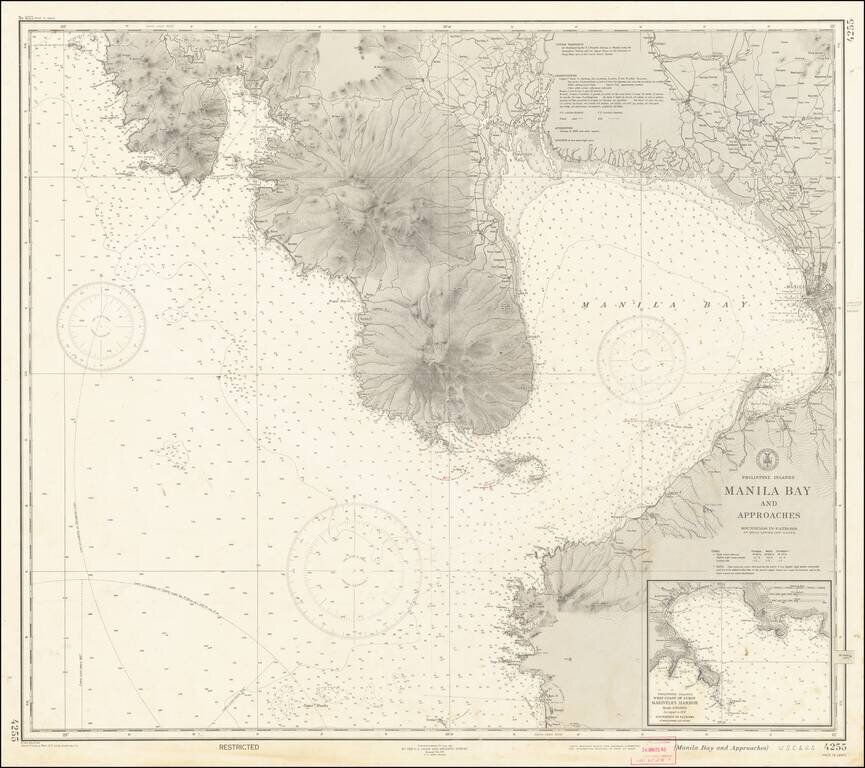
"RESTRICTED" World War II Map of Manila. Detailed chart U.S. Coast and Geodetic Survey (Philippine Divison) of Manila Bay, including Corregidor Island, originally published before the Japanese takeover during the early stages of the Second World War...
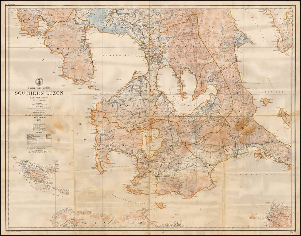
Highly detailed map of the southern part of Luzon Island in the Philippines, published by the US Coast and Geodetic Survey. The map shows topographical features, roads, towns, rivers, trails, lighthouses and many other details.