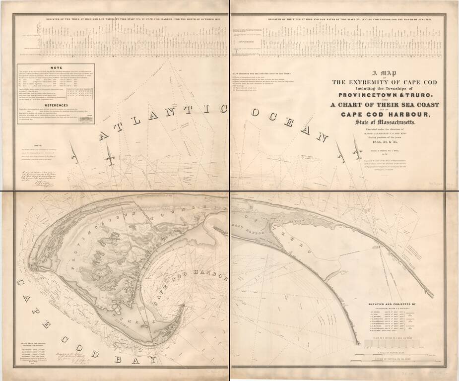
A remarkably detailed chart of the waters around Truro and Provincetown, by one of America's great topographical engineers of the 19th century. This mammoth chart is based on extensive surveys conducted by the Topographical Engineers in 1833-35, "to...
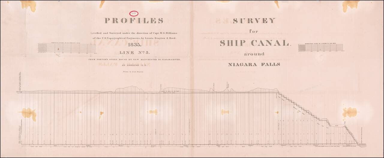
Large plan showing the surveys for a Ship's canal around Niagara Falls, as surveyed by Captain W.G. Williams for the US Corps of Topographical Engineers.
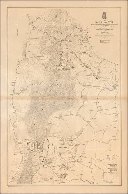
Large, detailed lithographed map of the Battle of South Mountain, a somewhat mixed Union Victory, which set the stage for the Battle of Antietam three days later. The Civil War Trust says of the Battle of South Mountain: After his success at Second...
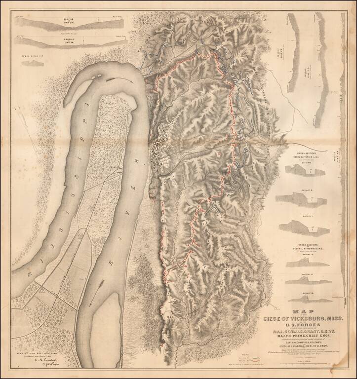
Detailed map of the Siege of Vicksburg, drawn by Charles Spangenberg. The present map is the printed version of a manuscript field map drawn by Spangenberg and dated August 20, 1863, the original of which is held by the Library of Congress....
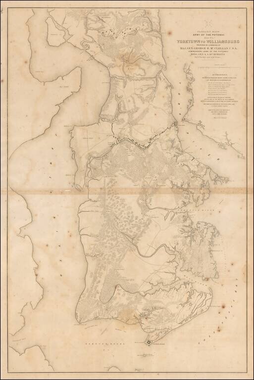
Large lithographed map of the area from Yorktown, Virginia to Williamsburg, prepared for McClellan and published in 1862. The map was one of a series of maps showing the theater of operations of the Army of the Potomac. The map shows Fortress Monroe,...
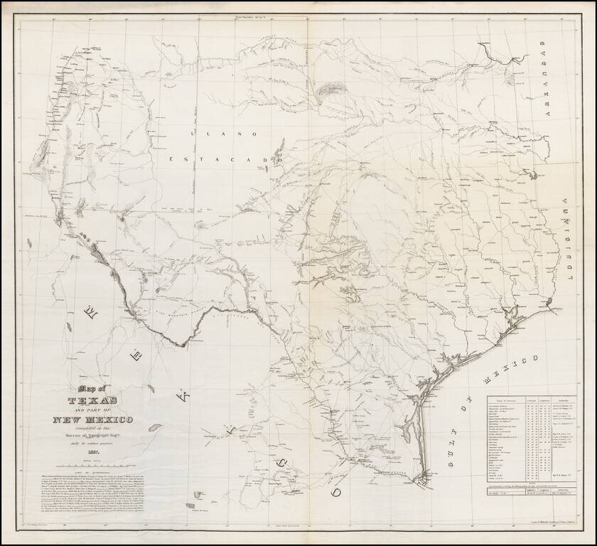
One of the Rarest Great Modern Maps of Texas First edition of this remarkable separately issued map of Texas and part of New Mexico, prepared by the United States Topographical Engineers in 1857 and issued in very small numbers, likely only for use...
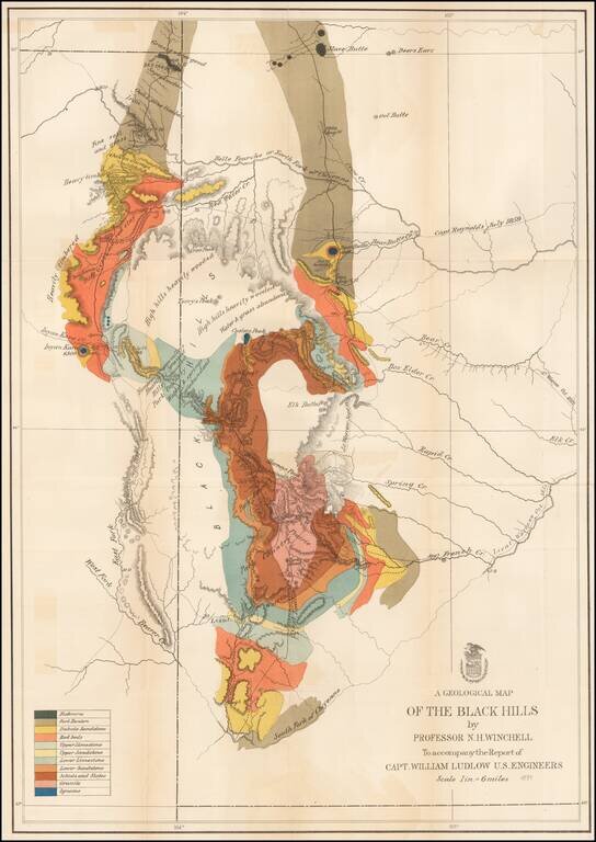
Important early geological survey map of the Black Hills region, undertaken by William Ludlow, while under the command of George Custer. In 1874, a large group of cavalrymen under the command of Lt. Col. George Armstrong Custer moved into the Black...
![[Yellowstone National Park]](/map/small/37103.jpg)
Highly detailed early map of Yellowstone National Park, which accompanied the Annual Report of the Superintendent of Yellowstone National Park for 1892. A note at the top of the map provides a key for identifying the roads which existed prior to 1891...