logo

1835. Profiles Survey for Ship Canal around Niagara Falls

  • Profiles Survey for Ship Canal around Niagara Falls

Profiles Survey for Ship Canal around Niagara Falls information:

Year of creation: 
Resolution size (pixels): 
 27663x11366 px
Disk Size: 
 60.3906MiB
Number of pages: 
 1
Place: 
 1835

Print information. Print size (Width x height in inches):
Printing at 72 dpi 
  384.21 х 157.86
Printing at 150 dpi 
 184.42 х 75.77
Printing at 300 dpi 
 92.21 х 37.89

An example of detailing the file of this map of in a printable high-resolution:

Click to open in high resolution (open in new tab).
Attention! this is just the central piece (central area 960x960 px) of the map file!
This is an example, so that you can see and study the level of detail of a given map. The entire Map will be fully available after payment!

Profiles Survey for Ship Canal around Niagara Falls

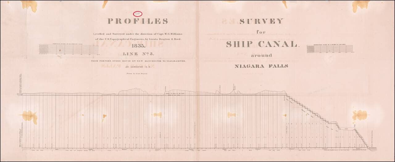
Large plan showing the surveys for a Ship's canal around Niagara Falls, as surveyed by Captain W.G. Williams for the US Corps of Topographical Engineers.


Special conditions for students!

If you are a student, write to us in telegram: @antiquemaps and indicate what material you need and for what work you need a map in high detail. We are ready to provide material on special terms. For students only!

Item information:

Year of creation:
Size:
27663x11366 px
Disk:
60.3906MiB
Number of pages:
1
Place:
1835
Author:
United States Bureau of Topographical Engineers.
$21.99

Related item