The Dirección de Hidrografía, or the Directorate of Hydrographic Works, was established in 1797. Its roots were in the Casa de Contratación, founded in 1503 in Sevilla, which housed all the charts of the Spanish Empire and oversaw the creation and maintenance of the padrón real, the official master chart. The Casa, now in Cadiz, was shuttered in 1790, but Spain still needed a hydrographic body. In response, the Dirección was created in 1797. One of its first projects was the publication of charts from the Malaspina Expedition (1789-1794). The Dirección oversaw not only publication, but also surveying. The Dirección was abolished in the early twentieth century, when their work was distributed to other organizations.
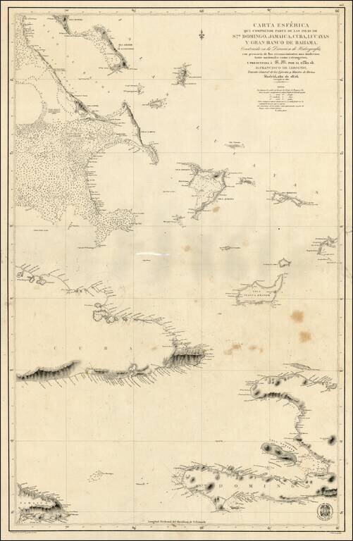
Scarce Spanish Sea Chart of the southern part of Haiti, the Caicos and neighboring Islands.
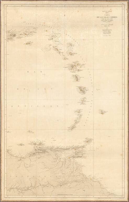
Scarce sea chart of the eastern Caribbean Ocean and the contiguous coastline of South America, published by the Spanish Hydrographical Office, la Direcci ón de Hidrograf ía. Originally issued in 1865, this is a rarer, updated version of 1868....
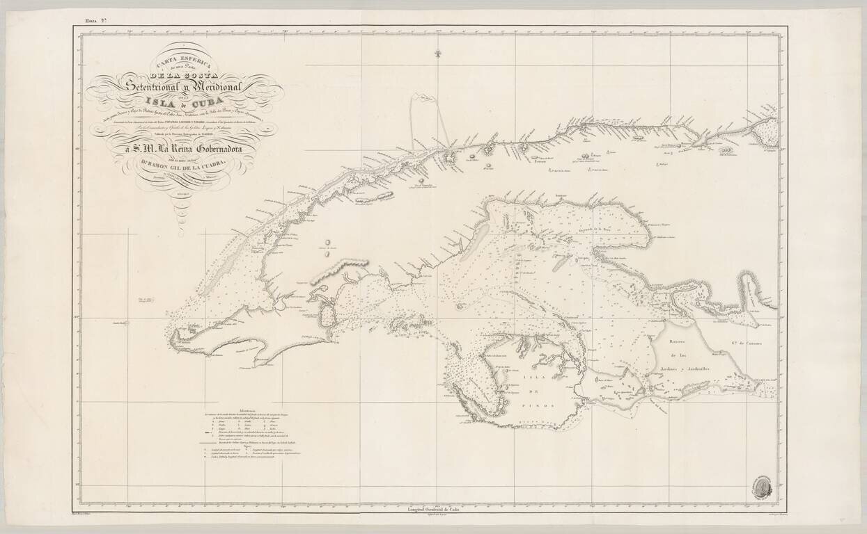
Fine Spanish Sea Chart of Western Cuba. Scarce and highly detailed chart of Cuba from official Spanish sources. Spanish maps of the Caribbean are quite scarce, even in the 19th Century. Extends from Cape San Antonio at the western tip of the island...
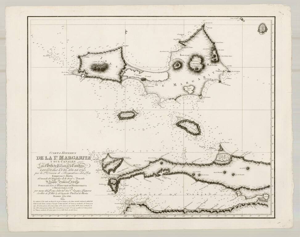
Fine map of Margarita Island and the Gulf of Cariaco, as surveyed by the Spanish at the end of the 17th Century. The present chart represents the southeastern most expeditionary work of Brigadier Joaquin Franciso Fidalgo, at the end of the 18th...
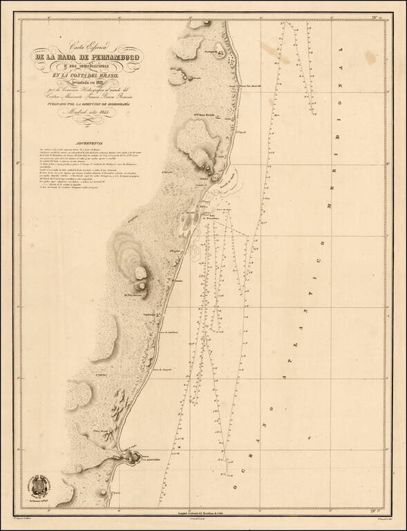
Scarce chart of the coast of Brazil, from Cape St. Agostinho to Gurparim, along the Pernambuco Coast. The charts produced by the 'Direccion de Hydrografica' were detailed surveys meant for marine use. Not unlike the well known blue-back charts of the...

Rare Spanish Sea Chart of the Coast of Venezuela and Trinidad Rare first state of the edition of this rare Spanish sea chart of the coastline of Venezuela and neighboring islands, including Trinidad and Margarita. The present chart represents the...
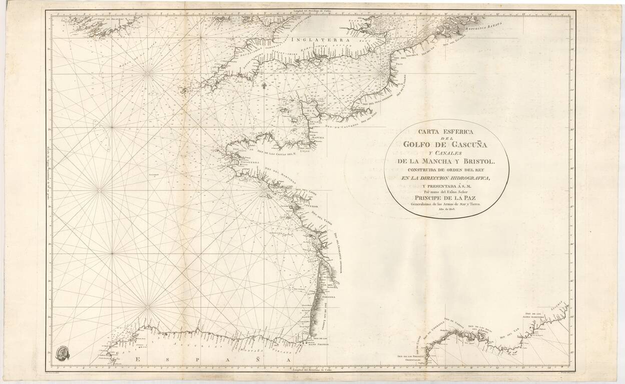
Rare Official Spanish Blue Backed Sea Chart of the Bay of Biscay (Biscaya) First edition of this fine sea chart, created by Juan Ferrer and engraved by Fernando Selma for the Spanish Hydrographical Department in 1803. The chart extends from the...
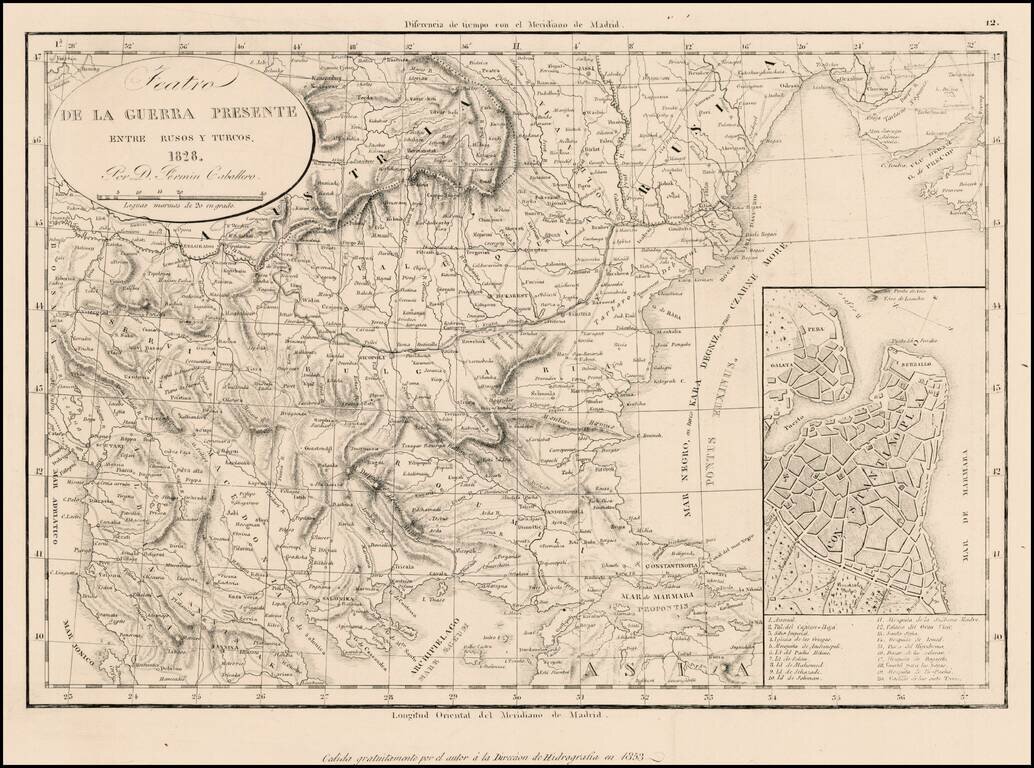
Rare separately issued map illustrating the Theater of War between the Russians and the Ottoman Empire, dated 1828 and issued by the Fermin, with a later imprint for the Direccion Hidrographia. Includes a large inset plan of Istanbul.
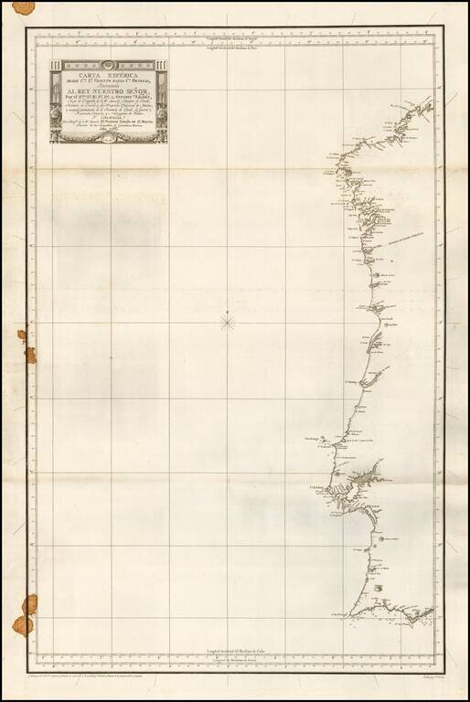
First edition of this rare separately issued Spanish Sea Chart of the Coast of Portugal and western Spain. The map was part of the first modern Hydrographical Atlas of Spain.
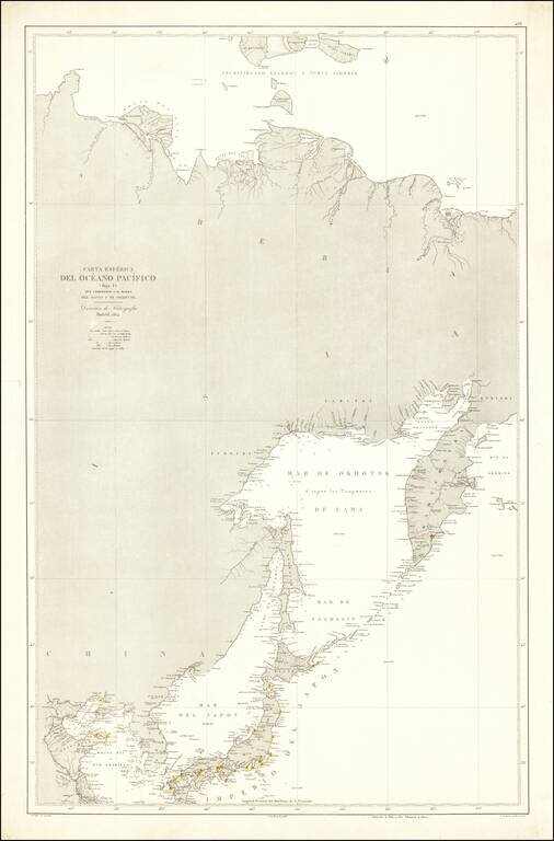
Rare Spanish Sea Chart of the Northeast Coast of Asia, published by the Spanish Hydrographical Department. The chart extends from Korea and the Yellow River to Kamtchatka.
![[Singapore & Malaca Strait] Carta Esferica Del Mar de China Comprendido Entre La Isla De Borneo y La Peninsula De Malaca, segun os trabajos mas modernos ingelese y holandeses . . . 1864](/map/small/62184.jpg)
Spanish Sea Chart of the Malacca Strait and Environs -- Singapore Fine Spanish nautical chart, illustrating the Straits of Malacca and northwestern Borneo, published by the Spanish Hydrographical Office in 1864. The map credits the work of modern...