Map size in jpg-format: 1.9173MiB
Click to open in high resolution (open in new tab).
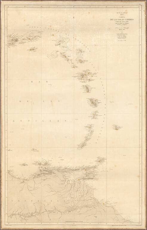
Scarce sea chart of the eastern Caribbean Ocean and the contiguous coastline of South America, published by the Spanish Hydrographical Office, la Direcci ón de Hidrograf ía. Originally issued in 1865, this is a rarer, updated version of 1868. Spanish sea charts of this region in the mid-nineteenth century are quite scarce on the market.
Founded in 1797, the Direcci ón was to serve as a replacement for the Casa de la Contrataci ón, which from 1503 to 1790 housed Spain's navigational charts. A Depósito Hidrográfico had existed since 1770, but the Direcci ón was more than a deposit-it was the center for the storage, creation, and dissemination of Spain's hydrographic knowledge, similar to the Royal Navy's Hydrographic Office (1795) and the French Dépôt des cartes et plans de la Marine (1724).
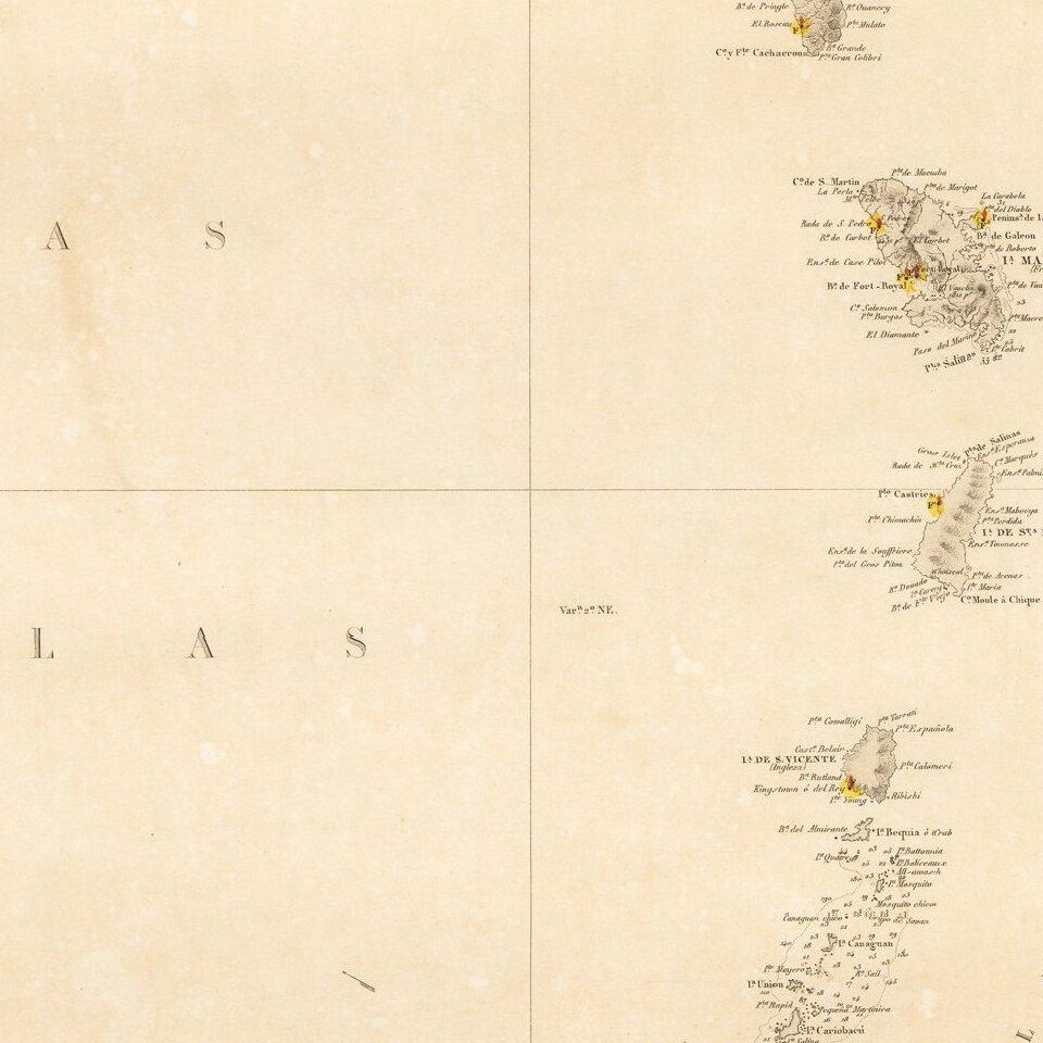
This chart is part of a series on the Mar de las Antillas and depicts sailing information. Different letters indicate the varying types of conditions common in the area such as sand (A), coral (Cl), stone (P), and stretches where no bottom was detected. There are also lighthouses (F), and floating lighthouses (FF) labeled. The lighthouses were of especial interest to a former user, as they have been marked with a red line and yellow circle on this copy.
The chart was a product of collaboration, not just between the sources of raw information-both Spanish and foreign-but between the compiler, S. Bregante, the engraver, I[gnacio] Tubao, and the letter engraver, F. Bregante. All three men produced numerous charts for the Direcci ón in the mid-nineteenth century. This particular collaboration would cost a consumer 3 pesetas, or an entire day's work in 1868. It cost 4 pesetas if one was overseas.
The Dirección de Hidrografía, or the Directorate of Hydrographic Works, was established in 1797. Its roots were in the Casa de Contratación, founded in 1503 in Sevilla, which housed all the charts of the Spanish Empire and oversaw the creation and maintenance of the padrón real, the official master chart. The Casa, now in Cadiz, was shuttered in 1790, but Spain still needed a hydrographic body. In response, the Dirección was created in 1797. One of its first projects was the publication of charts from the Malaspina Expedition (1789-1794). The Dirección oversaw not only publication, but also surveying. The Dirección was abolished in the early twentieth century, when their work was distributed to other organizations.
If you are a student, write to us in telegram: @antiquemaps and indicate what material you need and for what work you need a map in high detail. We are ready to provide material on special terms. For students only!


![[Wall Map] West-Indische Paskaert waer in de graden der breedde over weder zyden vande middelyn wassende so vergrooten dat die geproportioneert syn tegen hunne nevenstaende graden de lengde.](/map/small/60169.jpg)