Laurie & Whittle refers to the partnership of Robert Laurie (1755?-1836) and James Whittle (1757-1818), engravers and map publishers. Both men were employed by Robert Sayer (ca. 1724-1794), one of the most prominent British publishers and map sellers of the eighteenth century. Sayer died in 1794 and his business was taken over by his assistants. The two worked together as Laurie & Whittle until 1812, when Laurie retired. They were especially known for publishing sea charts and maritime atlases. From 1812-1818, when he died, Whittle worked with Laurie’s son, Richard Holmes Laurie, as Whittle & Laurie. After 1818, the firm was known as R. H. Laurie, even though Richard died in 1858. Later, the firm was managed by Laurie’s draughtsman, Alexander George Findlay, and, later, Daniel and William Kettle.
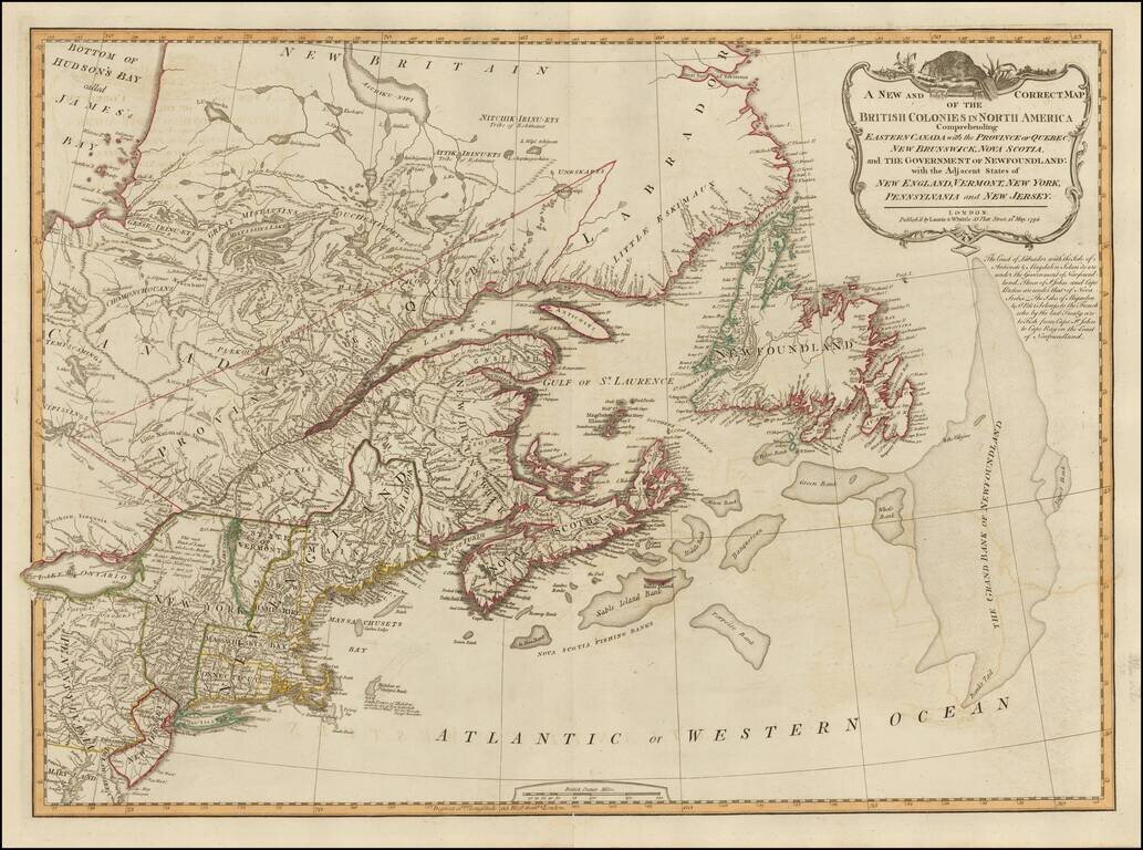
18th Century British Map of the Northern United States A nice example of Laurie & Whittle's map of Canada and the Northeastern United States, extending from Hudson and James Bays to Newfoundland and the Grand Bank, and to Delaware Bay, the Upper...
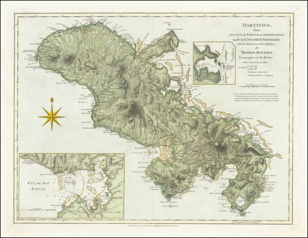
Detailed map of the lsland of Martinique, with inset maps of Port Royal Harbor and Gallion Harbor, which was first published by Thomas Jefferys in 1775. In 1720, a French naval officer, Gabriel de Clieu, procured a coffee plant seedling from the Royal...

Unusual Eighteenth-Century Map of Solar Eclipses over Europe Rare, separately-issued map showing the solar eclipses of 1715, 1724, 1737, 1748 and 1764, including the famous 1715 Halley’s Eclipse, named for the pioneer of eclipse mapping, astronomer...
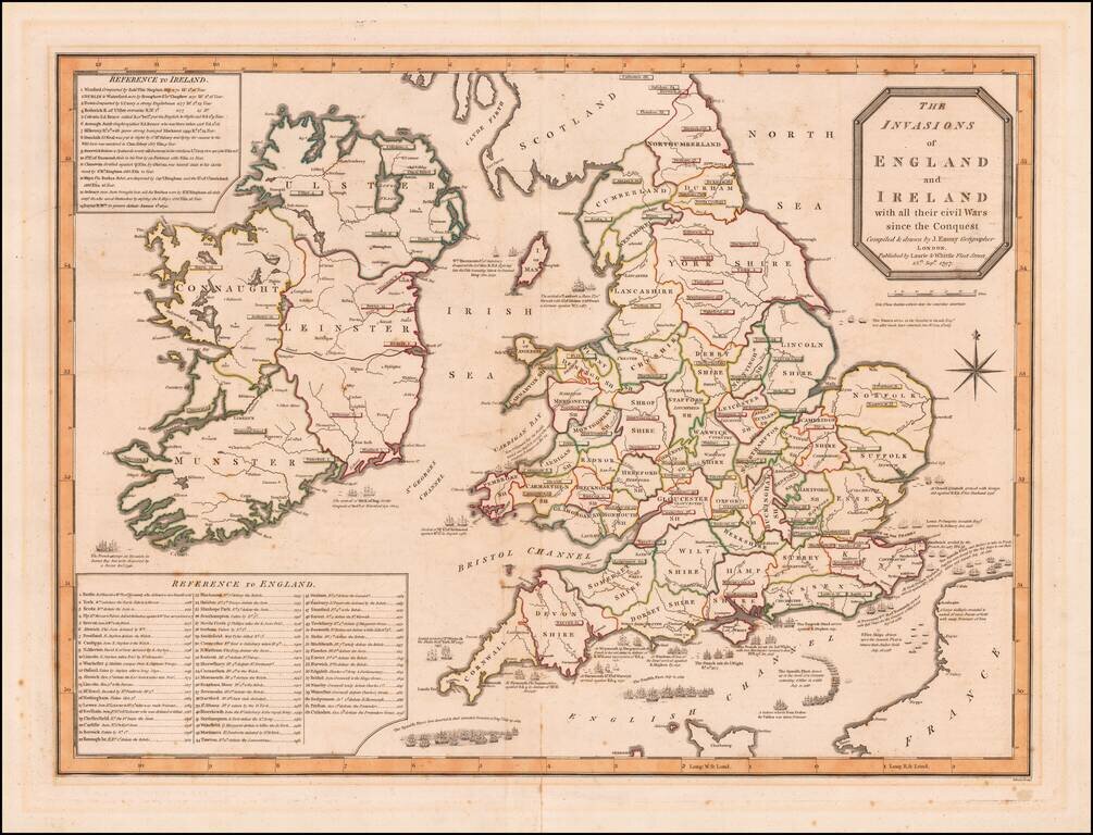
Detailed map depicting the invasions of England and Ireland. Shows the positions of the British, French and Spanish Fleets, with details and two extensive keys, giving the military history of England and of Ireland.
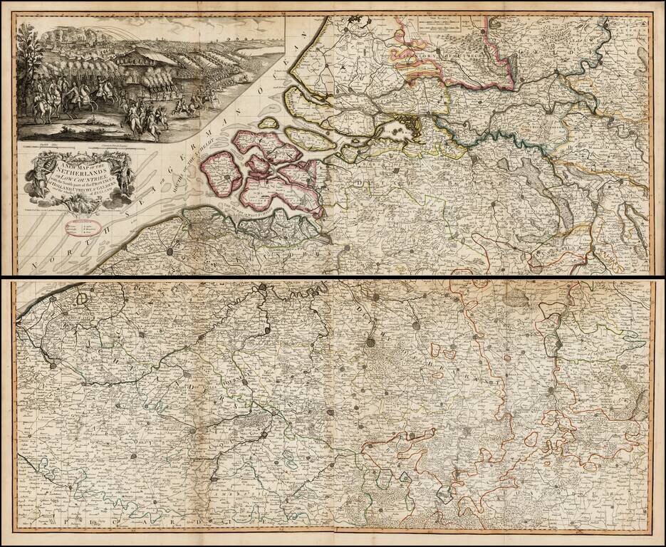
Scarce large format map of the southern part of the Low Countries, published by Laurie & Whittle in 1794. Above the decorative cartouche is a large (9" x 20") and beautifully rendered battle scene that may be the Battle of Flushing. Filled with...
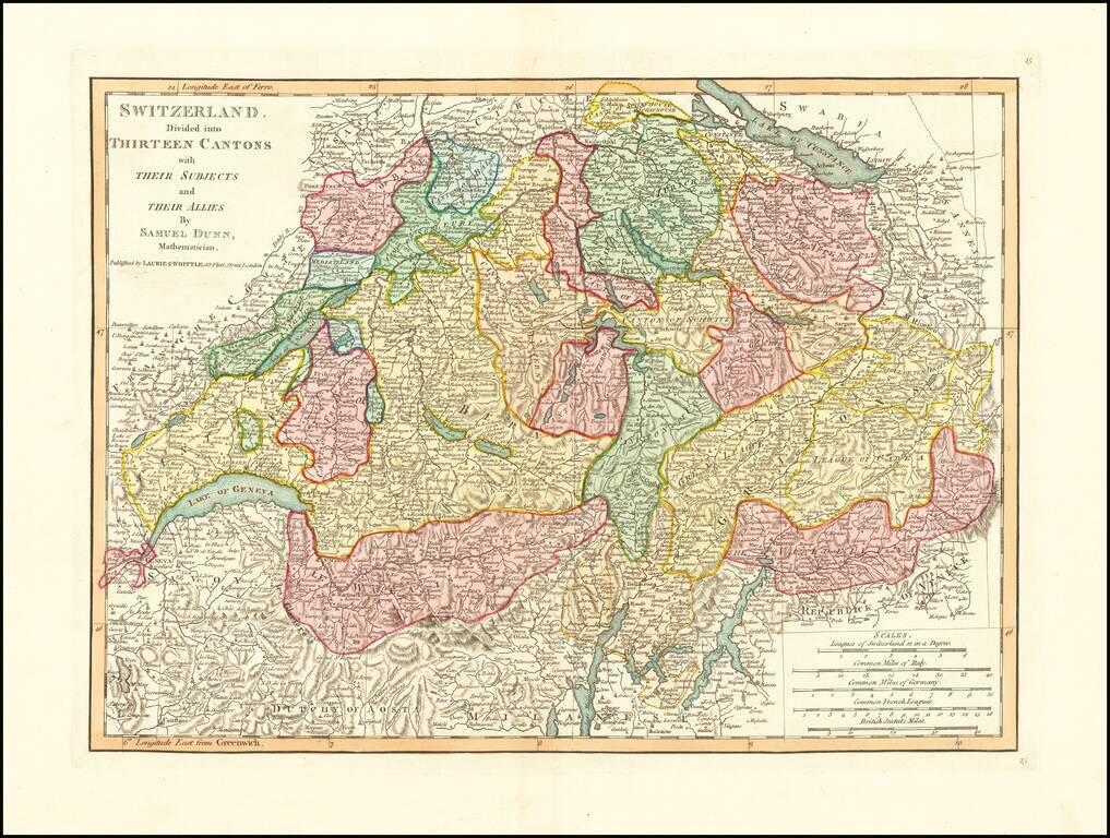
Detailed double-page engraved map of Switzerland, divided into Cantons, etc.
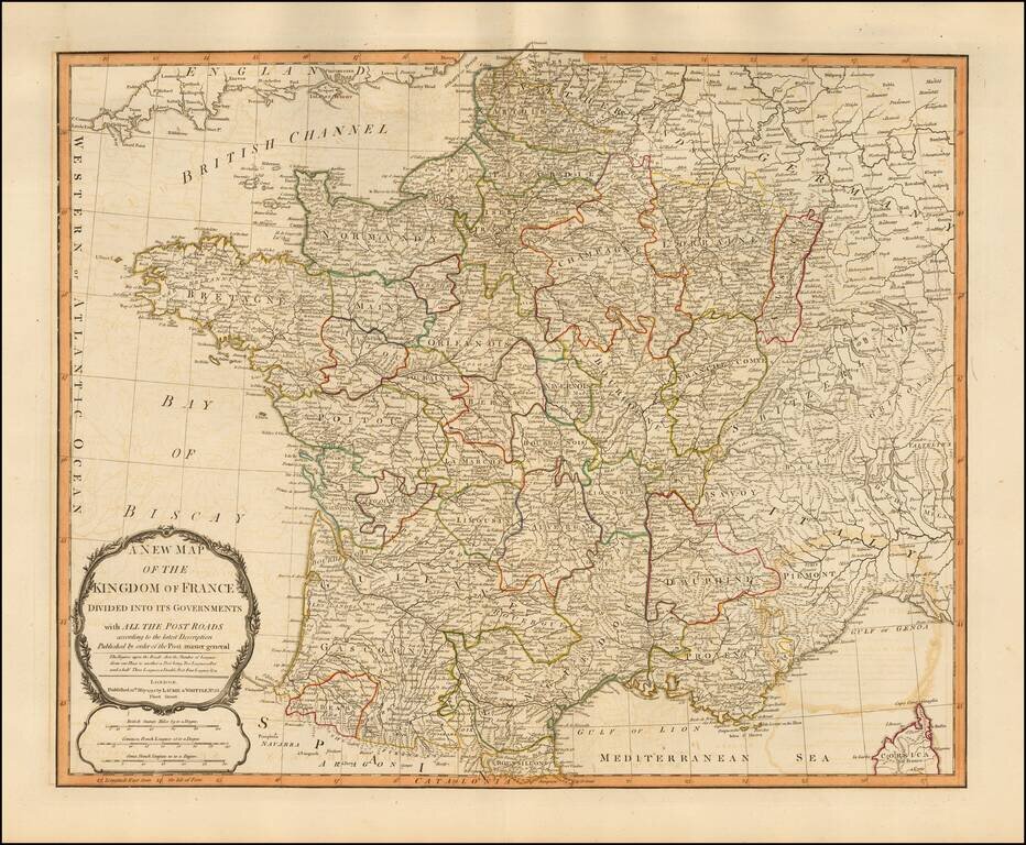
Handsome double-page engraved map of Napoleonic France, by one of the best English mapmaking firms of the period. Laurie & Whittle Robert Laurie (ca. 1755-1836) and James Whittle (1757-1818) formed their Fleet Street, London-based firm upon the...
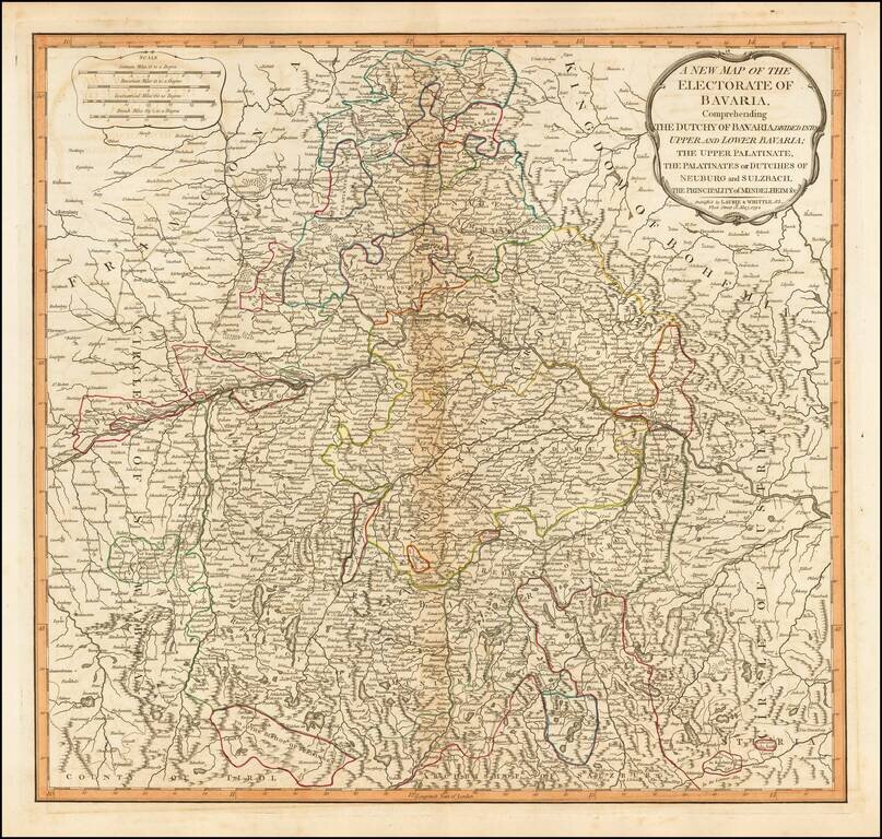
Detailed map of Bavaria, in present-day Germany, by the esteemed English mapmaking firm of Laurie & Whittle. The map highlights the political divisions and subdivisions of Bavaria in attractive original hand-color. Laurie & Whittle Robert...
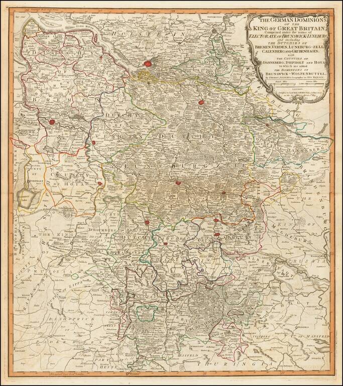
Fine engraved map of the territory in the west of Germany that constituted some of the inherited lands of George III. The chief cities on the map are Hamburg, Bremen, and Hanover, although many others are also shown. Laurie & Whittle Robert...
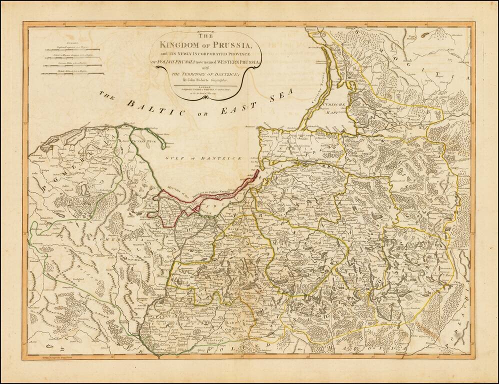
Strking full color example of this fine map of Prussia and Polish Prussia, following the Polish Dismemberment. Includes a significant section of modern Lithuania.
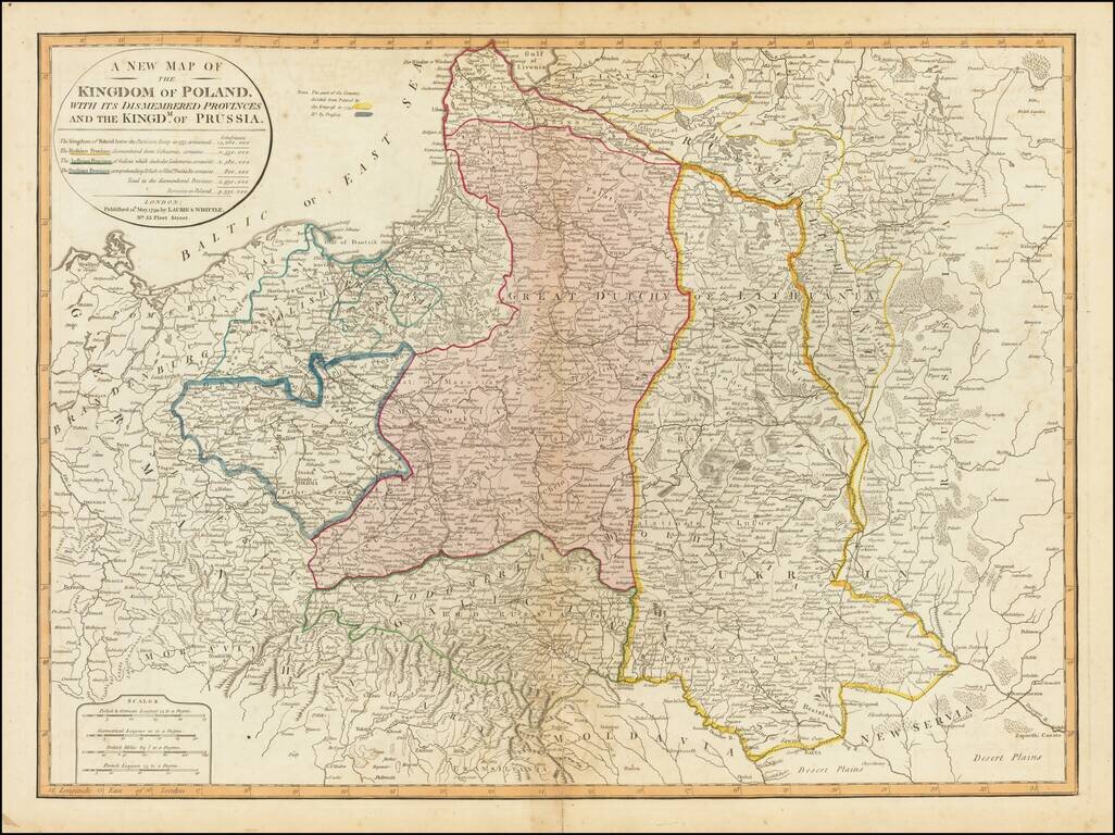
Striking full color example of this fine map of Poland, showing the provinces stripped from the control of Poland at the end of the 18th Century. The table notes the population of Poland before dismemberment (14,260,000), the populations of the...
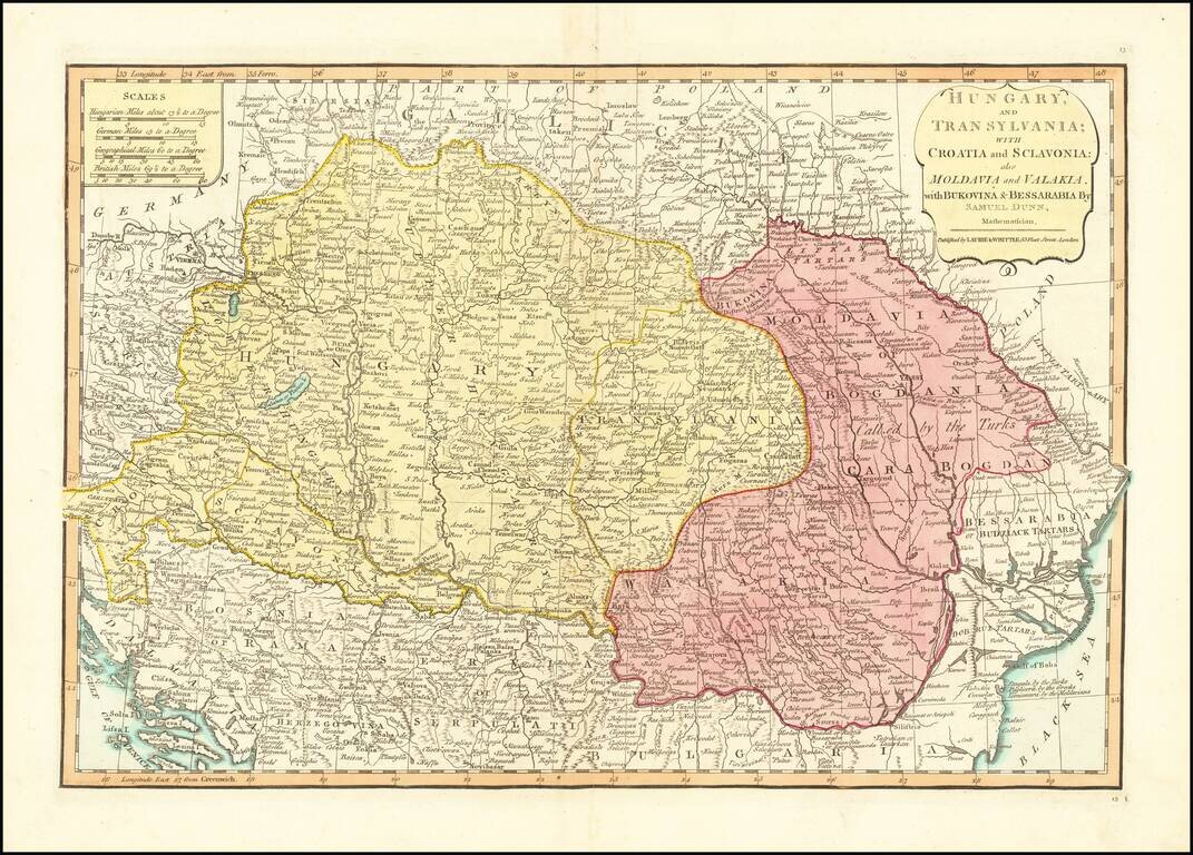
Detailed engraved map of the Balkans and Hungary, by one of the most important mapmaking firms of the end of the 18th century: Laurie & Whittle. The map shows Croatia, Serbia, Bosnia, Slovenia and the region extending east to Romania and the Black...
![A New Map of Turkey in Europe Divided into All Its Provinces; With the Adjacent Countries of Europe and Asia . . . 1794 [shows Cyprus]](/map/small/49114.jpg)
Striking map of the eastern Mediterranean, Greece, Turkey & Cyprus, bounded by Cyprus and the Mediterranean, the Black Sea, the Adriatic and Crete, centered on Greece and Turkey. Laurie & Whittle credit as sources maps published by the...
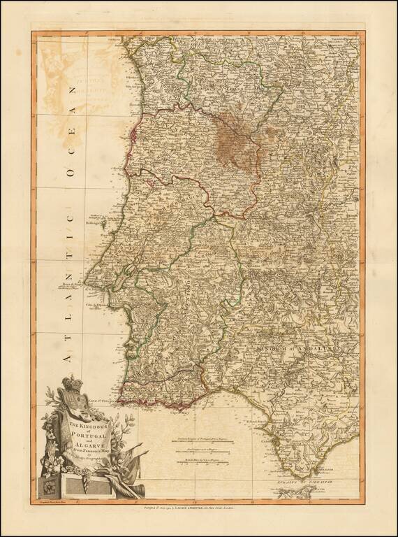
Beautiful double-page engraved map of Portugal, encompassing the Straits of Gibraltar, by John Lodge. The map features an elaborate cartouche in the lower left corner with the coats of arms of Portugal and Algarve. Algarve was a nominal kingdom in the...
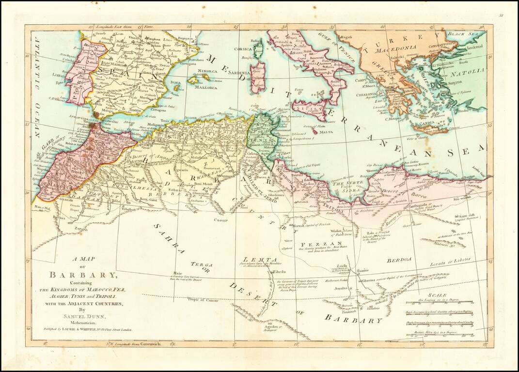
Detailed map of North Africa and the Mediterranean Sea. Nice detail and a number of annotations. The map was first printed for Robert Sayer at 53 Fleet Street, London.
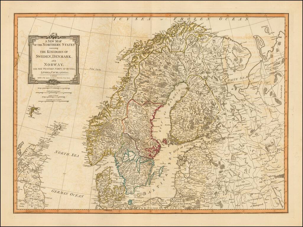
Detailed map of Scandinavia and the Baltic Region, published in London, by Laurie & Whittle. Laurie & Whittle Robert Laurie (ca. 1755-1836) and James Whittle (1757-1818) formed their Fleet Street, London-based firm upon the 1794 death of...