Map size in jpg-format: 41.3202MiB
Click to open in high resolution (open in new tab).
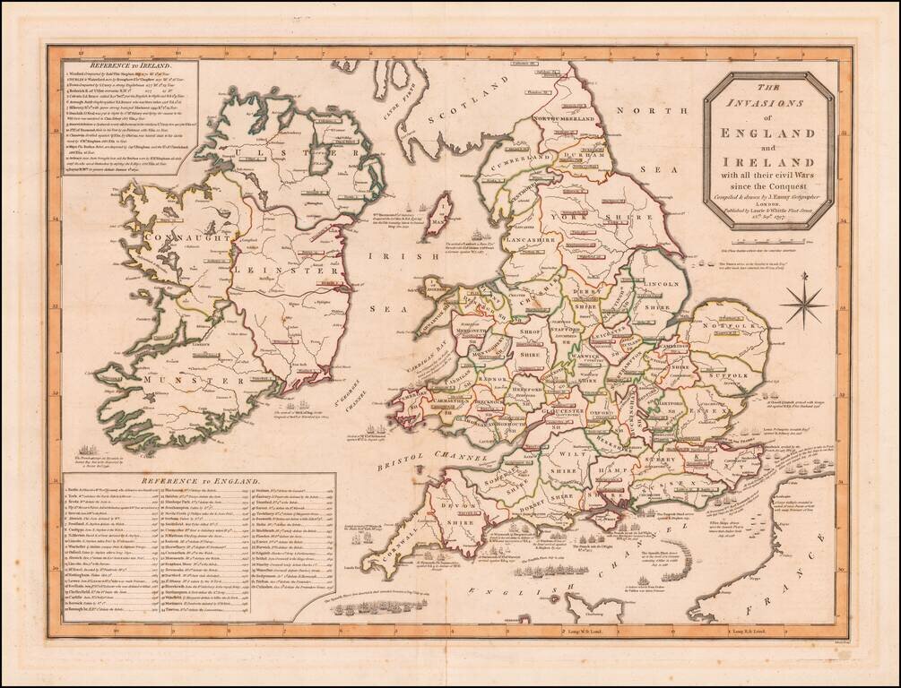
Detailed map depicting the invasions of England and Ireland.
Shows the positions of the British, French and Spanish Fleets, with details and two extensive keys, giving the military history of England and of Ireland.
If you are a student, write to us in telegram: @antiquemaps and indicate what material you need and for what work you need a map in high detail. We are ready to provide material on special terms. For students only!


