Peter Schenk the Elder (1660-1711) moved to Amsterdam in 1675 and began to learn the art of mezzotint. In 1694 he bought some of the copperplate stock of the mapmaker Johannes Janssonius, which allowed him to specialize in the engraving and printing of maps and prints. He split his time between his Amsterdam shop and Leipzig and also sold a considerable volume of materials to London.
Peter Schenk the Elder had three sons. Peter the Younger carried on his father’s business in Leipzig while the other two, Leonard and Jan, worked in Amsterdam. Leonard engraved several maps and also carried on his father’s relationship with engraving plates for the Amsterdam edition of the Histoire de l'Académie Royale des Sciences.

Beautifully hand-colored example of Visscher's famous map of the Western Hemisphere, showing California as an Island and a small slice of New Zealand at the lower-left corner, next to the title cartouche. Visscher's map became the proto-type map for...
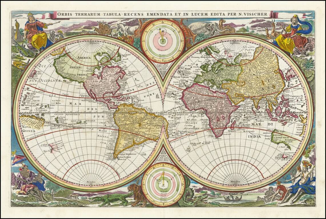
Scarce first state of Visscher's double hemisphere map of the world, which includes many of the great 17th Century cartographic myths and errors. A massive land extension north of California reaches nearly to Asia and shows the Straits of Anian and NW...
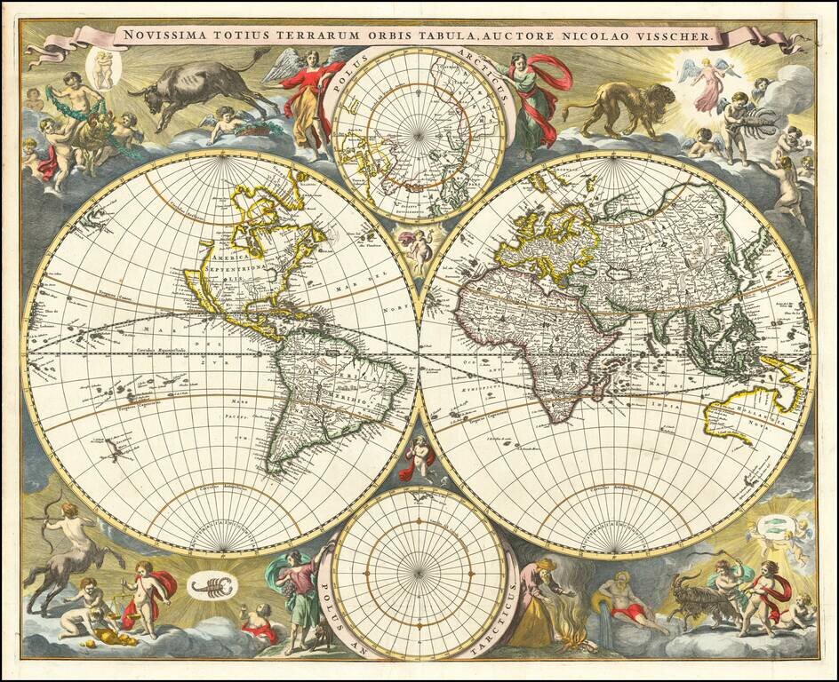
Gorgeous example of Nicholas Visscher's World map, which appeared in his Atlas Minor after 1679. The map is similar to Visscher's World map of 1659 (Shirley 406), only with the Straits of Anian being reduced to cover only 10 degrees. The surrounding...
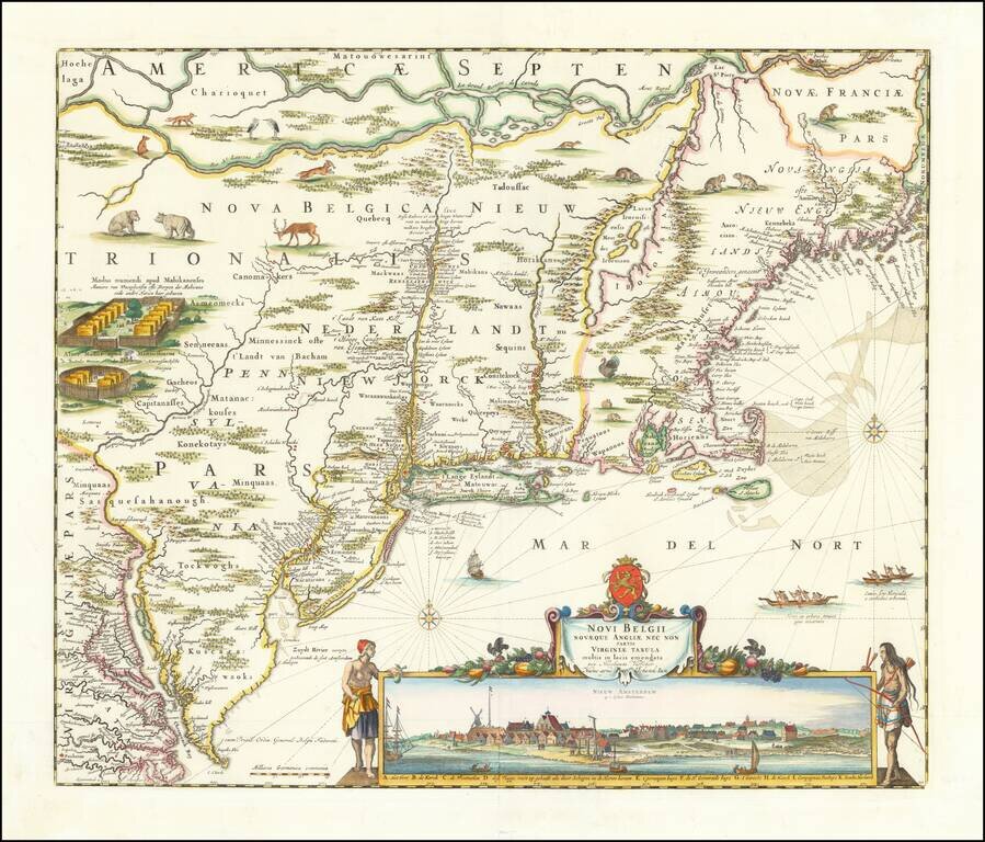
Visscher's Landmark Map of the Northeast -- Early View of New York City Finely colored example of Nicolaes Visscher's important map of the Northeast, with a large inset view of New York City. This is the first map containing the famous inset view of...
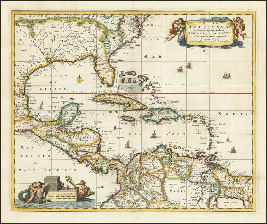
Nice example of Nicholas Visscher's map of the Caribbean, Florida, Southern US, Central America and part of South America. A number of cartographic myths appear on the map, including the large lake which appears in Georgia, a non-existent mountain...
![[Unique Extra-Illustrated Example!] Carte Nouvelle Contenant La Partie d'Amerique La Plus Septentrionale, . . . Le Canada ou Nouvelle France, La Nouvelle Ecosse, La Nouvelle Angleterre, Les Nouveau Pais Bas, La Pensylvanie . . . Et Jle. de Terre Neuve . .](/map/small/47720.jpg)
Heavily embellished example of the eastern part of Visscher's 2-sheet map of the Northeastern part of North America, first published in 1696. Cartographically, the map extends from Nova Scotia and Acadia to Newfoundland, the St. Lawrence Gulf and St....
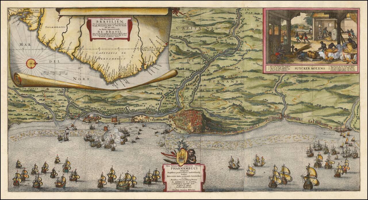
Rare Broadside Map Celebrating The Dutch Capture of The Town of Olinda in Pernambuco by the Dutch West Indies Company in February 1630 Rare separately published map of coast around Olinada in Portuguese held Pernambuco, published shortly after the...
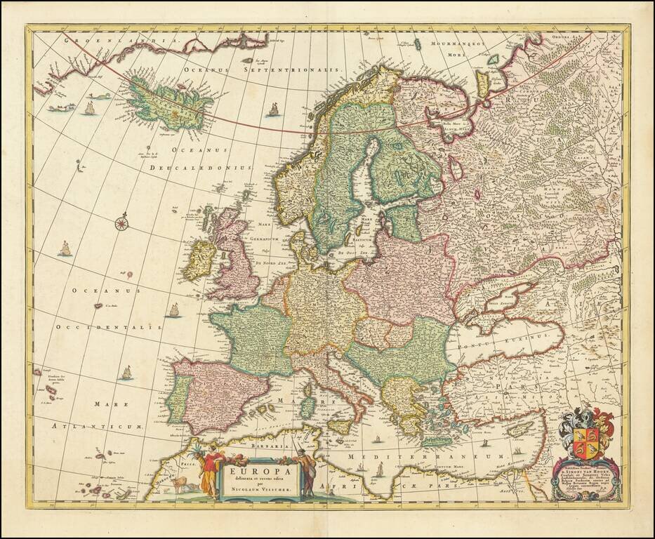
Fine old color example of Nicolas Visscher's map of Europe. Among the many great Dutch map publishers active in the 17th Century were the Visscher family, begun by Claes Jansz Visscher (1587-1652) and continued by his son Nicolaas (1618-1679),...
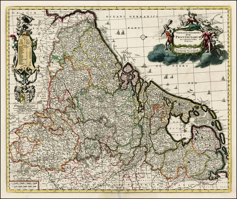
Scarce Visscher map of the low countries, with decorative cartouche and decorative key, including coat of arms. The map is dedicated to Theodoro Munter.
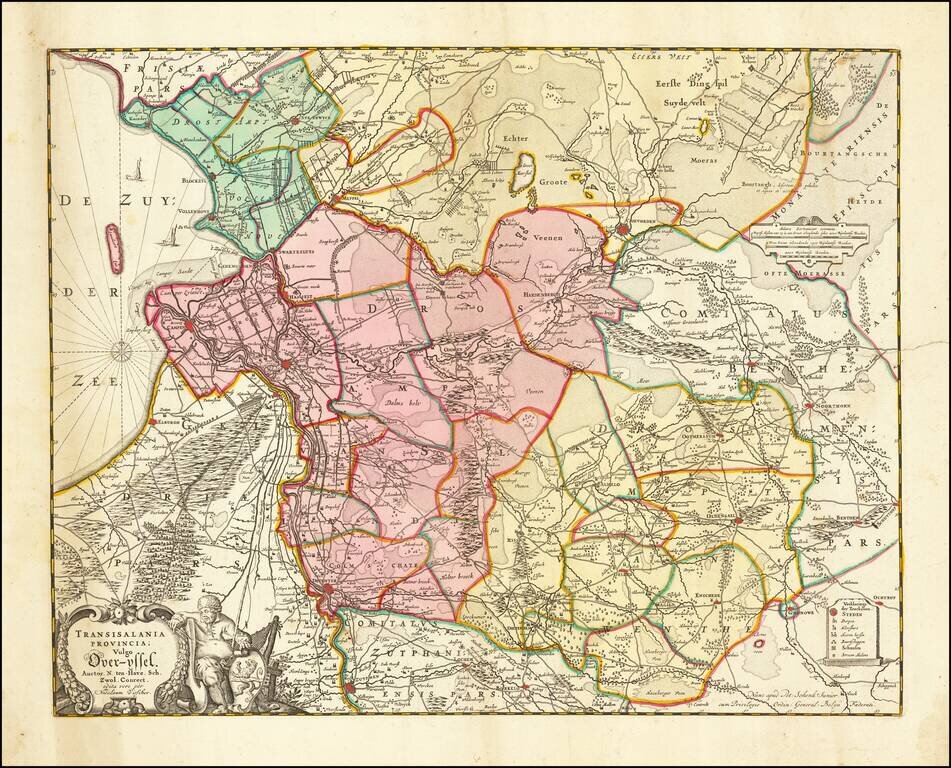
Nice map of Overijssel, published in Amsterdam by Visscher. Major cities include Deventer, Kamen, Zwolle, Almelo, Hengelo and Enschede.
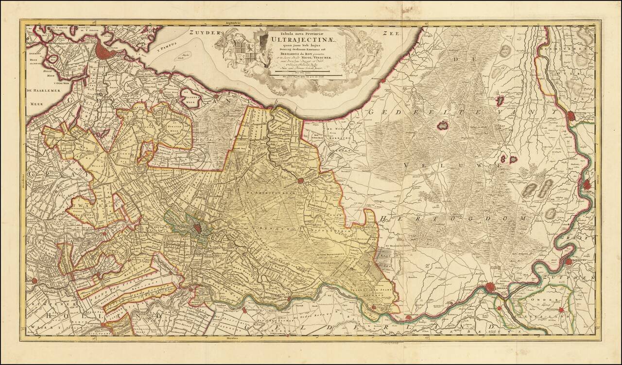
Highly detailed map shows the land development in Gelderland, Holland, near the Zuyder Zee. The map shows Amsterdam, Gouda, Schoonhoven, Buren, Wageningen, Arnhem, Sevener, Doesburg, Zutphen and the Yssel River, centered on Amersfoort, and also...
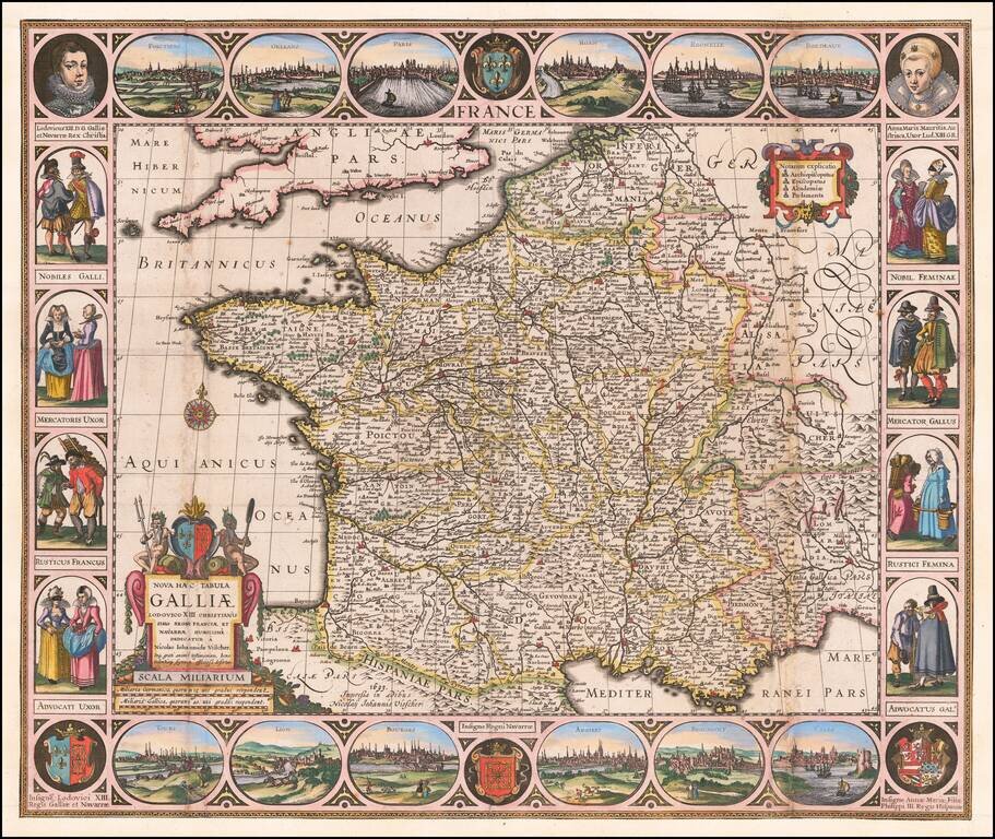
Carte-a-Figures Antique Map of France Highly decorative map of France, surrounded by vignettes of traditional French dress from the early 17th Century, with city views at the top and bottom. Decorative and detailed map of France by one of the best...
First State of Visscher's Map of the Rhine Valley Finely colored example of Nicholaus Visscher's decorative map of the German Rhine River Valley. The map follows the course of the Rhine River from the area near Baden-Baden in the south to just south...
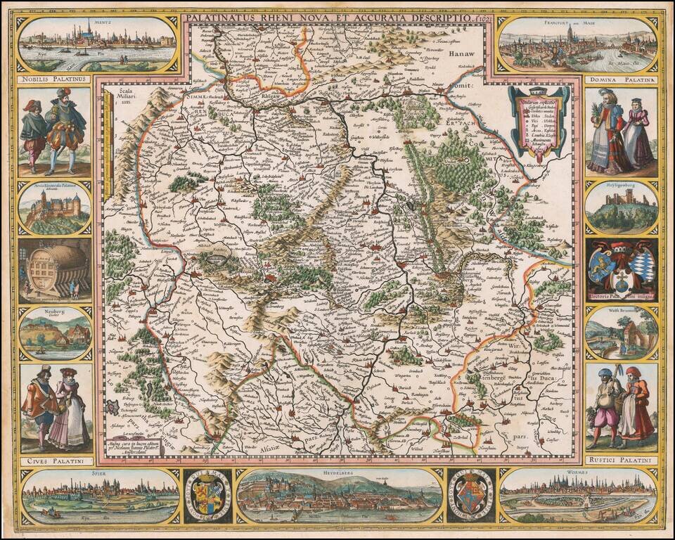
Old Color, gold highlighted example of this decorative map of a part of the Rhine region of Germany, including Frankfurt, Heidelberg, Manheim, Worms, Erpach and Maintz. Striking title cartouche. From a rare composite atlas by Abraham Wolfgang, with no...
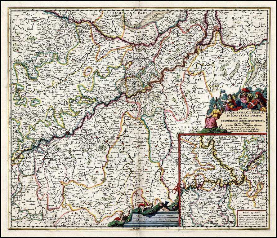
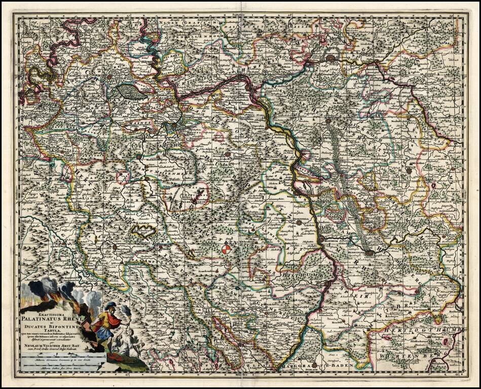
Old Color, gold highlighted example of this decorative map of western Germany, including Dortmund, Cologne, and the course of the Rhine as it winds into the eastern part of the Netherlands. West is at the top of the map. The title cartouche is...
![Regnum Siciliae Cum circumjacentibus Regnis et Insulis… [shows Malta] (Heighten with Gold Leaf)](/map/small/50376.jpg)
Fine old color, gold leaf example of Visscher's map of Sicily, Malta and a bit of Naples and Sardinia. Large decorative cartouche with 2 coats of arms and a large decorative military scale.