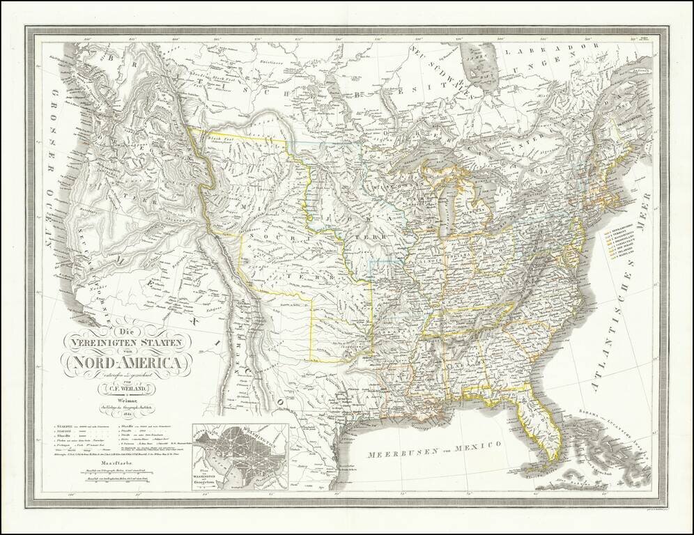
Republic of Texas Fine dark impression of this early coast to coast map of the United States, issued just after the declaration of Independence for the Republic of Texas in 1836. Marvelous large format map of the United States and the Republic of...
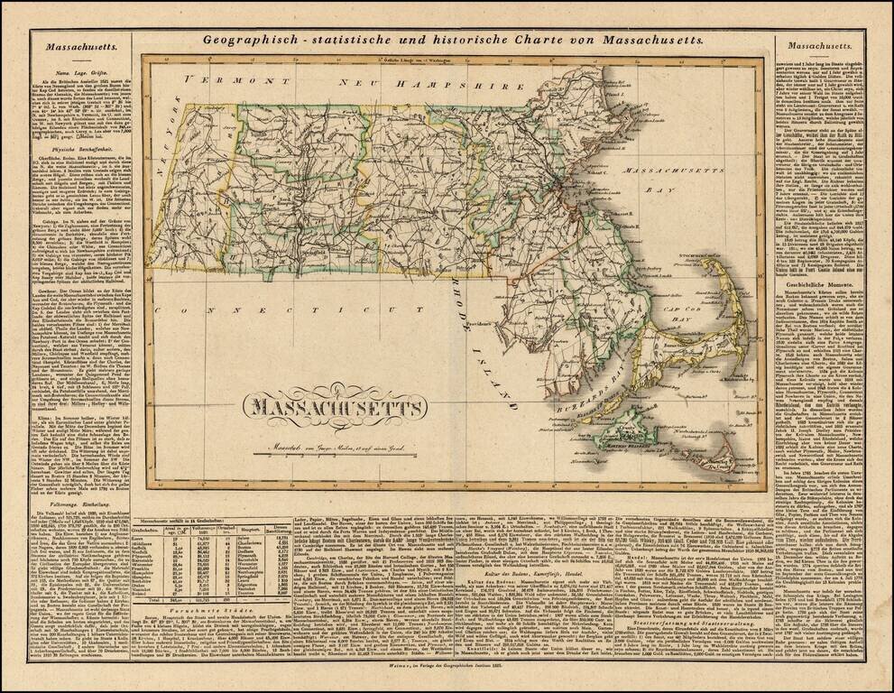
Rare German edition of Carey & Lea's map of Massachusetts. Shows early counties, roads, towns and a host of other details. Carey & Lea published their monumental Geographical, Statistical and Historical Atlas of North America in 1822. The...
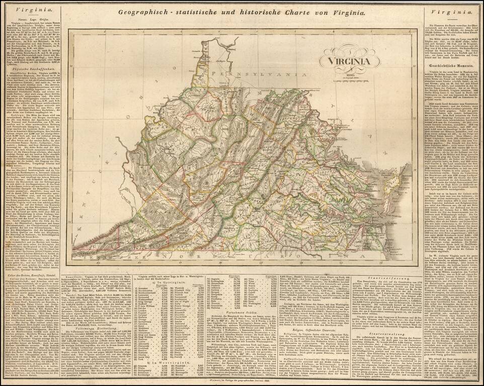
Rare German map of Virginia, mimicking the style popularized by Carey & Lea. The map shows early towns, roads, rivers, lakes, and other geographical features. The early road detail is noteworthy. Many court houses and post offices also shown....
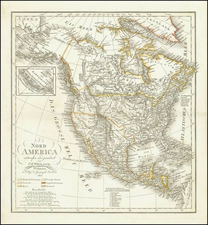
Ruins of an ancient city of the Aztecs Scarce map of North America, published shortly before Texas declared its independence from Mexico. In New Mexico, a note reads "Ruinen einer alten Stadt der Azteken" (Ruins of an ancient city of the Aztecs)...
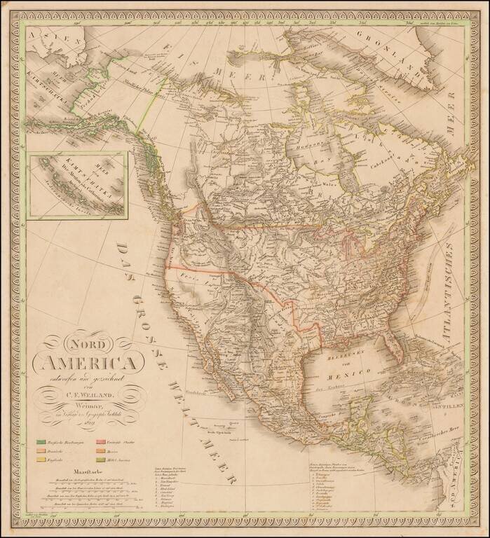
Scarce map of North America, published shortly before Texas declared its independence from Mexico. This map also includes significant revisions in British Columbia attributable to the explorations and discoveries made by the Northwest Company and...
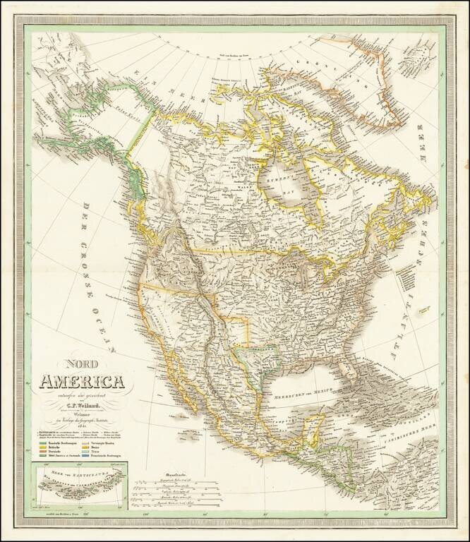
With Texas as a Republic. Scarce map of North America, published shortly after Texas declared its independence from Mexico. This map also includes significant revisions in British Columbia attributable to the explorations and discoveries made by the...
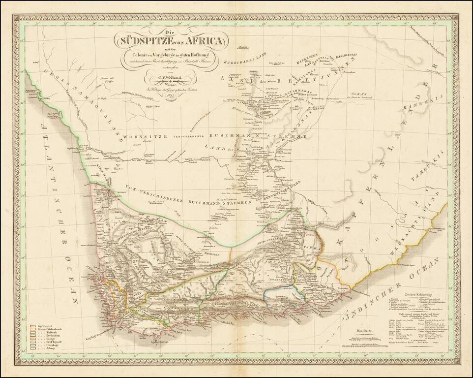
With Details of William Burchell's Travels in the Interior of South America Fine early map of Southern Africa and the Cape of Good Hope, published by CF Weiland in Weimar. The map provides a detailed look ath the southern part of the continent, with...
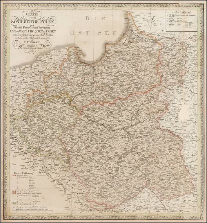
Scarce map of Poland and East and West Prussia, published by Weiland. The map includes the Free State of Cracow.
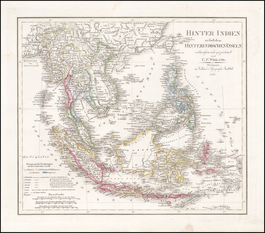
Scarce and highly detailed map of Southeast Asia, including southern China, the Philippines, the Malaysian Peninsula and extending south to Java, Timor and the northern tip of Australia. Includes rivers, some early roads, towns, topographical details,...