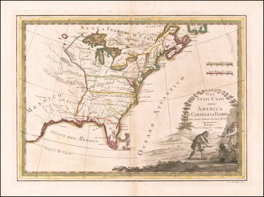
Scarce map of the United States, published in Rome by Giovanni Maria Cassini. Virginia and the Carolinas extend to the Mississippi River. Florida is shown as an archipelago.
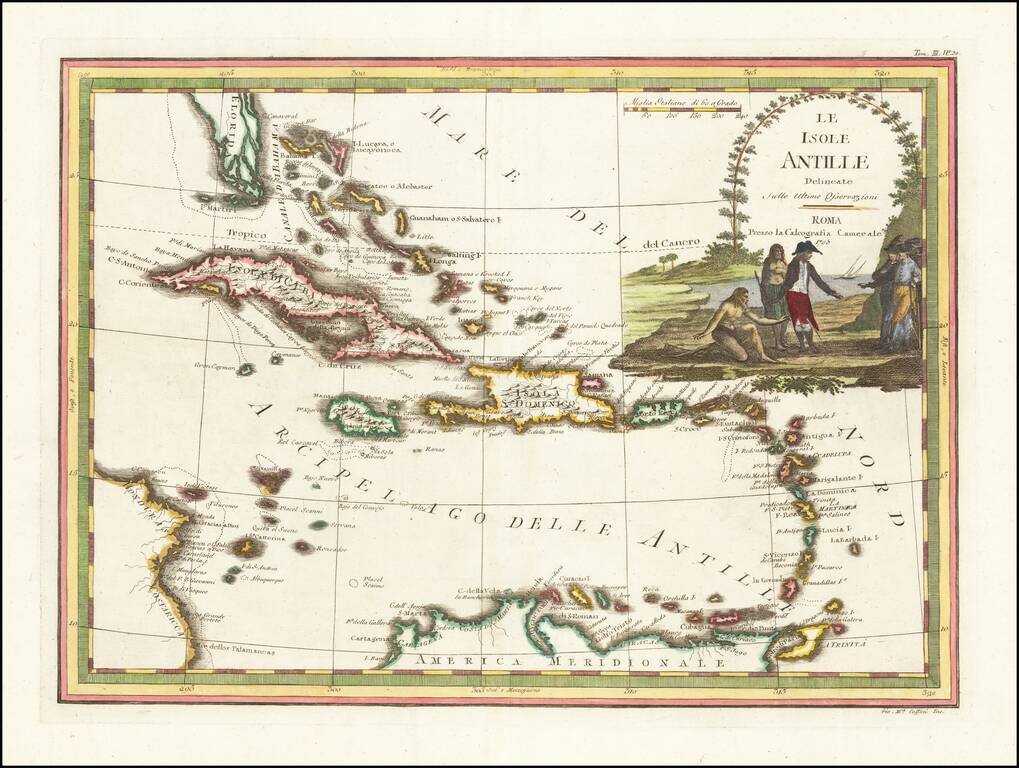
Antique Map of the Caribbean and South Florida A striking color example of Cassini's scarce map of the Caribbean and south tip of Florida. The map is outlined in attractive reds, greens and yellows, while the cartouche is fully colored and appears to...
![[California & The Southwest] La Parte Occidentale Dell'Antico, E Nuovo Messico Con Florida E La Bassa Luigiana…. 1798](/map/small/18560.jpg)
Striking full color example of Cassini's map of California, Arizona, New Mexico, part of Texas, Baja California and Mexico. This is perhaps the only 18th Century map of the region to feature a decorative cartouche and vignette. The Rio Grande extends...
![La Parte Orientale della Russia Asiatica Delineata…1796 [Includes Alaska]](/map/small/23720.jpg)
Decorative map of Siberia and Alaska from this scarce and highly decorative 18th Century atlas.
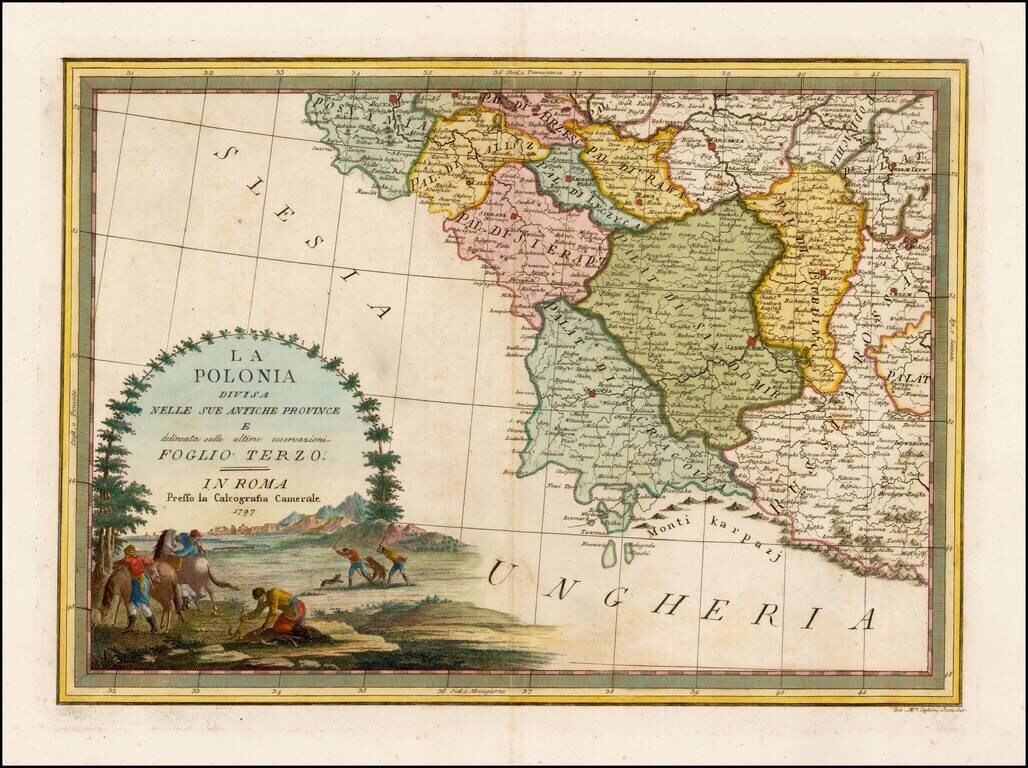
Rare and highly decorative regional map of Poland, showing the area which includes Warsawia, Posnan, Sieradz, Brzesc, Lublin, Chelm, Cracovia, etc. Ornate cartouche. Flawless example.
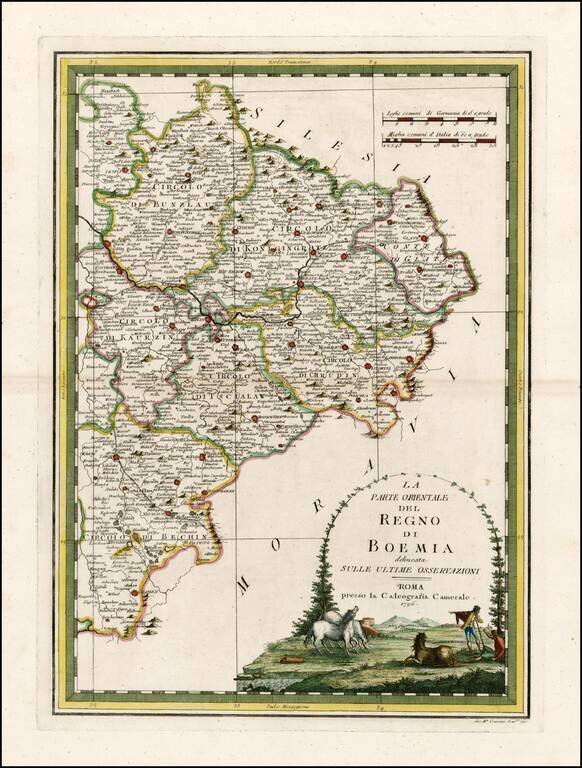
Rare and highly decorative regional map of the Eastern part of Bohemia. The map shows Prague in the west and extends to the Moravian and Silesian borders. Includes an ornate cartouche.
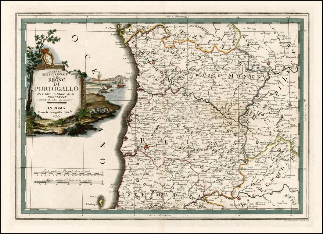
Rare and highly decorative regional map of the north part of Portugal, colored by regions. Includes an ornate cartouche.
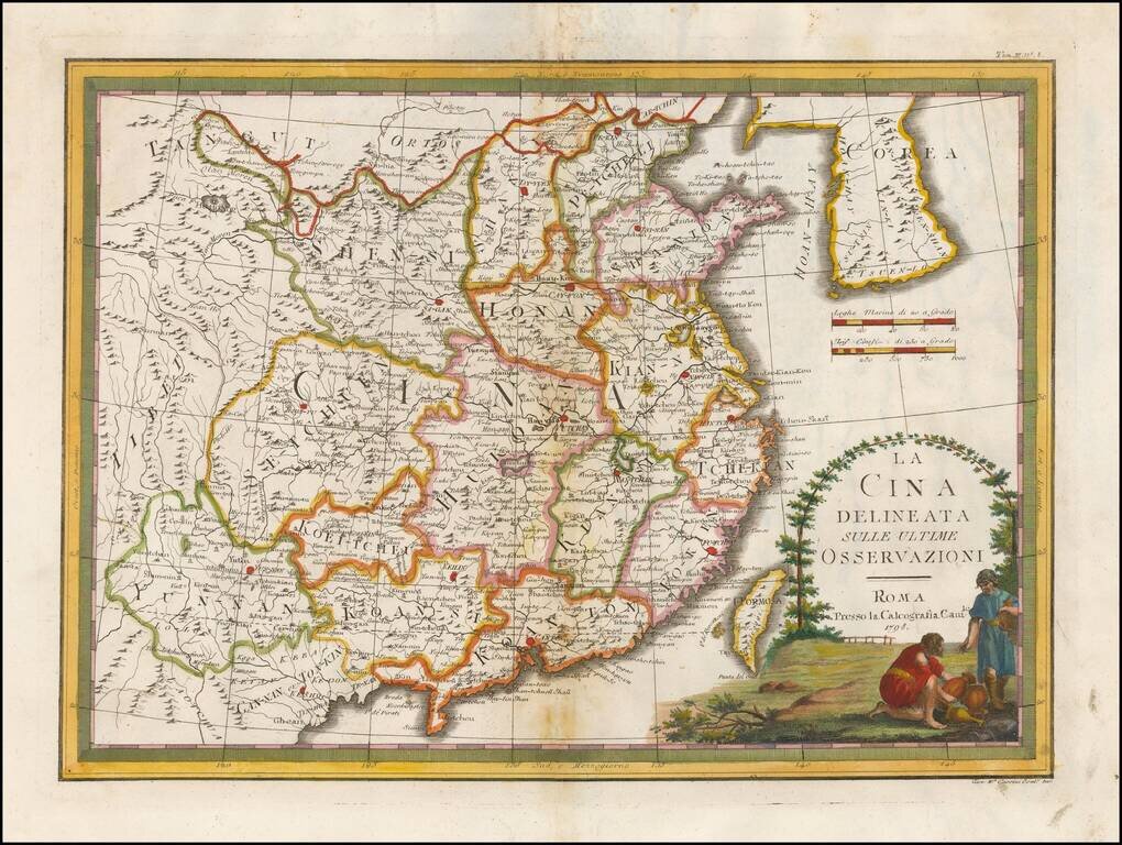
Nice example of Giovanni Maria Cassini's decorative map of China and Korea. The map includes a fine decorative vignette, being one of the last great decorative maps of the region.
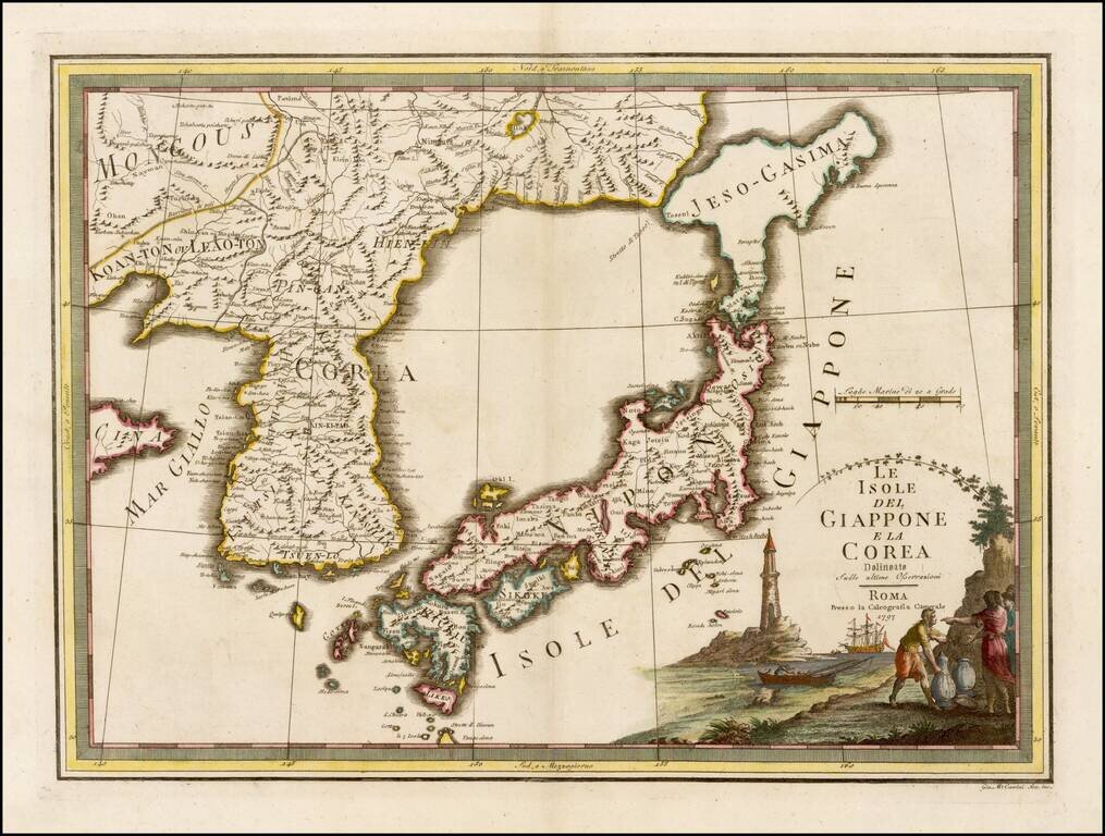
Fascinating early map of Korea and Japan, from Nuovo Atlante Geografico Universale. published by Cassini, in Rome. It has a very unusual, almost triangular, representation of 'Jeso-Gasima', the semi-mythical island to the north of Japan. The title is...
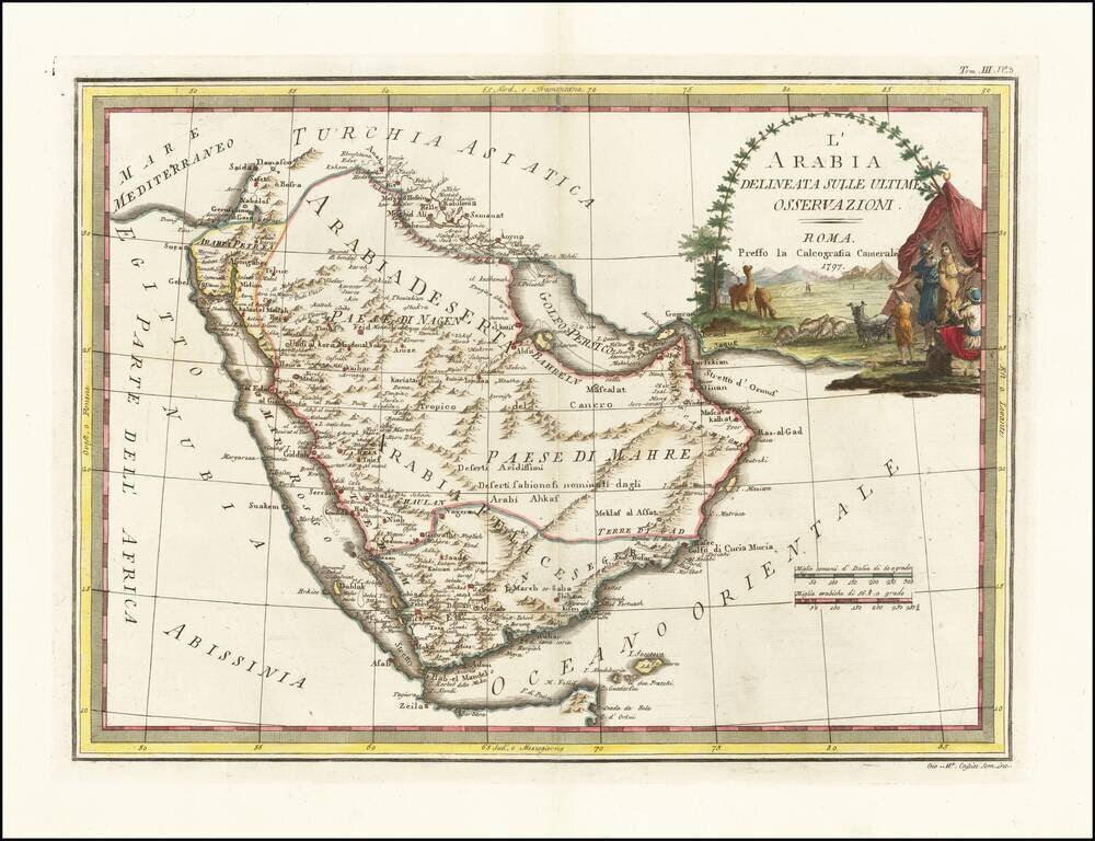
Decorative 18th Century map of the Arabian Peninsula, published in Rome by Cassini. The map extends from the Red Sea to the Persian Gulf, Straits of Hormuz and Indian Ocean, centered on Arabia, which is divided into several regions, including Paese di...
![[Arabia / Ottoman Empire] Gli Imperi Antichi Parte Occidentale (and) Gli Imperi Antichi Parte Occidentale](/map/small/70452.jpg)
Scarce pair of maps comprising a remarkable decorative map of Arabia, published in Rome by Cassini. The map covers the Turkish Empire centered on Arabia, from the 'Nuovo Atlante Geografico Universale', with a decorative title cartouche on each sheet....
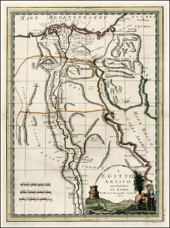
Fascinating early map of Ancient Egypt and the course of the Nile River, from Nuovo Atlante Geografico Universale. published by Cassini in Rome.
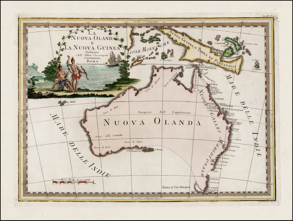
Striking early map of Australia, with large decorative title cartouche. Cassini's map of Australia is by far the most decorative map of Australia to appear in a commercially published atlas. Following Cook's landmark discovery of Australia's east...
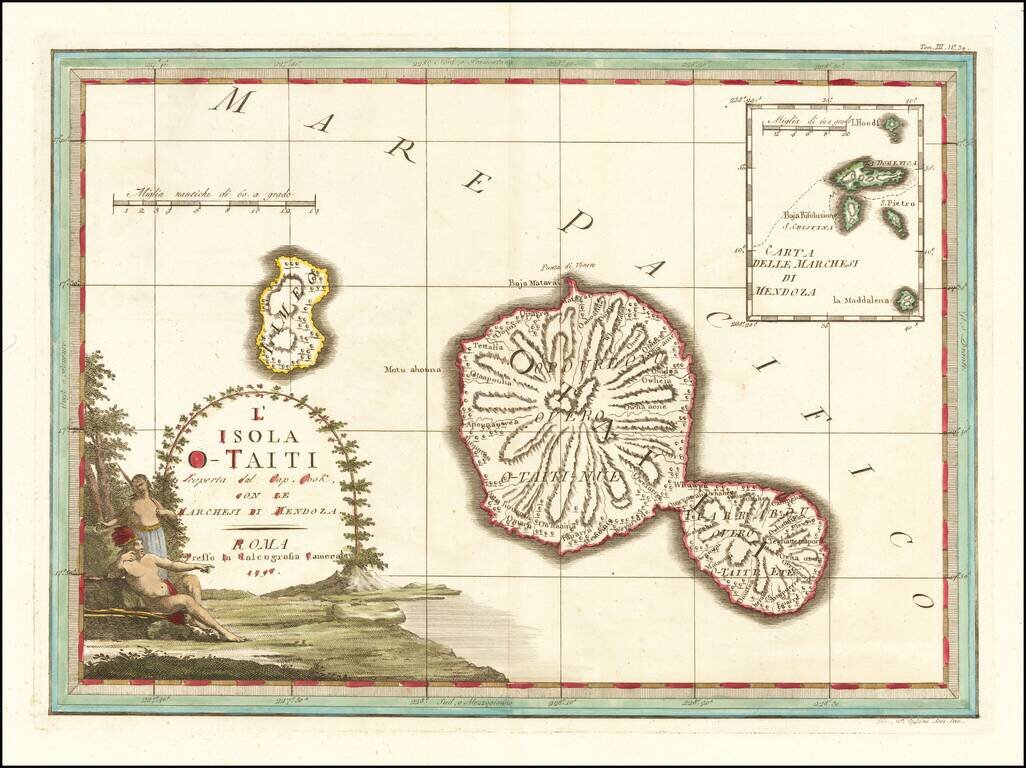
Decorative map of the island of Tahiti, published in Rome by Cassini, with a large inset map of the Marquesas Islands. Cassini's map celebrates the visit to Tahiti by Captain James Cook, during Cook's scientific mission to observe the transit of the...
![[Tonga Islands] Le Isole De Gli Amici Delineate Suller ulitime Osservazioni de Cap. Cook . . . 1798](/map/small/64141.jpg)
Decorative map of the island of the Friendly Islands (Tonga), published in Rome by Cassini, with a large inset map of the Marquesas Islands. Cassini's map illustrates Captain James Cook's visits to the islands in 1773, 1774, and 1777, with each visit...