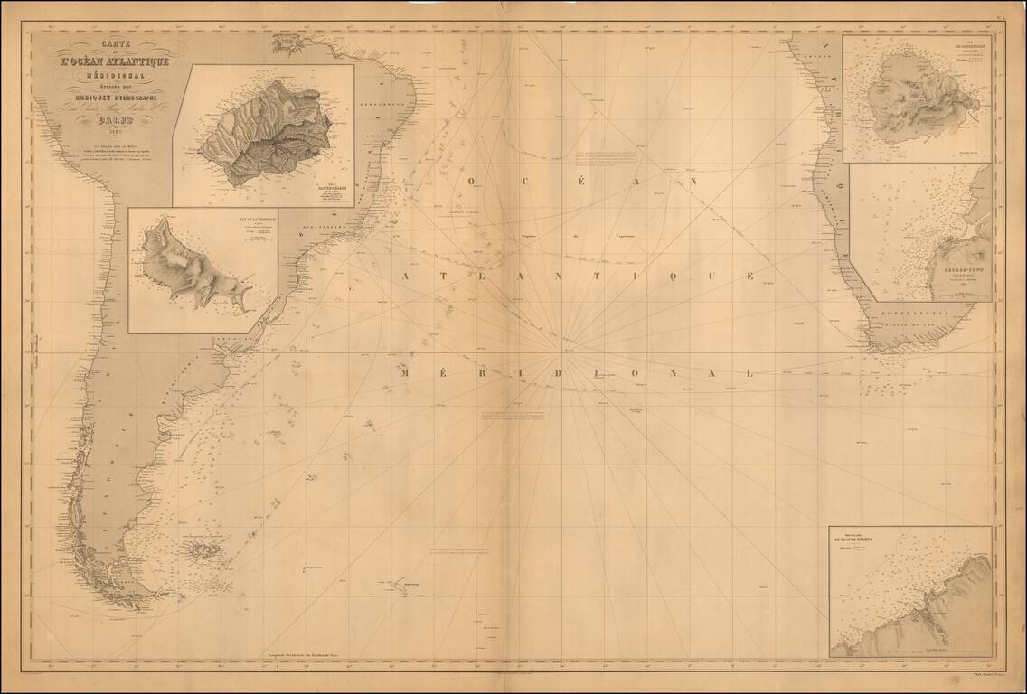
Scarce French sea chart of the South Atlantic, published by Aime Robiquet. The chart covers most of South America, the southern part of Africa and insets of Sainte Helene, the Island of Trinidad, the Island of Ascencion and the area around Georgetown,...
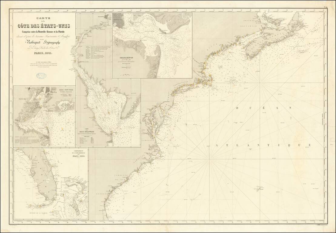
Rare separately published French chart of the region from Nova Scotia to Florida, with large inset maps of Florida, New York Harbor, Charleston and the Delaware Bay. The map was apparently used either for contemporary navigation or a survey off the...
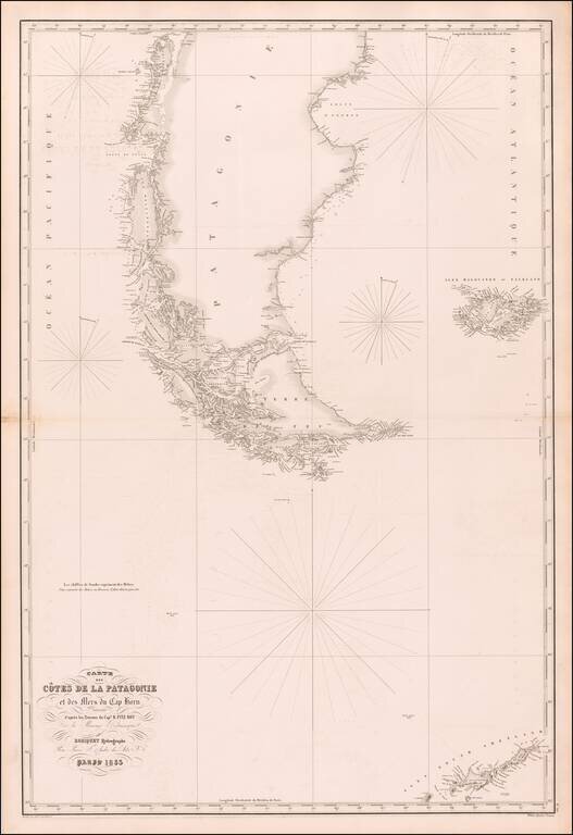
Rare separately published sea chart of the southern tip of South America, the Falkland Islands and the South Shetland Islands, published in Paris by Aime Robiquet. The chart lists Captain R. Fitz Roy of the British Admiralty as the source for the map...
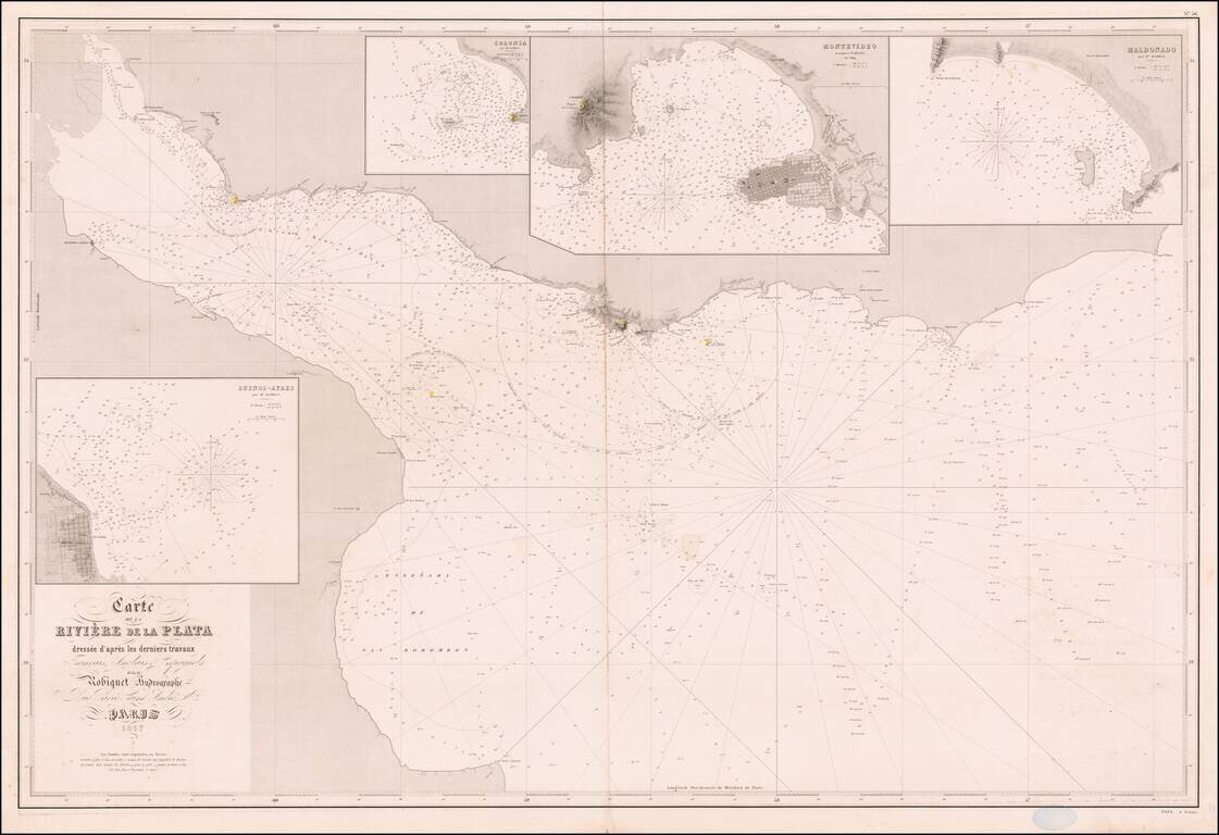
Rare French sea chart of the mouth of the Rio De La Plata, published in Paris by Aime Robiquet. The map includes large insets of: Buenos Aires Colonia Montevideo Maldonado Rare example of this working navigational chart.
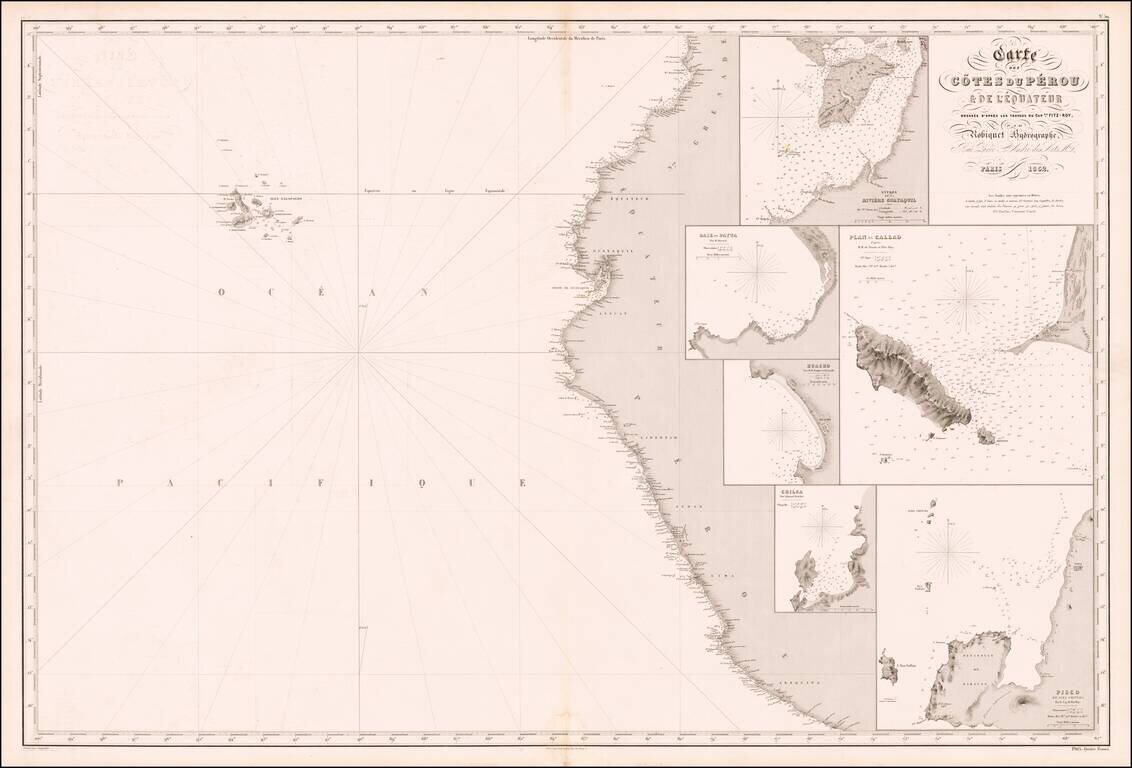
Rare French sea chart of the mouth of the coast of Peru, published in Paris by Aime Robiquet. The Galapagos Islands appear in the west. The map includes large insets of: Entrance to Guayquil River Payta Bay Callao Huacho Chica Pisco Rare...
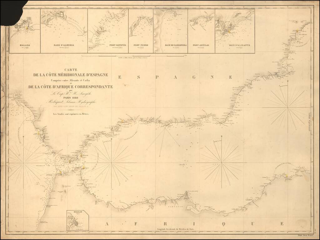
Rare separately published sea chart of the Strait of Gibraltar coast of Southern Spain and the corresponding coast of North Africa, published by Robique. Small inset maps of: Malaga Rade D'Almeria Port Genoves Port Pedro Baie de Carbonera Port...
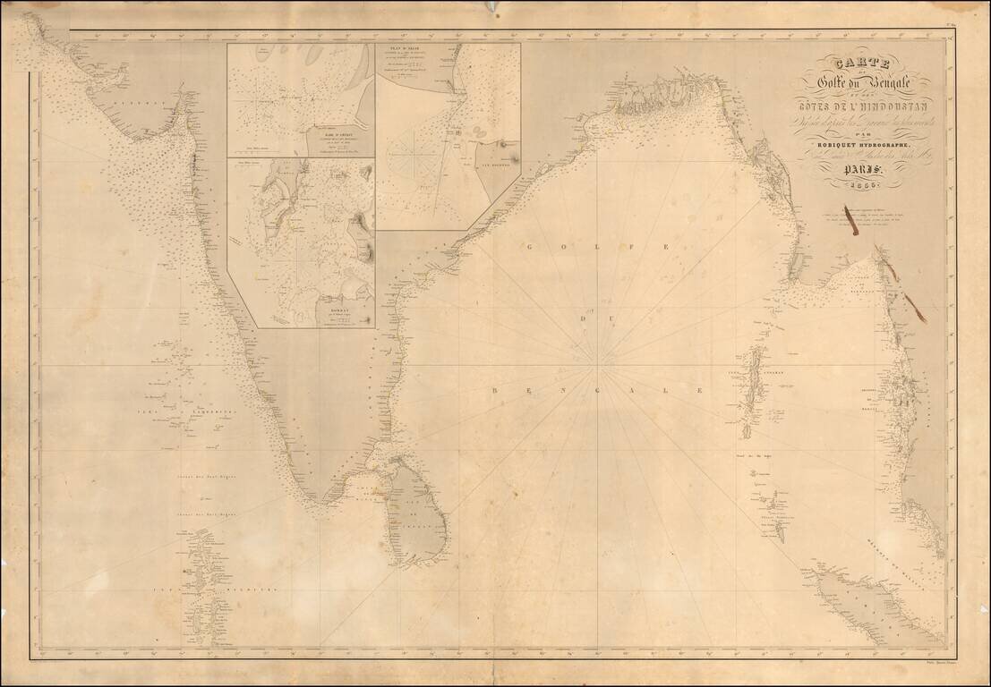
Scarce French sea chart of India and the west coast of Malaysia, etc., published in Paris by Robiquet. Includes large inset maps of: Bombay Amerst Akiab (Sittwe, Myanmar) Includes pencil annotations showing a voyage of the coast of Coromandel...
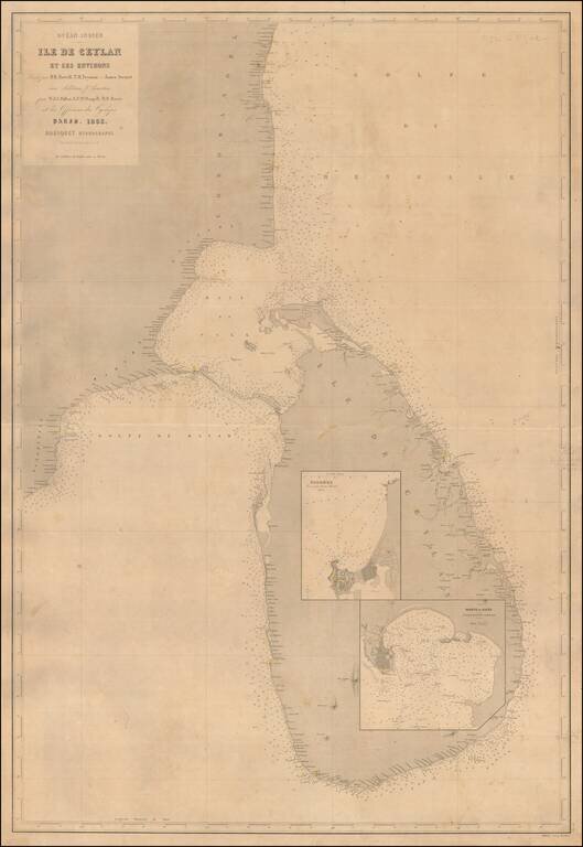
A Rare Large Chart of Sri Lanka Scarce large format sea chart of Sri Lanka and the adjacent coast of India with inset maps of the harbors at Colombo and Galle. Detail is confined to the coastlines, and includes soundings, navigational hazards and...