logo

1857. Carte de la Riviere de la Plata dressee d'apres derniers travaux Francais, Anglois & Espagnoes . . . 1857

  • Carte de la Riviere de la Plata dressee d'apres derniers travaux Francais, Anglois & Espagnoes . . . 1857

Carte de la Riviere de la Plata dressee d'apres derniers travaux Francais, Anglois & Espagnoes . . . 1857 information:

Year of creation: 
Resolution size (pixels): 
 24734x16949 px
Disk Size: 
 89.8736MiB
Number of pages: 
 1
Place: 
 Paris
Author: 

Print information. Print size (Width x height in inches):
Printing at 72 dpi 
  343.53 х 235.4
Printing at 150 dpi 
 164.89 х 112.99
Printing at 300 dpi 
 82.45 х 56.5

An example of detailing the file of this map of in a printable high-resolution:

Click to open in high resolution (open in new tab).
Attention! this is just the central piece (central area 960x960 px) of the map file!
This is an example, so that you can see and study the level of detail of a given map. The entire Map will be fully available after payment!

Carte de la Riviere de la Plata dressee d'apres derniers travaux Francais, Anglois & Espagnoes . . . 1857

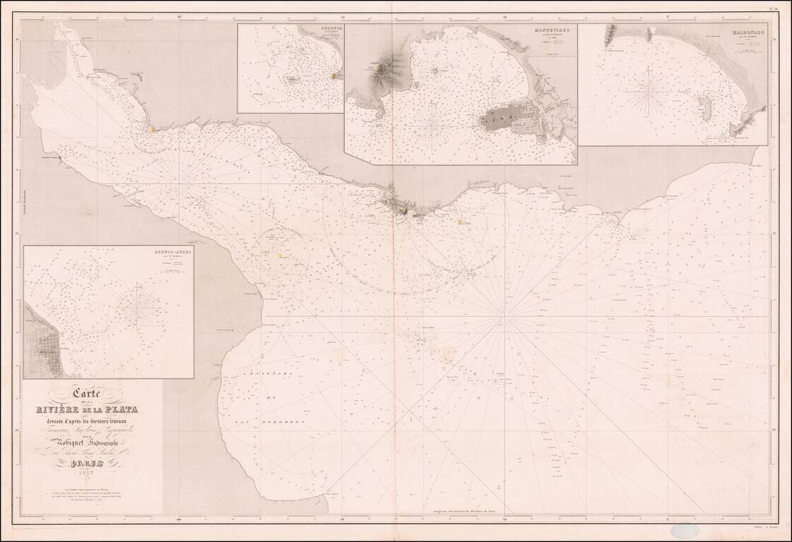
Rare French sea chart of the mouth of the Rio De La Plata, published in Paris by Aime Robiquet.

The map includes large insets of:

  • Buenos Aires
  • Colonia
  • Montevideo
  • Maldonado

Rare example of this working navigational chart.


Special conditions for students!

If you are a student, write to us in telegram: @antiquemaps and indicate what material you need and for what work you need a map in high detail. We are ready to provide material on special terms. For students only!

Item information:

Year of creation:
Size:
24734x16949 px
Disk:
89.8736MiB
Number of pages:
1
Place:
Paris
Author:
Aime Robiquet.
$21.99

Related item