Nicholas de Fer (1646-1720) was the son of a map seller, Antoine de Fer, and grew to be one of the most well-known mapmakers in France in the seventeenth century. He was apprenticed at twelve years old to Louis Spirinx, an engraver. When his father died in 1673, Nicholas helped his mother run the business until 1687, when he became the sole proprietor.
His earliest known work is a map of the Canal of Languedoc in 1669, while some of his earliest engravings are in the revised edition of Methode pour Apprendre Facilement la Geographie (1685). In 1697, he published his first world atlas. Perhaps his most famous map is his wall map of America, published in 1698, with its celebrated beaver scene (engraved by Hendrick van Loon, designed by Nicolas Guerard). After his death in 1720, the business passed to his sons-in-law, Guillaume Danet and Jacques-Francois Benard.
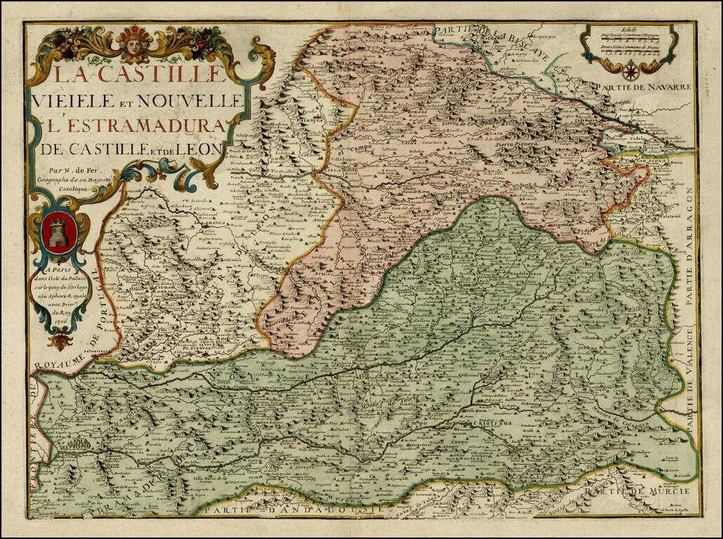
Detailed map of Castille, Estremadura and Leon. Includes a coats of arms in the title cartouche. Includes excellent detail. The map is apparently quite rare on the market. No examples listed on AMPR at auction or in dealer catalogues in the past 30...
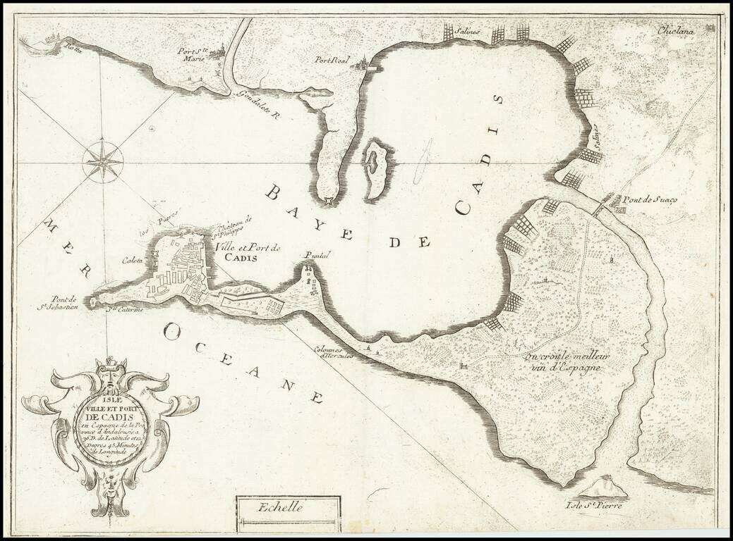
Scarce map of the the city and harbor of Cádiz, which appeared in Nicolas de Fer's book "Introduction de fortification". Includes a baroque cartouche. Cádiz is shown within a walled enclosure, with other cities arrayed around the bay.
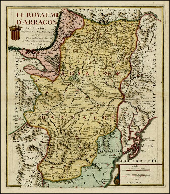
Detailed map of Aragon, with a coat of arms in the title. The map is centered on Zaragoza and shows the Kingdom in fine detail.
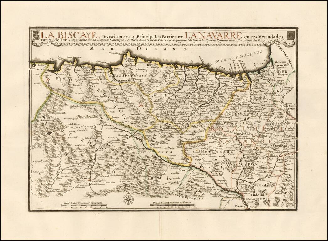
Large detailed map of the Basque region of Spain. The map extends from the San Sebastian Region to Santander in Cantabria and south to Pamplona, etc. The map is centered on Bilbao and Vitoria along the coastline and extending south to Burgos. Two...
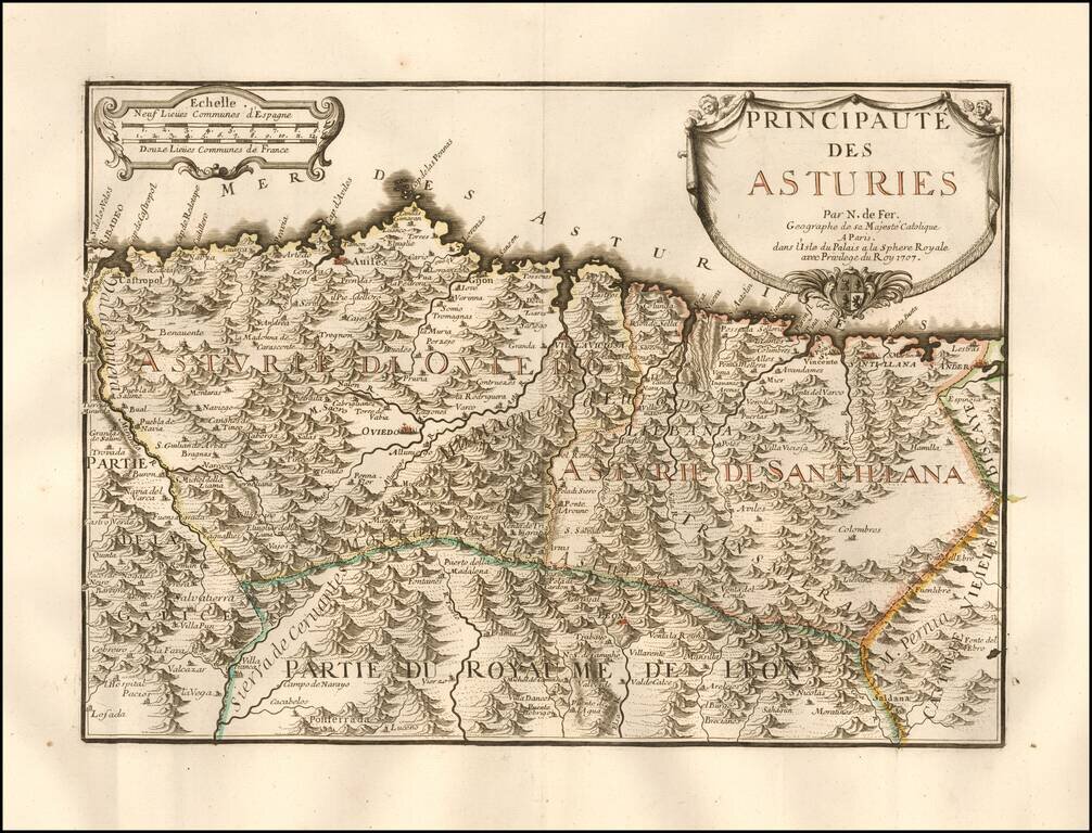
Rare map of the Asturias, published in Paris by Nicholas De Fer. Includes a coats of arms in the title cartouche. Includes excellent detail. The map is apparently quite rare on the market. No examples listed on AMPR at auction or in dealer catalogues...
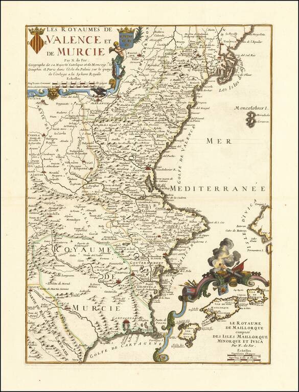
Detailed map of Valencia and Murcia, with a large decorative inset of the Balearic Islands. Includes 2 coats of arms in the title cartouche. Includes excellent detail, including the inset of the Balearic islands, which shows many place names and a...
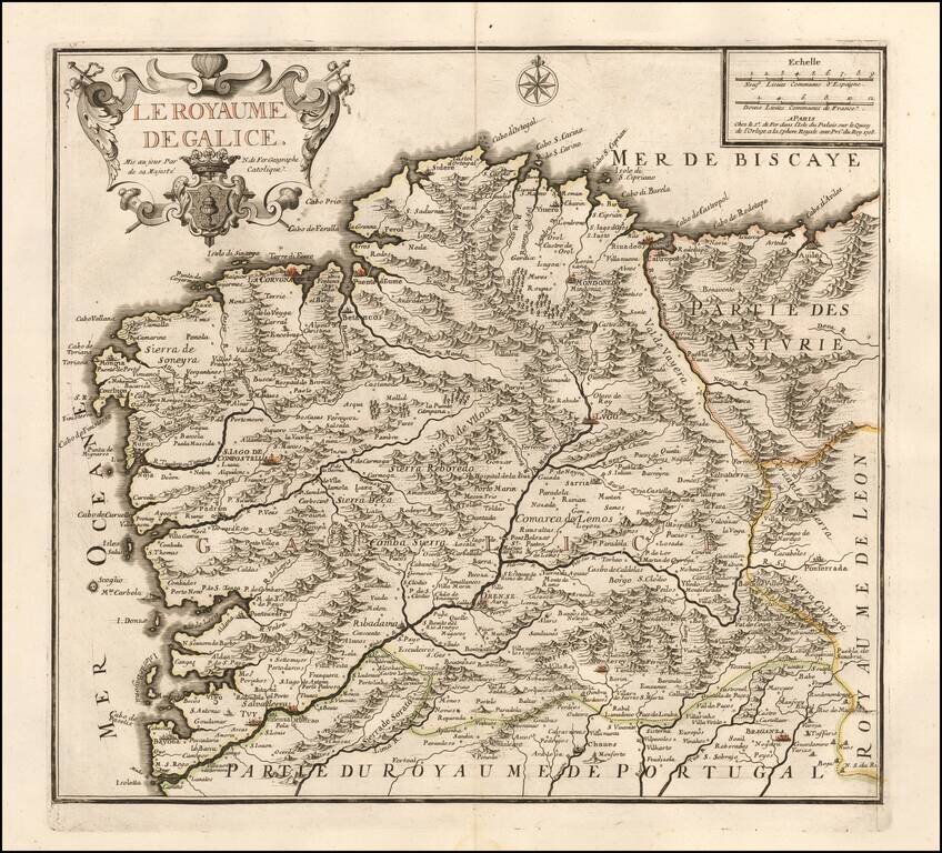
Scarce map of Galicia, published by Nicolas de Fer in Paris. De Fer's map is marvelously engraved in the style unique to De Fer, with excellent emphasis on the topographical details of Galicia, especially the depiction of the mountains in the region....
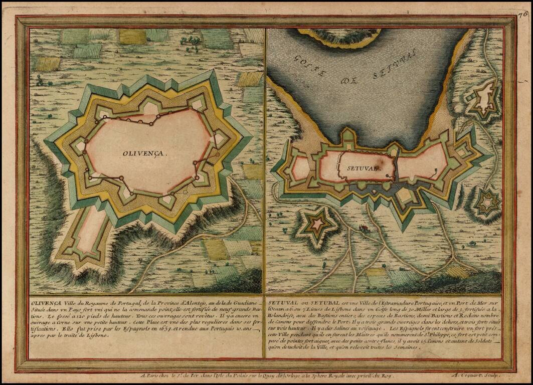
Two plans showing the fortifications of the towns of Olvenca and Setubal in Portugal.
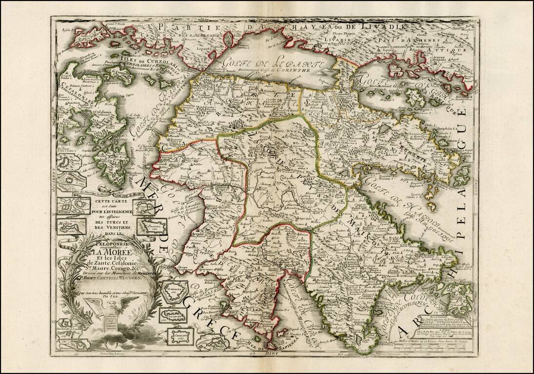
Scarce map of Peloponese and part of Greece and the Greek Isles, published by De Fer. Highly detailed map, which includes 12 inset plans of fortified towns and harbors for places within the bounds of the map. The dedication note that the map was...
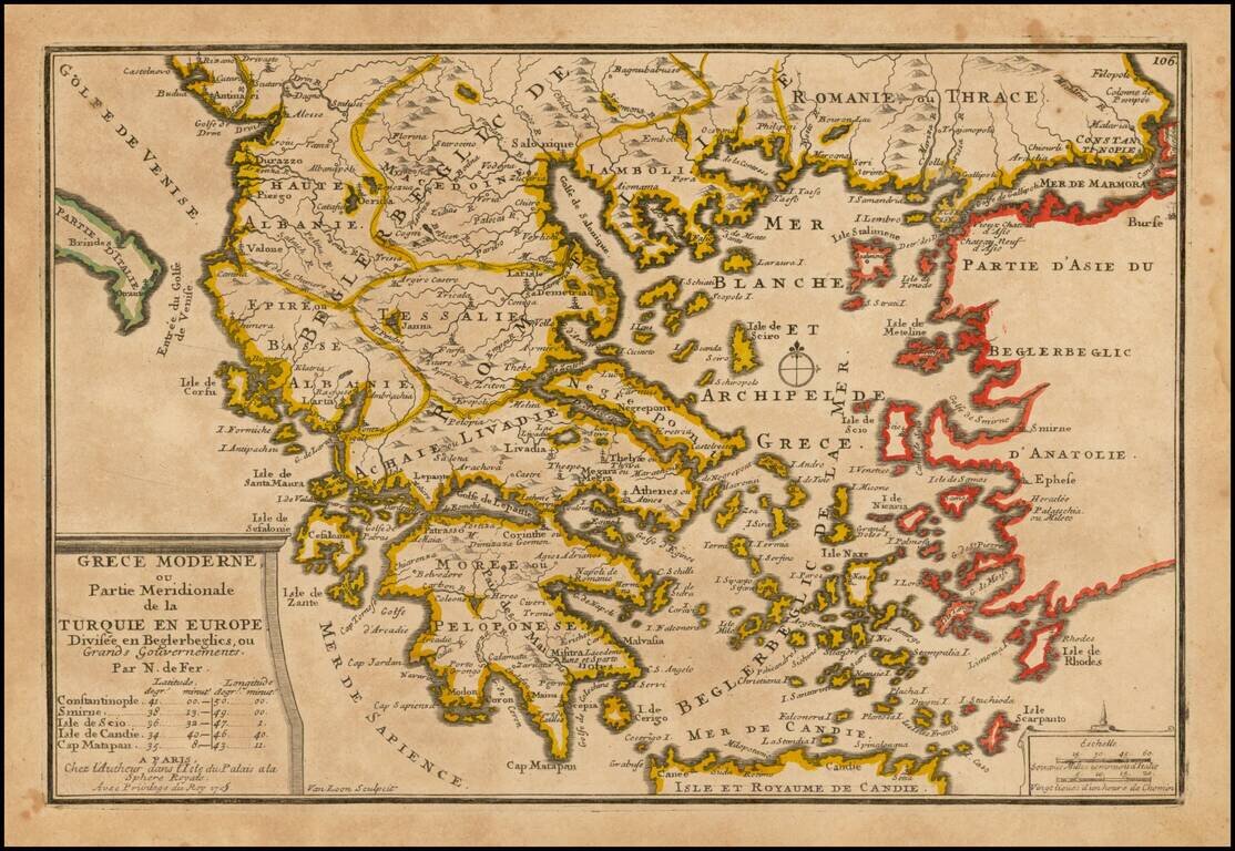
Detailed map of the Southern Part of Greece and contiguous Islands. From De Fer's Atlas Curieux.
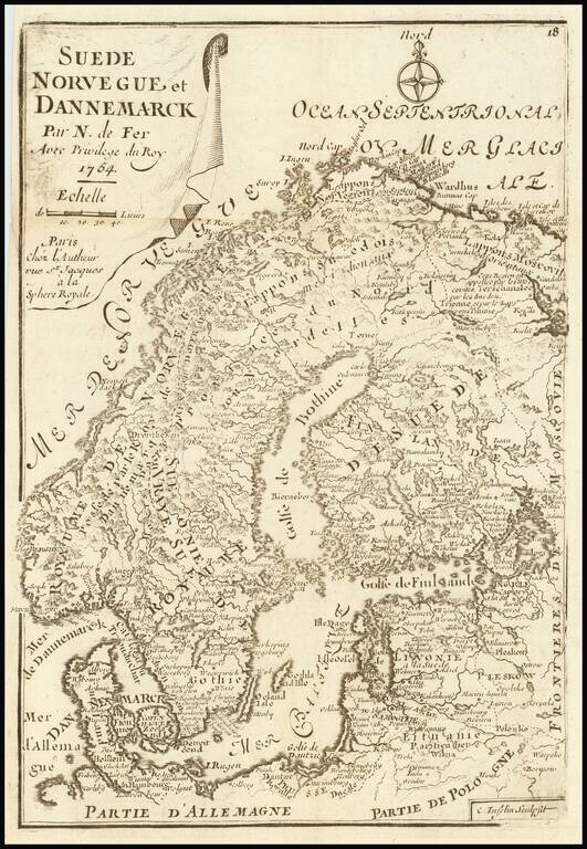
Rare late variant of De Fer's small map of Scandinavia.
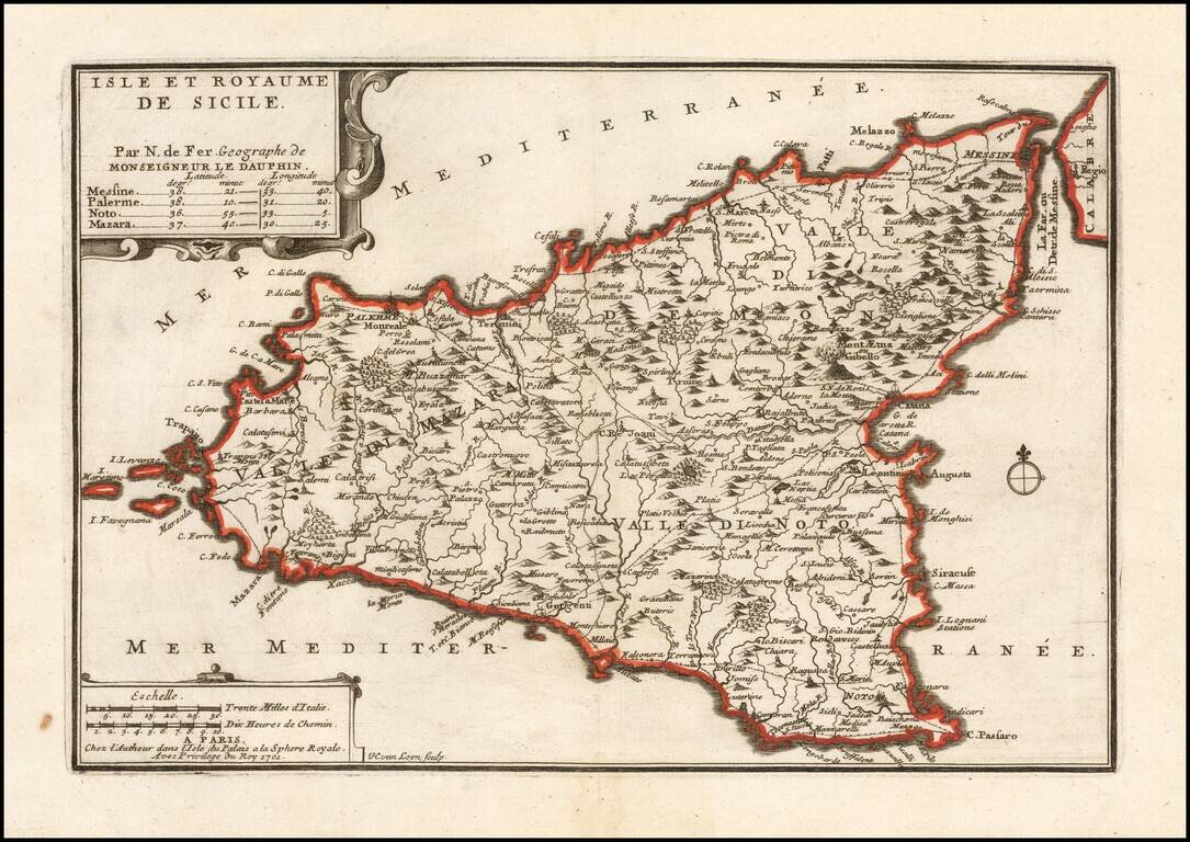
Detailed map of Sicily, showing towns, roads, rivers, harbors and a host of other details. From De Fer's Atlas Curieux . . .
![Les Isles Philippines Molucques et de La Sonde [Japan inset]](/map/small/51609.jpg)
Detailed map of part of Southeast Asia and the Philippines, with a large inset of Japan.
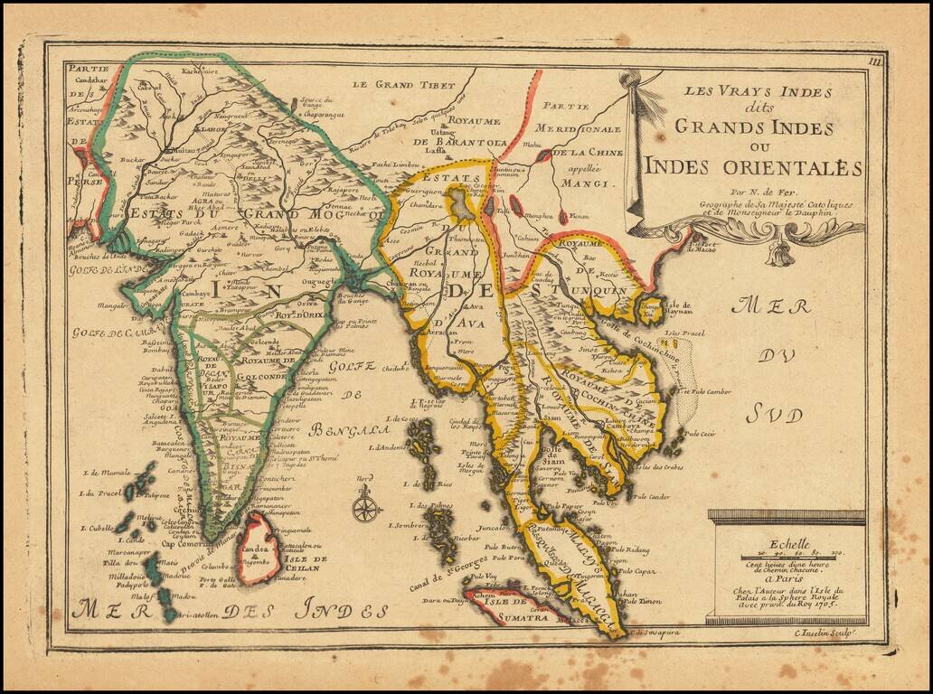
Striking map of India and the Malaysian Peninsula, showing excellent detail throughout. From De Fer's Atlas Curieux. Nice wide margins and decorative cartouche.
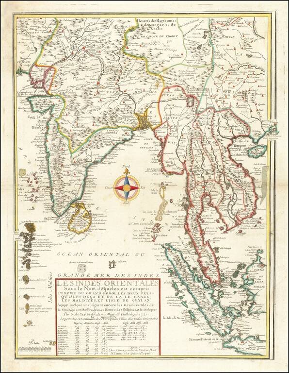
Second edition of De Fer's rare map of the region extending from Hong Kong and Macao in the east to the Indus River and Maldives in the west, bearing the imprint of his son-in-law and successor, Guillaume Danet. This fascinating map includes...
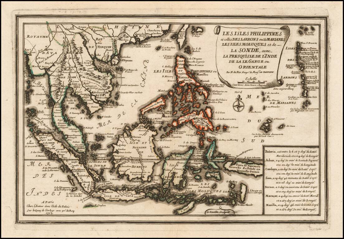
Striking map of the Philippines and Southeast Asia, showing excellent detail throughout. From De Fer's Atlas Curieux. Nice wide margins and decorative cartouche.