Nicholas de Fer (1646-1720) was the son of a map seller, Antoine de Fer, and grew to be one of the most well-known mapmakers in France in the seventeenth century. He was apprenticed at twelve years old to Louis Spirinx, an engraver. When his father died in 1673, Nicholas helped his mother run the business until 1687, when he became the sole proprietor.
His earliest known work is a map of the Canal of Languedoc in 1669, while some of his earliest engravings are in the revised edition of Methode pour Apprendre Facilement la Geographie (1685). In 1697, he published his first world atlas. Perhaps his most famous map is his wall map of America, published in 1698, with its celebrated beaver scene (engraved by Hendrick van Loon, designed by Nicolas Guerard). After his death in 1720, the business passed to his sons-in-law, Guillaume Danet and Jacques-Francois Benard.
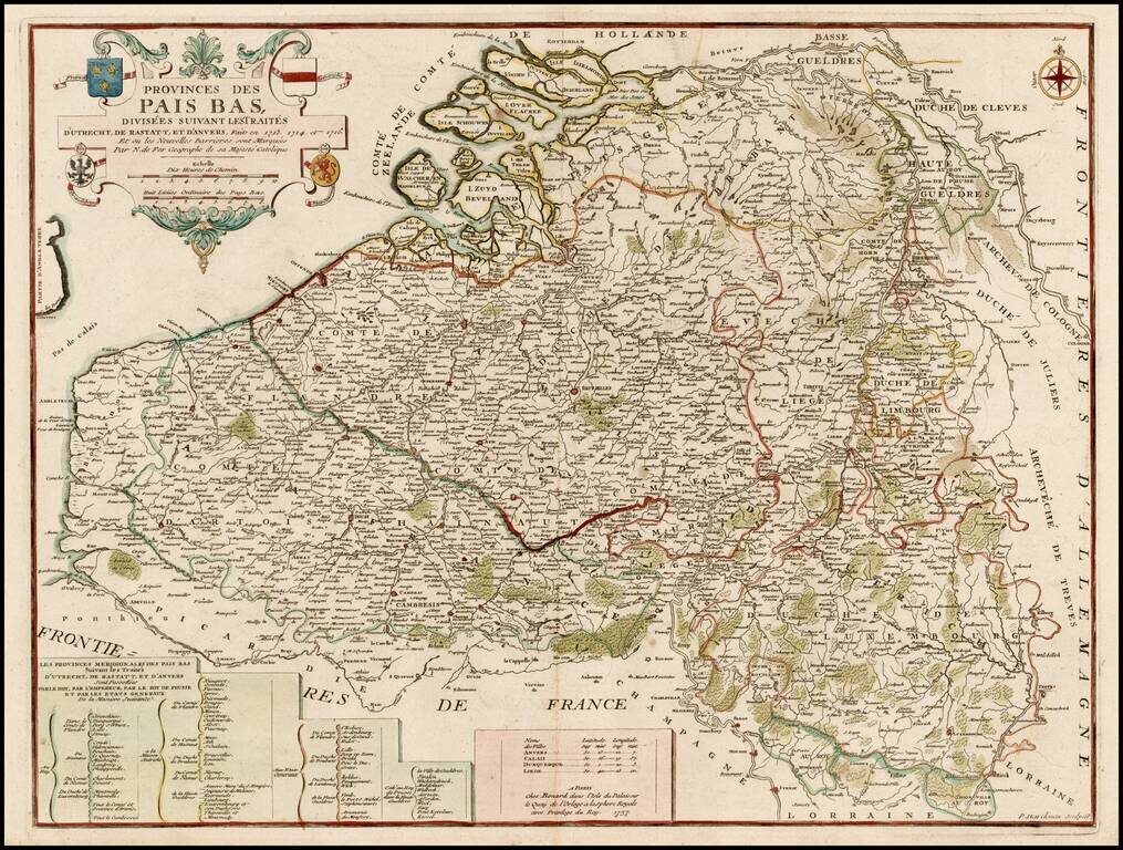
Scarce Benard edition of this detailed map of the Low Countries, from Zeland and Brabant to Luxembourg and Artois. The map includes the coats of arms of France, Austria, Brandenburg and the States General.
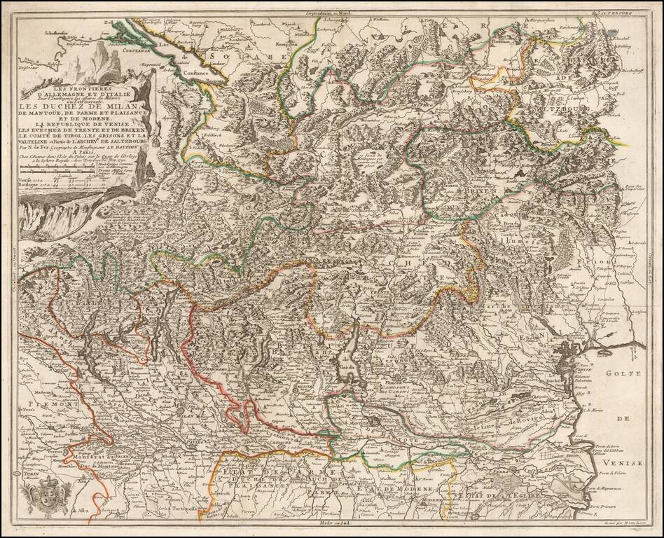
Detailed map of the Theater of War in Northern Italy, published in 1702 by Nicolas De Fer. The map extends from Locarno and Lake Constance to the Gulf of Venice and Saltzurg.
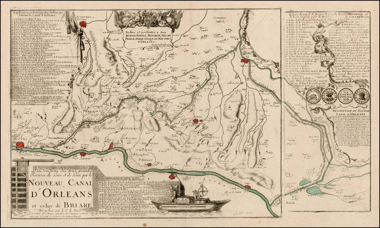
Rare early plan showing the Canal de Briare and the Canal D'Orleans, including keys identifying 65 places and 27 places on the two different canals, a dedication cartouche and illustration of a lock. The map is engraved using two plates, suggesting an...
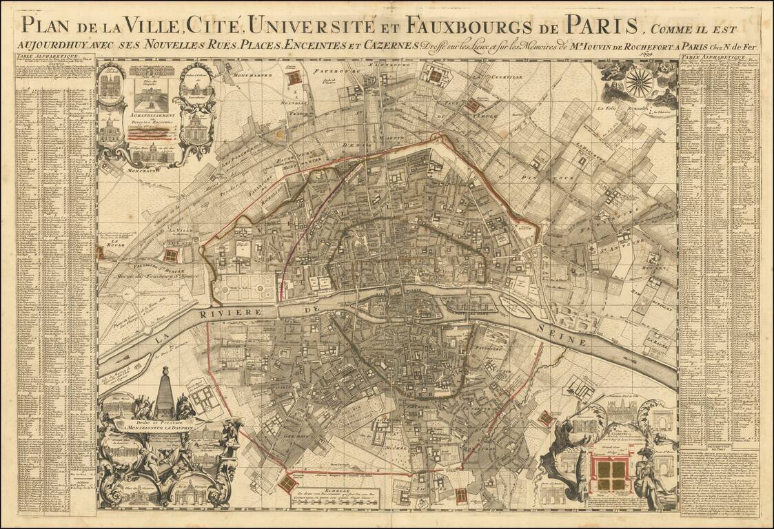
Rare large plan of Paris by Jouvin de Rochefort, published by Nicolas de Fer in 1694. Rochefort's map is of note as the second map to present Paris in a North-South axis, with the Seine being illustrated horizontally. The plan shows the city's five...
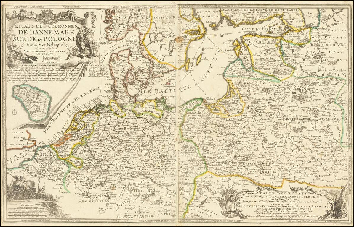
Scarce two sheet map of the Poland, the Baltic Sea and contiguous regions. The map includes a number of sea routes throughout the North Sea, Danish Sea and Baltic, ultimately connecting Finland and Latvia with Rotterdam, Friedrichstadt, Dantzig,...
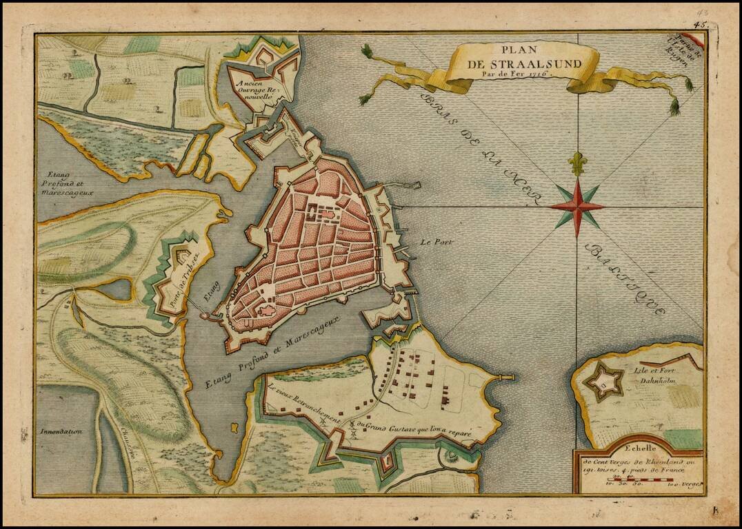
Detailed plan of Straalsund from De Fer's Atlas Curiuex. Shows the walled city, Fort Dahnholm and other details, including a large compass rose.
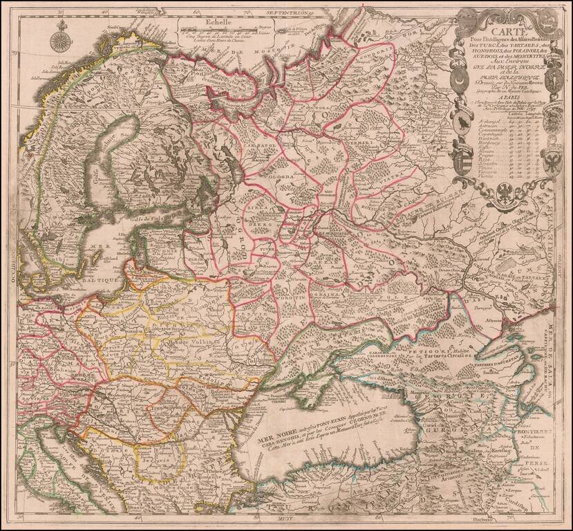
Scarce map of the region centered on the Black Sea and Russia, published by Nicolas De Fer in Paris. The map extends from Scandinavia and the Baltic in the west to the mouth of the Volga in the Caspian Sea. Elaborate cartouche includes 9 coats of...
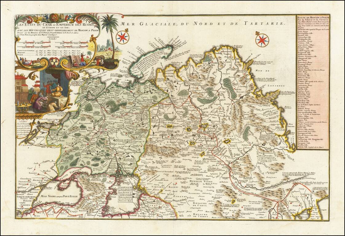
Rare large format map of Imperial Russia, extending from the Baltic and the Black Sea to China, prepared by Nicolas De Fer. De Fer's map is based upon the reports of Nicholas Witsen, Evart Esbrand (Evert Ysbrandzoon Ides) and Philippe Avril. Adam...
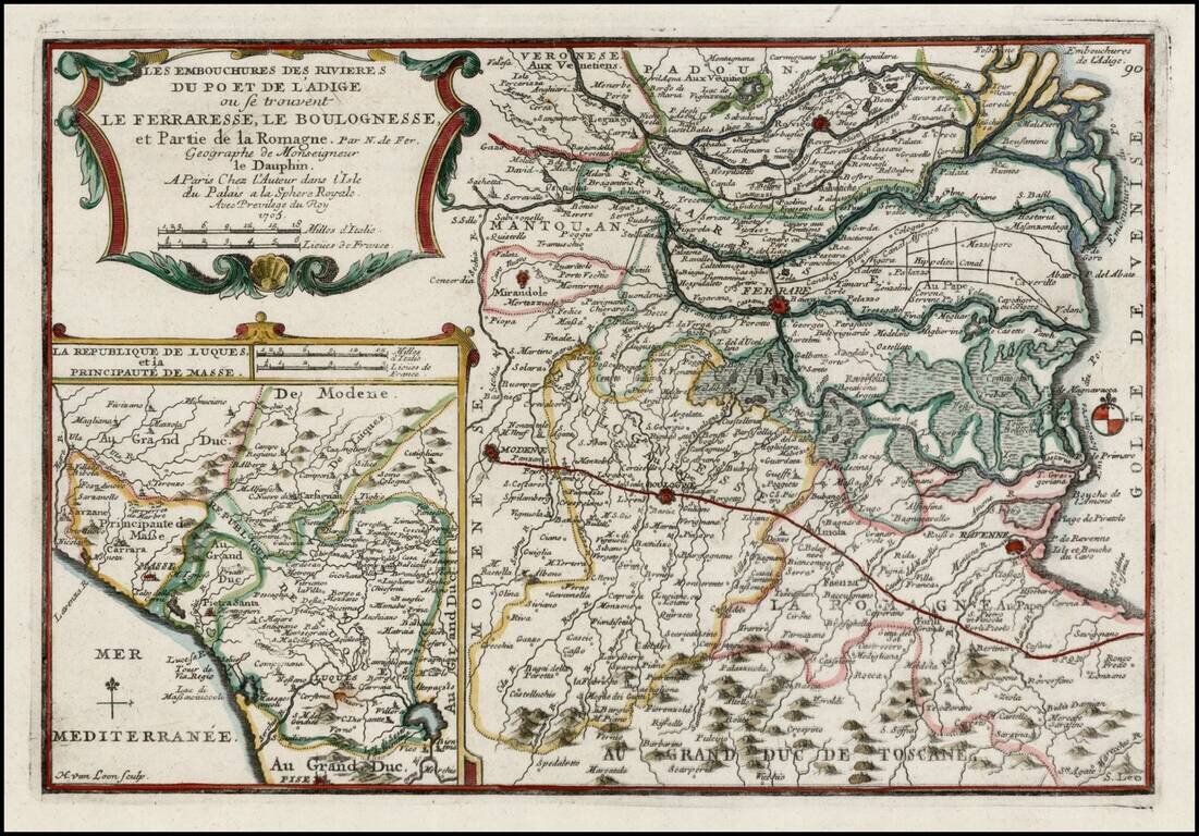
Scarce regional map of Italy, showing the mouths of the Po and Adige Rivers flowing into the Gulf of Venice. Shows towns, roads, rivers, lakes, mountains, etc. Excellent detail. Inset map shows the Republic of Luca and Principality of Masse on the...
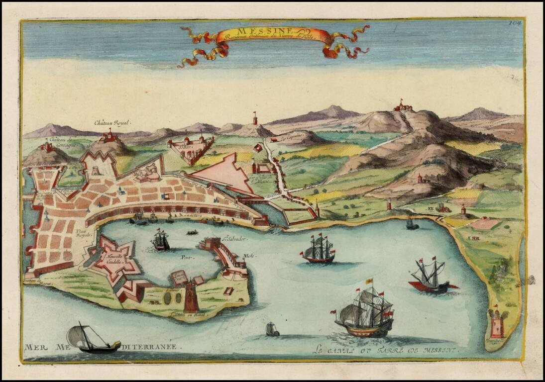
Detailed view of Messina, the residence of the Viceroy of Sicily. From De Fer's Atlas Curieux.
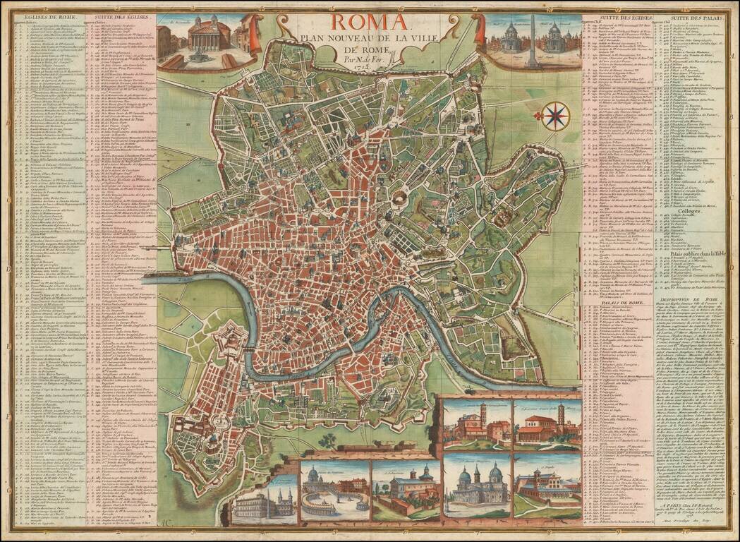
Rare 18th Century Plan of Rome, with 10 inset views and a key identifying over 450 places of interest within the map. The plan includes a number of profiles views of major monuments within the city, as well as bridges, gates and fortified walls. The...
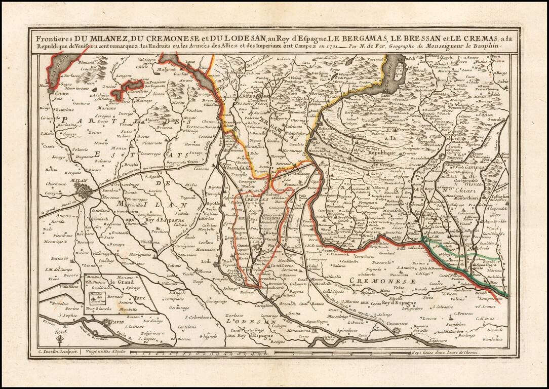
Detailed regional map, from Milan and Lago di Como to the Chiese River and Benzolo.
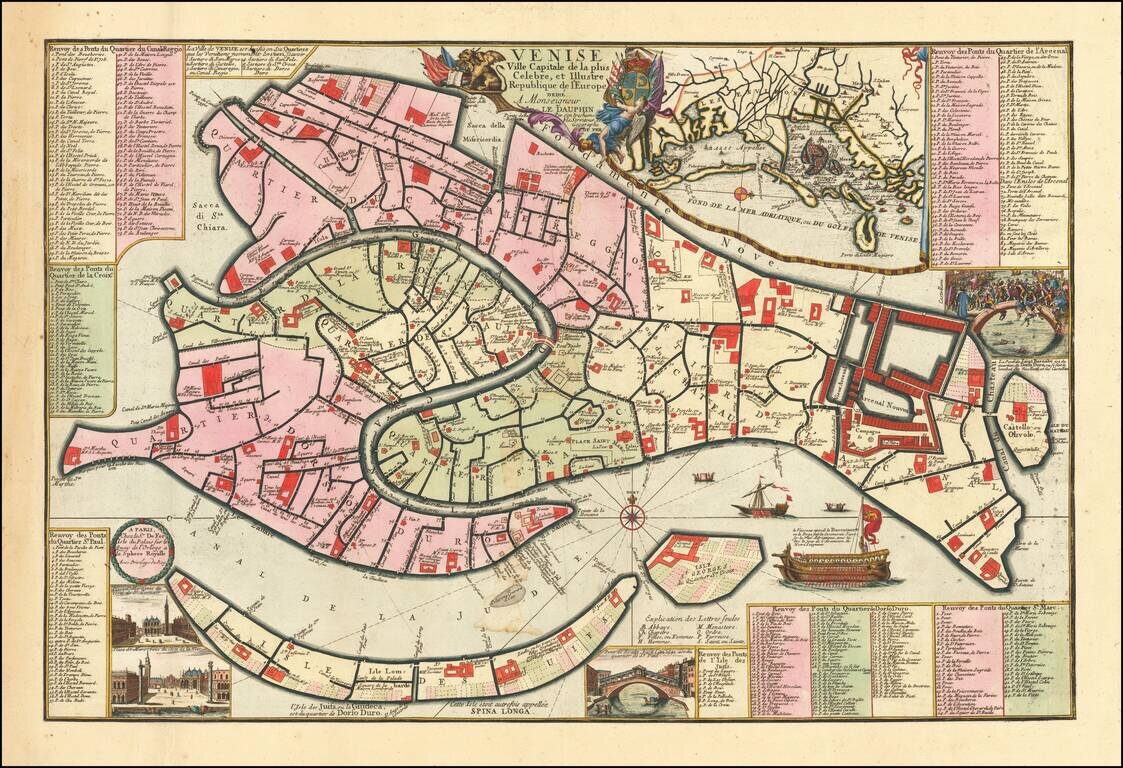
Fine example of this early edition of Nicolas De Fer's rare separately published plan of Venice, first published in Paris in 1695. The map includes an inset of the Lagoon of Venice near the title, inset vignettes of the Lagoon, two views of the Piazza...
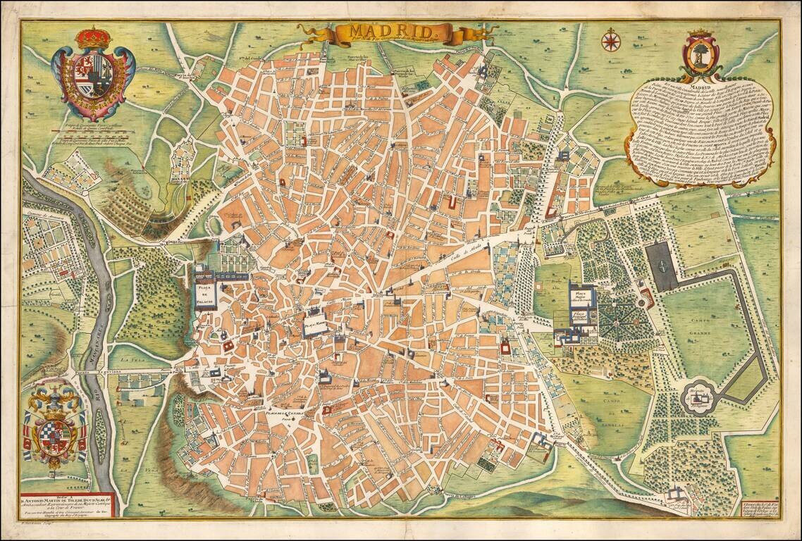
Rare first edition of Nicolas De Fer's plan of Madrid, with a key showing 26 places of interest. Early 18th Century plans of Madrid are relatively uncommon. Nice dark impression. From the first edition of De Fer's Atlas Curieux.
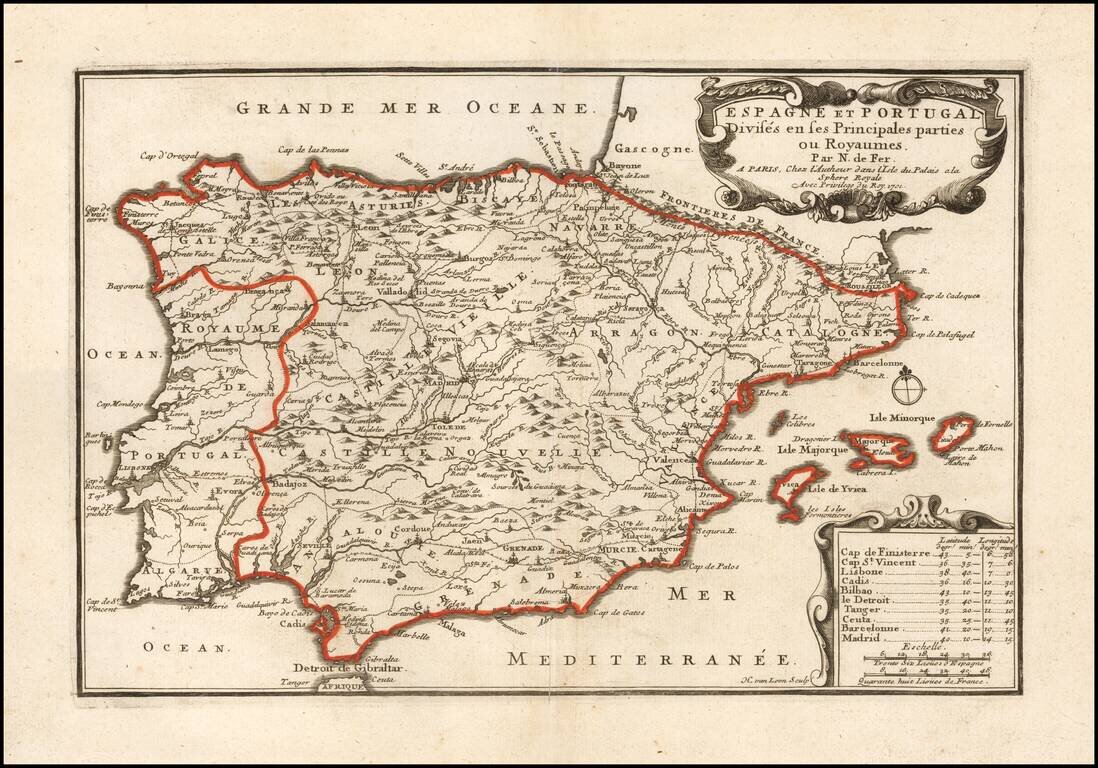
Scarce first state of this detailed map of Spain and Portugal, with decorative cartouche. Includes the Balaeric Islands.
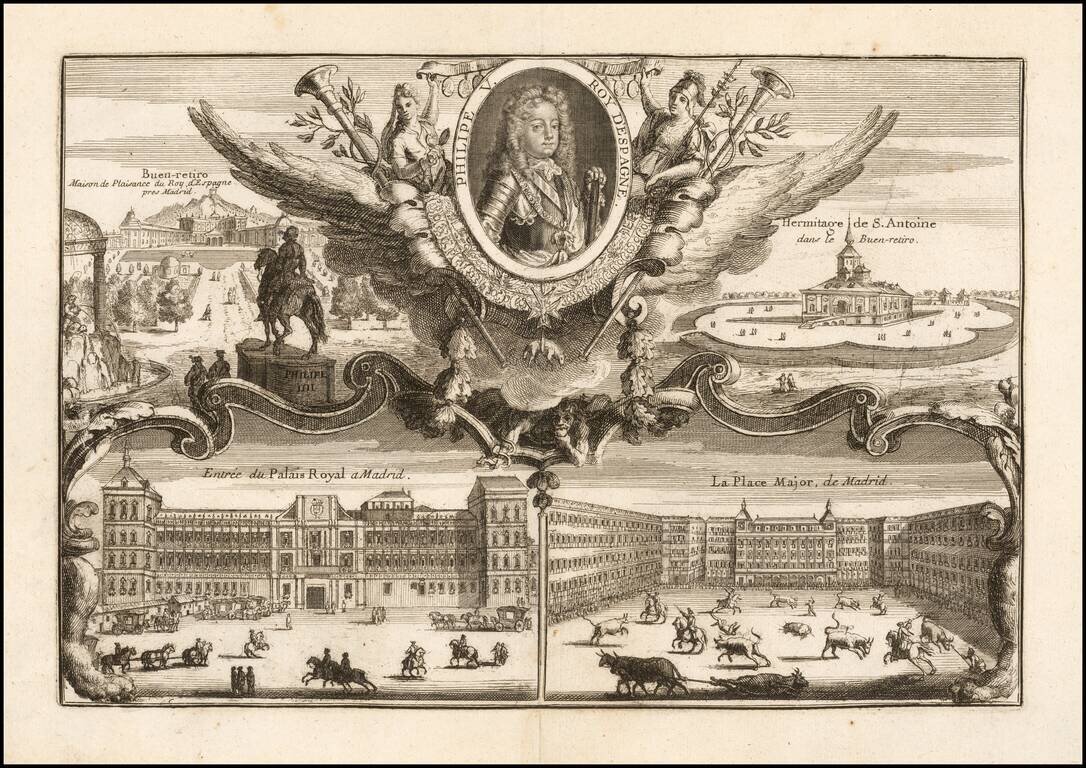
Decorative portrait of the King of Spain, with 4 decorative scenes of early 18th Century Madrid.