Gerard Mercator is one of the most famous cartographers of all time. Mercator was born in Flanders and educated at the Catholic University in Leuven. After his graduation in 1532, Mercator worked with Gemma Frisius, a prominent mathematician, and Gaspar a Myrica, a goldsmith and engraver. Together, these men produced globes and scientific instruments, allowing Mercator to hone his skills.
With his wife, Barbara, Mercator had six children: Arnold, Emerentia, Dorothes, Bartholomeus, Rumold, and Catharina. In 1552, Mercator moved to Duisburg from Leuven, where he lived for the rest of his life. In 1564, he was appointed the official cosmographer to the court of Duke Wilhelm of Cleve.
Mercator’s most important contribution was the creation and popularization of a projection which now bears his name. On Mercator projection maps, all parallels and meridians are drawn at right angles to each other, with the distance between the parallels extending towards the poles. This allowed for accurate latitude and longitude calculation and also allowed navigational routes to be drawn using straight lines, a huge advantage for sailors as this allowed them to plot courses without constant recourse to adjusting compass readings.
Mercator’s other enduring contribution to cartography is the term “atlas”, which was first used to describe his collection of maps gathered in one volume. The Mercator atlas was published in 1595, a year after Mercator’s death, thanks to the work of his sons, particularly Rumold, and his grandsons.
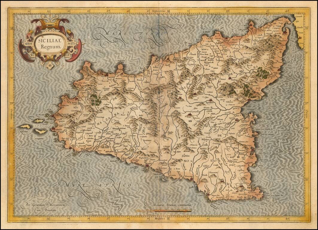
Nice old color example of the first state of Mercator's decorative map of Sicily. An example of the second state, with revised cartouche, can be seen here: /gallery/detail/31471sm
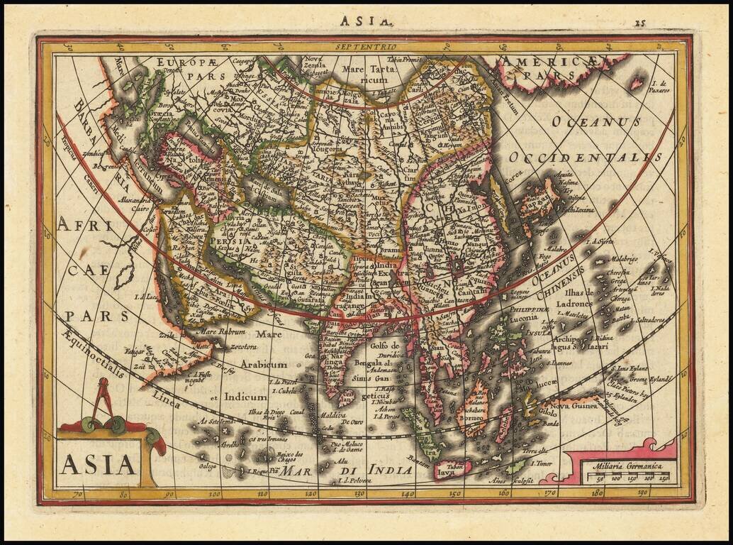
Detailed early map of Asia, from the Mercator-Hondius Atlas Minor. Korea is shown as an island. The Philppines are named and shown in a relatively recognizable shape.
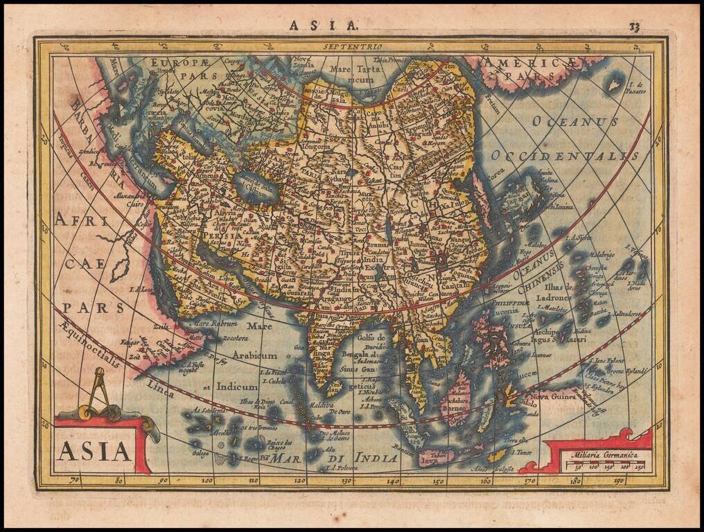
Striking example of this interesting map of Asia, from the Mercator-Hondius Atlas Minor. Includes Corea as an island, early depiction of the Philippines Islands and the land bridge to North America.
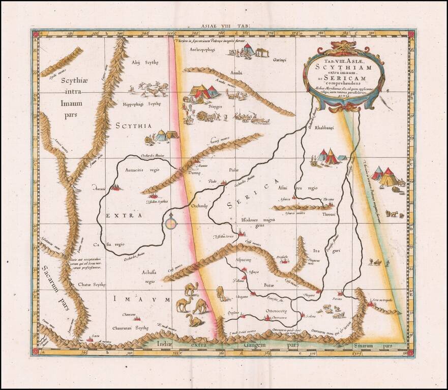
Fine Ptolemaic Map of Central Asia from Mercator’s Geographia Finely engraved map of Central Asia east of the Caspian Sea, encompassing parts of present-day Pakistan, Tajikistan, Kyrgyzstan, and western China. The map is from Mercator’s highly...
Nice example of Mercator's map of ancient Southeast Asia, first issued in the 1595 edition of Mercator's Geographia, based upon the works of Claudius Ptolemy. From Mercator's edition of Ptolemy's Geographia, first published in 1578 and republished in...
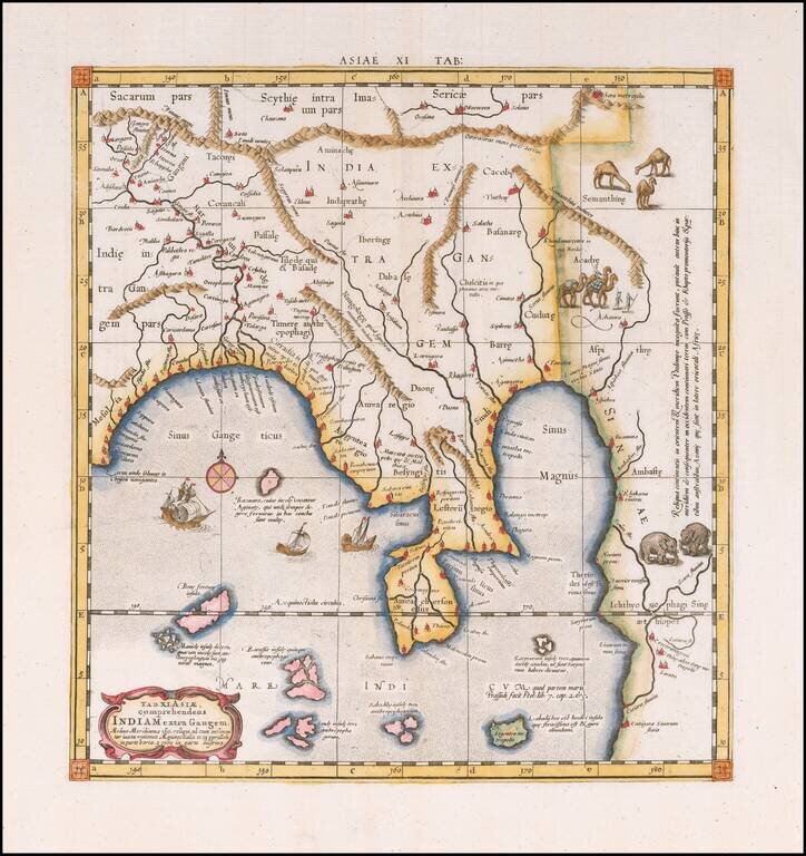
The Mercator-Ptolemy Map of India Colored example of Mercator's Ptolemaic map of much of India, first issued in the 1595 edition of Mercator's Geographia, based upon the works of Claudius Ptolemy. The present example is from the second set of plates,...
![[Pakistan Afghanistan & Western India] Tab: IX Asia Continens Ariam, Paropanisum, Drangianam, Arachosiam, et Gedrosiam. . . .](/map/small/54110.jpg)
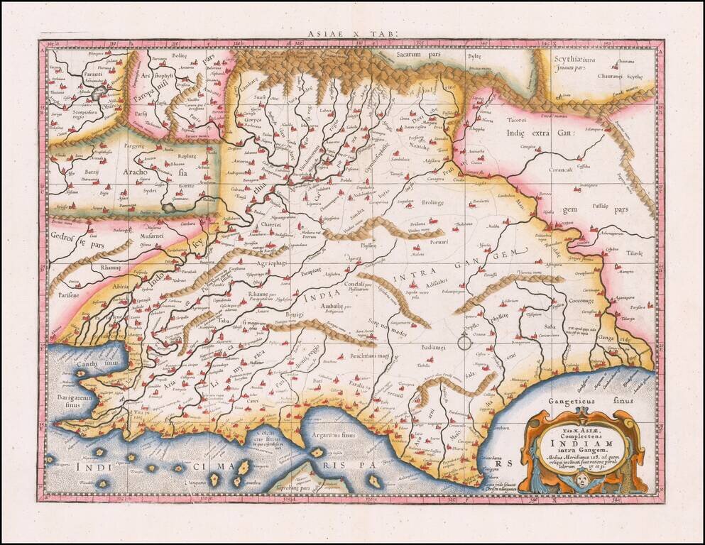
A striking Ptolemaic map of Central Asia, centered on the Indus River. The map extends from the Gujarat region in the east to west of Karchi, the north to the mountains. Mercator originally published this map in his 1578 edition of Ptolemy's...
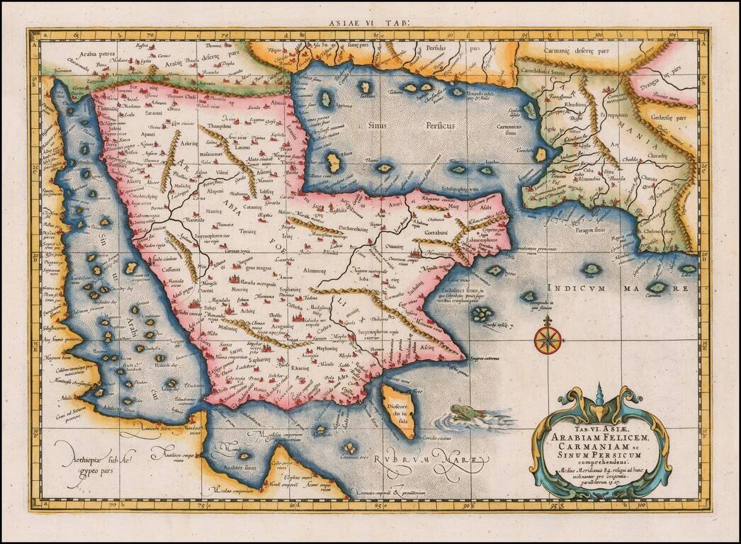
Nice example of the second edition of Mercator's Ptolemaic map of the Middle East, first issued in the 1695 edition of Mercator's Geographia, based upon the works of Claudius Ptolemy. Mercator's map was a landmark in the mapping of the Arabia...
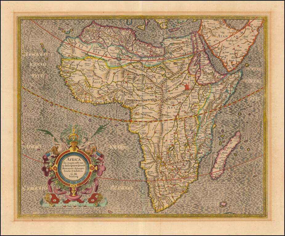
Nice old color example of the most influential maps of Africa published at the end of the 16th century. Mercator's finely engraved map of Africa depicts the continent as it was known in the late 16th century. This map is based on Gerard Mercator's...
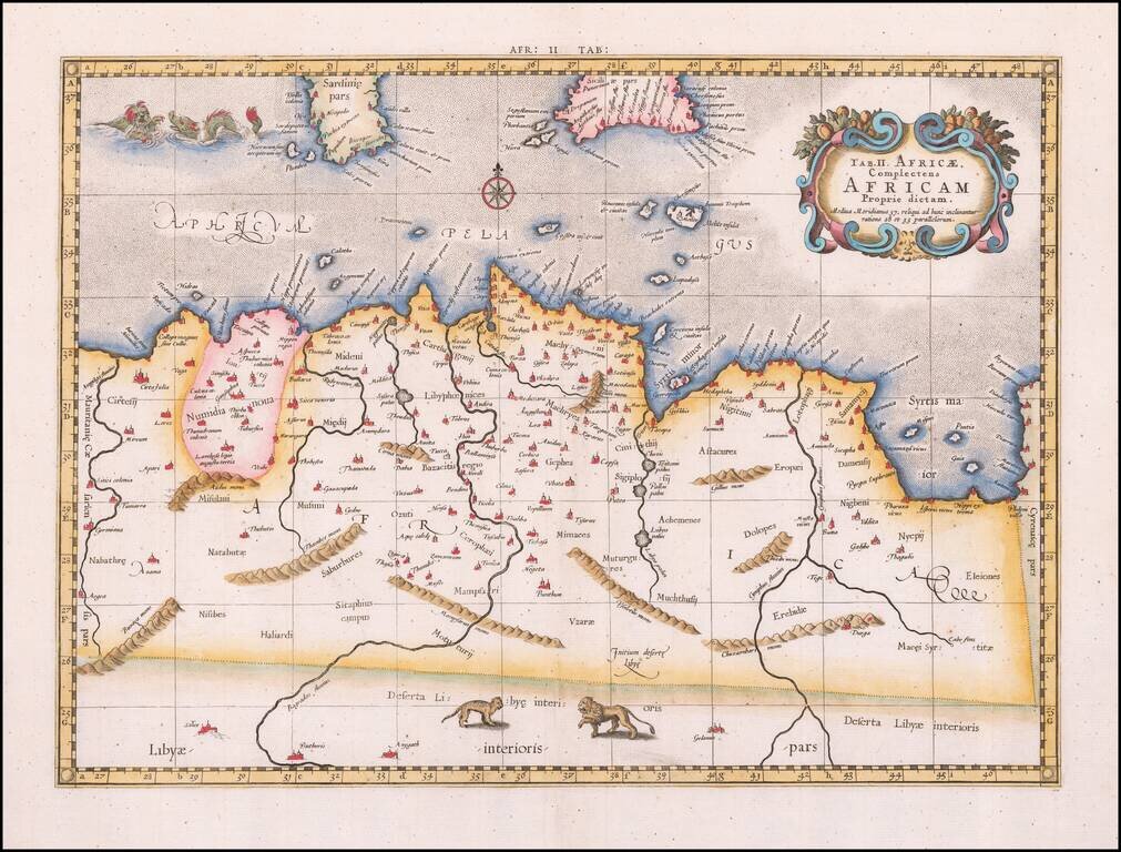
Nice full color example of Mercator's Ptolemaic map of North Africa. While Mercator is perhaps most famous for his maps of the Modern World, one of his life ambitions was to write an improved and corrected edition of Ptolemy's Geographia.