Gerard Mercator is one of the most famous cartographers of all time. Mercator was born in Flanders and educated at the Catholic University in Leuven. After his graduation in 1532, Mercator worked with Gemma Frisius, a prominent mathematician, and Gaspar a Myrica, a goldsmith and engraver. Together, these men produced globes and scientific instruments, allowing Mercator to hone his skills.
With his wife, Barbara, Mercator had six children: Arnold, Emerentia, Dorothes, Bartholomeus, Rumold, and Catharina. In 1552, Mercator moved to Duisburg from Leuven, where he lived for the rest of his life. In 1564, he was appointed the official cosmographer to the court of Duke Wilhelm of Cleve.
Mercator’s most important contribution was the creation and popularization of a projection which now bears his name. On Mercator projection maps, all parallels and meridians are drawn at right angles to each other, with the distance between the parallels extending towards the poles. This allowed for accurate latitude and longitude calculation and also allowed navigational routes to be drawn using straight lines, a huge advantage for sailors as this allowed them to plot courses without constant recourse to adjusting compass readings.
Mercator’s other enduring contribution to cartography is the term “atlas”, which was first used to describe his collection of maps gathered in one volume. The Mercator atlas was published in 1595, a year after Mercator’s death, thanks to the work of his sons, particularly Rumold, and his grandsons.
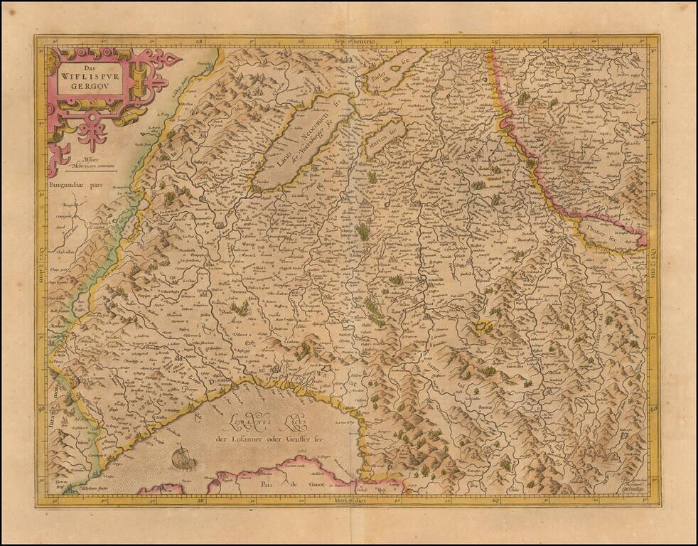
Old color example of Mercator's detailed map of southwestern Switzerland showing Geneva, Lake Geneva, Lake Neuchatel, Lake Biel, Bern, Freiburg, Lake Thuner, etc. Decorative cartouche.
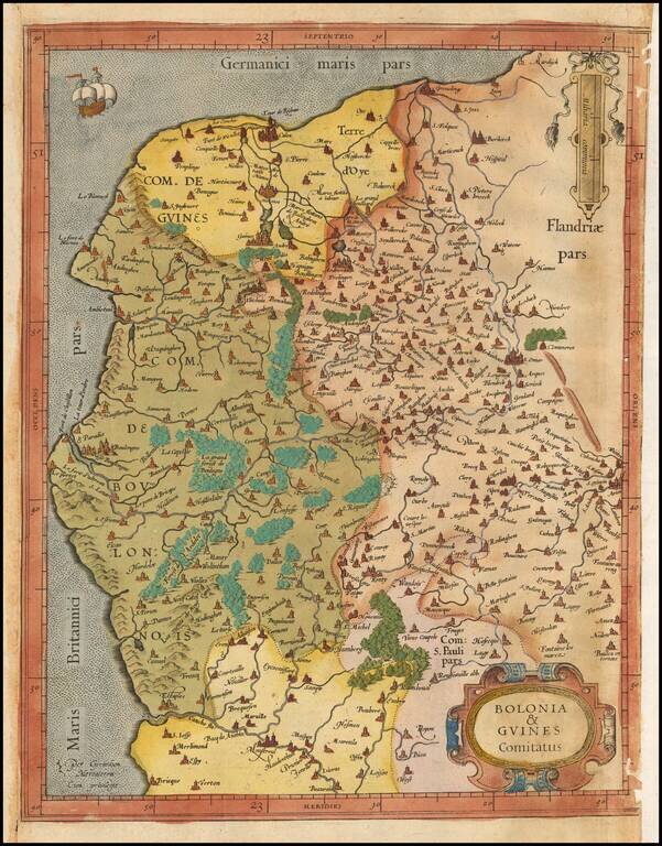
Old color example of Gerard Mercator's map of Northwestern France. The map extends from Calais and Dunkirk in the North, to La Canche River in the south.
![Corsica [and] Sardinia](/map/small/41806.jpg)
Old color example of Gerard Mercator's maps of Corsica and Sardinia. Includes decorative cartouches.
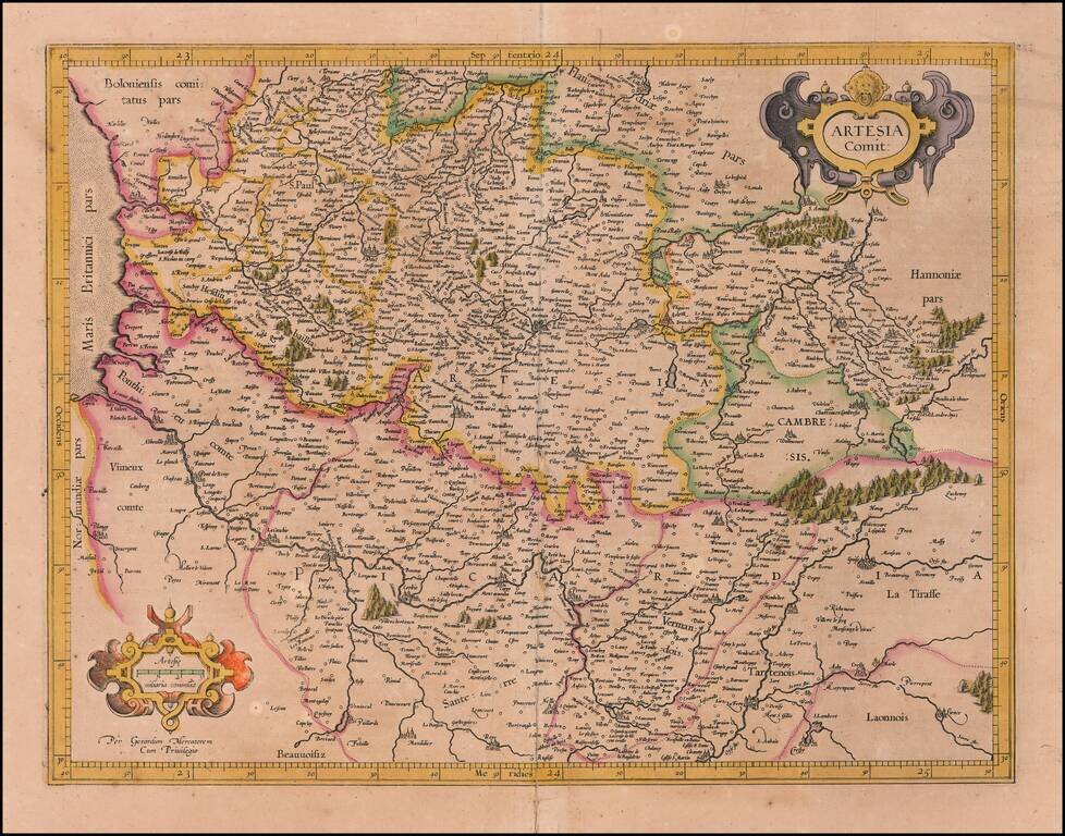
Nice old color example of Mercator's detailed regional map of Artois, which appeared in Mercator's Atlas Sive Cosmographia, the first collection of maps to use the modern name "Atlas."
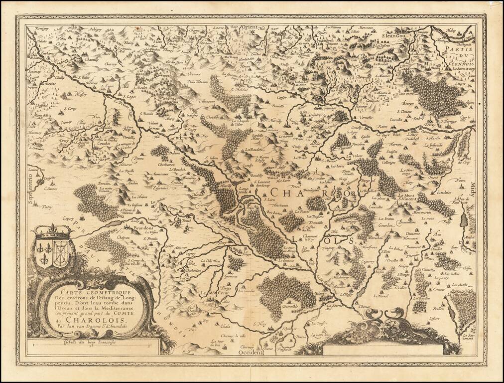
Striking map of the region of Charlois, published in Amsterdam.

Rare first edition of Mercator's detailed regional map of Germany, originally published in the first edition (1595) of Mercator's atlas. Shows the Waldeck Region in central Germany.
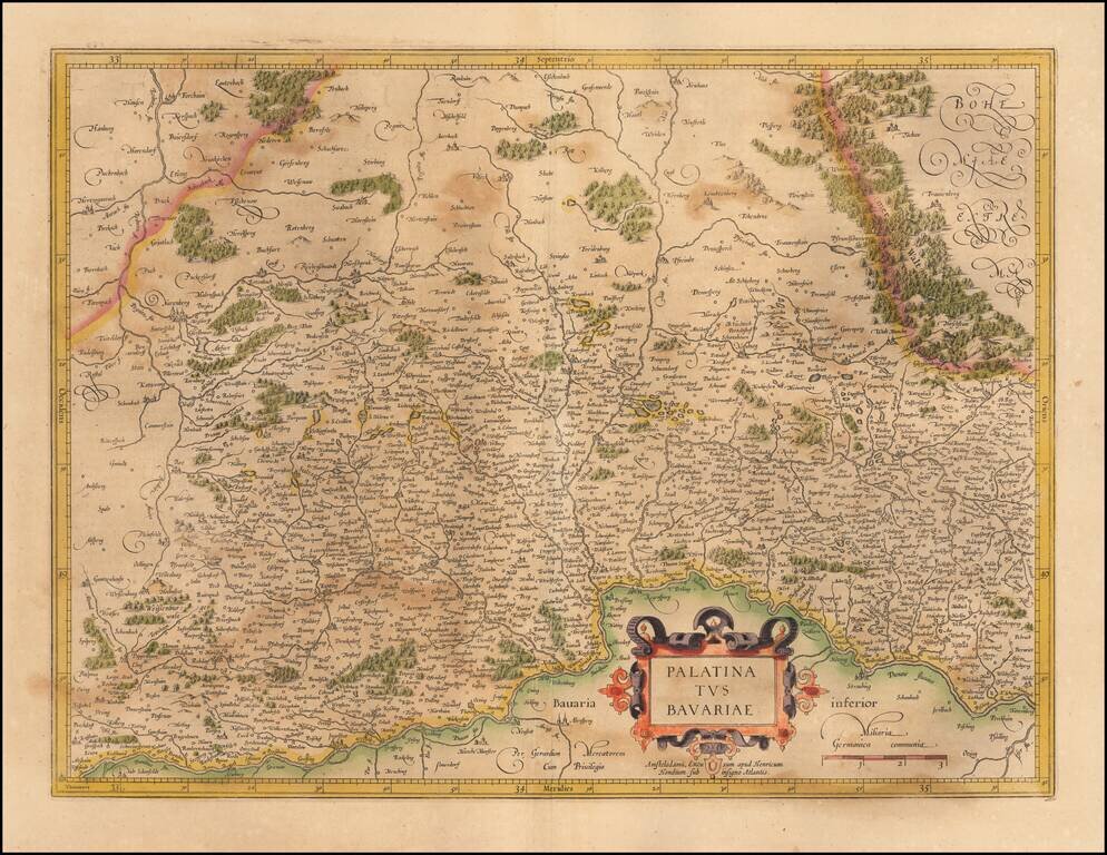
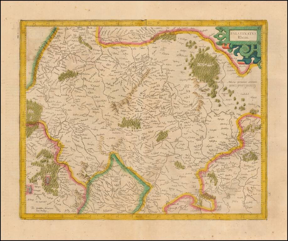
Nice example of the Mercator-Hondius map of the Bavarian Palatinate in Germany. The map follows the course of the Danube River across the bottom (centered on Regensburg). Nuremberg appears toward the upper left. Ingoldstadt is shown at the bottom...
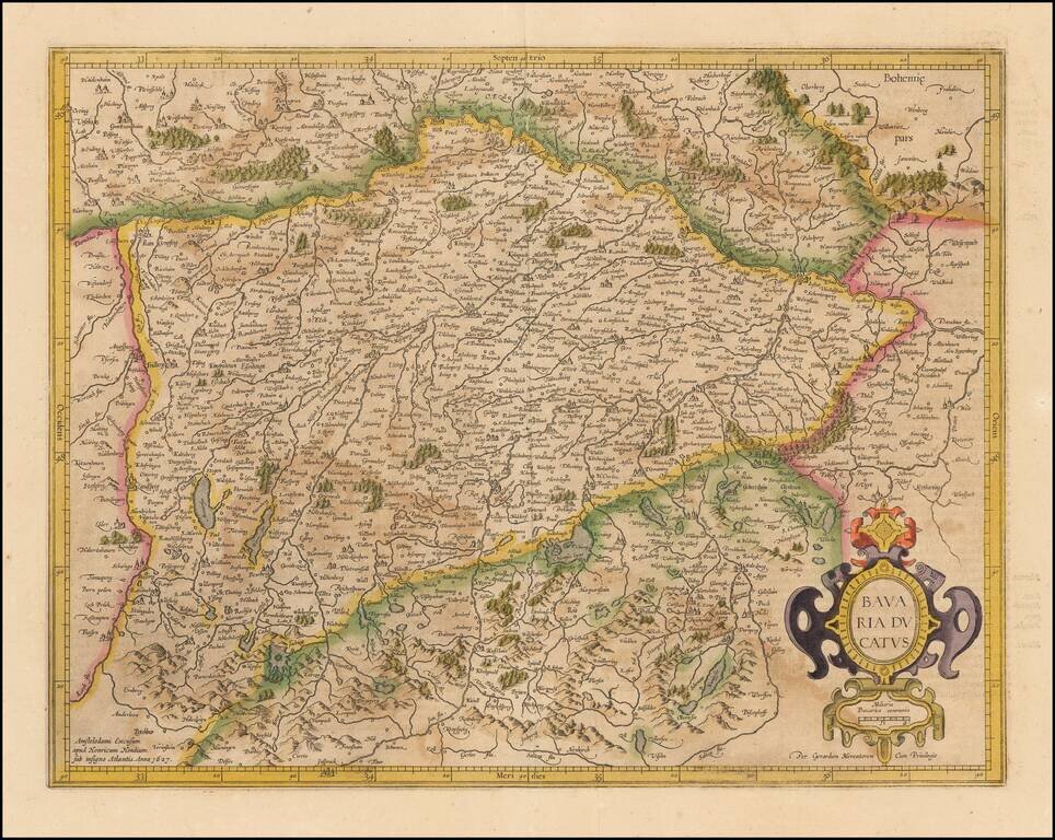
Nice old color example of Mercator's detailed regional map of Germany. The map map shows the course of the Danube in the north, flowing through Ingolstadt, Strassburg, and Passau and extending to the Alpine cities of Fussen, Partenkirchen, Innsburck...
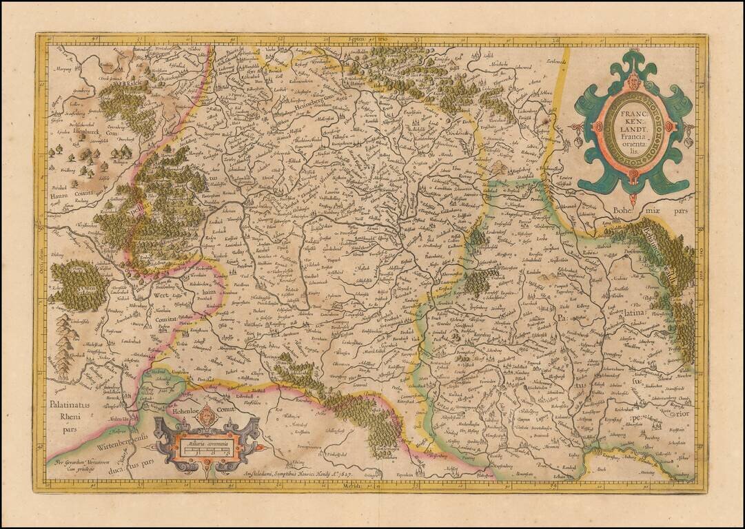
Mercator's double-page engraved German regional map, here in old hand. The map shows Frankfurt am Main, Heidelberg, Wurzburg and the course of the upper Main River, extending east to Regensburg and Eger in Bohemia.
Old color example of Mercator's regional map of a part of Germany from an early edition of the Mercator-Hondius Atas.
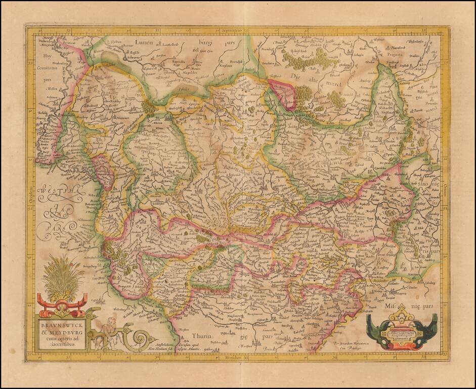
Nice old color example of Mercator's detailed regional map of a portion of Northwestern Germany. Includes Hamburg, Luneburg, etc.
Nice example of Mercator's detailed regional map of Germany. The map extend north to Frankfurt, Bingen and Bachrach and south to the Alsace Region of France, following the Upper Rhine. Heidelberg is near the center of the map.

Detailed map of Holstein, extending south to include Hamburg and Lubeck. From an early edition of Mercator's Atlas.
![[Untitled Map of Central Westphalia]](/map/small/51478.jpg)
Nice example of the Mercator-Hondius regional map of Westphalia, in modern-day Germany.
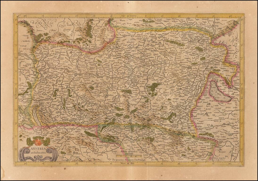
Old color example of the Mercator's map of Austria from his Atlas Sive Cosmographia. The map is centered on the Danube River from the Bavarian border to Pressburg.
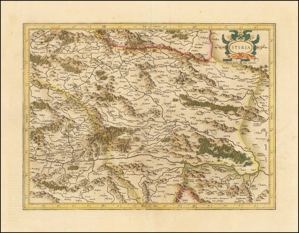
Detailed map of Stiria, centered on the course of the Dranus River and the Mura River. Decorative cartouche with coat of arms.