Gerard Mercator is one of the most famous cartographers of all time. Mercator was born in Flanders and educated at the Catholic University in Leuven. After his graduation in 1532, Mercator worked with Gemma Frisius, a prominent mathematician, and Gaspar a Myrica, a goldsmith and engraver. Together, these men produced globes and scientific instruments, allowing Mercator to hone his skills.
With his wife, Barbara, Mercator had six children: Arnold, Emerentia, Dorothes, Bartholomeus, Rumold, and Catharina. In 1552, Mercator moved to Duisburg from Leuven, where he lived for the rest of his life. In 1564, he was appointed the official cosmographer to the court of Duke Wilhelm of Cleve.
Mercator’s most important contribution was the creation and popularization of a projection which now bears his name. On Mercator projection maps, all parallels and meridians are drawn at right angles to each other, with the distance between the parallels extending towards the poles. This allowed for accurate latitude and longitude calculation and also allowed navigational routes to be drawn using straight lines, a huge advantage for sailors as this allowed them to plot courses without constant recourse to adjusting compass readings.
Mercator’s other enduring contribution to cartography is the term “atlas”, which was first used to describe his collection of maps gathered in one volume. The Mercator atlas was published in 1595, a year after Mercator’s death, thanks to the work of his sons, particularly Rumold, and his grandsons.
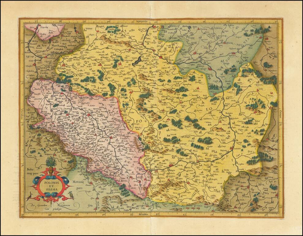
Fine old color example Mercator's detailed map of a portion of Poland, including a number of its major cities (Warsaw, Krackow, Oppeln, Breslau, Gnezna, Graudenz, Lublin, etc.).
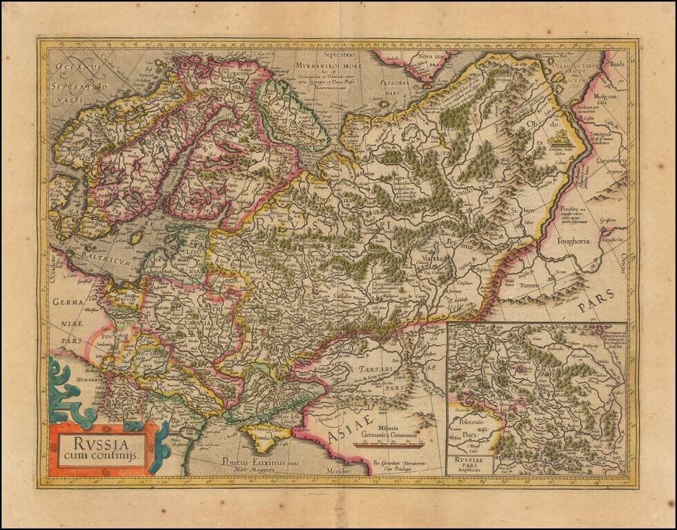
Nice outline color example of Mercator's first map of Russia. The map shows the region from Scandinavia to the Black Sea and the Oby River. Large inset of Russia Pars Amphisicata (Moscovia). Numerous Eastern European regions are shown, including:...
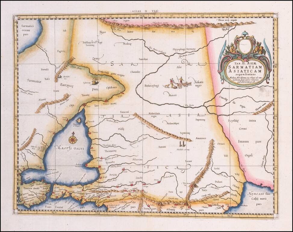
Colored example of Mercator's map of Armenia, Georgia, eastern Turkey, and parts of Ukraine and Southern Russia, from Mercator's Geographia, first published in 1578 and republished in Amsterdam beginning in 1695. Includes decorative cartouche and sea...
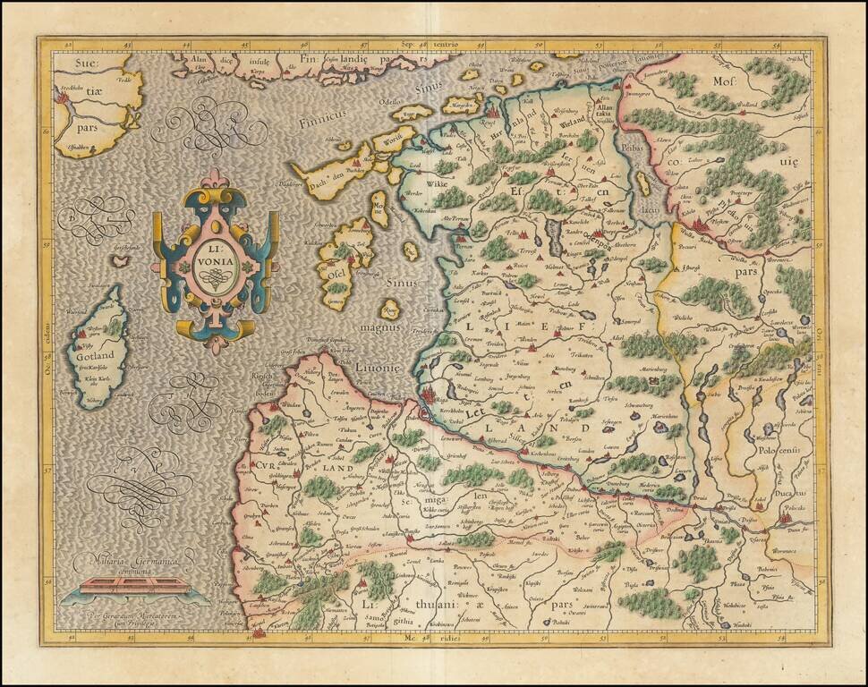
Finely colored example of Mercator's detailed map of the northern Baltic region. Decorative cartouche.
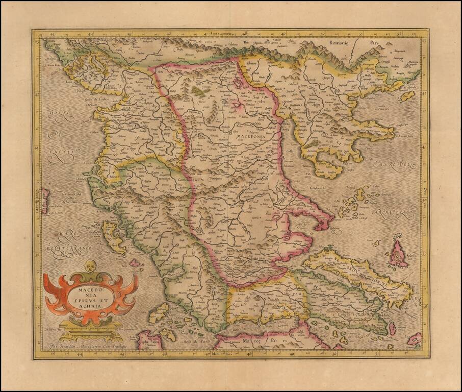
Nice old color example of Hondius's detailed regional map of Macedonia, with a decorative cartouche.
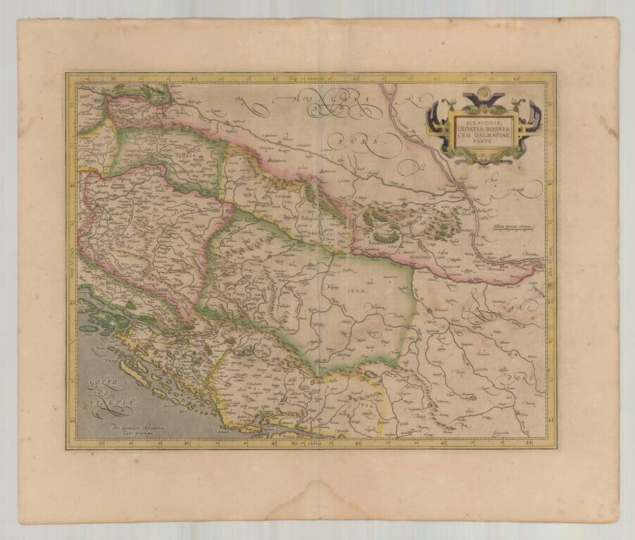
Decorative early map of the Balkans and the Gulf of Venice, with a large decorative cartouche. Finely engraved and highly detailed.
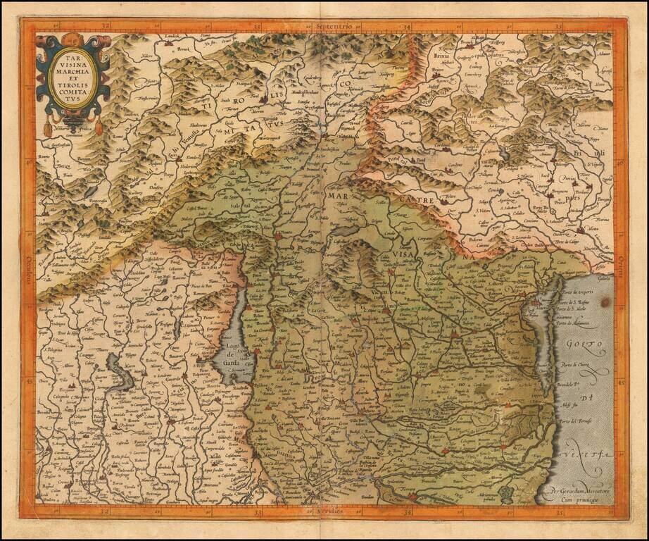
Finely engraved map of Northwestern Italy, published by Gerard Mecator in his Atlas Sive Cosmographia. The map shows the region around the Lago di Garda region in the west to the Lagoon of Venice in the East and North to Tirolia.
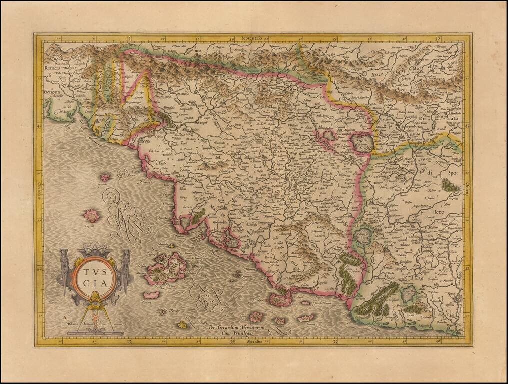
Striking map of Tuscany and surrounding regions, from an early edition of the Mercator-Hondius Atlas Sive Cosmographia. Drawn from contemporary Italian sources, this map is one of the most up to date modern maps of Tuscany printed in the early 17th...
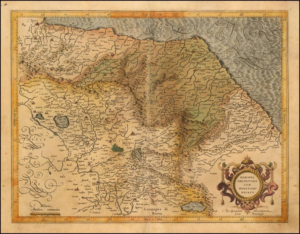
Finely engraved regional map Italy, published by Gerard Mecator in his Atlas Sive Cosmographia. The map extends from Ancona, Ravenna and San Angelo on the Adriatic Coast to Spoleto, Perugia, Tivoli and Lago di Celano
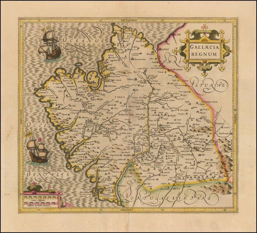
Old Color example of Mercator's map of Gallica. Beautiful map of the northwestern coast of Spain, extending from the Asturias de Oviedo region and Aviles in the northeast to Bayona and the Portuguese border on the south, centered on Santiago di...
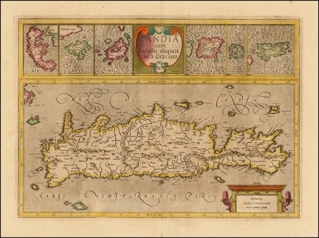
Nice old color example of the true first edition of Mercator's map of Crete and neighboring Greek Islands, from the first edition of Mercator's Atlas Sive Cosmographia. . . . Includes two large cartouches. Nice detail in the map of Crete and the large...
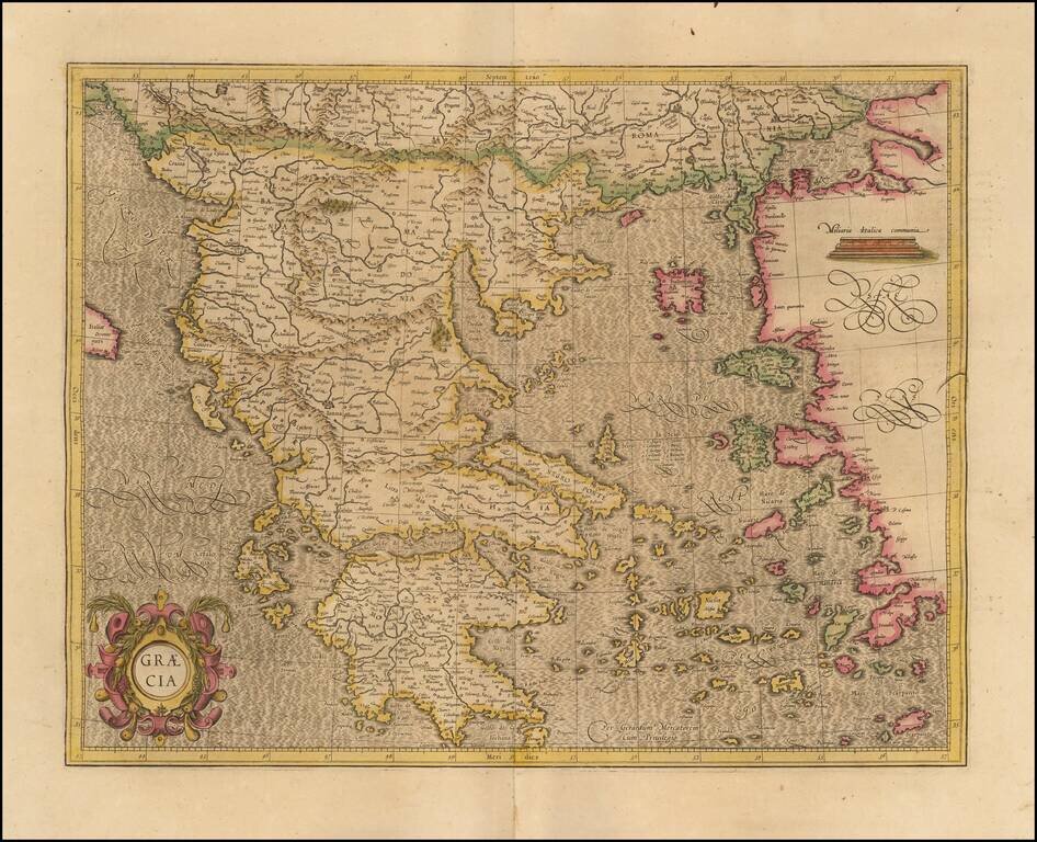
Fine example of Mercator's map of Greece, from an early edition of Mercator's Atlas Sive Cosmographia. The map bears the signature of "Gerardum Mecatorem," on the maps created by Mercator during his lifetime. The map is one of the earliest modern...
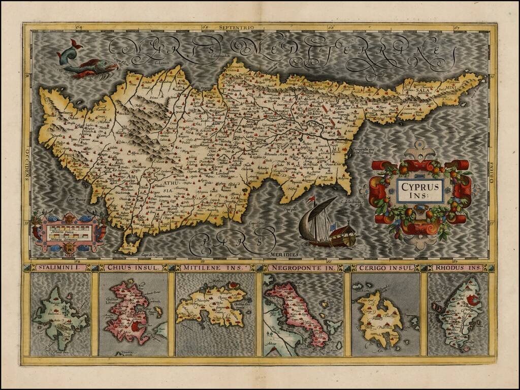
Striking early map of Cyprus, with 6 smaller maps below, showing Stalimini, Chius, Mitilene, Negroponte, Cerigo and Rhodus Islands. A fine example of Mercator's work, with the classic engraving of the sea characteristic of his work. Nice example.
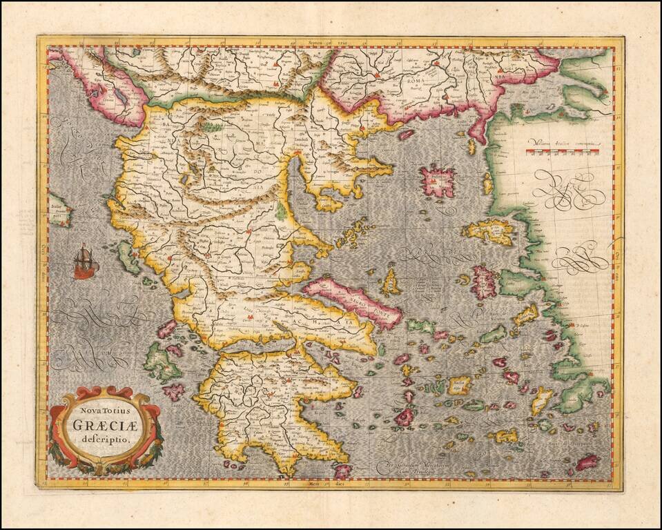
Striking early map of Greece. Decorative cartouche, sailing ship and elaborate engraving style.
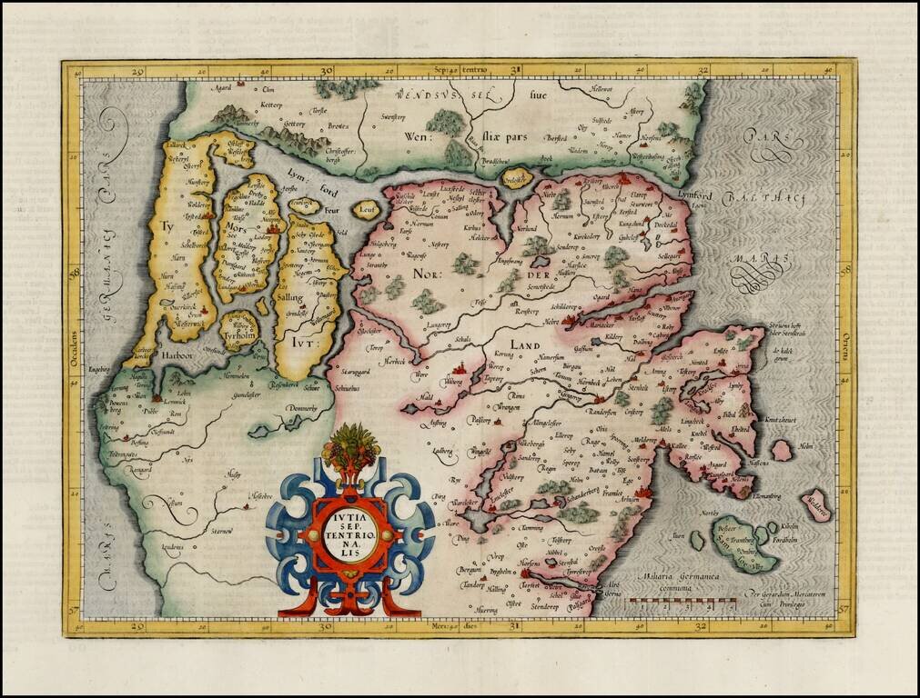
Fine full color example of Mercator's map of the northern part of Jutland, from the first edition of his Atlas Sive Cosmographia.
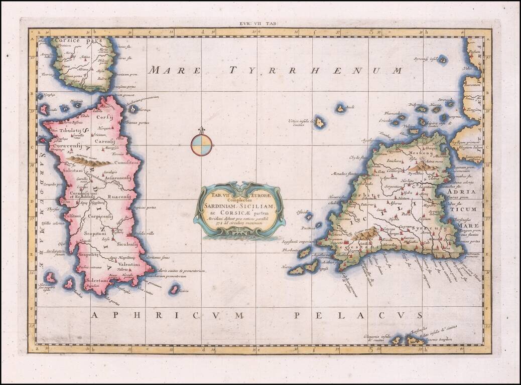
Nice example of Mercator's map of Sicily and Sardinia, from Mercator's edition of Ptolemy's Geographia, first published in 1578 and republished in Amsterdam beginning in 1695. Gerard Mercator published his edition of Ptolemy’s maps as what he...