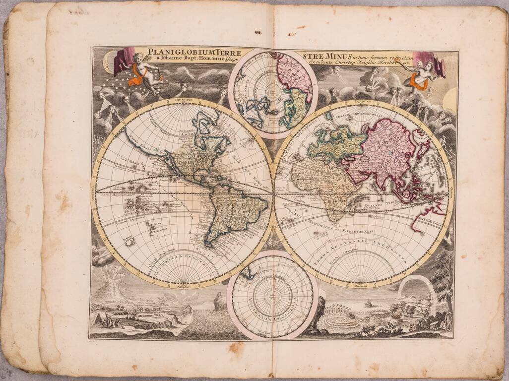
A good example of German historian David Koehler's popular early 18th-century atlas by Nuremberg mapmaker Christopher Weigel, with maps based on models by Homann, Moll, and Goos. Includes a map of the world and continents and 25 regional maps,...
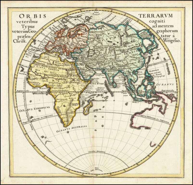
A detailed map of the Eastern Hemisphere, including a detailed depiction of the known coastlines of Australia. Four continents are shown in elegant color. Regions, cities, rivers, and more are all named and many more mountain ranges and features are...
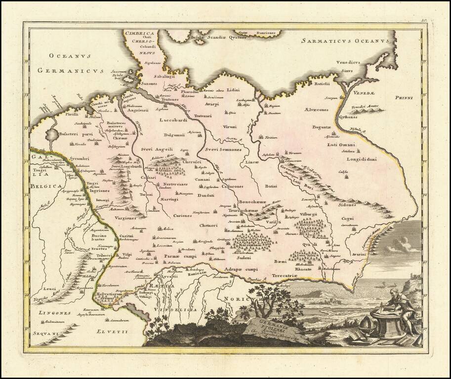
Decorative and highly detailed map of Ptolemaic Germany, extending east to the Vistula and South to the Danube River.
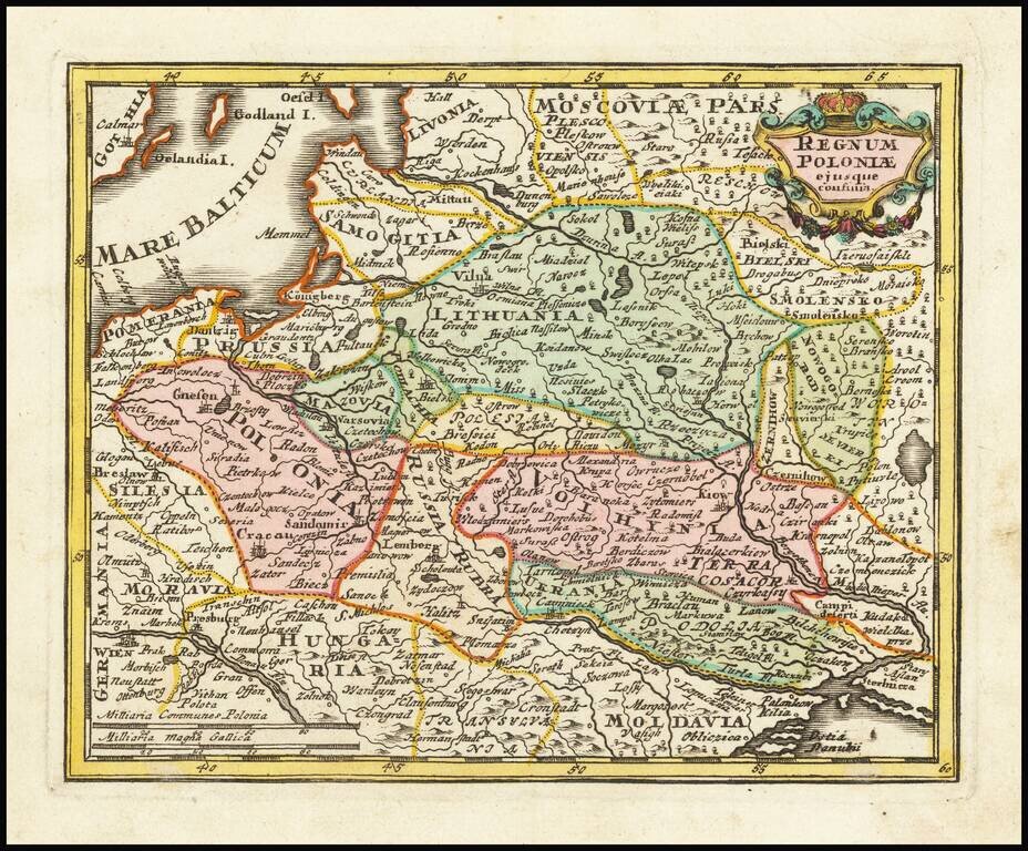
Decorative map of Poland and Lithuania in their grandest configurations, published by Weigel. The map extends from the Baltic to the Black Sea, capturing the details and reach of these then powerful countries at the beginning of the 18th Century. The...
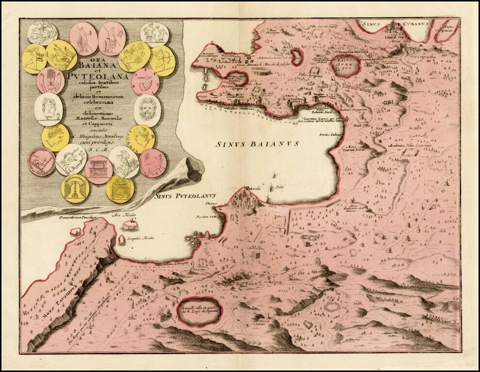
Detailed map the Bay of Naples, with large inset of the city of Puteoli, graphically depicted. In the first century, Puteoli was a mercantile outpost of Rome and one of the major trading ports of the Mediterranean. The map is beautifully engraved to...
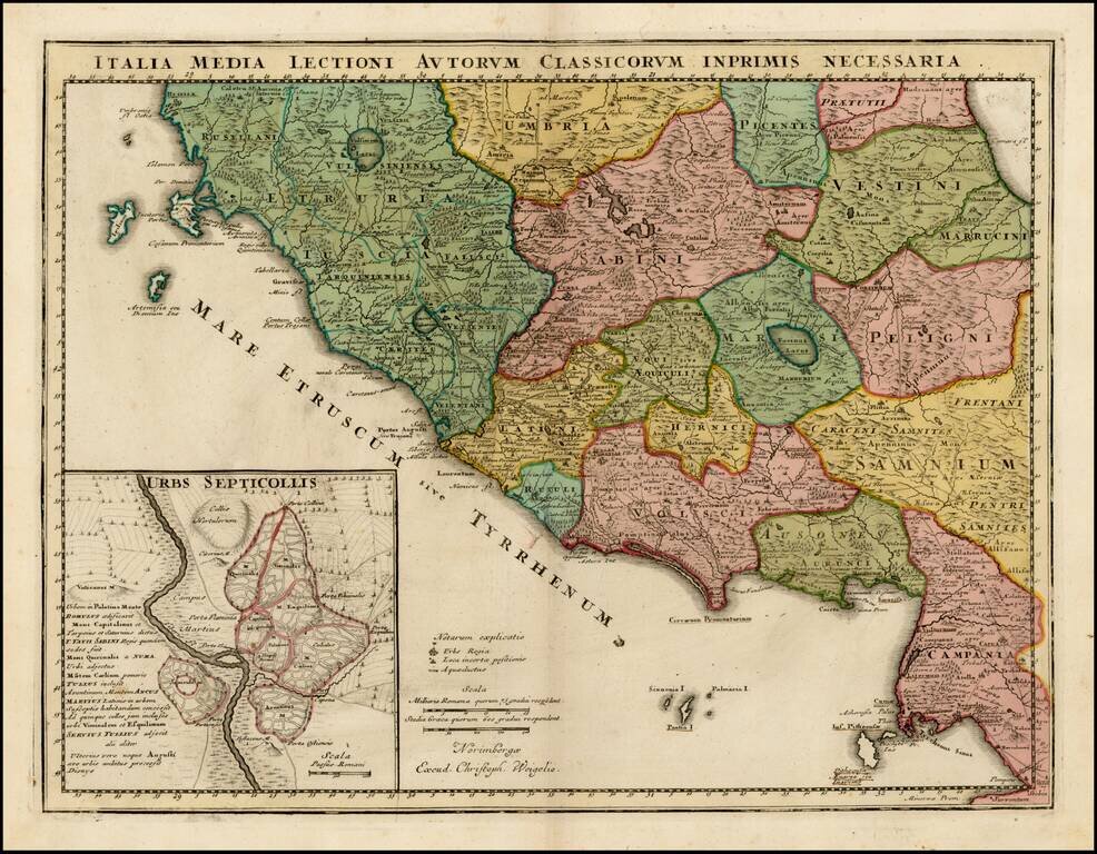
Detailed map of Central Italy in the Etruscan era. The map is divided into early regions, with Rome referred to as "Septicollis." Many early roads are illustrated.

Fine map of the Ottoman Empire, published in Nuremberg by Christopher Weigel. Includes a decorative allegorical cartouche.
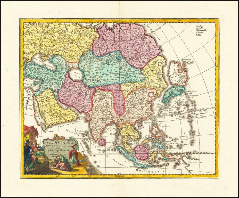
Fine map of Asia, published in Nuremberg by Christopher Weigel. At the top left, there are a list of major religious groups. It is likely that the intent was to color code the map by religious groups, but this apparently did not happen. Includes a...
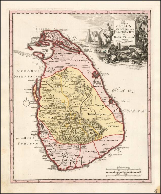
Rare modern map of Sri Lanka (Ceylon), published by Weigel in Nuremberg. The map credits Philips Baelde and Adrian Reland. Philips Baelde or Father Philippus Baldaeus was a Dutch minister. He went to Jaffna during the Dutch period in Ceylon with an...
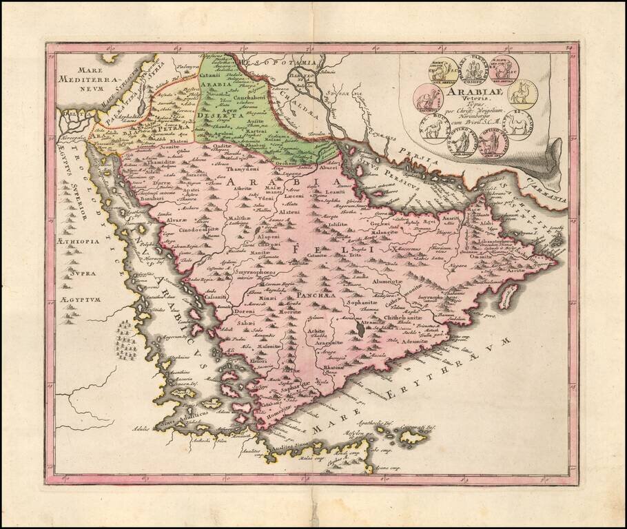
Striking map of the Arabian Peninusla featuring the geographical features known to the ancients and decorated with a vignette and 9 medallions. An interesting and highly decorative map.
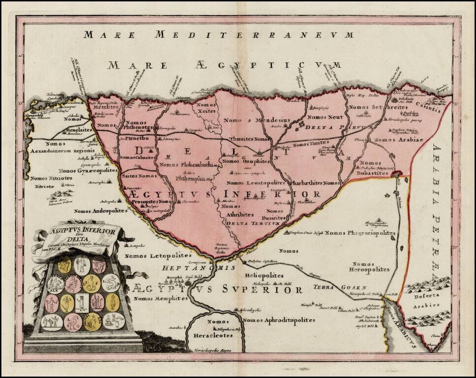
Detailed map of the Lower Part of Egypt, embellished with a cartouche illustrating 16 early Egyptian Coins. Provides a large format look at the Nile Delta, extending south the area near Memphis, Goshen, Nilopolis and Heracleopolis.
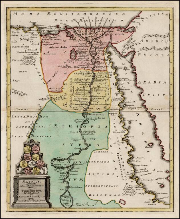
Detailed map of Egypt, embellished with a cartouche illustrating 11 early Egyptian Coins. Provides a fine image of Egypt and the Red Sea, extending south the Astaboras River.
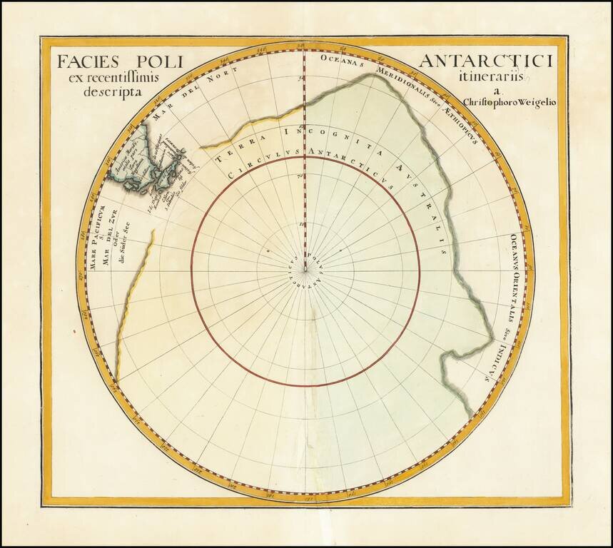
Interesting and nearly completely conjectural map of the South Pole from Davide Kohler's Descriptio Orbis Antiqui…published by Weigel in 1720. The map shows the prevailing belief in a massive southern hemisphere, which extended to just south of the...
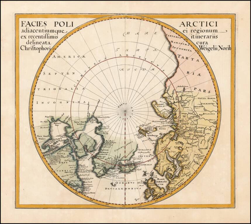
Interesting map of the North Pole from Davide Kohler's Descriptio Orbis Antiqui…published by Weigel in 1720. The map shows the prevailing belief in a massive northern hemisphere, extending to Alaska, Canada, the British Isles, Scandinavia and...