Robert Sayer (ca. 1724-1794) was a prominent London map publisher. Robert’s father was a lawyer, but his older brother married Mary Overton, the widow of prominent mapmaker Philip Overton and the proprietor of his shop after his death. Mary continued the business for roughly a year after her marriage and then, in early 1748, it passed to Robert. Robert became a freeman of the Stationers’ Company later that year; his first advertisement as an independent publisher was released in December.
Sayer benefited from Overton’s considerable stock, which included the plates of John Senex. In the 1750s, Sayer specialized in design books and topographical prints, as well as comic mezzotints. In 1753, he, along with John Roque, published a new edition of Thomas Read’s Small British Atlas, the first of several county atlases that Sayer would publish.
Sayer’s business continued to grow. In 1760 he moved further down Fleet Street to larger premises at 53 Fleet Street. In 1766, he acquired Thomas Jefferys’ stock when the latter went bankrupt. In 1774, he entered into a partnership with John Bennett, his former apprentice. The pair specialized in American atlases, based on the work of Jefferys. They also began publishing navigational charts in the 1780s and quickly became the largest supplier of British charts in the trade.
Bennett’s mental health declined, and the partnership ended in 1784. As Sayer aged, he relied on his employees Robert Laurie and James Whittle, who eventually succeeded him. He spent more and more time at his house in Richmond. In 1794, he died in Bath.

The First National Atlas of the United States. The Exceptionally Rare 1783 Edition of Jeffery’s American Atlas. Thomas Jefferys' American Atlas was one of the four great atlases of the Colonies available during the Revolution - along with Faden's...
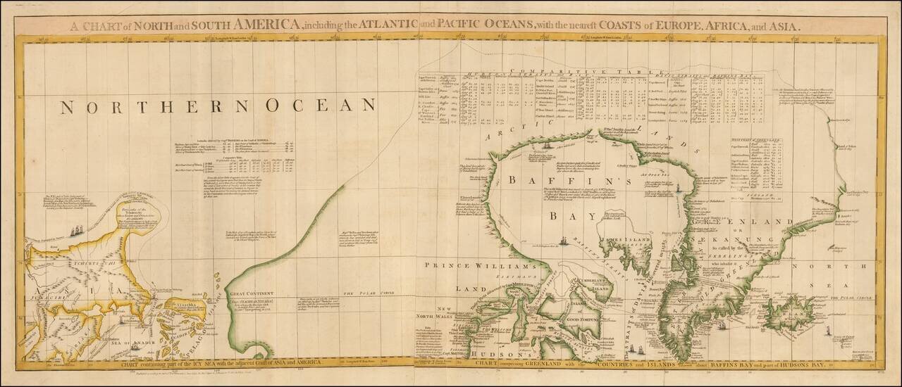
One of the Most Detailed and Important Map of the Americas made by a Scandalous Geographer This is a nice example of the northernmost sheets of 1775 edition of this important six sheet chart of North and South America, originally compiled by John...
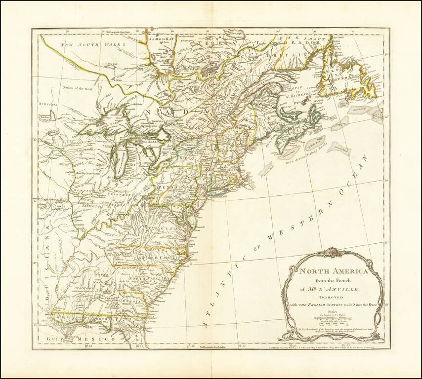
The third state of Jefferys map of the British Colonies, based upon D'Anville's map. This third state was issued after the conclusion of the French and Indian War. The map shows the Colonies on the eve of the American Revolutionary War. A note in the...
![The Theatre of War in North America, with the Roads and a Table of the Distances [with] A Compendious Account of the British Colonies in North-America.](/map/small/43988.jpg)
Nice example of the rare first state of Sayer & Bennett's Broadside Map and Account of the War in North America, one of the first widely distributed news accounts of the American Revolution in Great Britain. Following a brief peace attempt between...
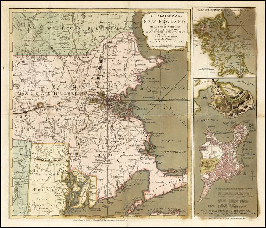
Important early broadside map and plan of the Battle of Bunker Hill and the area around Boston, published by Sayer & Bennett, in London in 1775. Sayer & Bennett's map of the Seat of War is one of the two earliest pictorial accounts of the...
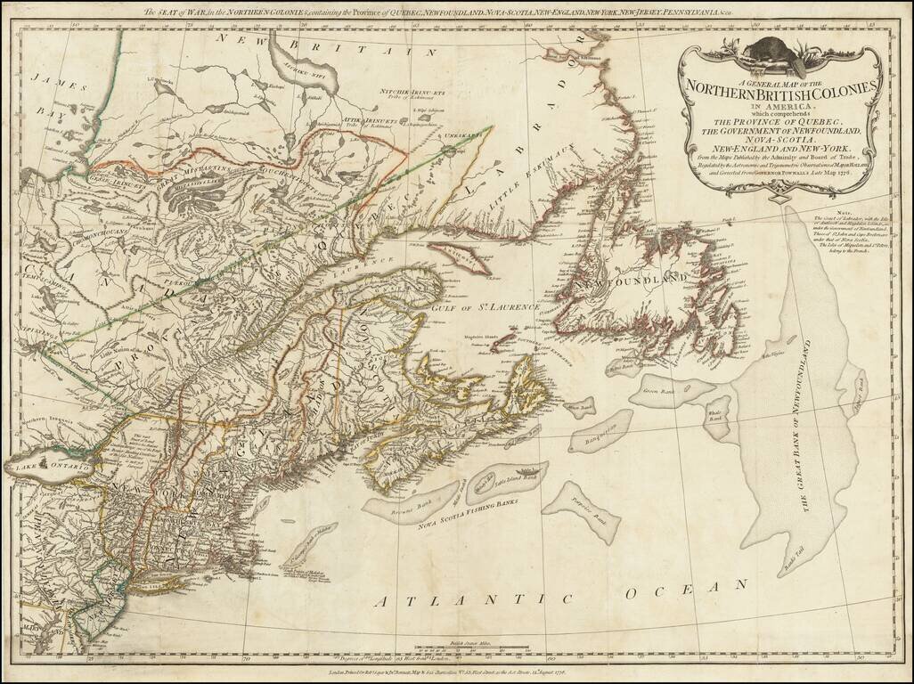
A scarce "Holster Atlas" edition of Sayer and Bennett's highly important map of New England and eastern Canada at the start of the American Revolution. This edition of the map was prepared specifically for the American Military Pocket Atlas, an atlas...
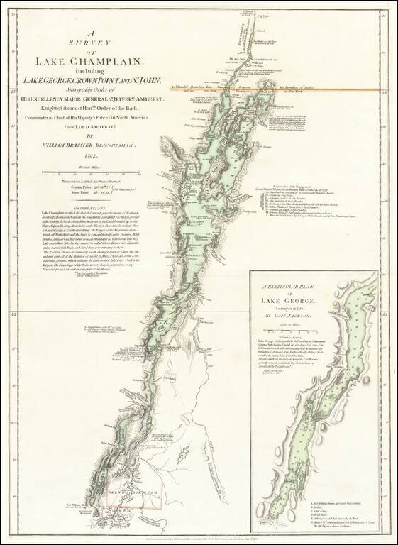
An Important Revolutionary War Period map of Lake Champlain & Lake George, based upon William Brassier's survey of the region during the French & Indian War. Sayer & Bennett's map is the first separately published map to focus on Lake...
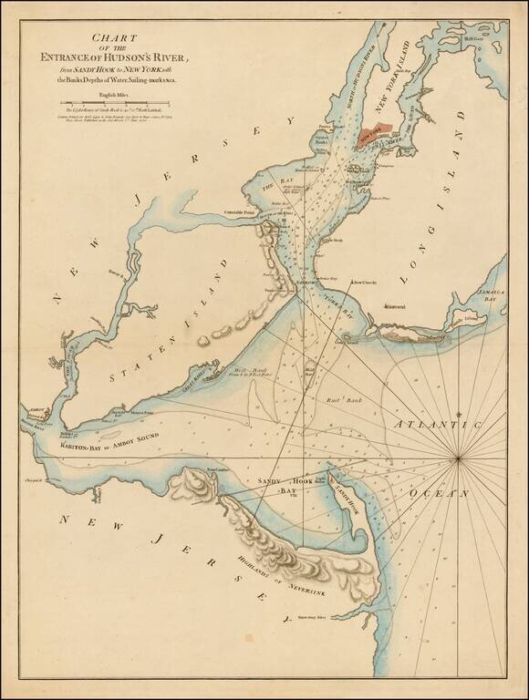
First state of this rare sailing chart of the area around New York Harbor and Long Island, which was issued separately and in the first edition of Sayer & Bennett's North American Pilot. This finely detailed chart is centered on Staten Island,...
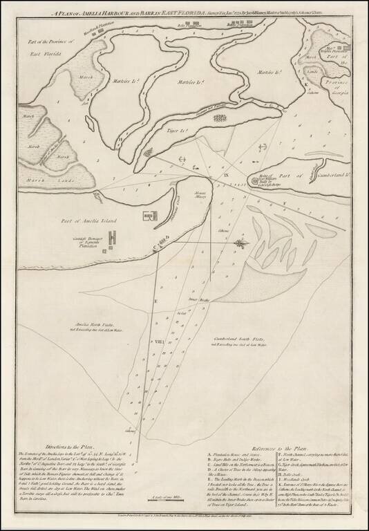
A Revolutionary War Florida Rarity. Fine wide margined example of Sayer & Bennett's chart of Amelia Harbor and Bar, based upon a survey conducted under the direction of Jacob Blamey in January 1775. The map is oriented with west at the top. On...
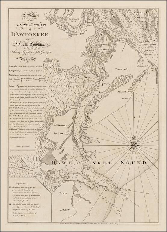
Highly detailed sea chart of the area around Hilton Head, South Carolina, based upon a survey by Captain John Gascoigne. Gascoigne's finely engraved chart was produced at the beginning of the American Revolution, at a time when the outcome among the...
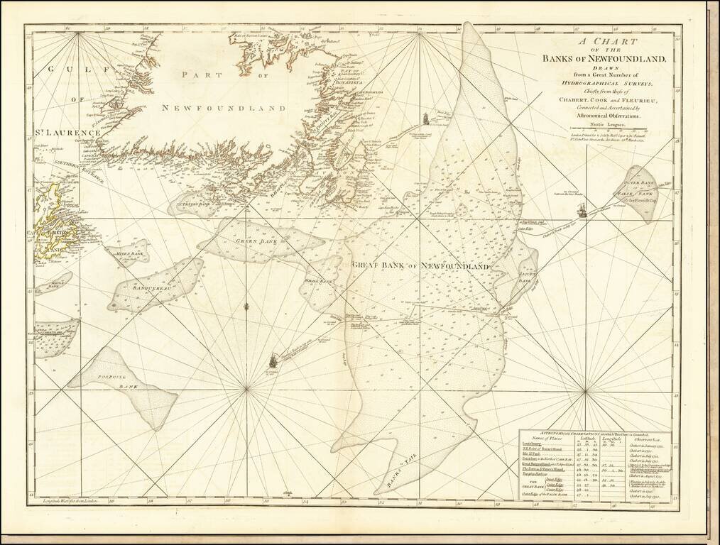
Detailed map of Newfoundland the Grand Banks, published in Jeffery's American Atlas. The map includes three ship illustrations representing the voyages of Chabert, Cook and Fleurieu, inset of astronomical observations on which the chart is based, as...
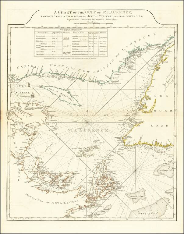
Fine example of Sayer and Bennett's chart of the Gulf of St. Laurence, based on the surveys by James Cook and Michael Lane. At the conclusion of the French and Indian War, the British needed accurate charts of the territories that had been awarded to...
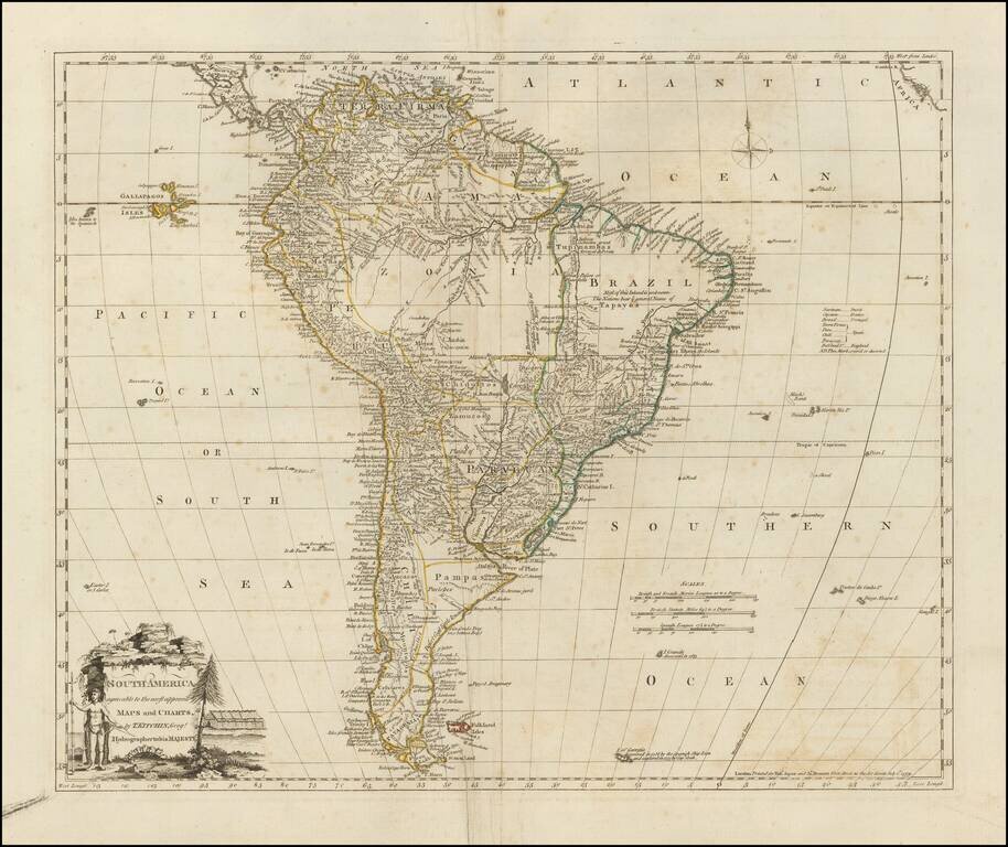
Detailed map of South America, drawn toward the end of Spain's colonial empire. Includes the Galapagos Islands and "Isles know to the Spaniards." A scarce early edition.
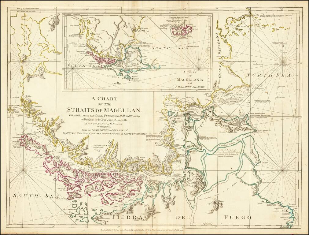
Nice example of this detailed map of the Straits of Magellan on continuous regions, prepared from the recently completed map of Juan de La Cruz Cano & Olmedilla and Hiolito Ricarte. Cruz Cano's eight-sheet map of South America, much like the...
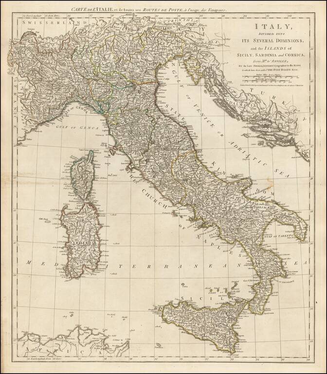
Detailed late 18th Century Postal map of Italy, Sicily, Corsica and Sardinia, with contiguous regions. Title also given in French.