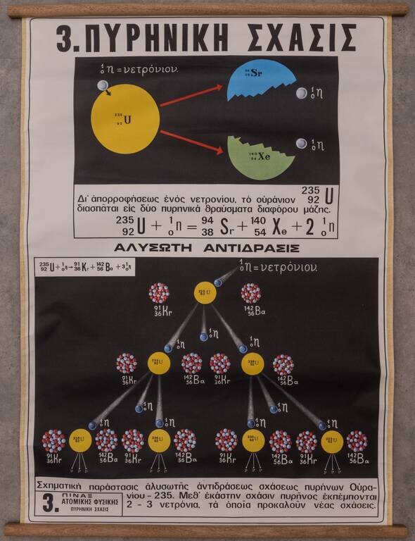
Interesting Greek-language didactic chart showing the process of nuclear fission for Uranium 235. The image above shows Uranium 235 splitting into Xenon and Strontium. The diagram at the bottom ("ΑΛΥΣΩΤΗ ΑΝΤΙΔΡΑΣΙΣ", i.e., "Chain...

A Manual for Recording Scientific Observations while in Lunar Orbit An extremely rare Apollo 13 visualization guide for astronauts while they were in lunar orbit, detailing the lunar features they would see, and the scientific observations they should...
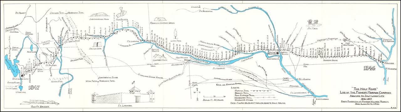
Rare historical / pictorial map of the Mormon Route from Navoo to Salt Lake, drawn by Robert A. Hanson. The map was likely published by the Western Cover Society, a California based society which published the Western Express. Hanson's maps were...
![[Lake Tahoe - Sierra Nevada - Gold Country] Scenic Highways](/map/small/63009.jpg)
Decorative map promoting tourism in the Western Sierra Nevada Mountains. The map is centered on California Highway 88, from Stockton to Genoa on Lake Tahoe, extending from Auburn and Lake Tahoe in the north to Angel's Camp in the South. The map is...
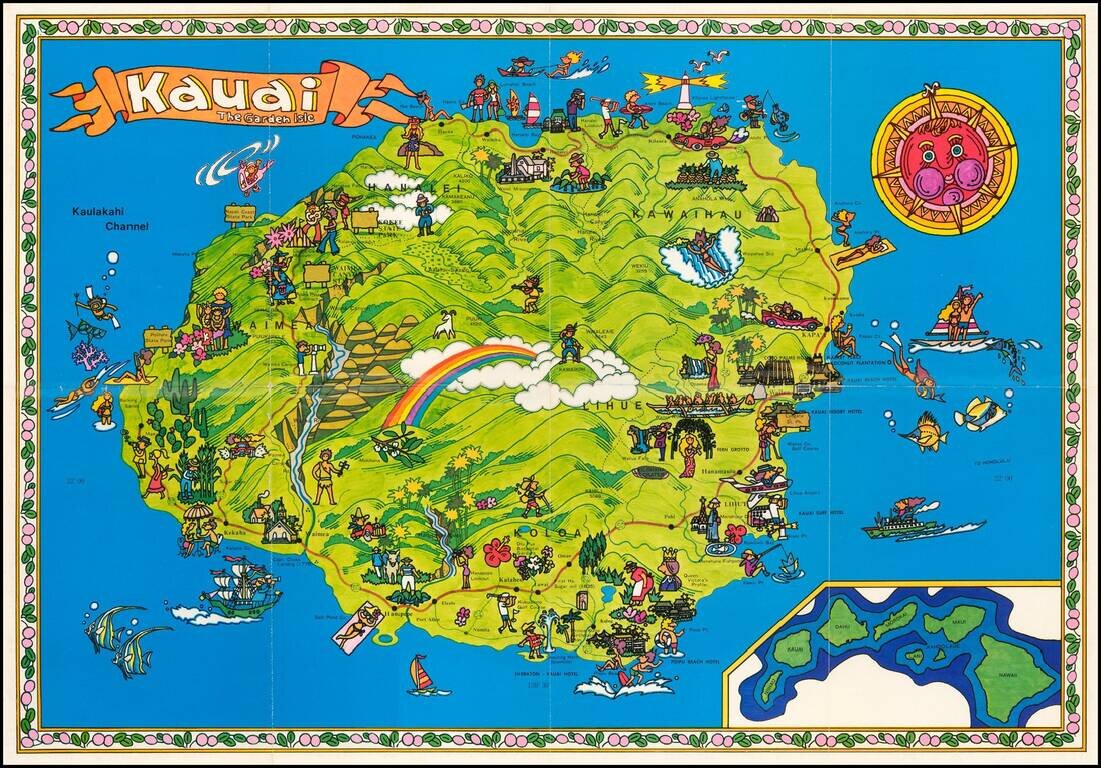
Whimsical promotional map of the Garden Island of Kauai in vivid colors. On the back of the map is a more conventional map of Kauai with insets of key cities. We have not previously seen or offered this map.
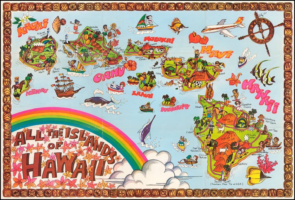
Whimsical promotional map of Hawaii in vivid colors. We have not previously seen or offered this map.
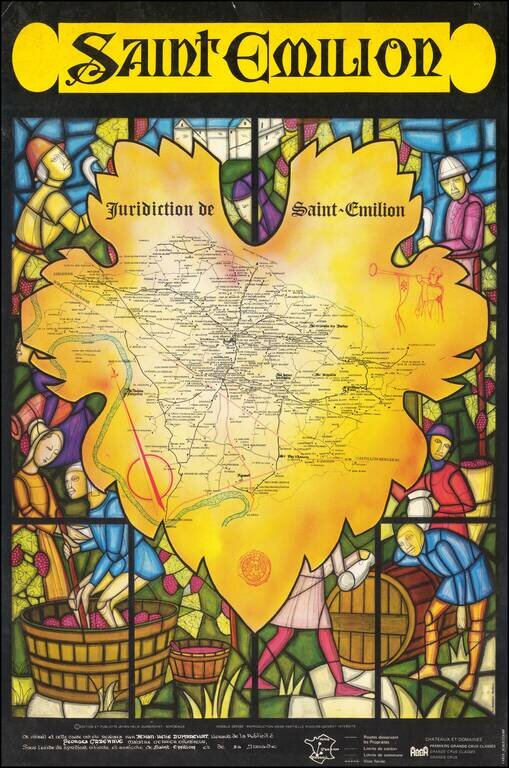
Striking wine map of the Saint-Emilion region, surrounded by a medieval stained glass image of wine making. The map was issued as a promotional map for Viticulture and Agricultural Syndicate of Saint-Emilion.
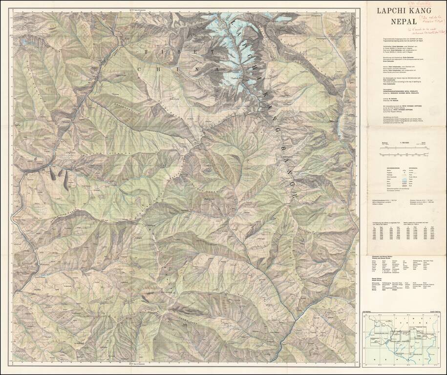
Scarce separately published map of Tibet and a section of Chinese Tibet. The map credits Peter Aufschnaiter as one of its makers. Peter Aufschnaiter (1899 - 1973) was a Tyrolean mountaineer, agricultural scientist, geographer, and cartographer. His...
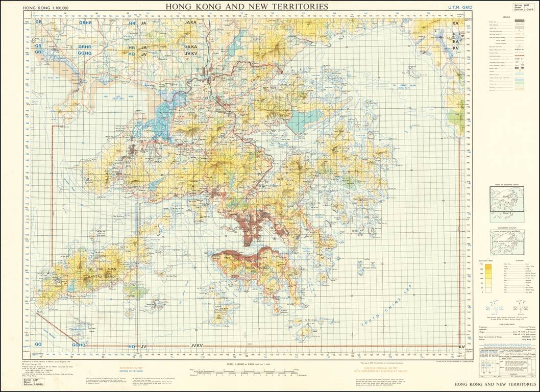
Scarce United Kingdom Ministry of Defence map of Hong Kong and New Territories. Published by the MOD in 1970 based on surveys from 1957 and 1968-69. Built-up areas, "squatter areas", areas under construction, topography, roads and tunnels, railroads,...
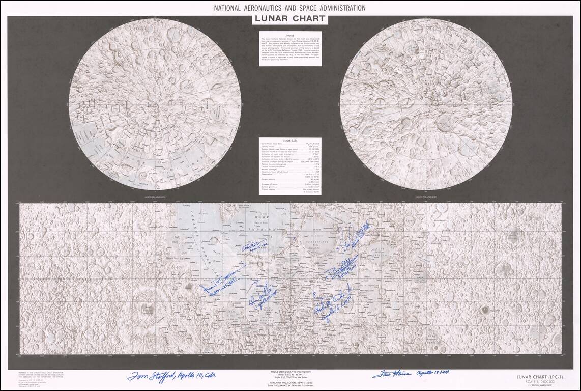
Signed By Eight Apollo Astronauts Double hemisphere map of the moon and chart showing landing/lunar surface exploration sites, published by NASA in 1970. Color lithographed moon map with two stereographic projections of the North and South poles. The...