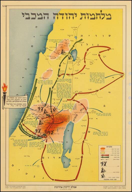
The map describes the story of Chanukah and the battles that the Maccabees fought to gain back their freedom. The Maccabees and the militants attacked each other from various hidden positions in the forests and hills of the region. The key at the...
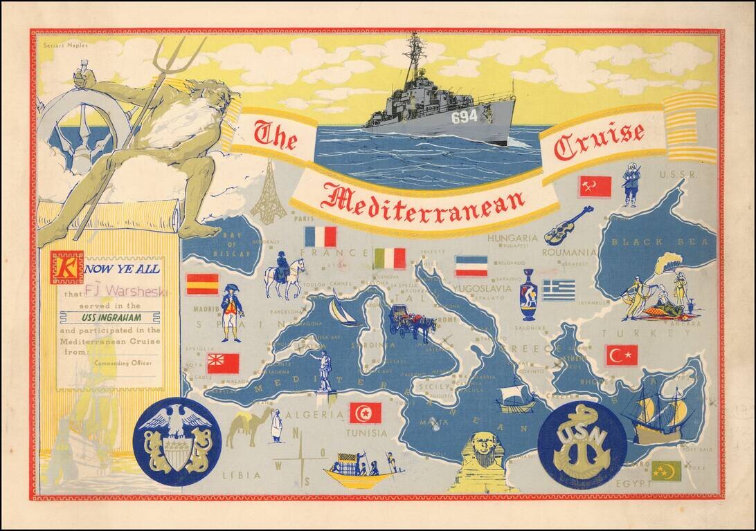
Decorative placemat map, given away aboard the USS Ingraham.
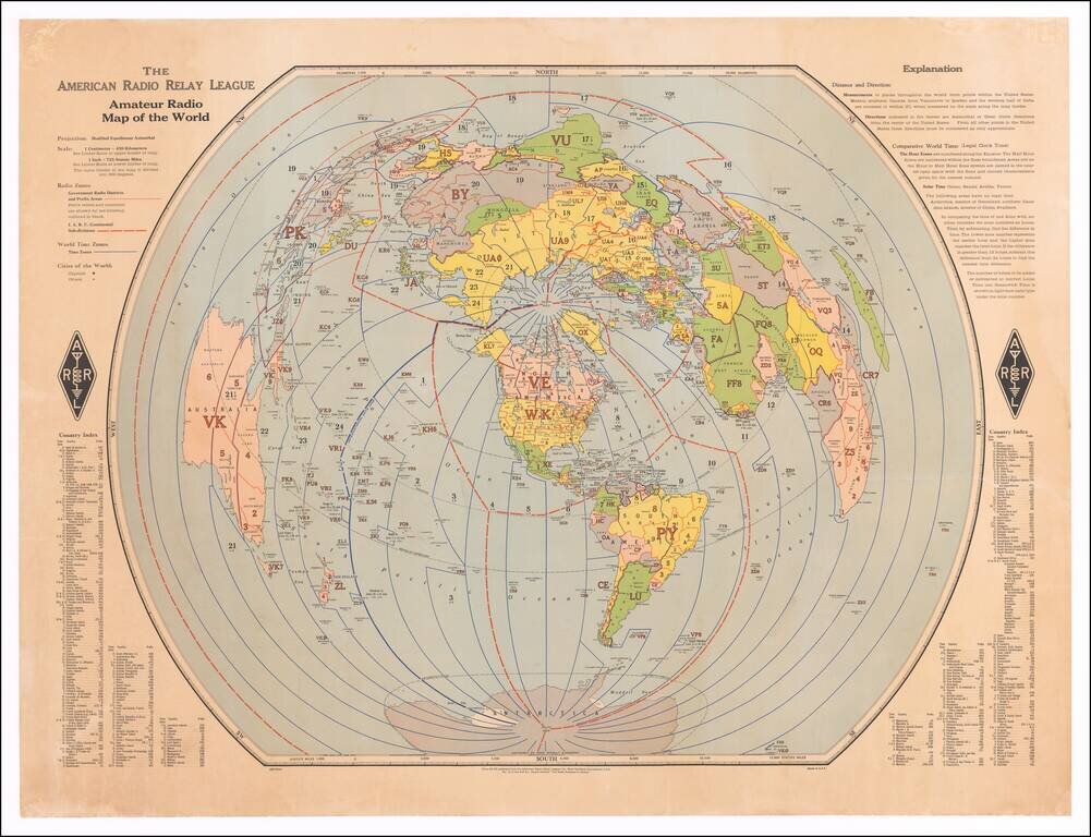
Finely executed map of the world, centered on the polar areas on a modified equidistant Azimuthal projection. Shows capital cities and major cities of the world, government radio districts and prefix areas, I.A.R.U. continental sub-divisions, I.T.U....
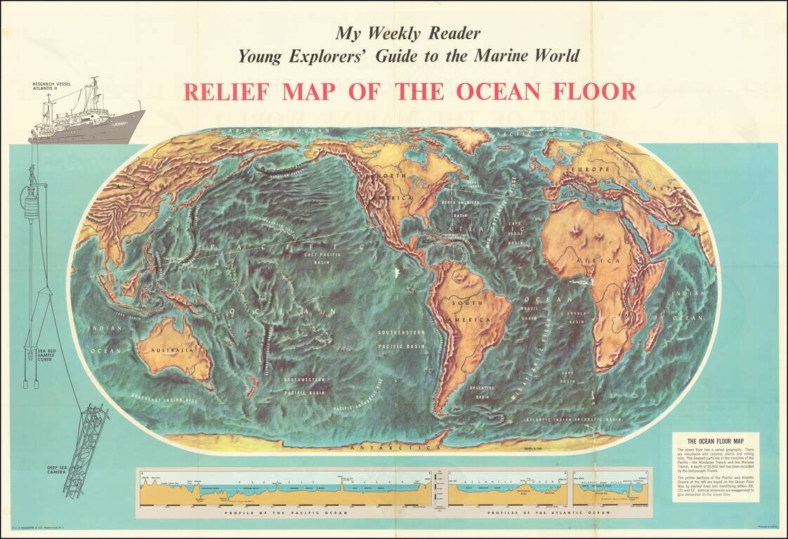
Fascinating map of the ocean floor, illustrating the topography of the seabeds for "Young Explorers". The map was issued as a supplement to My Weekly Reader, issued shortly after the expedition of the Bathyscaph Trieste to survey to survey the ocean...
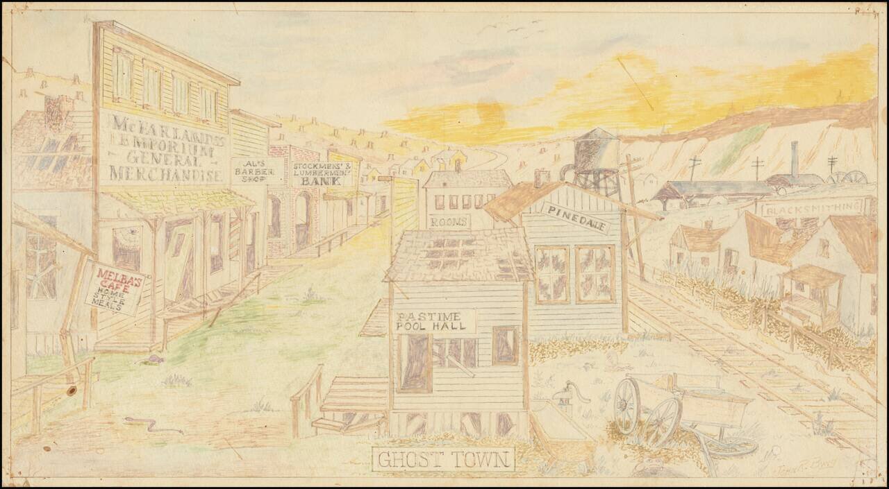
Quaint mid-century drawing of a fantasy Western Ghost Town by John R. Byng. Byng apparently made a number of these kinds of drawings of imagined urban scenes.
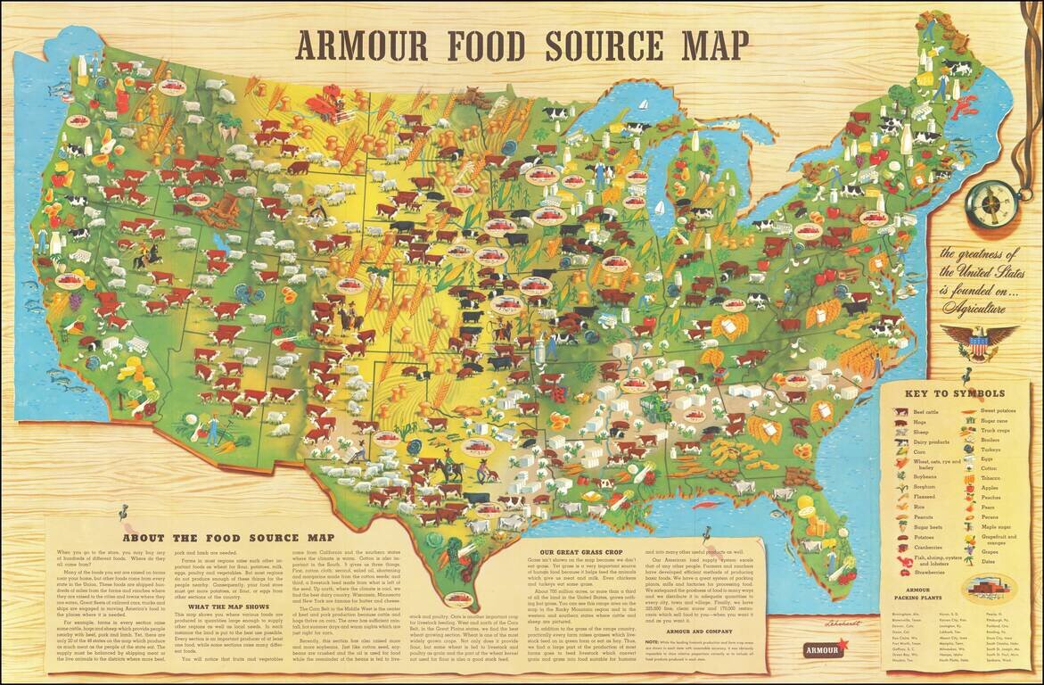
Scarce promotional map published by Armour & Company, displaying and illustrating the agricultural regions of the United States. This is the second of Armour's food maps, updated from the 1922 edition. It includes a lengthy text explanation of...
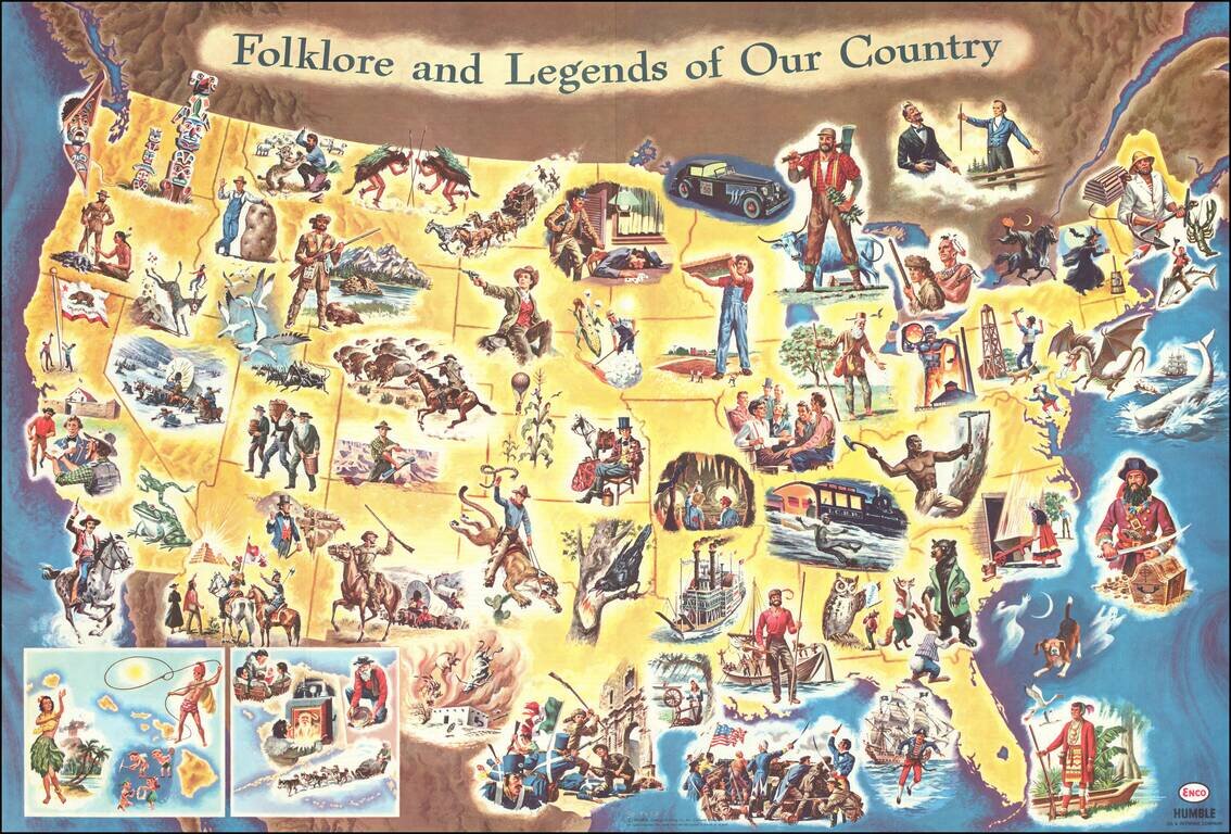
Interesting pictorial / gasoline map of the United States, illustrating on a state by state basis great events in American History. The map is geared toward children, providing a lively and sometimes politically off-color look at America's history....
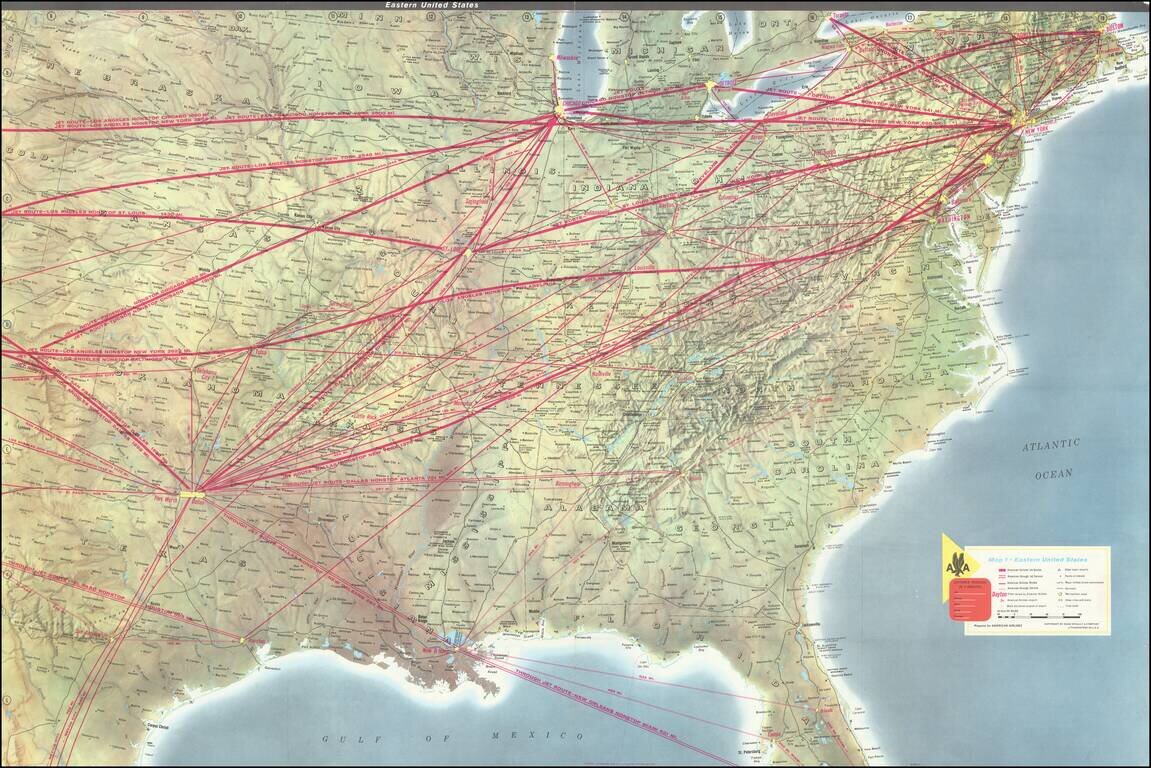
Striking example of this American Airlines promotional map, introducing the upcoming launch of Stage II of the 707 Astrojet. First introduced in 1959, the Boeing 707 "Astrojet" would become the backbone of commercial aviation. The present map was...
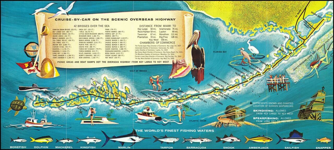
Decorative promotional map of the Florida Keys. The entire Overseas Highway from Key Largo to Key West appears, embellished with recreation and sport fishing illustrations. The map labels Key West, Marathon, etc. In the bottom margin there are...
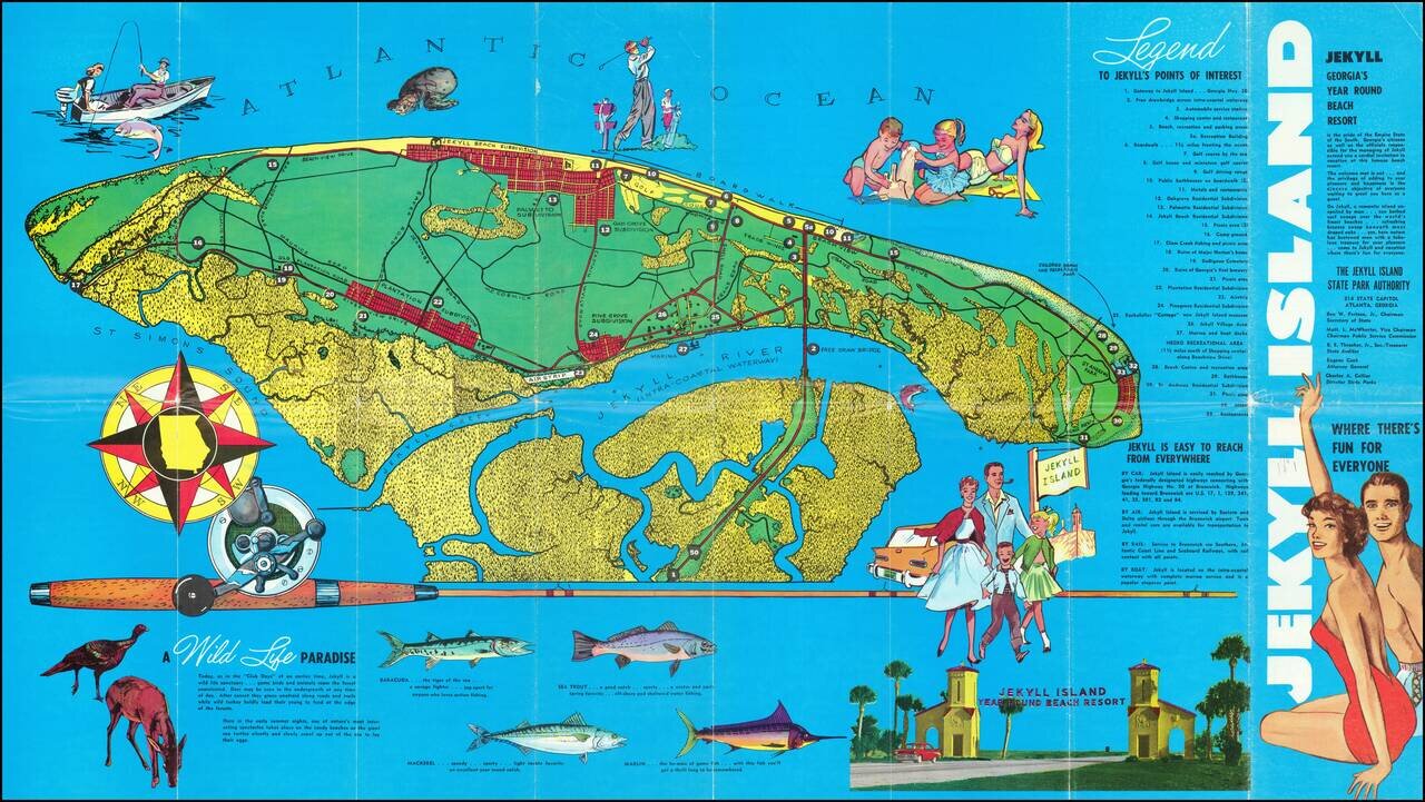
Pictorial map of Jekyll Island, Georgia, illustrating the island and its recreational activities. The map highlights the island's fishing, wildlife and golf activities, with photos on the verso.
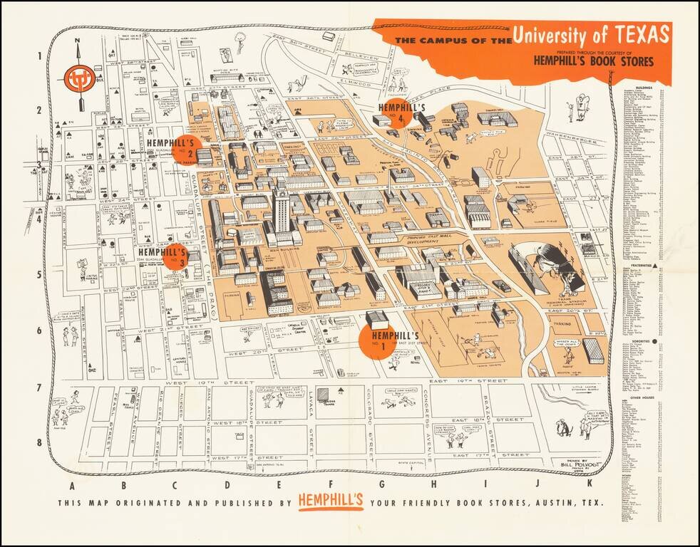
Whimsical map of the campus of the University of Texas at Austin, published in Austin by Hemphill's Bookstore. The map provides a fun-filled look at the University of Texas circa 1960. It shows the location of a new Hemphill’s book store and...
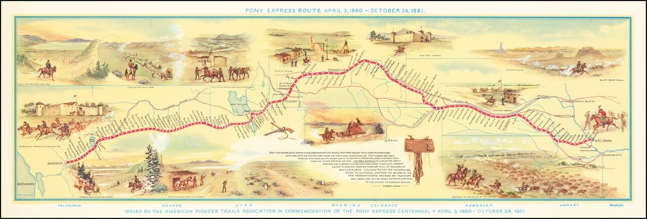
Fine pictorial map of the Pony Express Route, issued by the American Pioneer Trails Assocation in to commemorate the Centennial of the Pony Express. As noted by David Rumsey: Shows route of Pony Express with names and location of relay stations....
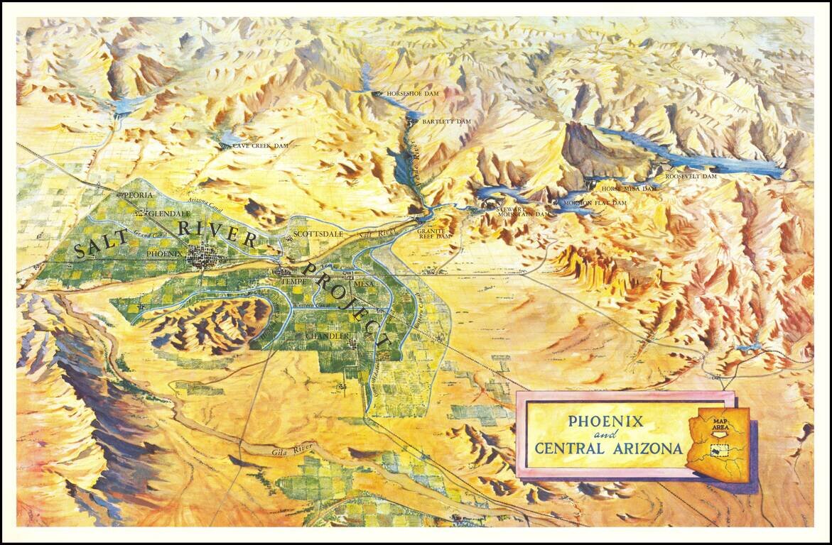
Scarce birdseye view style map of the area around Phoenix, highlighting the Salt River Project and the lands irrigated by the various canals in the area. The map shows a number of important early dams, including: Granite Reef Dam (built 1906-1908)...
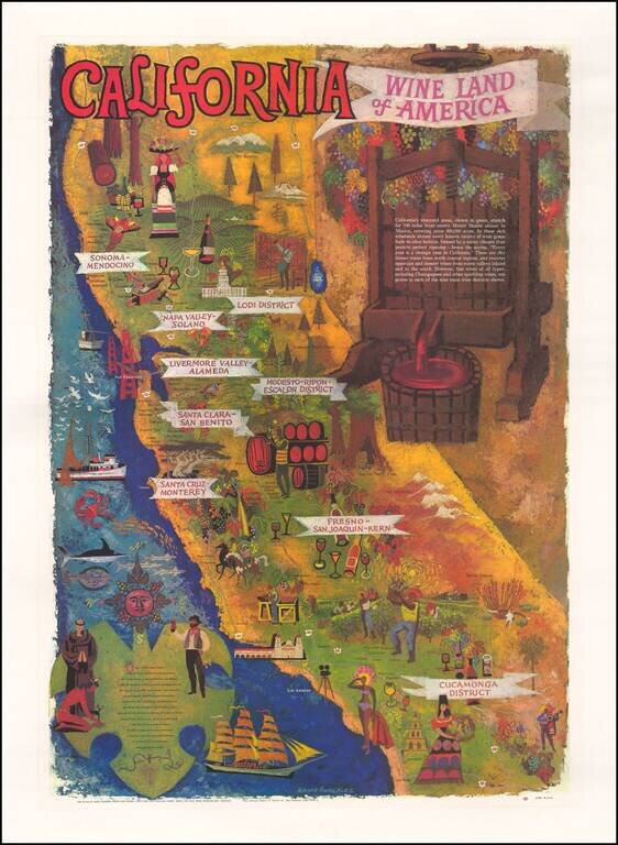
Striking map of California, prepared by the Wine Advisory Board to promote California wines. Includes a lively depiction of California's growing regions, with vignettes intended to illustrate the towns and characteristics of the various regions. The...
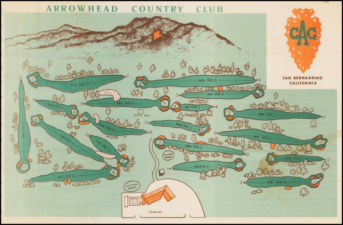
Decorative pictorial style map, showing the golf course and the San Bernardino mountains in the background, including the famous Arrowhead on the mountain. Having grown up in Rialto, I can say with confidence that the Arrowhead, while very clear on...
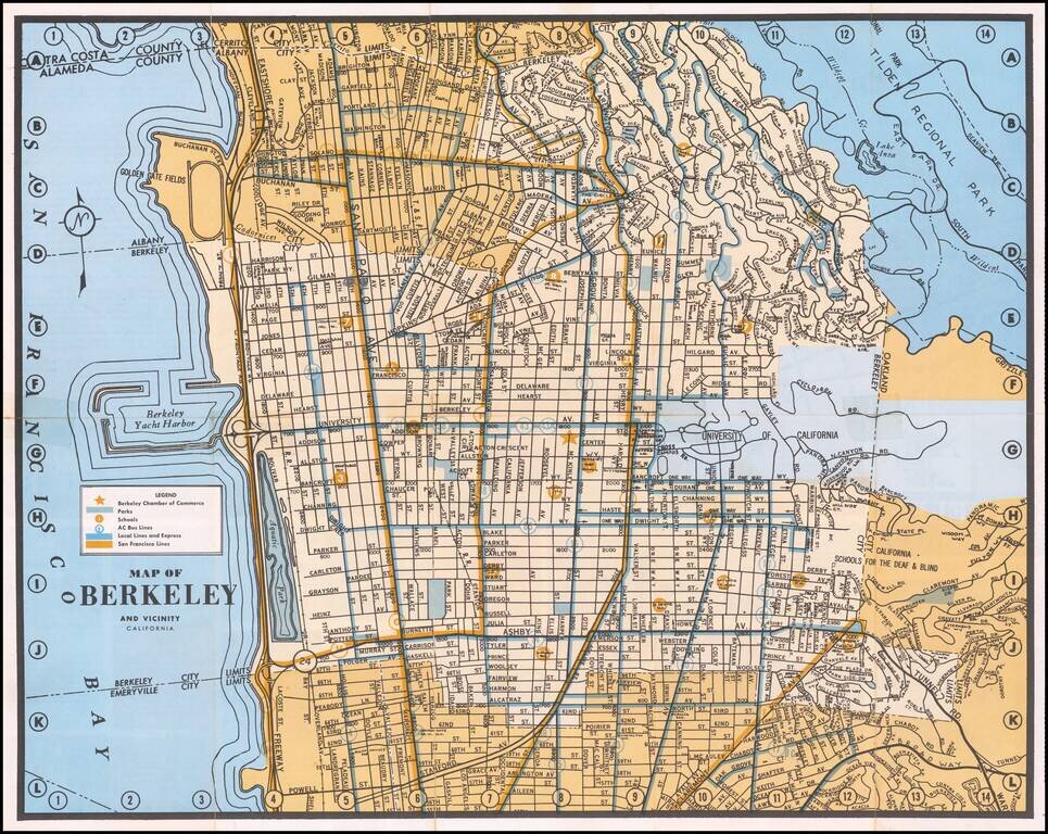
Detailed map of Berkeley, with emphasis on public transit and public works. The map locates the Chamber of Commerce, Parks, Schools, AC Bus Lines, Local and Express Bus Lines and San Francisco Bus Lines.