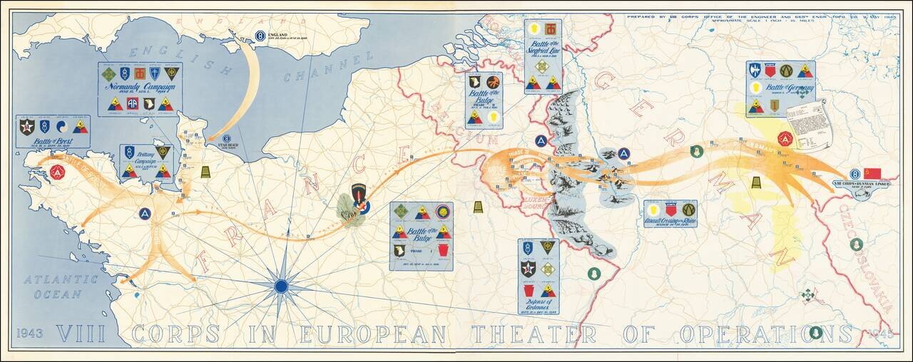
Superb map of the actions of VIII Corps, US Army, from 1943 to 1945. The map was prepared by VIII Corps Office of the Engineer and 665th Engr. Topo. Co. on the 9th of May 1945. The map, which stretches from Normandy to Czechoslovakia, lists the...
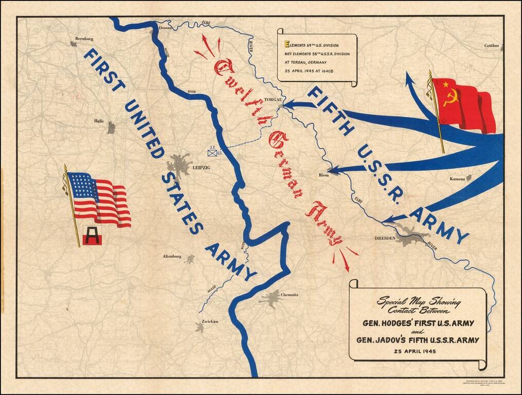
A Map Celebrating Elbe Day -- World War II Fine thematic map showing the progress of the American and Russian Forces against the last remnants of the German Army, published on Elbe Day. The two forces are shown moving toward each other, superimposed...
![(Second World War - Eastern Front) [The Soviet Encirclement of Konigsberg]](/map/small/65659.jpg)
Color-printed German map of East Prussia, with extensive manuscript additions in a Soviet hand noting the troop movements during the East Prussia Offensive and encirclement of Konigsberg. The Red Army movements are shown in red pencil, Wehrmacht...
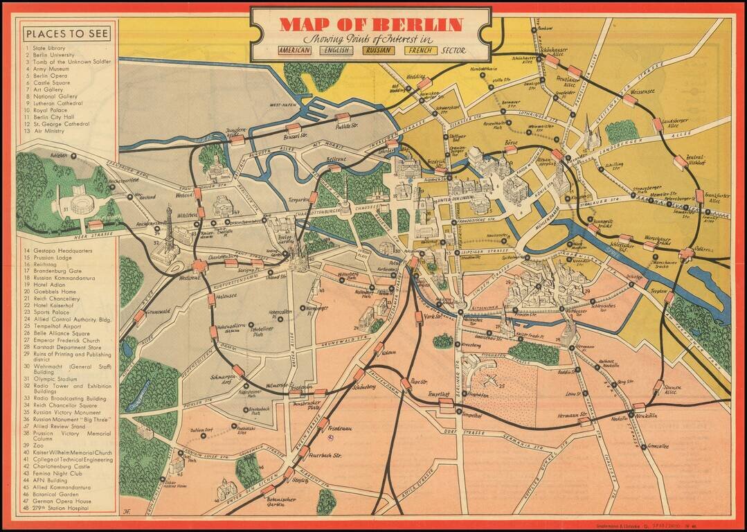
An attractive vintage pictorial map of Berlin during the earliest days of Allied occupation, preserving a rare view of the city prior to the building of the Berlin Wall. The front of the work depicts the heart of Berlin and its surroundings, stretching...
![[Battle of Berlin] План г. Берлин 1:25000](/map/small/68524.jpg)
"The Victory Map". The Official Soviet Map Used in the Battle of Berlin, April 1945. This is a color-printed folding map of Berlin, issued by the Soviet Union in 1945, shortly before the Fall of Berlin. Many examples of this map were used by...
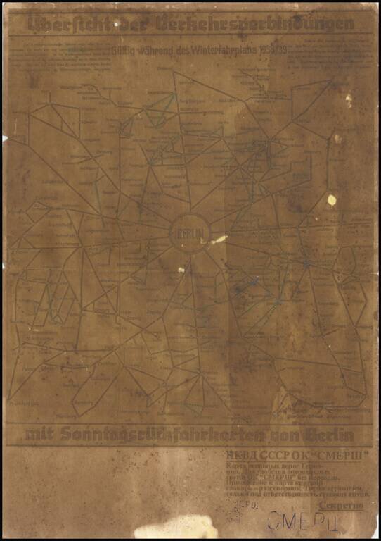
A fascinating relic of mapmaking on the Eastern Front of World War II, being a field-printed map of Berlin and the surrounding area produced for one of the most infamous groups involved in the Second World War, the Отдел Контрразведки...

Czech-Published Map Celebrating the Victories of the 575th Motor Ambulance Company, Published in Pilsen in 1945. Fascinating separately issued map of Western Europe focusing on the movements and exploits of the American 575th Motor Ambulance Company,...
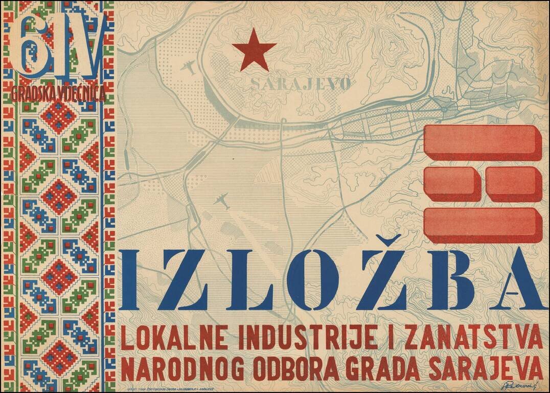
Decorative poster-map of Sarajevo, Bosnia, made at the end of World War II in order to advertise and promote local industry. The print was made by a prominent Bosnian artist Roman Petrović (1896-1947), schooled in Cracow, Budapest and Paris before...
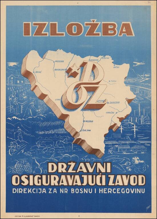
Decorative poster-map of Bosnia, made at the end of World War II in order to advertise and promote the region. The map shows recreational activities, farming, agriculture, domestic life, blacksmithing, commerce, industry and transporation.
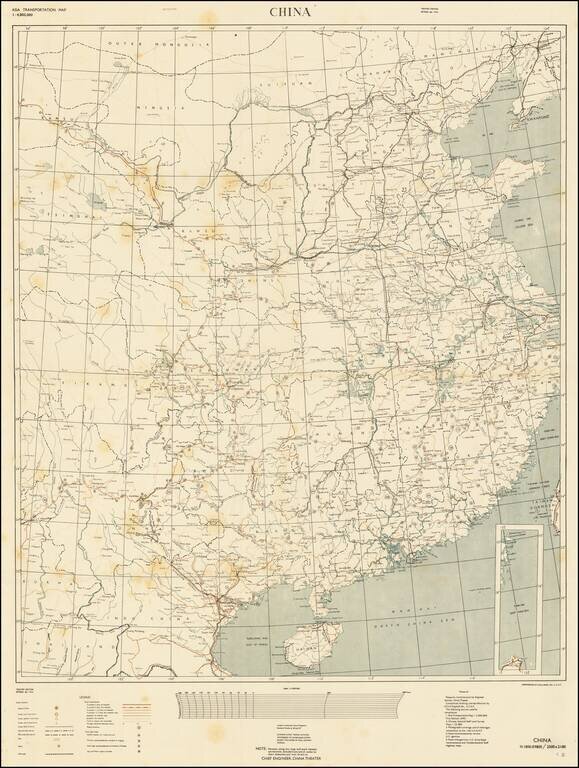
RESTRICTED - U.S. Military Mapping of China During the Final Stages of the Second World War. Color-printed separately issued map of China, part of the "Asia Transportation Map" Restricted series. This is the "Theater Edition" (i.e., for use in China)...
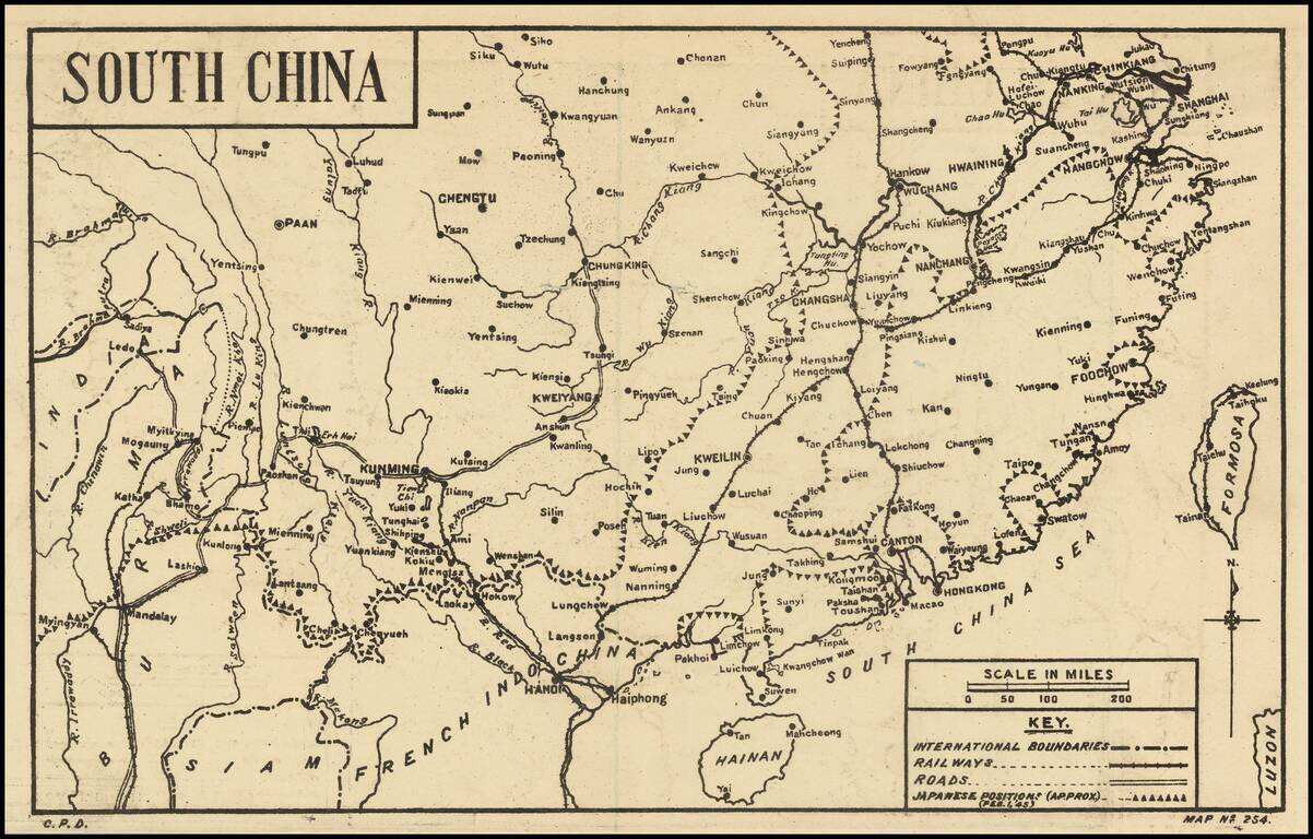
Scarce Map of the War in China -- February 1945 Detailed map of China, published in India for audiences within the British Empire, providing news of the war around the world. The present map illustrates the Japanese positions in China as of February...
![(Second World War - Okinawa) [Battlefield Composite Map of Southern Okinawa]](/map/small/63897.jpg)
Battle-Used Map of Okinawa. Impressive battlefield composite map of Okinawa, composed of numerous sections of SECRET Army Map Service sheets cut and pasted together to form one large image. The map covers the southern most parts of Okinawa, including...
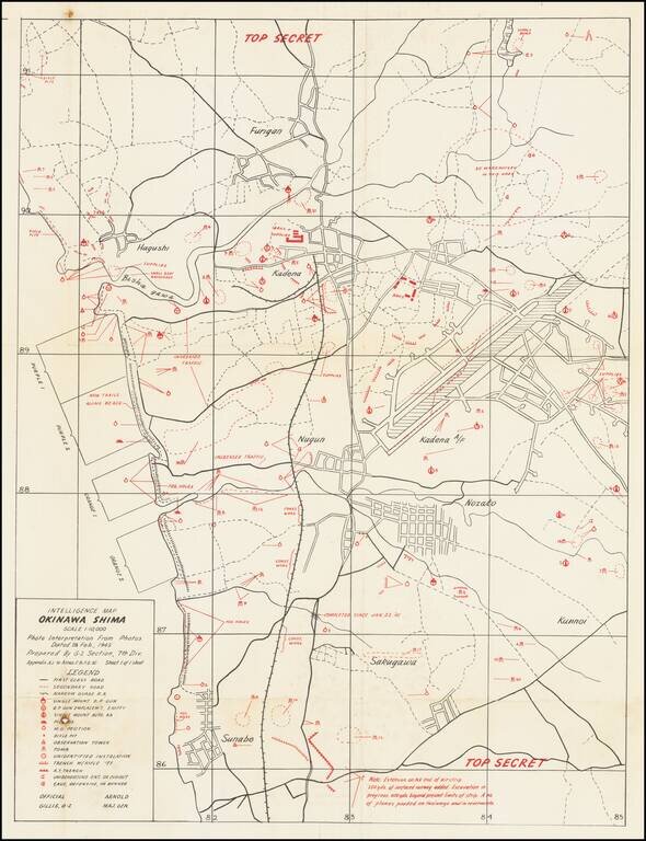
Top Secret American Map Used to Capture Kadena Airfield on Okinawa. Top Secret map of the Okinawa landing beaches Orange 1 & 2, and Purple 1 & 2, and the defenses between those beaches and Kadena airfield. The map was prepared based on...
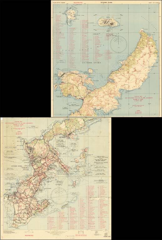
Restricted U.S. Military Map of Okinawa as it was Being Converted into a Major American Base. Color-printed map of Okinawa, produced by the 3020th Engr. Topo. Co. (Corps) on Okinawa, in September 1945, immediately after the end of World War II. The...
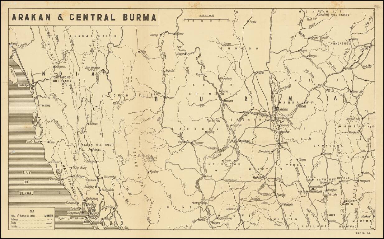
Scarce Map of the War in Burmah / Myanmar Detailed map of Burmah and India, published in India for audiences within the British Empire, providing news of the war around the world. The present map illustrates the theater of War in Birmah, centered...
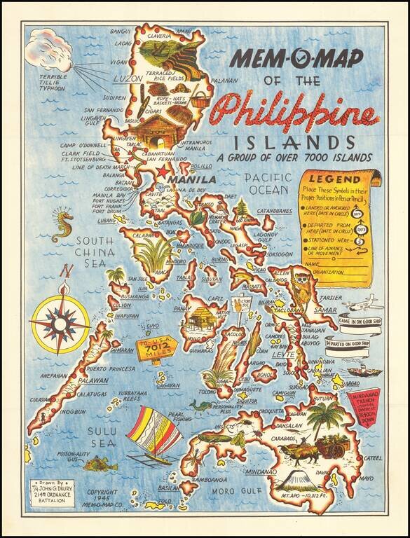
Lively pictorial map of the Philippines, drawn by John G. Drury of the 2145th Ordnance Battalion. This is one in a series of Mem-o-Maps published at the end of World War II. The maps were intended as souvenirs for the military. Military personnel...