
This is a 1933 Wander Company fantasy map board game of a treasure hunt featuring the radio show character Little Orphan Annie. The map traces the 'charted course' from the Start through several childhood obstacles faced by children that misbehave...
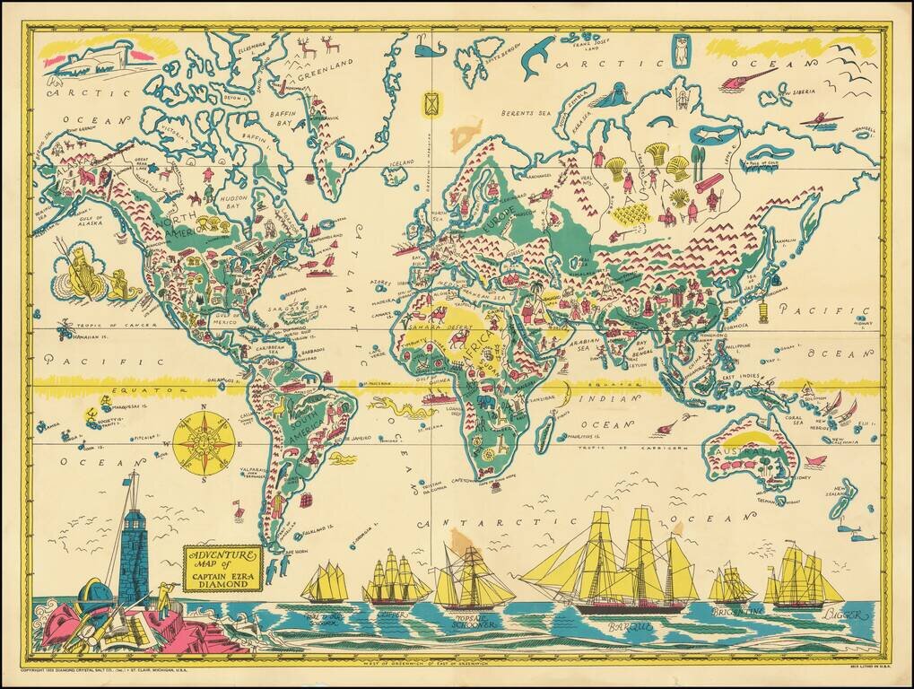
Rare Pictorial World Map, prepared as a promotional premium to promote the Captain Ezra Diamond Radio Show. Captain Ezra Diamond was the fictional spokesperson for the Diamond Salt Company began in the early 1930s. The company itself began some 50...
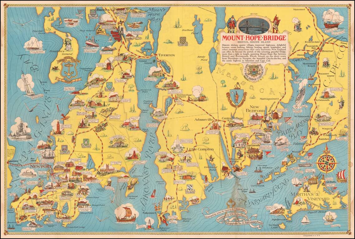
Scarce pictorial map of Mount Hope Bridge and vicinity, published in Bristol, Rhode Island by the Mount Hope Bridge Corporation. The map is "Arranged" by John W. Haley, Rhode Island Historian, designed by H.W. Hetherington and lithographed by the J.C....
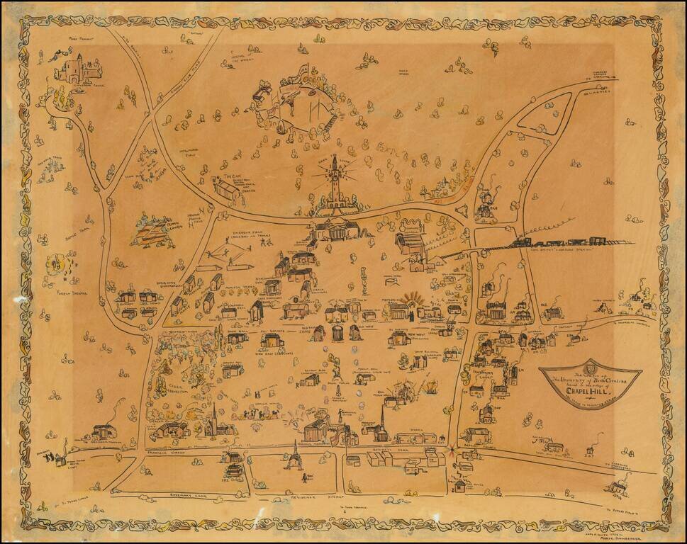
Impressive manuscript pictorial map of the University of North Carolina at Chapel Hill, drawn by Mary C. Dirnberger in 1933. The view is oriented with south at the top, at the bottom of the map it is bounded by Rosemary Street, at the top (south) of...
![[With Original Envelope!] A Geographical Map of the Century of Progress Exposition Held in Chicago, Illinois 1933 Faithfully executed and drawn in a carnival spirit by Tony Sart '33](/map/small/69226.jpg)
Rare large map of the Chicago World's Fair in two parts, published by Tony Sarg in 1933. David Rumsey notes: Two pictorial maps on one sheet, a panorama view of exposition grounds, whimsical sea monsters, whales, planes, and boats in the water....
![[Southwest Colorado Gold] Map of the Durango and Mancos Colorado District Where Sensational GOLD STRIKE Was Made Oct. 27, 1933](/map/small/69161.jpg)
The Greatest Gold Strike in Forty Years Fascinating promotional piece published by the Lucky Discovery Gold company, promoting a gold strike in Southwestern Colorado. The map pertains to the Placer Gold mining discovery at the Red Arrow Mine in 1933....
![[Southwest Colorado Gold] Mystery Gold Now In The Mancos Sensational Gold Camp](/map/small/69307.jpg)
Mystery Gold -- Red Arrow Bonanza Fascinating promotional piece published by the Mystery Gold Mining Company, promoting a gold strike in Southwestern Colorado. The 2 maps pertain to the Placer Gold mining discovery, which supposedly began at the Red...
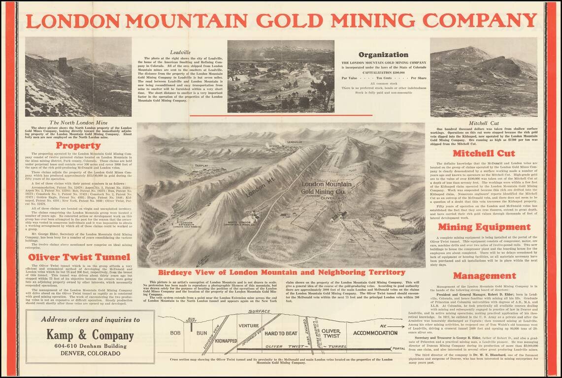
Depression Gold Mining in the Alma District of Colorado Scarce promotional birdseye view map and brochure, promotiong the London Mountain Gold Mining Company The central image includes a detailed view of London Mountain, the claims of the London...
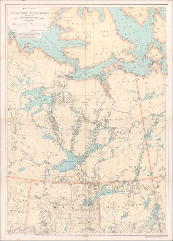
Detailed map of a portion of the Northwest Territories, published by the Department of the Interior in 1932. The map illustrates: Main, Wagon and Winter Roads Falls and Rapids Ranger Cabins Royal Candian Mounted PoliceStations Sea Plane...
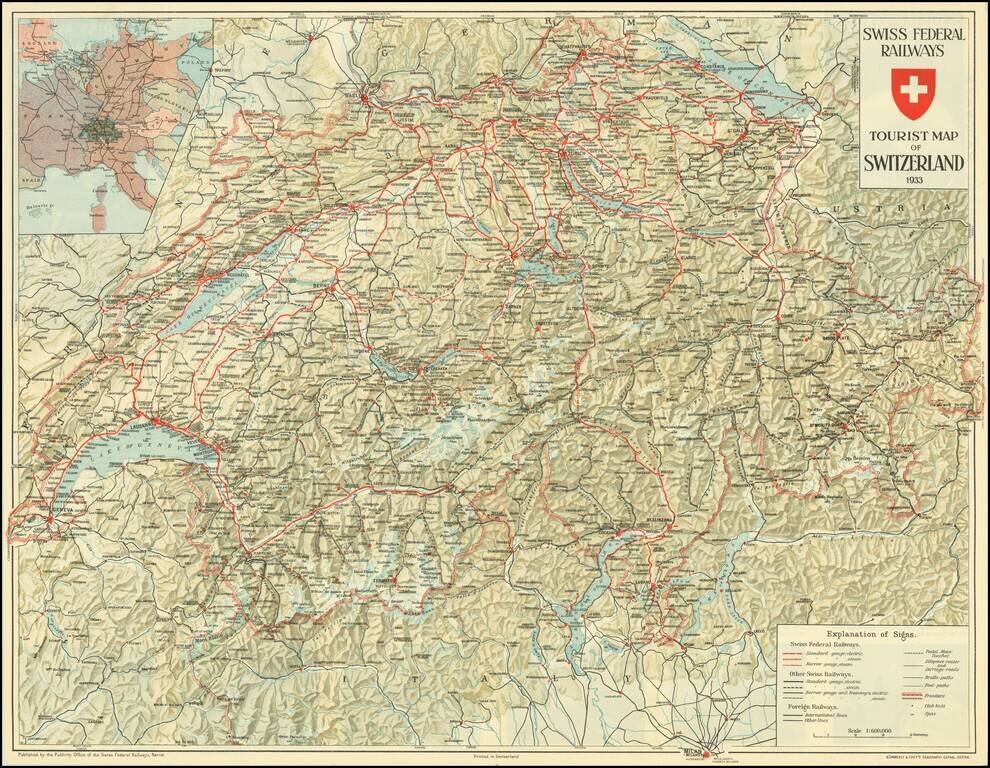
Detailed map of Switzerland, promoting Tourism to the English market prior to World War II. Pictures and promotional text on the verso.
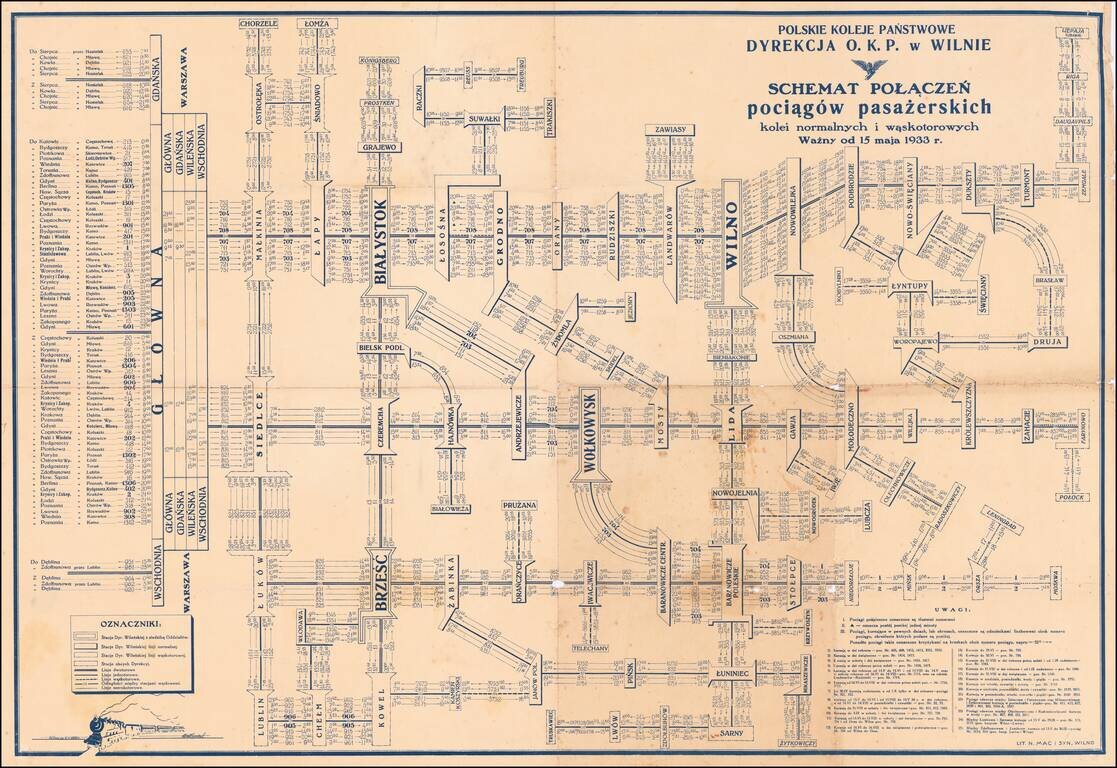
Detailed schematic map of the passenger train routes on normal and narrow gauge rail lines, centered on Vilnius and Bialystok. The title translates as: Polish State Railways Directorate P.K.P. Vilnius village - Diagram Connection of passenger trains...
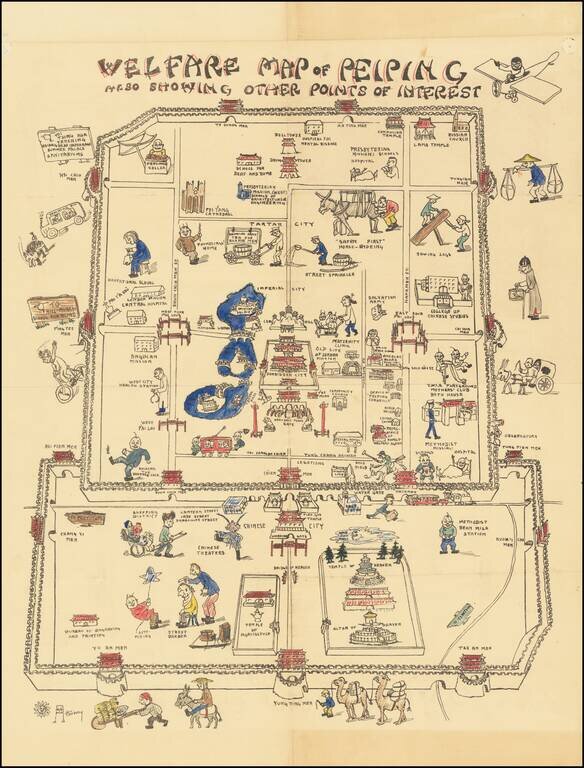
A Beijing Pictorial Rarity – The Welfare Map Whimsically-designed and colored example of an extremely rare pictorial map of China, made by an American missionary woman born in Tianjin. The map takes the viewer on a cartoonish tour of Beijing, or...
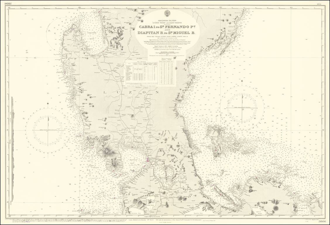
Scarce British Admiralty chart covering a large part of Luzon, including Manila Bay.