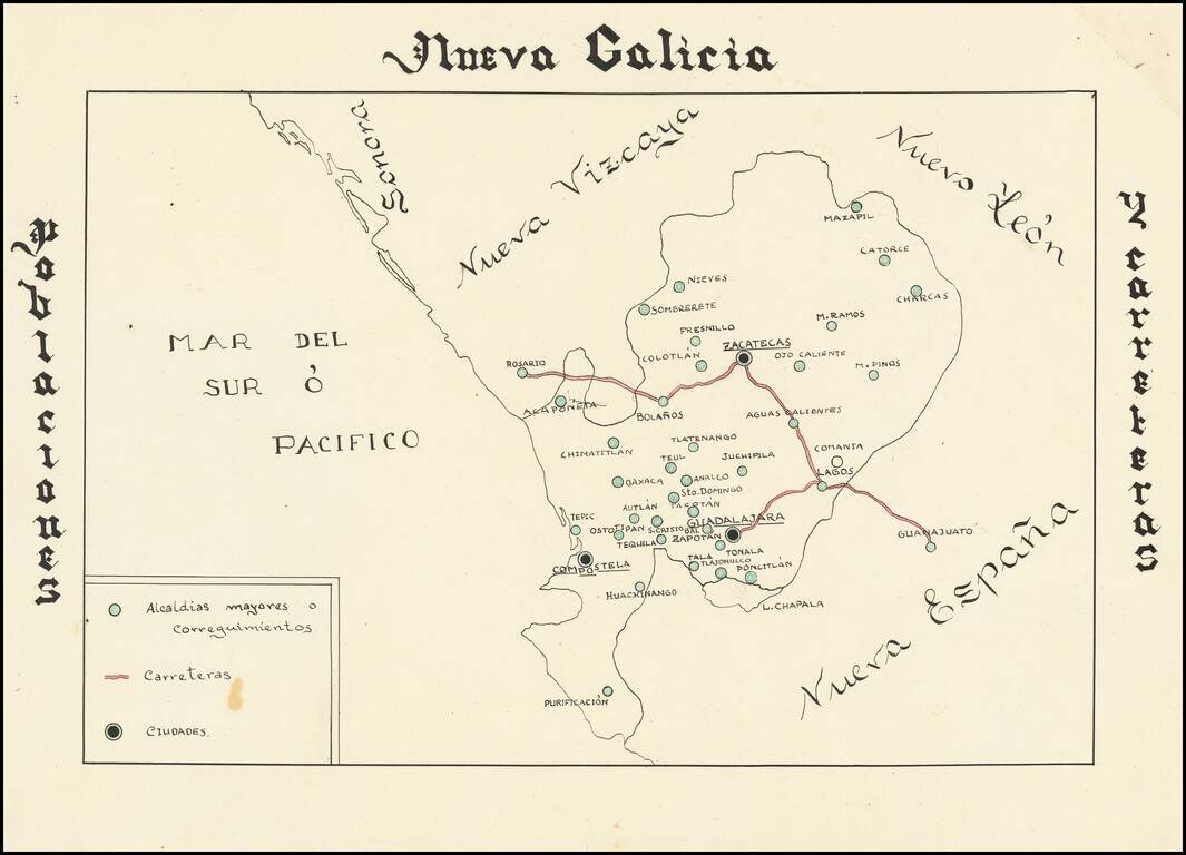
Hand drawn thematic map of the Nueva Galicia, centered on Zacatecas, showing primary roads and population centers. The date is estimated.
![{Central Mexico] Mapa de producciones](/map/small/62148.jpg)
Hand drawn thematic map of the region of Mexico centered on Zacatecas, displaying the agricultural, livestock and mineral producing regions. The date is estimated.
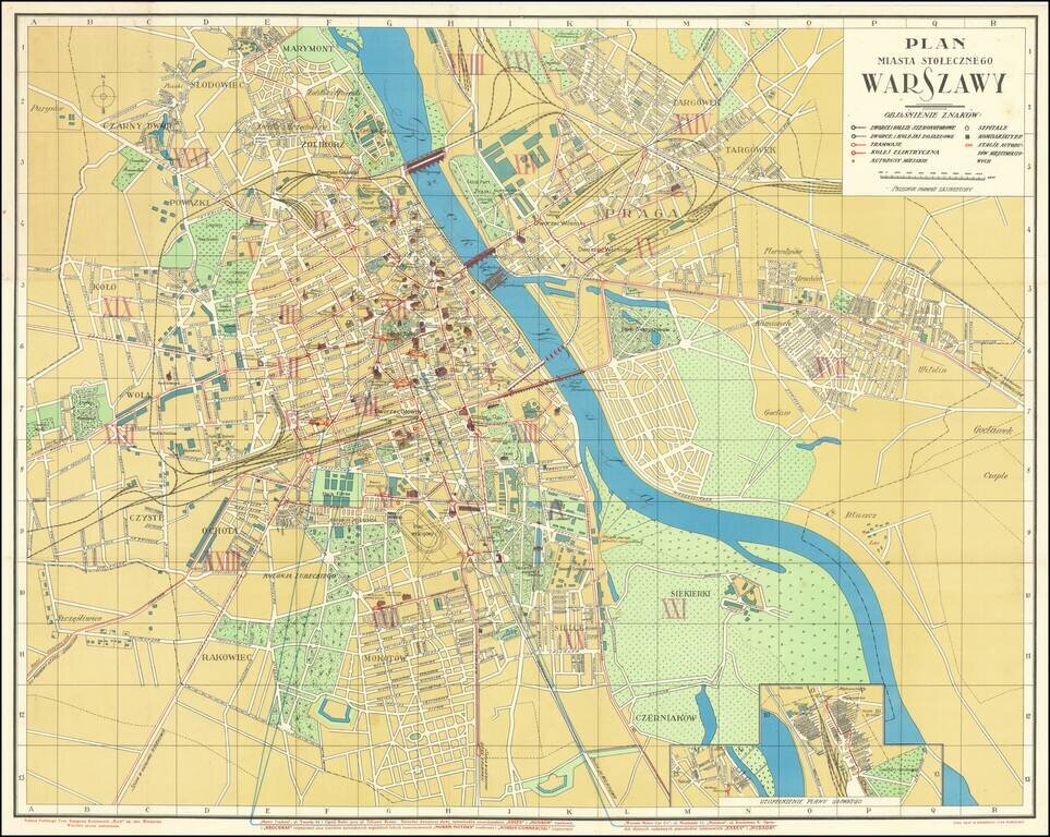
Wonderful Interwar Map of Warsaw. Detailed color-lithographed map of Warsaw issued by the famous Polish publisher and train station kiosk operator, RUCH. The map has an inset at the bottom showing a railway station. The map marks the main parts of...
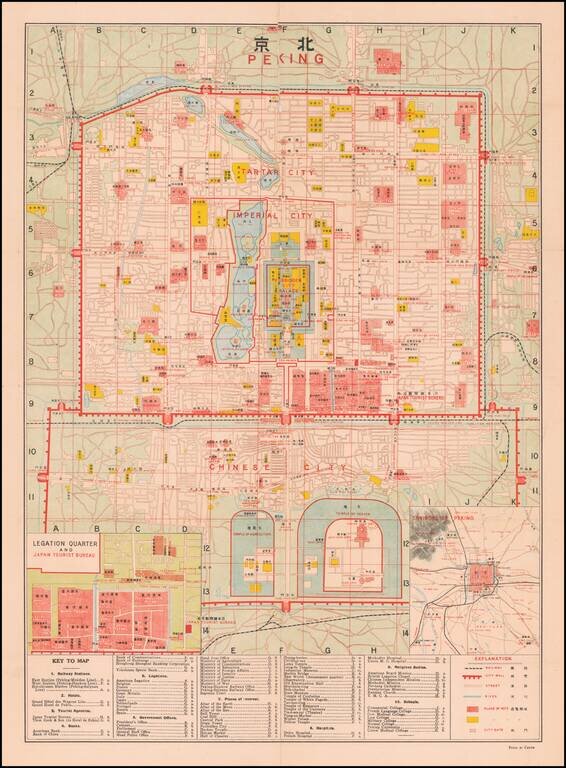
Finely detailed map of Peking, published for Japanese Tourists. At the center of the map is the Forbidden City Palace, Imperial City, Tartar City, with the Chinese City below. The Temple of Agriculture and Temple of Heaven appear at the bottom,...
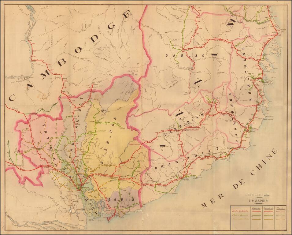
A Detailed French Study of the Roads in Southern Vietnam Finely mauscript map of part of Southern Vietnam, drawn by an unknown French source. The map focuses on the various roads throughout the region, all of which include distances in Kilometers at...
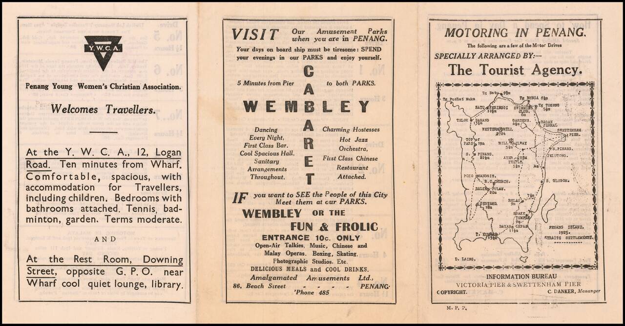
Specially Arranged By -- The Tourist Agency Fascinating early road map of Penang Island, with the name D. Laing at the lower left corner of the map. The map is one panel of a six panel promotional brochure, published by the Penang Information...
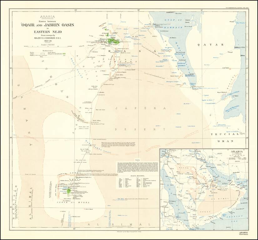
Mapping The Gulf of Salwah Finely executed map of Qatar and the region of Saudi Arabia to the west of Riyadh, published by the Royal Geographical Society in London. Cheesman was the first man to map the Arabian coast from the Gulf of Salwah to Uqair....