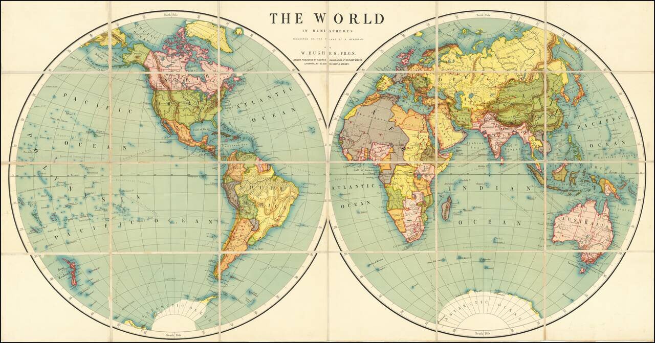
Fine large world map, illustrating the world in two hemispheres at the end of the 19th Century.
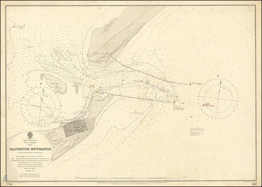
Galveston in the Year of The Great Hurricane (1900) Scarce separately published map of the area around Galveston, Texas, published by the British Admiralty. The coding at the bottom left of the map suggest this is the third revision in 1900, and...
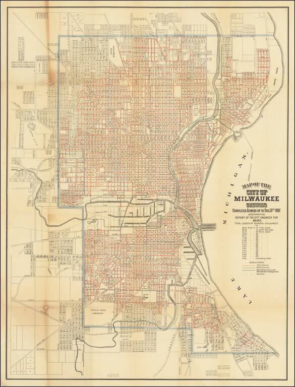
Rare map of the City of Milwaukee, published by the city to illustrate a report of the City Engineer. The map shows the progress of public works up to the end of 1897, showing sewers, intercepting sewers, manholes, block numbers, streets, railroads,...
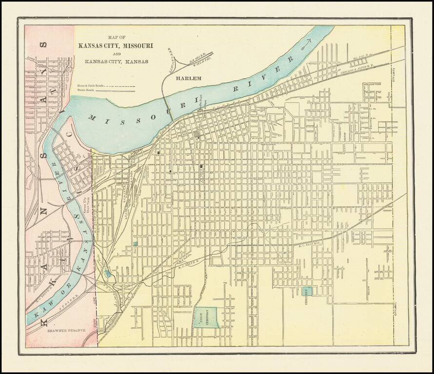
Detailed city plan of Kansas City, showing streets, buildings, train lines, public places, rivers etc. Cram was one of the pre-eminent American Mapmakers of the late 19th Century, relying upon a cerographic printing process first applied to maps by...
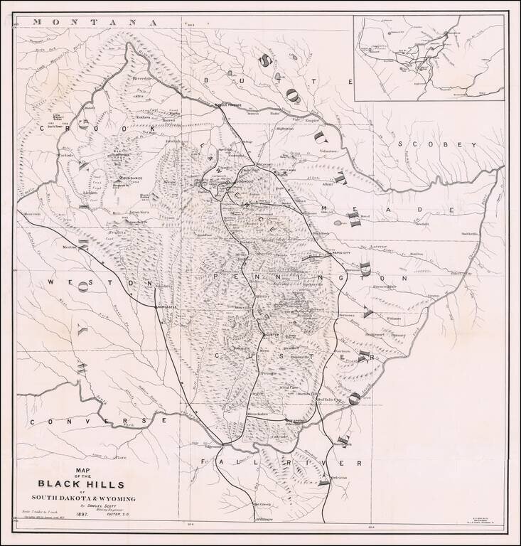
The First Book on Descriptive Mineralogy of the Black Hills with An Important Map Detailed map of the Black Hills region of western South Dakota and eastern Wyoming, between the North Fork and the South Fork of the Cheyenne River, published by Samuel...
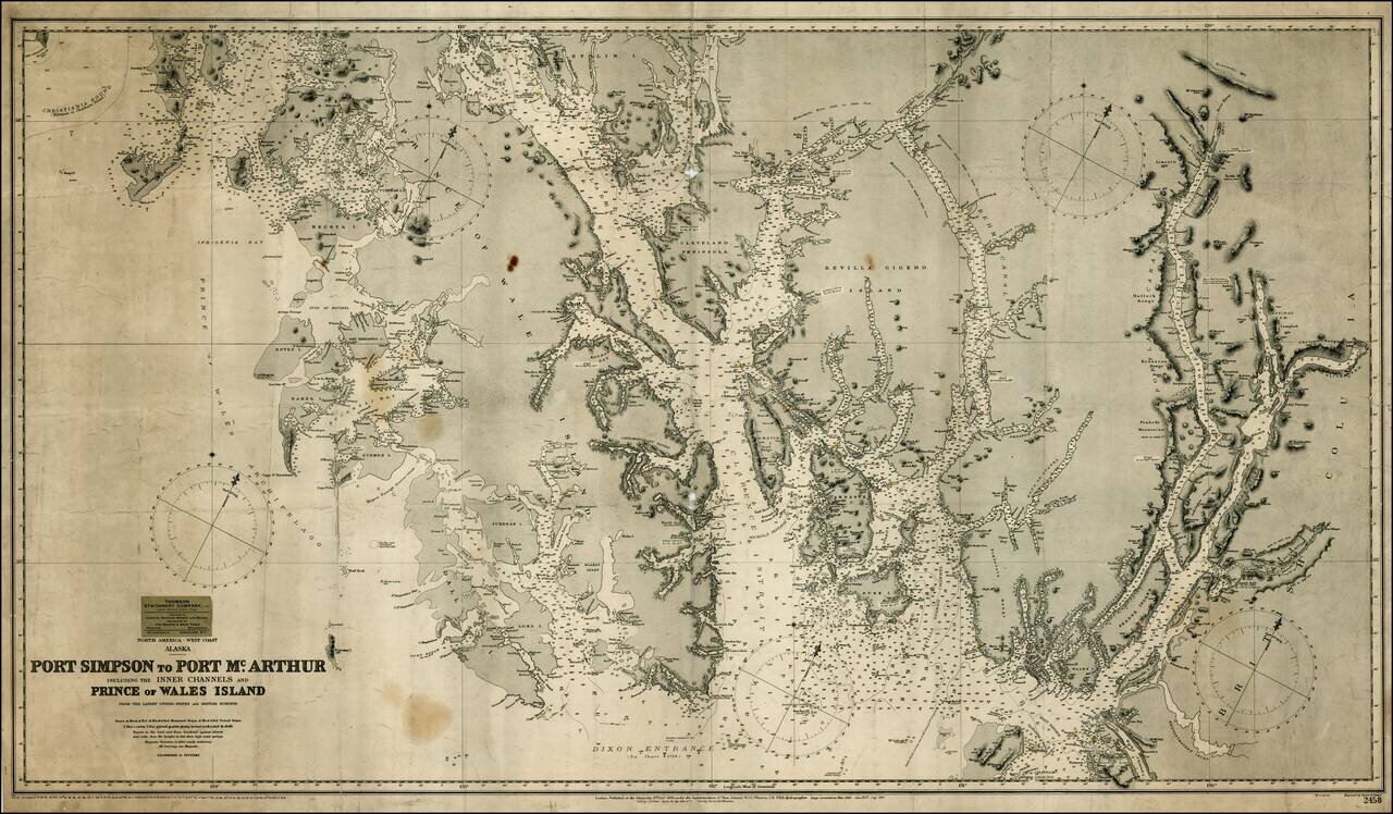
Detailed map of the southernmost part of Alaska, centered on Ketchikan and extending to the Alaska-Canada Border, north to Thorne Island and east to Mt. Gladstone (BC). As noted in George Davidson's The Alaska Boundary (1903) discussing an earlier...

Rare separately issued map of Alaska and British Columbia, showing the route to Gold Regions of Alaska, among the earliest printed maps to illustrate the route to the newly discovered Gold Regions in Alaska. Lowman & Hanford of Seattle produced...
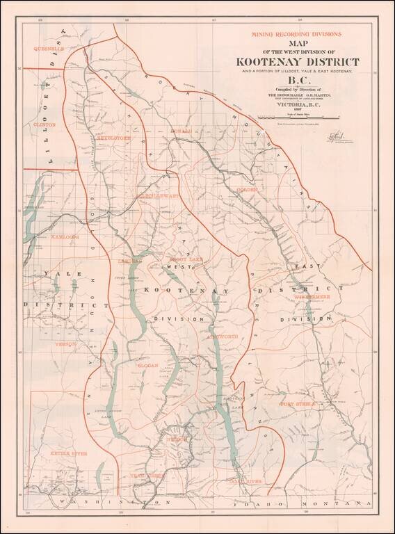
British Columbia's Progress Illustrated Graphically (and a Great Map of the West Kootenay District) Fine large Canadian government publication, illustrating the West Kootenay Mining District on the front side of the map and the Klondyke, Cassiar,...
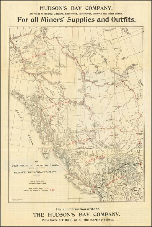
Hudson's Bay Company Guide & Map To The Klondike Gold Fields -- Rare Winnipeg Imprint Rare Hudson's Bay Trading Company map of the the Klondike and Yukon Gold Regions, illustrating the Canadian Routes to the Gold regions from Winnipeg and...
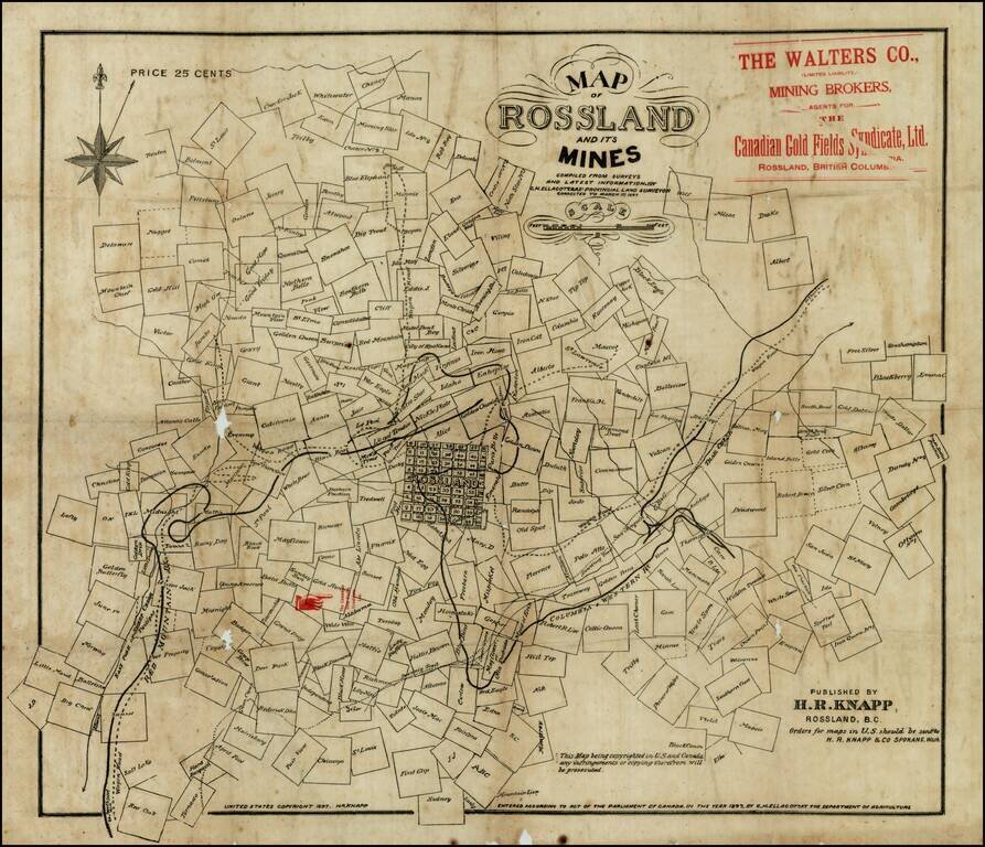
Rare early map of Rossland, British Columbia, in the Kootenay District, in the year of the great Rossland Gold Rush. The present map shows Rossland at the beginning of its boom period, during which time it would become one of the largest cities in...
![A Map of British Honduras... [bound in:] Tratado de Limites Entre Los Estados-Unidos Mexicanos y Honduras Britanica Seguido de los principales documentos que a el se refieren. Edicion Oficial.](/map/small/70984.jpg)
Determining Belize's Northern Limits. Frist official Mexican edition of the treaty with Great Britain establishing the Mexico-Belize border. Belize's borders have long been an issue for the country and its neighbors. The Belize-Mexico and...
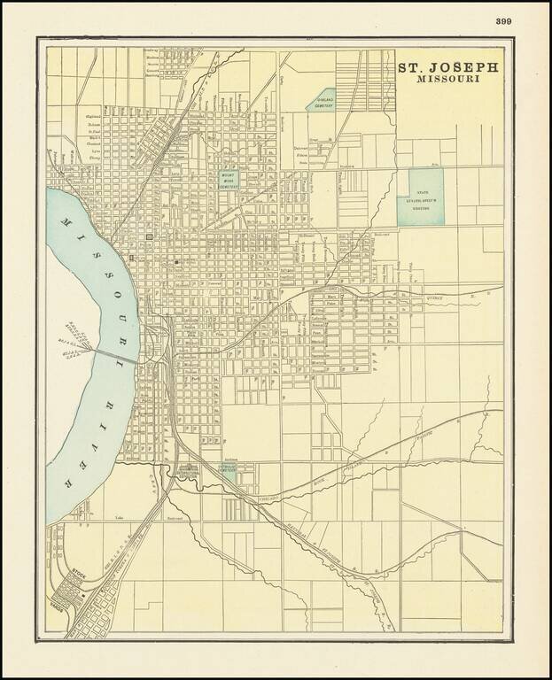
Detailed city plan of St. Joseph, showing streets, buildings, train lines, public places, rivers etc. Cram was one of the pre-eminent American Mapmakers of the late 19th Century, relying upon a cerographic printing process first applied to maps by the...
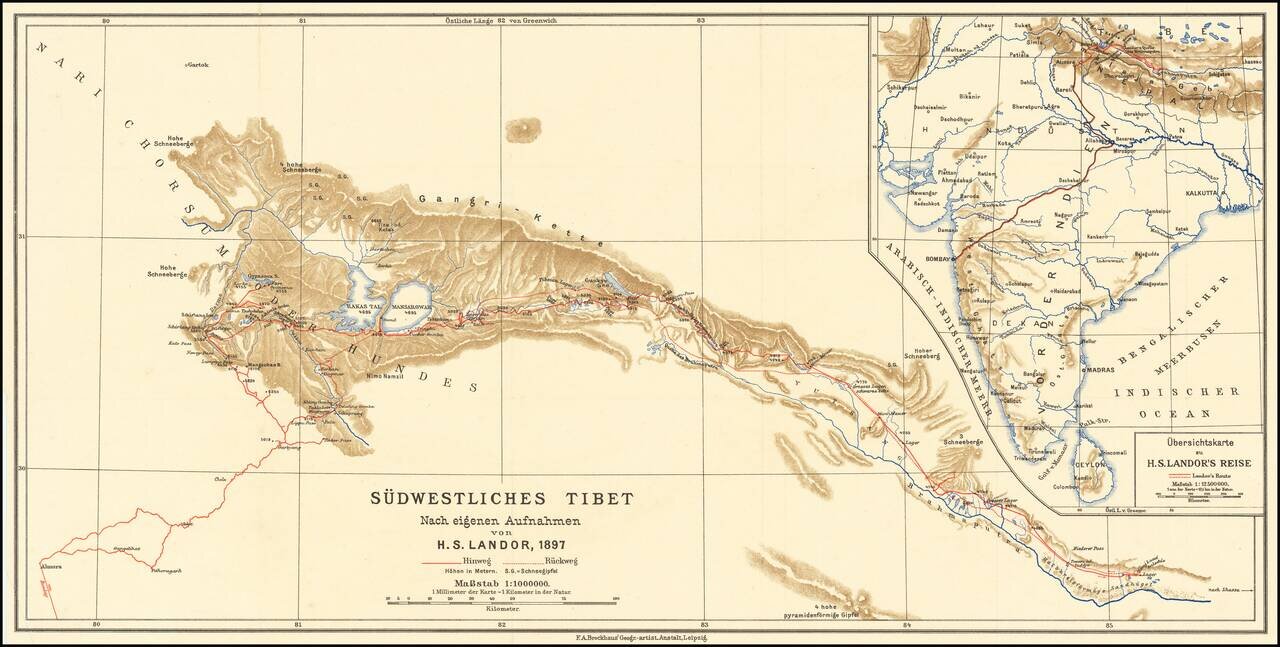
Scarce map of southwestern Tibet, illustrating the report of H.S. Candor. Candor was the first European to reach both sources of the Brahmaputra River. His book on Tibet was published in 1897.