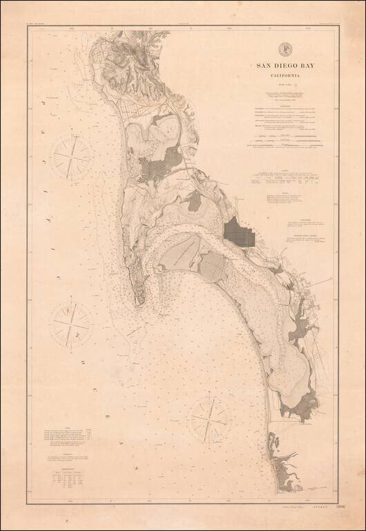
Rare 1895 Coast & Geodetic Survey Chart of San Diego Bay, published February 1895. The map extends north to La Jolla, La Hoya Valley (La Jolla Shores) and Rose Canyon and south to Otay Valley, the Tijuana River and the monument locating the...
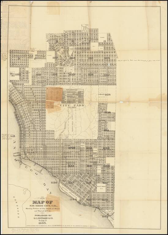
A San Diego Rarity Extremely rare large format separately published map of San Diego, published by S.E. Hoffman & Co. in 1895. The map includes a number of pencil and pen annotations, including: Florence Heights Add. No #2 New $50,000...
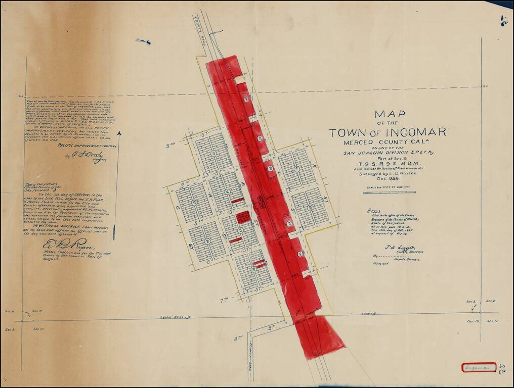
Detailed 1897 survey of Ingomar in Merced, California, by Lott D. Norton, one of the primary surveyors for the Pacific Improvement Company. Highly detailed map of this small railroad town in Merced County, showing the town plan, subdivisions, public...
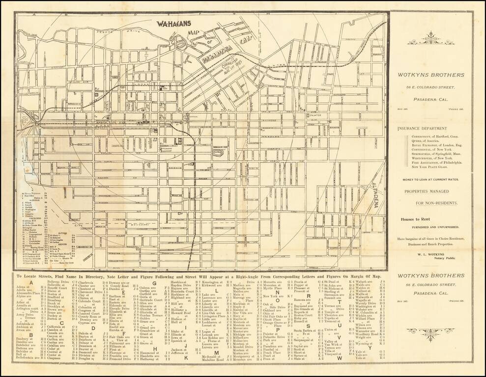
Rare separately published map of Pasadena, printed by Kitts & Jeffries in Los Angeles. The map is centered on the Santa Fe Train Depot, with the Green Hotel and Carleton Hotel across the street. The Fire Deparatment, Los Angeles T. Depot and...
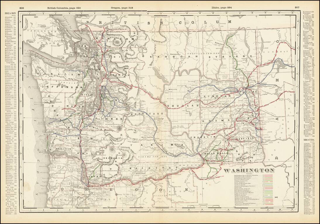
Detailed railroad map of Washington State, showing counties, railroad lines, towns, rivers, township surveys, lakes, mountains, creeks, waterfalls, and a host of other information. Includes a list of over 20 operating railroad lines in Washington...
![Western Part of Washington [with] Eastern Part of Washington](/map/small/69112.jpg)
Scarce two-sheet George Cram map of Washington State. The map, which appeared only in a few 1890s editions of the Cram railroad atlases, contains a wealth of information on late-19th century railroads in Washington. This is the first time we have had...
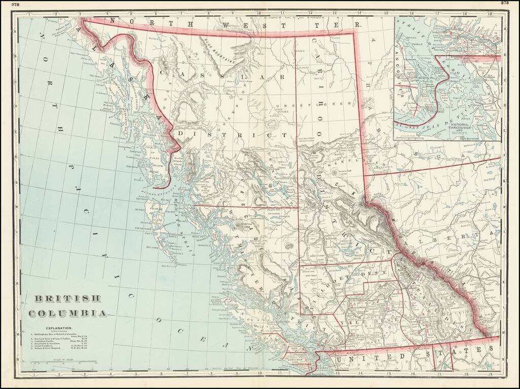
Rare map of the Canadian Pacific Railway, tracking the route of the lines between Medicine Hat and Dunimore to New Westminster and Vancouver. The map shows the region from Vancouver Island East to the Alberta-Saskatchewan border. Also includes some of...
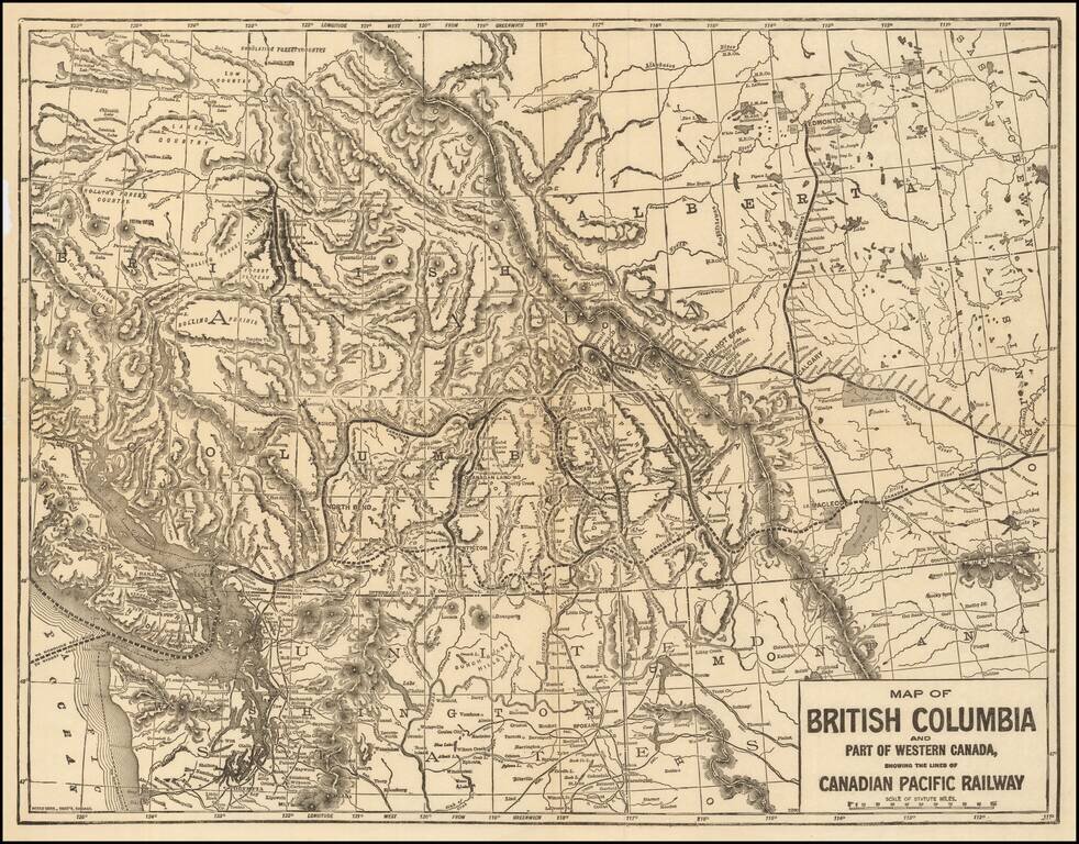
Fine large format map of British Columbia, published in Chicago by George Cram. Includes topographical features, towns, rivers, mountains and early railroads (completed and proposed) The map divides British Columbia into Districts, including...
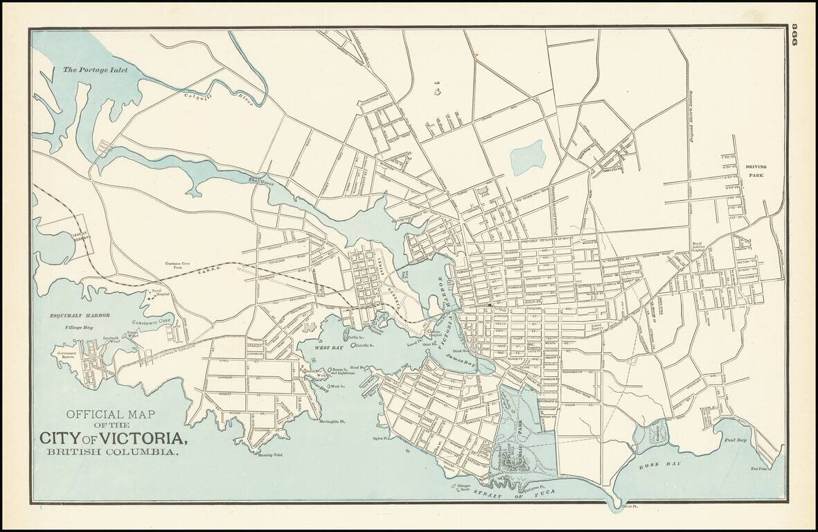
Detailed map of Victoria and environs, published by George Cram in Chicago. The map is centered on Victoria harbor, with a large Indian Reserve on the waterfront. The line of the E & N Railroad extends westward from downtown and a large park in...
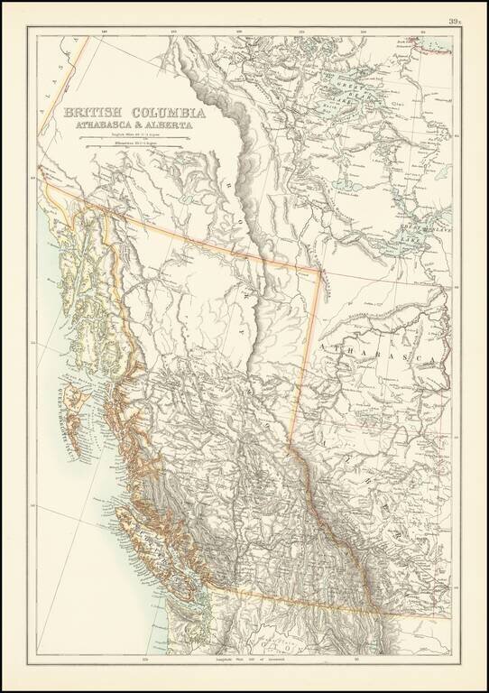
Scarce map of British Columbia and environs, published by A & C Black. The map provides excellent topographical detail for the region, illustrating lakes, rivers, mountains, etc. A number of rivers in the map are illustrated with dashed lines,...
![[Bilene - Limpopo River -- Mozambique] Esboco Hydrographico do Rio Limpopo entre a Ilha dos Patos e o Vão do Gongunhana, abrangendo o rio Changâne até ao Monte Chibuto: feito pelo 1º tenente da Armada Alvaro Andréa commandante da Lancha C.ª Capêllo dur](/map/small/60869.jpg)
Bilene, Mozambique -- Rio Limpopo From Chibuto to Military Post of Languene Rare separately published map of a portion of the Limpopo River, from the Mount Chibuto Region to the Military Post of Languene, just north of Xai-Xai District. The map was...
![[Timbuktu and Environs] Carte de la region de Tombouctou au 1/500,000.e Dressee par Mr. le Lieutenant Vaisseau Hourst, Commandant la Flottile du Niger et Mr. le Lieutenant Bluzet de l'Infanterie de Marine d'apres la carte Caron et Lefort, les travaux d](/map/small/65023.jpg)
Rare map of the region around Timbuktu, published by the French Geographical Society in April, 1895. Finely detailed map of the lake region of Faguibine and Tele, near Timbuktu, formed by the branching off of the Niger River. This rich and...
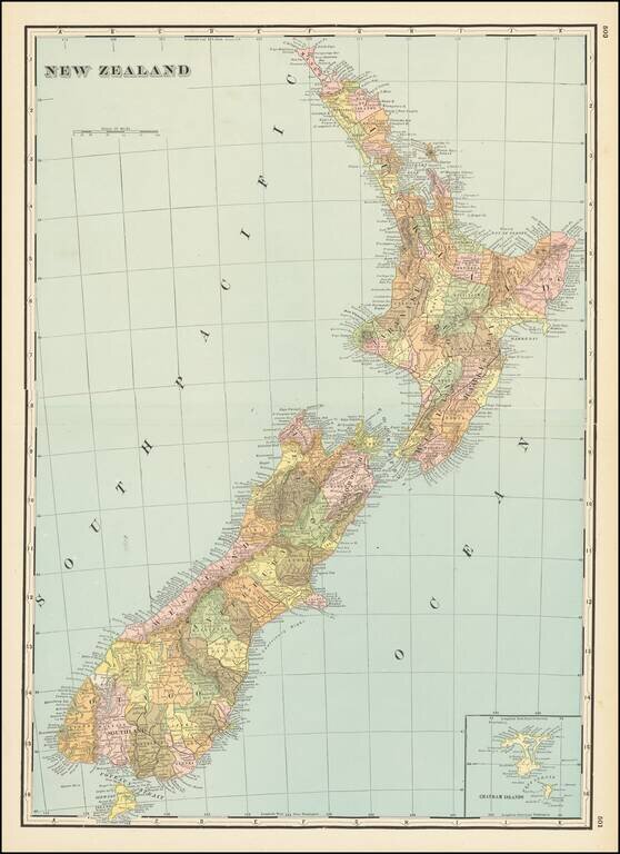
Large detailed map of New Zealand, published by George Cram in Chicago. Large inset of the Chatham Islands.