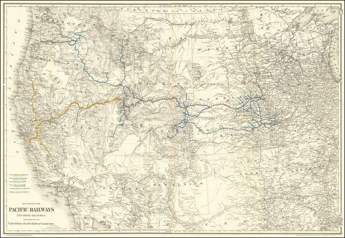
Mapping the Railroads of the Transmississippi West. Highly detailed map of the Western United States, illustrating the railroads in operation and under construction west of the Mississippi River. The key at the lower left identifies the Central...
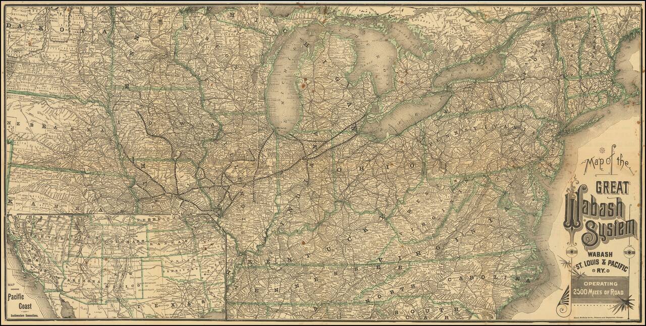
Mapping The Wabash Lines in 1887 Scarce Railroad Timetable Map of the Wabash System, published for the Wabash, St. Louis and Pacific Railway in 1887. The map shows the company railroad lines, extending from Lake Michigan to Kansas City, Council...
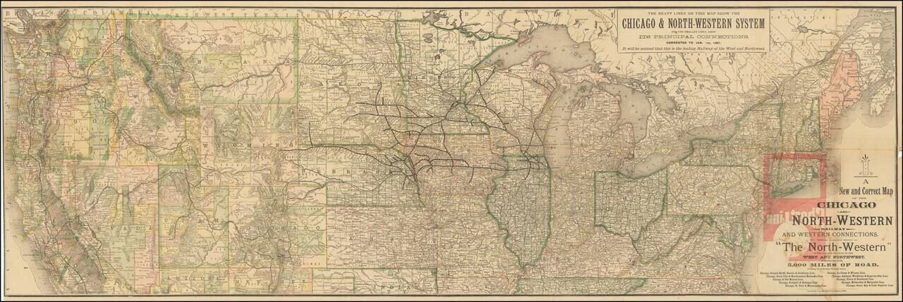
Mapping The Chicago & Northwestern System and Its Principal Connections in 1887 Scarce Railroad Timetable Map of the Chicago & Northwestern System, published for the Chicago and North-Western Railway in 1887. The map shows a fine images of...
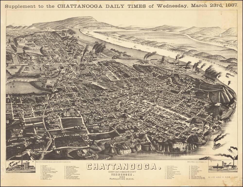
Wellge's bird's-eye-view provides a fine large view of City of Chattanooga, with significant buildings, streets, rivers, rail roads, and other geographical points of interest labeled. States of the View This is a later state of the view, which was...
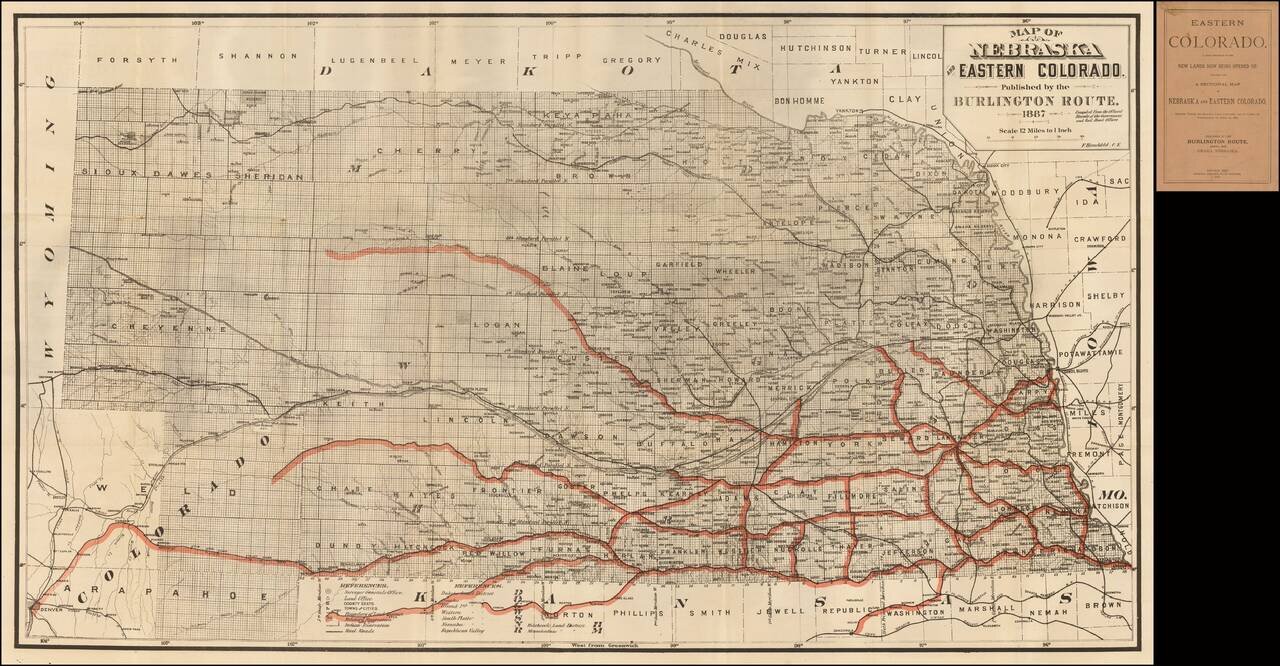
Fine railroad promotional map, stretching from Denver, Ft. Collins and Cheyene in the west to the Missouri River. Scarce promotional booklet for lands being opened up by the Burlington Route of the Chicago, Burlington & Quincy Railroad Company....
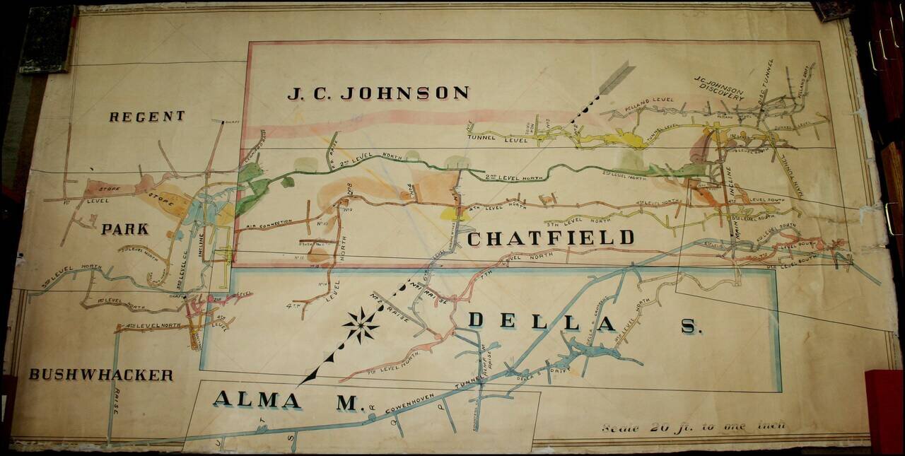
A Remarkable Aspen Mining Map -- Smuggler Mountain Large map illustrating the competing mining claims of several silver mines in Aspen, Colorado, which resulted in litigation between John C. Johnson and the Standard Mining Company of Kansas City,...
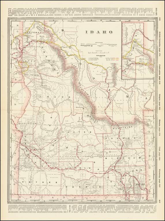
Early and highly detailed map of Idaho showing railroads, towns, cities and mountain ranges. Includes early county configurations. Includes many early roads, rivers, mining areas, Indian names and other details.
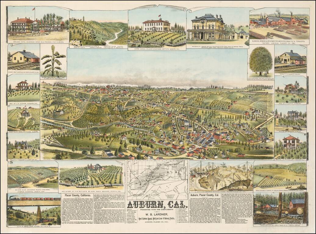
Rare birds-eye view of Auburn, California, including 22 smaller views and a map showing Placer County's Railroad Connections to Sacramento and San Francisco. This fine view illustrates one of the important early California Gold Rush boom towns. The...
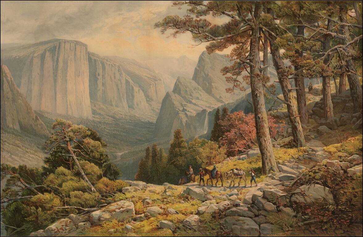
Fine large chromolithographic view of Yosemite Valley, looking from the Mariposa Trail in the Southwest corner of the valley toward El Capitan, the Three Brothers and Bridal Veil Falls. The image is drawn from a painting by Andrew Melrose.
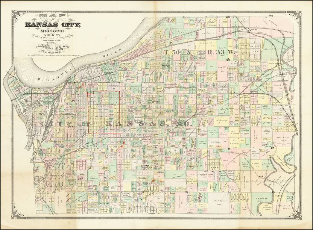
Scarce early map of Kansas City and environs, published by G.M. Hopkins of Philadelphia and promoting Geo. F. Winter & Co. The map shows the area around Kansas City in fine detail ad includes the names of many larger land owners.
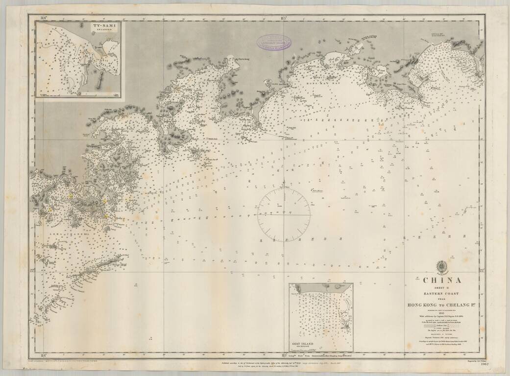
Detailed British Admiralty sea chart of China, extending from Hong Kong and the Lena Islands in the south to Hie Che Chin Bay in the north. Victoria is named on Hong Kong. The map includes extensive soundings and other sailing information. Includes...
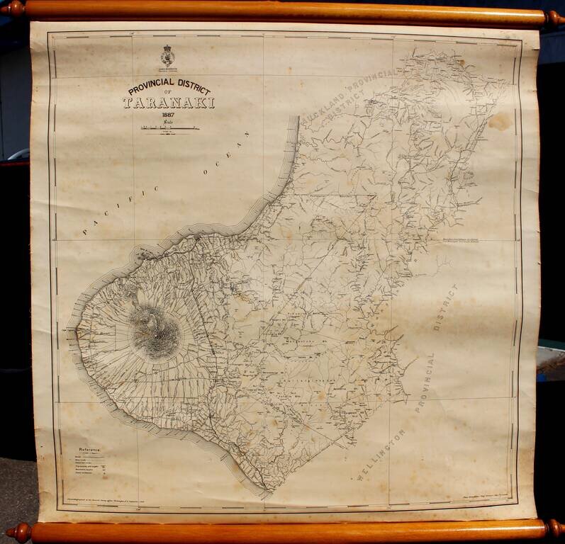
Rare Provincial Map of Taranaki District, New Zealand Highly detailed map of Taranaki Province, by the New Zealand Survey, led locally by Thomas Humphries, Chief Surveyor in New Plymouth. The most prominent feature on the map is Mount Taranaki, with...
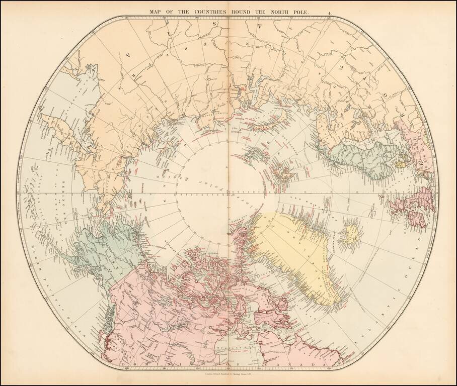
Fine early edition of Edward Stanford's map depicting the entire Arctic Region, featuring the furthest-most points reached by numerous exploring expeditions. This fascinating map embraces the entire Arctic regions of the World, within a unique ovoid...